Lake Washington Feature
Mapped Location
Lake Washington: The mapped location is an approximation and should not be used for navigation or wayfinding.
Information
General information on Lake Washington
- Feature Type: Feature
Official, historical, colloquial and alternative toponyms for Lake Washington
A brief list of names that this geographic feature has been named
| Name | Description |
|---|---|
| Lake Washington | Official |
Origin Notes and History of Lake Washington
References to Lake Washington that document the origin of its place name

LAKE WASHINGTON, a large body of water lying east of Seattle, King County. Isaac N. Ebey visited the lake in the spring of 1851 and named it "Lake Geneva," after the beautiful lake of Switzerland. (Victor J. Farrar, The Ebey Diary, Washington Historical Quarterly, Volume VII., pages 240-241.) That name did not endure. The railroad surveys under Governor Isaac I. Stevens, beginning in 1853, produced a map showing "Lake Dwamish." In the lower left hand corner of the same map is a supplementary sketch by A. W. Tinkham of a route through Snoqualmie Pass to Seattle. It is dated January, 1854, and the lake is shown as "Atsar-kal- Lake." (Pacific Railroad Reports, Volume XI., Part II., Chart No. 3.) Those two names gave an honor for the Duwamish tribe and also sought to record the Indian name for the lake. In that same year, 1854, the pioneers of Seattle held a picnic, at which Thomas Mercer suggested that the large lake be given the name of Washington, after the father of his country, and the smaller one Union because by it the waters of the large lake would one day be united with those of Puget Sound. One year before (March 2, 1853.) Congress had established and named Washington Territory. The suggested name for the lake was approved at the picnic but the pioneers published no map. Preston's Map of Oregon and Washington West of the Cascade Mountains, dated 1856, shows "Dwamish Lake." The same name appears on the Map by the Surveyor General of Washington Territory, dated 1857. (United States Public Documents, Serial No. 877.) in 1858, George Davidson, of the United States Coast Survey, in his Directory for the Pacific Coast of the United States, mentions Lake Washington. (United States Public Documents, Serial No. 1005, page 446.) After that the name soon found its way on all maps and charts. Another Duwamish Indian name, "It-how-chug," said to mean "large lake," was published in 1895. (J. A. Costello, The Siwash.)
A Selected Bibliography of Lake Washington, Feature
A compilation of essential readings detailing the history, geography, and culture of the region.
Taming of the Slough the intriguing story of the Sammamish Slough Race, "the crookedest race in the world" : plus ... the history of the Seattle Outboard Association and the Seattle to Lake Sammamish race course by Jim A. Benson, Carolyn Benson, Craig Fjarlie, Craig Smith
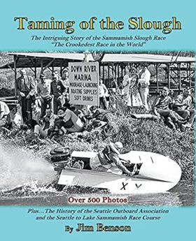
"There is an old adage that says, 'Truth is stranger than fiction.' This is the way it was told in the fascinating stories about the famous Sammamish Slough Race. Your Author covers a boat racing era from the 1920s to the 1970s. His personal knowledge, being born into a racing family, has given him insight that few people still living have. In the Pacific Northwest, the area where the Slough Race took place, significant changes occurred that had a long-term effect on outboard racing of that period. He leads you through the years that made boat racing a competition as exciting as major-league sports are today. The contest started from various locations on Lake Washington, ran across the lake and proceeded into a narrow-crooked river that wound through several small towns. It took a brief stop at one of the resorts on the upper connecting lake--Lake Sammamish. The competitors restarted their race boats after stopping and headed back downstream to the starting point, finishing their long grueling marathon. You will learn about some of the local history along the path of the racecourse, which is fascinating in itself. Many alterations were made to the terrain-history was rewritten as a result. The River took some vicious twists and turns, which was the exciting attraction for thousands of spectators. It nearly killed some of the drivers. You are treated to hundreds of wonderful photographs while reading about some of the wild events that happened along the way of this 'Crookedest Race in the World'"--Page 4 of cover
544 pages : illustrations, maps, portraits ; 24 cm
Non-circulating [ 1 ]
Renton, where the water took wing an illustrated history by David M. Buerge, Cynthia Barker, Nada Oakley
David M. Buerge, Cynthia Barker, and Nada Oakley’s Renton, where the water took wing: an illustrated history chronicles the profound industrial and civic transformation of the fertile lowlands at the southern shores of Lake Washington. Set against the coal-rich Cascade foothills and a historically dynamic hydrological landscape, the narrative details how early homesteaders, immigrant miners, and indigenous communities navigated a terrain fundamentally altered by massive civic engineering—most notably the 1916 lowering of Lake Washington, which permanently dried up the vital Black River and redirected the Cedar River. By tracing the transition from rugged, resource-extraction frontier towns and river-dependent settlements into a pioneering aviation manufacturing hub built on the newly exposed lakeshores, the text reveals how tight-knit ethnic neighborhoods and industrial workforces coalesced through shared labor and rapid environmental adaptation. Ultimately, this illustrated history demonstrates how collaboratively harnessing both the region's natural waterways and its radically re-engineered geography successfully transformed a scattered mining settlement into a cohesive, enduring modern city whose legacy of flight reshaped the Pacific Northwest.
135 pages : illustrations (some color), map ; 29 cm
Non-circulating [ 1 ]
The Lake Washington story a pictorial history by Lucile Saunders McDonald
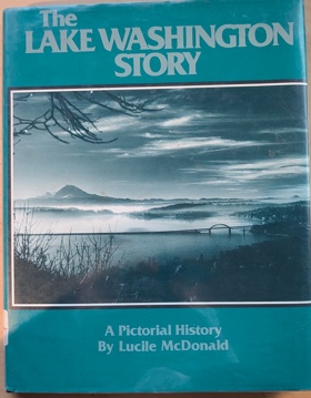
The Lake Washington Story offers a rich visual and historical account of the expansive freshwater lake that serves as the geographic heart of the Seattle metropolitan area in Washington State. The narrative meticulously traces the early development along the lake's shores, highlighting the nascent logging and shipbuilding hubs of Kirkland and Renton, as well as the densely forested, isolated enclaves of Mercer Island prior to the modern era of floating bridges. McDonald places special emphasis on the dramatic topographical engineering of the region, particularly detailing the construction of the Lake Washington Ship Canal and the Montlake Cut, which permanently lowered the lake's water level and physically connected it to the saltwater of Puget Sound. Through its extensive photographic archive, the book captures the physical transformation of this vital aquatic corridor from a remote pioneer waterway navigated by steamboats into the defining geographic boundary separating Seattle from the Eastside suburbs.
160 pages : illustrations ; 28 cm
Non-circulating [ 1 ]
Last updated: 2017-06-25