City of Renton King County, Washington
Event: 1916 lowering of Lake Washington: immediate and total reorganization of daily life, the local economy, and civic infrastructure forced by the sudden disappearance of the city's primary waterway. When the opening of the Lake Washington Ship Canal lowered the lake by nine feet, the physical geography of Renton changed in a matter of months, forcing three distinct community shifts:
- Indigenous displacement and survival: For the Duwamish people and other indigenous groups who maintained villages along the Black River, adaptation meant confronting the abrupt destruction of their ancestral fishery and canoe routes. Historical accounts describe the river drying into stagnant pools while residents frantically harvested stranded salmon; families were forced to abandon centuries-old settlement sites and rapidly reorganize their kinship networks to survive in a suddenly dry landscape.
- Agrarian and industrial land grabs: The receding lake waters exposed hundreds of acres of flat, fertile lakebed. Pioneer farmers and industrial planners had to quickly adapt their land claims and operations to exploit this newly created topography. This sudden expanse of flat land directly adjacent to the water ultimately provided the massive footprint required to transition Renton from a steep-valley coal town into a sprawling, flat-ground aviation manufacturing hub.
- Civic reengineering: Settlers and civic leaders had to instantly rethink the town's infrastructure. With the Black River gone and the Cedar River permanently rerouted to flow directly into Lake Washington to prevent flooding, existing bridges spanning the old riverbed became obsolete. The community had to rapidly pivot its entire supply line strategy, abandoning riverboat transport to rely entirely on expanding rail lines and newly constructed roads.
Mapped Location
City of Renton: The mapped location is an approximation and should not be used for navigation or wayfinding.
Information
General information on City of Renton
- Feature Type: Incorporated
Official, historical, colloquial and alternative toponyms for City of Renton
A brief list of names that this geographic feature has been named
| Name | Description |
|---|---|
| City of Renton | Official |
| Renton | Official |
Origin Notes and History of City of Renton
References to City of Renton that document the origin of its place name

RENTON, a city near Seattle, King County. It was first known as Black River Bridge. (Interview with Mr. Houser in History of Kittitas County, Ellensburg Normal School, page 1.) The present name is an honor for Captain William Renton of the Port Blakely Mill Company.
A Selected Bibliography of City of Renton, King County, Washington
A compilation of essential readings detailing the history, geography, and culture of the region.
Renton, where the water took wing an illustrated history by David M. Buerge, Cynthia Barker, Nada Oakley
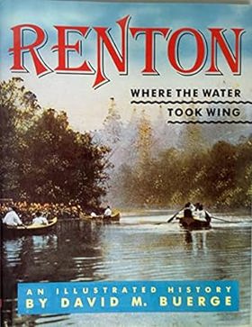
David M. Buerge, Cynthia Barker, and Nada Oakley’s Renton, where the water took wing: an illustrated history chronicles the profound industrial and civic transformation of the fertile lowlands at the southern shores of Lake Washington. Set against the coal-rich Cascade foothills and a historically dynamic hydrological landscape, the narrative details how early homesteaders, immigrant miners, and indigenous communities navigated a terrain fundamentally altered by massive civic engineering—most notably the 1916 lowering of Lake Washington, which permanently dried up the vital Black River and redirected the Cedar River. By tracing the transition from rugged, resource-extraction frontier towns and river-dependent settlements into a pioneering aviation manufacturing hub built on the newly exposed lakeshores, the text reveals how tight-knit ethnic neighborhoods and industrial workforces coalesced through shared labor and rapid environmental adaptation. Ultimately, this illustrated history demonstrates how collaboratively harnessing both the region's natural waterways and its radically re-engineered geography successfully transformed a scattered mining settlement into a cohesive, enduring modern city whose legacy of flight reshaped the Pacific Northwest.
135 pages : illustrations (some color), map ; 29 cm
Non-circulating [ 1 ]
The Lake Washington story a pictorial history by Lucile Saunders McDonald
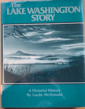
The Lake Washington Story offers a rich visual and historical account of the expansive freshwater lake that serves as the geographic heart of the Seattle metropolitan area in Washington State. The narrative meticulously traces the early development along the lake's shores, highlighting the nascent logging and shipbuilding hubs of Kirkland and Renton, as well as the densely forested, isolated enclaves of Mercer Island prior to the modern era of floating bridges. McDonald places special emphasis on the dramatic topographical engineering of the region, particularly detailing the construction of the Lake Washington Ship Canal and the Montlake Cut, which permanently lowered the lake's water level and physically connected it to the saltwater of Puget Sound. Through its extensive photographic archive, the book captures the physical transformation of this vital aquatic corridor from a remote pioneer waterway navigated by steamboats into the defining geographic boundary separating Seattle from the Eastside suburbs.
160 pages : illustrations ; 28 cm
Non-circulating [ 1 ]
Renton from coal to jets by Morda C. Slauson , Ethel Telban , Clark Petersen (Designer), Joann Morgan (Contributor), Renton Historical Society (Publisher, Contributor)

Renton from coal to jets examines the dramatic industrial evolution and severe geographic manipulation of a critical aquatic chokepoint situated at the southern tip of Lake Washington. Slauson and her co-contributors detail how the region's formidable physical barriers—specifically the rugged, resource-heavy foothills of the Cascade Range that abruptly meet the flood-prone alluvial fan of the Cedar River—strictly dictated the initial margins of pioneer resource extraction. By mapping the immense physical labor required to excavate deep coal seams from the precipitous inland slopes and transport that heavy freight via precarious riparian corridors to urban markets, the narrative highlights the grueling early reliance on the region's raw geological topography. The absolute geographic necessity of expanding this frontier economy eventually forced a monumental reengineering of the landscape itself, as residents aggressively rerouted the volatile river and capitalized on the artificial lowering of the lake's shoreline to forge the massive, flat industrial grid required for modern aerospace manufacturing. Ultimately, this civic and historical record serves as a deeply localized spatial history, demonstrating how the complex hydrological force and steep topographical gradients of the Puget Sound lowlands inherently shaped the fiercely resilient, highly engineered transition of the Renton settlement from a rugged frontier mining camp into a global aviation hub.
[6], 183, [4] pages, 31 unnumbered pages of plates : illustrations, maps, portraits ; 23 cm
Non-circulating [ 1 ]
King County
- Adams
- Adelaide
- Adelaide
- City of Algona
- Alki
- Allentown
- Ames Lake
- Arcadia
- Ashwood
- Atkinson
- City of Auburn
- Avondale
- Bagley Junction
- Bandera
- Baring
- Barneston
- Bayne
- Bayne Junction
- Beacon Hill
- Beaumont
- Town of Beaux Arts Village
- City of Bellevue
- Belltown
- Belridge
- Benson Hill
- Berrydale
- Bethel Park
- Beverly Park
- Biloxi
- Birch
- Bitter Lake
- City of Black Diamond
- Blue Ridge
- Boddy
- Boise
- Boulevard Park
- Briarcliff
- Briarcrest
- Broadview
- Bryant
- Bryn Mawr
- Buenna
- City of Burien
- Burton
- Camelot
- Campton
- Carlton Park
- City of Carnation
- Cedar Falls
- Cedar Grove
- Cedar Mountain
- Cedar Park
- Cedarhurst
- Chautauqua
- Chelsea
- Cherokee Bay Park
- Christopher
- Clyde
- City of Clyde Hill
- Coal Creek
- Coalfield
- Columbia City
- Colvos
- Cottage Lake
- Cougar Hills
- Cove
- City of Covington
- Cowley
- Crossroads
- Cumberland
- Danville
- Day City (historical)
- Denny Creek
- Denny Regrade
- City of Des Moines
- Dilworth
- Dockton
- Dorre Don
- Dunlap
- Durham
- City of Duvall
- Duwamish
- East Hill
- East Renton Highlands
- East Seattle
- Eastland
- Echo Lake
- Edgewater (historical)
- Edgewick
- Elliott
- Ellisport
- Ellisville
- Endolyne
- City of Enumclaw
- Ernies Grove
- Evansville
- Evergreen
- Factoria
- Fairwood
- Fall City
- Fauntleroy
- City of Federal Way
- Feriton
- Fern Heath
- Firloch
- Five Corners
- Fortuna
- Foy
- Franklin
- Garcia
- Georgetown
- Glen Acres
- Glendale
- Green Lake
- Green River
- Gregory Heights
- Grotto
- Harbor Heights
- Harman Heights
- Hawthorne Hills
- Hazelwood
- Henrys
- High Point
- High Valley
- Highlands
- Highlands Park
- Highline
- Hillman City (historical)
- Hilltop
- Hobart
- Holly Park
- Hollywood
- Hollywood Hill
- Hongking (historical)
- Humphrey
- Town of Hunts Point
- Inglesea
- City of Issaquah
- Jovita
- Juanita
- Junction
- Kanaskat
- Kanaskat Junction
- Kangley
- Kenilworth
- City of Kenmore
- Kennydale
- City of Kent
- Kenwood
- Kerriston
- City of Kirkland
- Kitts Corner
- Klahanie
- Krain
- Kummer
- Lake Desire
- City of Lake Forest Park
- Lake Heights
- Lake Marcel
- Lake Morton
- Lake Park
- Lakeland
- Lakeridge
- Lakewood
- Lakota
- Landsburg
- Latona
- Latona (historical)
- Lavilla
- Lawton
- Lawtonwood
- Lemolo
- Lester
- Lisabeula
- Lowman Beach Park
- Luana Beach
- Lucerne
- Madrona
- Magnolia Beach
- Magnolia Bluff
- Manitou
- Mann
- Manzanita
- Maple Hills
- City of Maple Valley
- Maple Valley Heights
- Maplewood Heights
- Matthews Beach
- Maury
- May Creek
- Maywood
- McGilvara
- McMicken Heights
- McVan
- Meadowbrook
- City of Medina
- Mercer Heights
- City of Mercer Island
- Mercer Island Town
- Meridian
- Meridian Heights
- Metum
- Midlakes
- Mileta
- Miller River
- Mint Grove
- Mirror Lake
- Mirrormont
- Mirrormount Estates
- Montlake
- Moorland
- Moorlands
- Mount Baker
- Mount View
- Naco
- Nagrom
- Newaukum
- City of Newcastle
- Newport Hills
- Newport Shores
- Noble
- Nordrum (historical)
- City of Normandy Park
- North Beach
- City of North Bend
- North Broadway
- North College Park
- Northgate
- Northrup
- Novelty
- Olympic Hills
- One Hundred One Pines
- Orchard Grove
- Osceola
- Oskams Corner
- Overlake
- City of Pacific
- Page
- Palmer
- Palmer Junction
- Paramount Park
- Parkwood
- Phinney Ridge
- Pinehurst
- Pines
- Pleasant Hill
- Pontiac
- Portage
- Portage Bay
- Preston
- Raeco
- Ragnar
- Rainier Beach
- Rainier Valley
- Ravenna
- Ravensdale
- City of Redmond
- Redondo
- City of Renton
- Ridgecrest
- Riverbend
- Riverton
- Roanoke
- Rockdale
- Ronald
- Roosevelt
- Rose Hill
- Rosehilla
- Ross (historical)
- Roxbury Heights
- City of Sammamish
- Sand Point
- Seahurst
- City of SeaTac
- City of Seattle
- Selleck
- Seola Beach
- Seward Park
- Shawnee
- Shore Acres
- City of Shoreline
- Shorewood
- Town of Skykomish
- Skyway
- Snoose Junction
- City of Snoqualmie
- Snoqualmie Falls
- Snyders Corner
- Somerset
- South Park
- South Seattle
- Southern Heights
- Spring Beach
- Spring Beach
- Spring Glen
- Stampede
- Star Lake
- Stevens
- Stillwater
- Stuart
- Stuck
- Summerhurst
- Summit
- Sunnydale
- Sunset Village
- Tahlequah
- Tahoma
- Tamill
- Tanner
- The Highlands
- Thomas
- Timberlane
- Tokul
- Trude
- City of Tukwila
- University District
- University Village
- Upper Mill
- Upper Preston
- Van Asselt
- Vasa Park
- Vashon
- Vashon Heights
- Veazie
- Vermontville (historical)
- Victory Heights
- Wabash
- Wayne
- West Woodland
- White
- White Center
- Wilderness
- Willows
- Windermere
- City of Woodinville
- Woodridge
- Wynaco
- Town of Yarrow Point
- York
- Youngstown
- Zenith
Political Boundaries
Last updated: 2026-09-24