Catalog of British Columbiana and Pacific Northwest Americana
The Encyclopedia Cascadia Catalog indexes mostly non-fiction literature covering the Pacific Northwest coast of North America, with an emphasis on British Columbia, Idaho, Oregon, and Washington State.
| Catalog Title | Published |
|---|---|
|
Pacific tugboats by Gordon R. Newell 
Gordon R. Newell’s Pacific Tugboats chronicles the grueling industrial mastery of the Pacific seaboard, where a violent and geographically complex marine topography mandated the development of a highly specialized, heavy-duty towing fleet. The narrative maps how the severe environmental realities of the coastal Northwest—characterized by labyrinthine deep-water fjords, treacherous estuarine river bars, and unpredictable, storm-battered straits—frequently paralyzed conventional sail-driven commerce and completely obstructed the aquatic transit of massive inland timber harvests. By detailing the technological evolution from early, vulnerable steam-powered vessels to robust, high-powered diesel tugs, the text illustrates how the expansion of regional industry was strictly dictated by the necessity of deploying these mechanized workhorses to muscle colossal log rafts and guide vulnerable deep-draft freighters through dangerous, tide-ripped marine highways. Ultimately, the account demonstrates that engineering the raw mechanical power necessary to conquer these formidable navigational hazards was the absolute prerequisite for breaching the region's coastal isolation and linking the heavily forested western frontier to the broader global maritime economy. 191 pages illustrations 28 cm Non-circulating [ 1 ]
|
1957 |
|
Spokane story by Lucile Foster Fargo
Lucile Foster Fargo’s Spokane Story chronicles the rapid industrial colonization of a remote inland metropolis built entirely around the colossal kinetic energy of the Spokane Falls, situated within the vast, arid expanses of the Columbia Plateau. The narrative maps how the severe geographic isolation of this landlocked basin—walled off by the formidable Rocky Mountains to the east and the Cascades to the west—initially restricted early pioneers to a precarious existence, forcing them to rely entirely on the localized hydrological power of the roaring river to operate rudimentary sawmills and gristmills. By detailing the massive regional transition from an isolated river crossing to the mechanized epicenter of the Inland Empire, the text illustrates how the aggressive exploitation of surrounding timber stands, Palouse agriculture, and Coeur d'Alene mineral wealth was strictly dictated by the arrival of transcontinental rail networks engineered to conquer these massive continental distances. Ultimately, the account demonstrates that artificially harnessing the violent hydrology of the falls and deploying heavy transit infrastructure to overcome the profound physical detachment of the inland steppe were the absolute prerequisites for transforming a remote frontier outpost into the vital commercial and industrial anchor of eastern Washington. 276 pages Non-circulating [ 1 ]
|
1957 |
|
County government in Washington State by Washington State Association of County Commissioners, Barbara Byers
Barbara Byers and the Washington State Association of County Commissioners’ County Government in Washington State chronicles the structural evolution of localized administrative power, a political necessity dictated entirely by the vast, geographically fractured landscape of the Pacific Northwest frontier. The narrative maps how the severe environmental realities of the region—divided by the towering alpine barrier of the Cascade Range, expansive arid inland plateaus, and impenetrable coastal rainforests—rendered centralized territorial governance logistically impossible, forcing early pioneers to carve the wilderness into decentralized jurisdictions often bounded by sheer mountain ridges and massive riverine highways. By detailing the urgent expansion of county-level authority to construct vital rural road networks, manage rugged land claims, and regulate localized resource extraction, the text illustrates how deploying robust civic infrastructure was strictly dictated by the immense overland distances and imposing topography separating isolated settlements. Ultimately, the account demonstrates that artificially imposing administrative order and financing localized, mechanized transit corridors to conquer this profound continental detachment were the absolute prerequisites for transforming a geographically segmented wilderness into a functional, economically integrated state. 218 pages 24 cm Non-circulating [ 1 ]
|
1957 |
|
This is Washington by Bob Spring, Ira Spring, Byron Fish
Bob Spring, Ira Spring, and Byron Fish’s This is Washington chronicles the comprehensive industrial and pioneer subjugation of a massively diverse territorial expanse defined by deeply fractured, jarring geographical extremes. The visual and textual narrative maps how the severe environmental realities of the state—ranging from the rain-choked, impenetrable coastal timberlands of the Olympic Peninsula and the volatile marine labyrinth of Puget Sound to the formidable alpine barricade of the Cascade Range and the arid, sun-baked scablands of the Columbia Basin—strictly dictated the distinct survival strategies and localized economic engines of early regional settlements. By detailing the monumental, varied engineering efforts required across these isolated zones—whether deploying heavy maritime fleets to navigate inland waterways, forcing logging infrastructure into sheer coastal mountainsides, or constructing colossal hydroelectric dams to artificially irrigate and reclaim the eastern deserts—the text illustrates how large-scale prosperity was entirely governed by the necessity of mastering these localized topographies. Ultimately, the account demonstrates that systematically conquering this collection of distinctly hostile environments with heavy mechanical, hydrological, and transit infrastructure was the absolute prerequisite for binding a geographically segmented, untamed wilderness into a unified, modern industrial state. 157 pages : illustrations ; 23 cm Desiderata
|
1957 |
|
Empire of the Columbia a history of the Pacific Northwest by Dorothy O. Johansen, Charles M. Gates
Dorothy O. Johansen and Charles M. Gates’s Empire of the Columbia chronicles the monumental pioneer and industrial subjugation of a vast continental expanse unified and dominated by the violent, immense hydrological network of the Columbia River basin. The narrative maps how the severe environmental realities of this massively fractured topography—spanning the treacherous coastal ocean bar, the towering alpine barricades of the Cascades, and the sprawling, arid inland plateaus—initially dictated all human migration and economic expansion, forcing early explorers and settlers to rely exclusively on this singular, volatile aquatic highway. By detailing the grueling transition from vulnerable fur-trading canoe fleets and arduous overland wagon migrations to the deployment of transcontinental railways and colossal hydroelectric dams, the text illustrates how the aggressive exploitation of regional timber, agriculture, and raw kinetic energy was strictly governed by the necessity of mastering these imposing geographic extremes. Ultimately, the account demonstrates that artificially harnessing the violent hydrology of the Columbia and deploying massive mechanized infrastructure to breach the region's immense overland barriers were the absolute prerequisites for transforming a geographically isolated, untamed wilderness into a deeply integrated, industrialized empire on the Pacific seaboard. xiii, 685 pages illustrations, maps 24 cm Non-circulating [ 1 ]
|
1957 |
|
This was sawmilling by Ralph W. Andrews 
History about the sawmill industry in the Pacific Northwest is rich in memories. Here is the vital and true story of the triumphant growth and its undying promise, shown with superb photography and told with exciting text. The utilitarian waterwheel, the great days of the steam sawmill, and the epic courage of the schooner masters are told in all their glory. Ralph Andrews augments his careful and thorough research with anecdotes of the men who transformed logs into the building materials of a nation. The reader takes a step back in time, as the history of the industry which has gone on continuously since 1825 is brought to life. 176 pages : illustrations ; 23 cm Desiderata
|
1957 |
|
The land of Sunrise Mountains memoirs of Idaho by Cloah Sebastian Cowling
Cloah Sebastian Cowling’s The Land of Sunrise Mountains: Memoirs of Idaho chronicles the grueling pioneer settlement and agrarian transformation of the Snake River Plain, a massive, high-desert basin defined by its rugged volcanic topography and profound continental isolation. The narrative maps how the severe environmental realities of this arid inland steppe—characterized by unpredictable alpine climates, sheer basalt river gorges, and cavernous lava tubes—initially restricted early homesteaders to a highly precarious existence, forcing them to endure a vast landscape largely devoid of easily accessible surface water. By detailing the arduous regional transition from isolated high-desert livestock grazing to cooperative community building, the text illustrates how physical survival was strictly dictated by the necessity of mastering localized irrigation networks and erecting robust communal infrastructure to withstand the stark, forbidding environment. Ultimately, the account demonstrates that artificially adapting to this rain-starved geography and conquering the profound natural extremes of Idaho's volcanic plains were the absolute prerequisites for transforming a harsh, unyielding frontier into a permanent, self-sustaining agrarian settlement. 201 pages illustrations 21 cm Non-circulating [ 1 ]
|
1956 |
|
Memories of old Alturas County, Idaho by Lucille Hathaway Hall
Lucille Hathaway Hall’s Memories of Old Alturas County, Idaho chronicles the grueling pioneer colonization and frenetic mineral extraction of a massive, rugged jurisdiction carved directly out of the formidable Sawtooth Mountains and the high-desert plateaus of central Idaho. The narrative maps how the severe environmental realities of this remote alpine wilderness—defined by plunging subzero winters, impassable snowbound mountain passes, and sheer granite topography—initially paralyzed overland movement, forcing early prospectors and settlers to endure profound seasonal isolation. By detailing the explosive Wood River mining boom and the arduous construction of localized rail spurs and heavy ore-milling infrastructure, the text illustrates how extracting the region's immense subterranean wealth was strictly dictated by the urgent necessity to breach these towering continental barricades. Ultimately, the account demonstrates that deploying mechanized engineering to violently extract deep-vein silver deposits and artificially connecting this snow-choked high country to broader terrestrial transit networks were the absolute prerequisites for transforming an impenetrable mountainous frontier into a highly lucrative epicenter of inland industrial wealth. 72 pages : illustrations, map (on linging papers) ; 24 cm Desiderata
|
1956 |
|
The Columbia by Stewart H. Holbrook, Ernest Richardson (Illustrator), Fitzgerald Rivers of America Collection (Library of Congress)
Stewart H. Holbrook’s The Columbia chronicles the monumental pioneer and industrial subjugation of the Pacific Northwest’s most violent and dominant hydrological artery, a massive riverine highway carving directly through formidable alpine barricades and vast arid plateaus. The narrative maps how the severe environmental realities of this treacherous watercourse—ranging from the ship-killing estuarine choke point of the Columbia River Bar to the sheer, impassable basalt walls of the Columbia Gorge—initially dictated all regional transit, forcing early fur traders, loggers, and steamboat captains to relentlessly battle its untamed kinetic energy. By detailing the grueling transition from precarious riverboat navigation and localized salmon extraction to the colossal engineering triumphs of Bonneville and Grand Coulee dams, the text illustrates how the aggressive economic expansion of the inland empire was strictly governed by the necessity of artificially harnessing the river's massive volume. Ultimately, the account demonstrates that systematically domesticating this volatile aquatic highway and deploying massive concrete infrastructure to transform its raw hydrological fury into electrified, mechanized power were the absolute prerequisites for binding a geographically fractured wilderness into the modern, industrialized powerhouse of the Pacific seaboard. [10], 393 pages : illustrations, maps ; 21 cm. Desiderata
|
1956 |
|
Some history of early steamboating on Yaquina Bay by Jack Fogarty
Jack Fogarty’s Some history of early steamboating on Yaquina Bay chronicles the arduous pioneer colonization and mechanized maritime subjugation of a vital, storm-battered estuarine enclave carved into the rugged central Oregon coast. The narrative maps how the severe environmental realities of this isolated coastal basin—walled off from the fertile inland Willamette Valley by the impenetrable, heavily timbered barricade of the Coast Range and guarded by a treacherous, shifting ocean bar—initially paralyzed overland movement, forcing early settlers to rely entirely on the sheltered aquatic highway of the bay and its tributary river. By detailing the grueling, specialized deployment of shallow-draft steamboats to navigate perilous tidal mudflats and muscle massive timber harvests to localized mills, the text illustrates how the economic survival of these remote coastal settlements was strictly dictated by the necessity of adapting steam-powered marine transit to a volatile estuarine topography. Ultimately, the account demonstrates that engineering robust, localized maritime fleets and systematically mastering this isolated aquatic environment were the absolute prerequisites for transforming a geographically severed wilderness into a viable commercial hub prior to the arrival of trans-mountain rail networks. 19 pages illustrations 21 cm Non-circulating [ 1 ]
|
1956 |
|
Baker County sketch book by Gordon Stewart, Patricia Stewart
Gordon Stewart and Patricia Stewart’s Baker County Sketch Book chronicles the arduous pioneer colonization and explosive industrial extraction of a rugged inland expanse defined by the formidable alpine barricades of the Blue Mountains and the arid high-desert valleys of northeastern Oregon. The narrative maps how the severe environmental realities of this remote topography—characterized by steep, ore-choked canyons, vast sagebrush steppes, and plunging winter climates—initially challenged early overland migration, forcing prospectors and settlers to endure a punishing existence profoundly isolated from the fertile coastal plains. By detailing the frenetic regional transition from an unforgiving pioneer transit corridor to a booming epicenter of deep-vein gold mining, heavy timber harvesting, and expansive cattle ranching, the text illustrates how the aggressive exploitation of the county's immense natural wealth was strictly governed by the necessity of engineering robust localized rail networks to finally breach the mountain passes. Ultimately, the account demonstrates that violently extracting its subterranean riches and deploying heavy transit infrastructure to conquer the profound geographical detachment of the inland plateau were the absolute prerequisites for transforming a forbidding alpine frontier into a lucrative, permanent commercial anchor of the eastern Oregon empire. 40 pages : illustrations ; 28 cm Non-circulating [ 1 ]
|
1956 |
|
The historical and regional geography of the Willapa Bay area, Washington by Jean Hazeltine 
Jean Hazeltine’s The historical and regional geography of the Willapa Bay area, Washington provides a comprehensive spatial and economic history of the expansive, resource-rich estuary originally charted by early pioneers as Shoalwater Bay. Set against the vast tidal mudflats, cranberry bogs, and dense coastal rainforests of the Willapa Hills, the text details how the pre-existing maritime networks of the Chinook and Willapa peoples were eventually superseded by waves of pioneer oystermen and industrial loggers. By tracing the collaborative physical labor required to harvest the bay's famous oyster beds and extract the surrounding timber, Hazeltine reveals how isolated, water-bound settlements like Oysterville, South Bend, and Raymond relied on tight-knit maritime and kinship alliances to navigate the boom-and-bust cycles of Pacific coastal trade. Ultimately, this geographic history documents how the cooperative industrialization of the region's unique tidal ecology successfully transformed a remote coastal inlet into a highly organized, enduring economic engine that supplied the booming nineteenth- and twentieth-century markets of the West Coast. Desiderata
|
1956 |
|
The Kaska Indians an ethnographic reconstruction by James Teit
James Teit’s The Kaska Indians: An Ethnographic Reconstruction provides a baseline anthropological and geographic study of the Dene-speaking Kaska communities inhabiting the upper Liard and Dease river drainages of the Stikine region. Teit documents traditional social structure, material technology, seasonal hunting territories, and overland trail corridors spanning Lower Post, McDame, Dease Lake, Good Hope Lake, Hyland Ranch, and Hyland Post. The volume records oral histories, language vocabularies, and spiritual traditions, analyzing the severe disruptions brought by nineteenth-century fur posts, placer gold migrations, and expanding trade routes across the Cassiar plateau. 65 pages : illustrations ; 25 cm Desiderata
|
1956 |
|
The Coast Salish of British Columbia by H. G. Barnett
H. G. Barnett’s The Coast Salish of British Columbia chronicles the intricate social engineering and rigid economic structuring necessitated by the punishing seasonal extremes of the Salish Sea, encompassing the rugged, tide-ripped straits of the San Juan archipelago and the insular geography surrounding Orcas Island. The narrative maps how the severe environmental realities of the Pacific Northwest winter—characterized by violent coastal storms, terrestrial resource scarcity, and profound maritime isolation—forced these populations to retreat into massive, highly engineered cedar-plank winter villages. By detailing the complex, heavily ritualized redistribution of wealth through the potlatch system and the strict territorial control of specific riverine and estuarine environments, the text illustrates how the survival of the societal hierarchy was strictly dictated by the necessity of managing the explosive, yet hyper-concentrated, caloric wealth of the seasonal salmon runs. Ultimately, the account demonstrates that artificially regulating this biological surplus and deploying rigid socio-economic systems to conquer the lean, dark months of coastal detachment were the absolute prerequisites for maintaining a deeply stratified, permanent civilization on this volatile aquatic frontier. xiii, 320 pages : illustrations, folded map ; 26 cm. Non-circulating [ 1 ]
|
1955 |
|
The Coast Salish of British Columbia by H. G. Barnett
|
1955 |
|
Peaceful conquest story of the Lewis and Clark Expedition by Kelsie Ramey Osborne, Colista Murray Dowling
Kelsie Ramey Osborne and Colista Murray Dowling’s Peaceful Conquest: Story of the Lewis and Clark Expedition chronicles the grueling initial overland and hydrological subjugation of an impossibly scaled transcontinental wilderness spanning from the Great Plains to the violent Pacific edge. The narrative maps how the severe environmental realities of this untamed western expanse—defined by the sheer, snow-choked alpine barricades of the Bitterroot Mountains and the treacherous, roaring rapids of the Columbia River gorge—initially dictated every agonizing mile of advance, forcing the early explorers to rely entirely on grueling physical endurance and critical indigenous navigational technologies. By detailing the monumental logistical effort required to muscle heavy riverine transport against relentless currents, portage across jagged continental divides, and endure the punishing, rain-battered winter encampment at the estuarine choke point of the coast, the text illustrates how basic human survival was strictly governed by the necessity of adapting to these profoundly hostile geographical extremes. Ultimately, the account demonstrates that methodically surviving this unforgiving topography and mapping its raw, unexploited aquatic corridors were the absolute prerequisites for initiating the mechanized imperial expansion that would eventually shatter the profound continental isolation of the Pacific Northwest. 123, iv pages : illustrations ; 22 cm Non-circulating [ 1 ]
|
1955 |
|
Canoe and saddle by Theodore Winthrop, Alfred Powers (Writer of introduction)
A narrative of travel in Washington Territory in 1853. This ed. does not include Isthmiana, a narrative of travel on the Isthmus of Panama in 1852 xiv, 194 pages, 11 unnumbered pages of plates : frontispiece (portrait), illustrations, portraits ; 23 cm Non-circulating [ 1 ]
|
1955 |
|
Sentinels of the North Pacific the story of Pacific coast lighthouses and lightships by Jim Gibbs, Binfords & Mort
Examines the history and purpose of lighthouses and describes notable examples around the world, including the building of St. George Reef in Tillamook, Lighthouses in San Diego, San Francisco, Puget Sound, Columbia Coast, and Alaska 232 pages illustrations 23 cm Non-circulating [ 1 ]
|
1955 |
|
This was seafaring a sea chest of salty memories by Ralph W. Andrews, Harry A. Kirwin 
Ralph W. Andrews and Harry A. Kirwin’s This Was Seafaring: A Sea Chest of Salty Memories chronicles the grueling maritime subjugation and hazardous commercial exploitation of the Pacific Northwest’s volatile coastal frontier. The narrative maps how the severe environmental realities of this treacherous oceanographic zone—characterized by the ship-killing breakers of the Columbia River Bar, fog-choked labyrinthine fjords, and violent, storm-battered straits—strictly dictated the design and deployment of the region's heavily reinforced marine fleets. By detailing the precarious transition from vulnerable wind-driven tall ships to rugged, mechanized steam-tugs, alongside the catastrophic shipwrecks that inevitably littered the jagged shoreline, the text illustrates how the economic survival of isolated coastal settlements was entirely governed by the necessity of mastering these unforgiving aquatic highways. Ultimately, the account demonstrates that aggressively engineering robust nautical infrastructure and deploying highly specialized maritime labor to conquer the explosive kinetic energy of the Pacific edge were the absolute prerequisites for breaching the region's profound continental isolation and connecting its massive timber and marine harvests to the broader global economy. 168 pages illustrations 28 cm Non-circulating [ 1 ]
|
1955 |
|
Pageant of B.C. glimpses into the romantic development of Canada's far western province by B. A. McKelvie 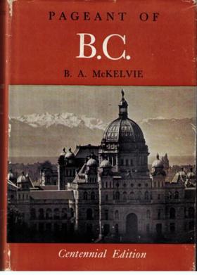
McKelvie's title is too modest: this is in essence a very well researched short history of British Columbia to the end of the nineteenth century, written for the general reader. Its more than 100 short chapters "first appeared in serial form in The Vancouver Daily Province, between February 1953 and March 1955". 263 pages plates (some color), portraits 23 cm Desiderata
|
1955 |
|
Native accounts of Nootka ethnography by Edward Sapir, Morris Swadesh 
This volume constitutes a continuation of Nootka Texts, Tales, and Ethnological Narratives, with Grammatical Notes and Lexical Materials, published in 1939. A third volume, Nootka Legends and Stories, is in preparation. Edward Sapir died while Nootka Texts was in press. The material for the subsequent volumes was already collected, the general plan laid out, the translation and editing begun by Sapir or by myself working under his guidance. However, a great deal remained to be carried out with- out his help. Editorial economy was a major problem. If the full body of Sapir's native Nootka collection were to be published in the manner followed in Nootka Texts, it would require eight or ten comparable volumes. Some simplification for the subsequent volumes, such as omissions of interlinear translation and linguistic commentary, were already envisaged by Sapir. However, it proved desirable to go much farther-- to adopt a terser style of translation, to limit materials given in notes, to use simple phonetic symbols which eliminate diacritics and allow more compact printing. For people familiar with Vancouver Island it has to be explained that the present materials do not come from the town of Nootka, but from the vicinity of Alberni. We say Nootka, because anthropologists are in the habit of using that term for all the west coast Indians from Alberni Canal to Kyuquot Sound. . Indiana University, 1, v. 21, no. 4, pt. 2 457 pages 26 cm Desiderata
|
1955 |
|
Eminent Men Of The Northwest, 1955 by C. W. Taylor
|
1955 |
|
Hail Columbia the thirty-year struggle for Grand Coulee Dam by George Sundborg
George Sundborg’s Hail Columbia: The thirty-year struggle for Grand Coulee Dam chronicles the monumental political crusade and unprecedented industrial subjugation of the Pacific Northwest's most powerful hydrological artery, situated within the massive, arid expanse of the Columbia Basin. The narrative maps how the severe environmental realities of this unforgiving inland topography—defined by the raw, untamed kinetic energy of the Columbia River trapped deep within a sheer basalt trench, juxtaposed against millions of acres of sun-baked, rain-starved sagebrush steppe—initially paralyzed large-scale agrarian settlement. By detailing the grueling, decades-long legislative warfare and the ultimate deployment of colossal, mechanized engineering required to pour the largest concrete gravity structure on Earth, the text illustrates how the economic salvation of the inland empire was strictly dictated by the necessity of artificially lifting this massive water volume out of its gorge. Ultimately, the account demonstrates that permanently domesticating the volatile hydrology of the Columbia and deploying this mammoth hydroelectric infrastructure to both artificially irrigate the desert and generate massive industrial wattage were the absolute prerequisites for transforming a barren, landlocked wasteland into the electrified powerhouse of the modern Pacific seaboard. 467 pages 22 cm Non-circulating [ 1 ]
|
1954 |
|
Adventures of Captain Bonneville by Washington Irving, Benjamin Louis Eulalie de Bonneville 
This is the deluxe Klickitat edition of this great classic a hundred and seventeen years after the first edition. It has come by its popularity, far beyond that of most books, even of most good books, by it having the frontier fur trade for a subject, by being a first hand record, by receiving a final enchantment from the one who could write Rip Van Winkle and the Legend of Sleepy Hollow. The "father of American literature" tells with gusto and charm the amazing travels of a picturesque soldier of fortune in the Far West during 1832-1835. Robert Reynolds, talented Northwest artist, did the original illustrations which make this book a collector's item. Adventures of Captain Bonneville is a companion volume to our Astoria 375pp. 357 pages illustrations Non-circulating [ 1 ]
|
1954 |
|
The untamed Olympics the story of a peninsula by Ruby El Hult 
The Untamed Olympics: The Story Of A Peninsula is a non-fiction book written by Ruby El Hult. The book provides a detailed account of the Olympic Peninsula in Washington State, USA, and its history, geography, and natural beauty. The author takes the reader on a journey through the history of the region, from the early Native American tribes that lived there, to the arrival of European explorers, and the logging and fishing industries that developed in the area.The book also focuses on the unique and diverse wildlife that inhabits the Olympic Peninsula, including elk, deer, black bears, and mountain lions. The author describes the breathtaking landscapes of the region, including the Olympic Mountains, the Hoh Rainforest, and the rugged coastline.In addition to its natural beauty, the Olympic Peninsula is also home to many fascinating cultural landmarks, such as the Makah Indian Reservation, the historic town of Port Townsend, and the Victorian-era Lake Quinault Lodge.Overall, The Untamed Olympics: The Story Of A Peninsula is a comprehensive and engaging exploration of one of America's most beautiful and fascinating regions. The author's vivid descriptions and personal anecdotes make the book a must-read for anyone interested in the history and natural wonders of the Olympic Peninsula.This scarce antiquarian book is a facsimile reprint of the old original and may contain some imperfections such as library marks and notations. Because we believe this work is culturally important, we have made it available as part of our commitment for protecting, preserving, and promoting the world's literature in affordable, high quality, modern editions, that are true to their original work. This description may be from another edition of this product. 267 pages : illustrations ; 22 cm Non-circulating [ 1 ]
|
1954 |