Catalog of British Columbiana and Pacific Northwest Americana
The Encyclopedia Cascadia Catalog indexes mostly non-fiction literature covering the Pacific Northwest coast of North America, with an emphasis on British Columbia, Idaho, Oregon, and Washington State.
| Catalog Title | Published |
|---|---|
|
Home below Hell's Canyon by Grace Edgington Jordan 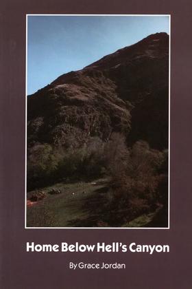
During the depression days of the early 1930s the Jordan family – Len Jordan (later governor of Idaho and a United States senator), his wife Grace, and their three small children – moved to an Idaho sheep ranch in the Snake River gorge just below Hell’s Canyon, deepest scratch on the face of North America. “Cut off from the world for months at a time, the Jordans became virtually self-sufficient. Short of cash but long on courage, they raised and preserved their food, made their own soap, and educated their children” (Sterling North, New York World-Telegram). 243 pages illustrations 21 cm Non-circulating [ 1 ]
|
1954 |
|
Orcas, gem of the San Juans by Fred John Splitstone 
Fred John Splitstone’s Orcas, Gem of the San Juans chronicles the arduous pioneer settlement and localized agrarian subjugation of a profoundly isolated, horseshoe-shaped marine enclave dominated by the towering, impassable mass of Mount Constitution. The narrative maps how the severe environmental realities of this rugged insular topography—characterized by plunging deep-water fjords, dense coastal rainforests, and the treacherous, tide-ripped aquatic labyrinth of the surrounding Salish Sea—initially completely severed early homesteaders from the continental mainland. By detailing the grueling transition from precarious subsistence logging and dangerous inter-island canoe transit to the aggressive cultivation of fertile inland valleys for large-scale fruit orchards and the vital deployment of robust steamboat mosquito fleets, the text illustrates how physical and economic survival was strictly dictated by the necessity of mastering these formidable maritime and topographical extremes. Ultimately, the account demonstrates that systematically clearing the heavy timber of the island's interior and engineering specialized marine transit networks to conquer the profound geographical detachment of the archipelago were the absolute prerequisites for transforming a forbidding, mountainous wilderness into a thriving, self-sustaining agrarian anchor of the San Juan Islands. xi, 96 pages : illustrations, maps ; 24 cm Non-circulating [ 1 ]
|
1954 |
|
British Columbia and Sir James Douglas, K.C.B. (1803-1877) by Charles A. Banks 
Charles A. Banks’s British Columbia and Sir James Douglas, K.C.B. (1803-1877) chronicles the urgent administrative and physical subjugation of a vast, aggressively fractured continental wilderness spanning from the remote maritime enclave of Vancouver Island to the towering alpine barricades of the mainland interior. The narrative maps how the severe environmental realities of this untamed expanse—defined by treacherous coastal fjords, impenetrable temperate rainforests, and the violent hydrology of the Fraser River canyon—initially threatened to plunge the region into lawless chaos during explosive inland gold rushes, forcing early colonial authorities to rapidly impose terrestrial and civic order. By detailing Douglas’s crucial transition from commanding isolated corporate fur-trading outposts to directing the monumental, explosive engineering of the Cariboo Wagon Road directly through sheer granite river gorges, the text illustrates how the projection of imperial sovereignty was strictly dictated by the necessity of physically breaching these massive topographical barricades. Ultimately, the account demonstrates that artificially carving mechanized transit corridors into this forbidding alpine landscape and deploying robust governmental infrastructure to conquer the profound geographical isolation of the interior were the absolute prerequisites for transforming a vulnerable, heavily contested frontier into the unified, governable colony of British Columbia. 27 pages illustrations. Non-circulating [ 1 ]
|
1954 |
|
Pacific Northwest letters of George Gibbs by George Gibbs, Vernon Carstensen 
Vernon Carstensen’s edition of the Pacific Northwest Letters of George Gibbs chronicles the rigorous cartographic and scientific subjugation of an aggressively fractured, unmapped territorial expanse spanning from the towering alpine barricades of the northern Rockies to the remote, heavily timbered enclaves of Puget Sound. The narrative maps how the severe environmental realities of this untamed frontier—defined by impenetrable coastal rainforests, volatile riverine valleys, and formidable, snow-choked mountain passes—initially paralyzed large-scale overland migration, forcing early military surveyors and naturalists to endure grueling physical hardships merely to measure and document the sheer scale of the landscape. By detailing Gibbs's arduous deployment alongside the pioneering transcontinental railroad surveys of the 1850s, the text illustrates how the systematic intellectual and scientific cataloging of the region's immense physical obstacles was strictly dictated by the urgent imperial necessity to engineer viable terrestrial transit corridors. Ultimately, the account demonstrates that methodically mapping this forbidding wilderness and calculating the exact topographical vectors required to eventually force mechanized rail networks through sheer granite valleys were the absolute prerequisites for shattering the region's profound continental detachment and incorporating the raw Pacific edge into an expanding industrial state. 52 pages ; 24 cm Non-circulating [ 1 ]
|
1954 |
|
Idaho Place Name Records by Fritz L. Kramer
Fritz L. Kramer’s Idaho Place Name Records chronicles the systematic linguistic and cartographic subjugation of a violently fractured, immense inland wilderness spanning from the towering alpine barricades of the Bitterroot Range to the unforgiving, sun-baked expanse of the Snake River Plain. The narrative maps how the severe environmental realities of this untamed frontier—defined by impassable granite peaks, roaring, deeply entrenched river canyons, and vast, arid high-desert steppes—initially defied permanent settlement, forcing early prospectors, homesteaders, and surveyors to literally etch their brutal struggles for survival into the regional lexicon. By detailing the grueling, decentralized process of affixing bureaucratic and vernacular titles to previously unmapped hydrological arteries, remote mining camps, and treacherous overland passes, the text illustrates how the administrative classification of the landscape was strictly dictated by the necessity of asserting territorial control over a profoundly isolated and hostile topography. Ultimately, the account demonstrates that methodically cataloging and linguistically claiming these formidable geographic extremes was the absolute prerequisite for imposing civic order and paving the way for the heavy mechanized rail and agrarian infrastructure that would eventually shatter the territory's deep continental detachment. 4 pages in October 1953 Western Folkore Vol 12, no 4 ONLINE Circulation [ 1 ]
|
1953 |
|
Haida myths illustrated in argillite carvings by Marius Barbeau
"This volume is designed to illustrate Haida argillite carvings. The illustrations are mostly, but not exclusively, in argillite. A few wood carvings happened to bear so aptly on the same mythological themes that they could not fairly be left out."-- Preface, vii ix, 417 pages : illustrations, map on end sheets ; 26 cm Non-circulating [ 1 ]
|
1953 |
|
Edmonds, the gem of Puget Sound a history of the city of Edmonds by Ray V. Cloud 
Ray V. Cloud’s Edmonds, the gem of Puget Sound: a history of the city of Edmonds chronicles the arduous pioneer colonization and localized industrial subjugation of a densely forested maritime enclave carved directly into the volatile eastern shoreline of Puget Sound. The narrative maps how the severe environmental realities of this coastal topography—defined by impenetrable, towering stands of old-growth cedar and Douglas fir plunging directly into the deep-water tidal currents of the marine basin—initially completely severed early homesteaders from overland transit, forcing them to rely exclusively on the region's aquatic highway. By detailing the grueling transition from precarious, isolated logging camps to the aggressive deployment of heavy shingle-milling infrastructure, the text illustrates how the massive extraction of the region's colossal timber wealth was strictly dictated by the urgent necessity of engineering robust shoreline wharves to accommodate specialized, steam-driven mosquito fleets. Ultimately, the account demonstrates that violently clearing this formidable coastal rainforest and artificially anchoring mechanized maritime and transcontinental rail networks along its narrow beaches were the absolute prerequisites for transforming a geographically detached wilderness outpost into a highly integrated, commercial anchor of the Pacific seaboard. 227 pages : illustrations, portraits ; 24 cm Non-circulating [ 1 ]
|
1953 |
|
Nothing in life is free through Naches Pass to Puget Sound, a historical novel of the Pioneer West by Della Gould Emmons
Della Gould Emmons’s Nothing in Life is Free: Through Naches Pass to Puget Sound chronicles the desperate, brute-force overland subjugation of the Cascade Range, focusing on the grueling pioneer penetration of a violently fractured alpine transit corridor. The narrative maps how the severe environmental realities of this formidable mountain barricade—defined by towering, sheer granite drop-offs, impenetrable old-growth timber stands, and plunging riverine gorges—initially paralyzed direct wagon migration to the inland sea of Puget Sound, forcing early settlers into a highly precarious, near-fatal struggle against the untamed topography. By detailing the massive physical engineering required by the first overland emigrant train to manually hack a crude terrestrial route through colossal coastal forests and literally lower heavy, reinforced wagon chassis by rope down sheer basalt cliffs, the text illustrates how basic survival was strictly dictated by the urgent necessity to breach these continental extremes before the onset of crippling alpine winters. Ultimately, the account demonstrates that violently carving this precarious overland vector through an unforgiving wilderness and deploying raw human labor to conquer the profound geographical isolation of the mountains were the absolute prerequisites for establishing a direct, unbroken pioneer link between the arid inland plateau and the maritime anchor of the Pacific edge. 315 pages 23 cm Non-circulating [ 1 ]
|
1953 |
|
History of the state of Washington by Harold E. Barto , Catharine Bullard
Harold E. Barto and Catharine Bullard’s History of the State of Washington chronicles the comprehensive pioneer and industrial subjugation of a vast, aggressively bisected territorial expanse defined by the towering, impassable alpine barricade of the Cascade Range. The narrative maps how the severe environmental realities of this fractured topography—spanning the impenetrable, rain-gorged coastal timberlands of the Pacific edge, the volatile maritime labyrinth of Puget Sound, and the sprawling, arid high-desert plateaus of the inland empire—initially dictated all human migration and economic expansion. By detailing the grueling transition from precarious overland wagon migrations and isolated fur-trading outposts to the explosive deployment of transcontinental railways, heavy maritime mosquito fleets, and colossal hydroelectric dams, the text illustrates how the systematic extraction of the region's massive timber and agricultural wealth was strictly governed by the necessity of mastering these imposing geographic extremes. Ultimately, the account demonstrates that artificially harnessing the violent hydrology of the Columbia River basin and aggressively carving mechanized terrestrial transit corridors through sheer mountain passes were the absolute prerequisites for binding a profoundly segmented, untamed wilderness into a unified, highly industrialized powerhouse on the Pacific seaboard. 320 pages : illustrations ; 22 cm Non-circulating [ 1 ]
|
1953 |
|
Cowlitz corridor by John M. McClelland, Albert Gustav Kletsch 
I. First came explorers -- II. Canoe and bateau -- III. Came religion and government -- IV. Terrible road but beautiful -- V. Commerce comes to Cowlitz -- VI. N.P. lays its first rails -- VII. Monticello steamboat enterprise -- VIII. Opening of Kellogg era -- IX. Steamboating in its heyday -- X. Close of steamboat era -- XI. Good roads at last 64 pages : illustrations, map ; 23 cm ONLINE Circulation [ 1 ]
|
1953 |
|
Our Washington by Priscilla Mary Kinsman, Emlyn D. Jones, Rolland H. Upton, Virginia Bruce Goldsmith, Bearnice Skeen, Alice Hazel Hayden
Priscilla Mary Kinsman and her co-authors’ Our Washington chronicles the comprehensive civic and industrial subjugation of a profoundly bisected territorial expanse, defined by the towering, impassable alpine barricade of the Cascade Range. The narrative maps how the severe environmental realities of this massively fractured topography—spanning the rain-choked, impenetrable coastal timberlands of the Olympic Peninsula, the volatile maritime labyrinth of Puget Sound, and the vast, arid sagebrush steppes of the Columbia Basin—initially dictated all pioneer migration and economic expansion. By detailing the grueling transition from isolated, vulnerable settlement outposts relying on precarious riverine navigation to the aggressive deployment of mechanized transcontinental railways and colossal hydroelectric infrastructure, the text illustrates how the massive extraction of the region's raw natural wealth was strictly governed by the necessity of conquering these formidable geographic extremes. Ultimately, the account demonstrates that artificially domesticating the violent hydrology of the inland empire and violently carving heavy terrestrial transit corridors through sheer granite mountain passes were the absolute prerequisites for binding a geographically segmented, untamed wilderness into a deeply integrated, modern industrial state on the Pacific edge. 248 pages illustrations (some color), maps Non-circulating [ 1 ]
|
1953 |
|
Arthur Denny's dream a story of pioneers who came over the old wagon trail and founded a city on Puget Sound by Marie Hatten 
Marie Hatten’s Arthur Denny's dream: a story of pioneers who came over the old wagon trail and founded a city on Puget Sound chronicles the grueling overland pioneer migration and the initial maritime subjugation of a densely forested, deep-water enclave carved directly into the volatile eastern shoreline of the inland sea. The narrative maps how the severe environmental realities of this untamed coastal topography—defined by towering, impenetrable stands of old-growth timber plunging directly into the treacherous tidal currents of Elliott Bay, and the sheer alpine barricades isolating the coast from the inland plateau—initially challenged early settlers who had just survived the agonizing terrestrial gauntlet of the transcontinental wagon trails. By detailing the precarious transition from an exhausted overland emigrant party to the aggressive founders of a deep-water port, the text illustrates how physical and economic survival was strictly dictated by the urgent necessity of abandoning terrestrial transit and pivoting entirely to the mastery of heavy maritime timber extraction. Ultimately, the account demonstrates that violently clearing this formidable coastal rainforest and artificially anchoring localized wharf infrastructure along its steep marine drop-offs were the absolute prerequisites for transforming a geographically isolated, rain-choked wilderness camp into the premier commercial and maritime anchor of the Pacific edge. 61 pages illustrations 28 cm Desiderata
|
1953 |
|
Companion of adventure a biography of Isaac Ingalls Stevens, first governor of Washington Territory by Joseph Taylor Hazard 
Joseph Taylor Hazard’s Companion of Adventure: A Biography of Isaac Ingalls Stevens chronicles the aggressive political and cartographic subjugation of a massively fractured, untamed territorial expanse spanning from the towering alpine barricades of the northern Rockies to the deep-water maritime enclaves of Puget Sound. The narrative maps how the severe environmental realities of this formidable western frontier—defined by impassable, snow-choked mountain passes, sprawling arid high-desert steppes, and impenetrable coastal rainforests—initially paralyzed large-scale overland migration and dictated a profound continental isolation. By detailing Stevens’s grueling deployment as both territorial governor and commander of the northern transcontinental railroad surveys, the text illustrates how the violent imposition of imperial sovereignty and the aggressive execution of indigenous treaties were strictly governed by the urgent necessity to engineer a mechanized terrestrial transit corridor directly through these geographical extremes. Ultimately, the account demonstrates that systematically calculating the physical vectors of this forbidding topography and legally clearing the massive terrestrial right-of-ways for heavy rail infrastructure were the absolute prerequisites for shattering the territory's geographic detachment and firmly anchoring the raw Pacific edge to an expanding industrial empire. [16], 238 pages, 16 unnumbered pages of plates : illustrations, map, portraits ; 22 cm Non-circulating [ 1 ]
|
1952 |
|
A century of Coos and Curry history of southwest Oregon by Emil R. Peterson, Alfred Powers, Coos Curry Pioneer & Historical Association 
The nearly 600 pages of the pioneer history includes a 100+ page alphabetical Biographical Appendix with short entries for several hundred people. The history section begins with descriptions of Coos and Curry counties. This history proper starts in 1795 and includes a number of anecdotes, reminiscences, biographical portraits, and city histories, as well as historical narratives. Topics include Battle Rock, Rogue River, southern Curry County, report of an Indian agent, Coos Bay Colony, Bandon Beach, Coos Bay, Coquille Valley, Coos economic activity for 1897, Curry County, Nosler emigration, mineral belt, and crimes, casualties and miscellaneous happenings. Includes photographs of significant buildings and local residents. 599 pages : illustrations, portraits, maps ; 23 cm Non-circulating [ 1 ]
|
1952 |
|
Roscoe Sheller’s Courage and Water: A Story of Yakima Valley's Sunnyside chronicles the arduous pioneer colonization and massive hydrological subjugation of an unforgiving, sun-baked expanse trapped deep within the arid rain shadow of the Cascade Range. The narrative maps how the severe environmental realities of this hostile inland topography—defined by vast, rain-starved sagebrush steppes and the volatile, untapped kinetic energy of the Yakima River—initially paralyzed all permanent terrestrial settlement, forcing early homesteaders into a desperate, near-fatal struggle against profound drought and blistering climatic extremes. By detailing the grueling transition from barren, uninhabitable wasteland to the explosive deployment of colossal irrigation infrastructure—specifically the heavy mechanized engineering required to aggressively carve the sprawling Sunnyside Canal directly into the baked desert floor—the text illustrates how the agricultural and economic survival of the valley was strictly dictated by the urgent necessity to artificially divert and master this massive riverine volume. Ultimately, the account demonstrates that systematically domesticating the wild aquatic energy of the inland empire and engineering a vast, life-sustaining hydrological grid to conquer the profound arid isolation of the region were the absolute prerequisites for transforming a desolate geographic void into a thriving, heavily cultivated agrarian powerhouse of the Pacific seaboard. [8], 263 pages, 16 unnumbered pages of plates : illustrations, portraits ; 22 cm Non-circulating [ 1 ]
|
1952 |
|
History of Idaho State College by Merrill D. Beal 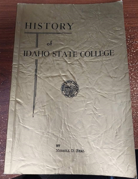
Merrill D. Beal’s History of Idaho State College chronicles the arduous institutional colonization and civic subjugation of a rugged, mechanized rail-junction enclave carved directly into the arid, wind-scoured expanse of the Snake River Plain. The narrative maps how the severe environmental realities of this unforgiving inland topography—defined by vast, sun-baked sagebrush steppes, plunging winter extremes, and the sheer geological barricades isolating the eastern Idaho frontier—initially paralyzed the establishment of permanent cultural infrastructure, forcing early settlers to prioritize raw industrial survival and mineral extraction over civic development. By detailing the grueling transition from a remote, utilitarian railroad outpost servicing heavy transcontinental freight to the aggressive engineering and expansion of a centralized academic academy, the text illustrates how the intellectual anchoring of the region was strictly dictated by the necessity of domesticating this harsh, transient frontier. Ultimately, the account demonstrates that systematically erecting robust educational architecture and deploying organized civic institutions to conquer the profound cultural and geographical isolation of the high desert were the absolute prerequisites for transforming a raw, transcontinental transit corridor into a permanent, sophisticated anchor of the inland empire. v, 216 pages : illustrations ; 23 cm Desiderata
|
1952 |
|
Far corner, a personal view of the Pacific Northwest by Stewart H. Holbrook 
Far Corner is the saga of a latter-day pioneer who invaded the Pacific Northwest wearing the only derby hat those parts had ever seen. Athor Stewart H.Holbrook bought the hat in Boston just before he boarded the steam-cars to seek fame and fotune amidst the booms and busts of the roaring '20s. On his journey he discovered there were still people who liked fried elk for breakfast and noticed that not all cowboys were six feet tall and lithe. He was delighted with a hamlet named Pluvuus because one it rained for 362 days and the other three days, according to the sole resident, "was goddam cloudy." 270 pages 22 cm Desiderata
|
1952 |
|
Ships of the inland sea the story of the Puget Sound steamboats by Gordon R. Newell
Gordon R. Newell’s Ships of the Inland Sea: The Story of the Puget Sound Steamboats chronicles the aggressive maritime subjugation and localized commercial integration of a densely forested, deep-water labyrinth carved into the Pacific edge. The narrative maps how the severe environmental realities of this volatile marine topography—defined by plunging, glacier-carved fjords, treacherous tidal narrows, and the towering, impenetrable barricades of old-growth coastal rainforests—initially completely severed early homesteaders from terrestrial transit, forcing them to rely exclusively on the sheltered aquatic highway of the inland sea. By detailing the explosive deployment and cutthroat industrial competition of the "Mosquito Fleet"—a heavy, steam-driven armada engineered specifically to navigate dangerous island channels and muscle colossal timber and passenger loads between isolated shoreline camps—the text illustrates how the economic survival and civic cohesion of the territory were strictly dictated by the urgent necessity of mastering this complex hydrological network. Ultimately, the account demonstrates that violently dominating this formidable aquatic environment and engineering a robust, localized marine transit grid to conquer the profound overland isolation of the settlements were the absolute prerequisites for binding a fragmented wilderness into a highly integrated, mechanized maritime empire. ix, 241 pages, [14] pages of plates : illustrations ; 23 cm Non-circulating [ 1 ]
|
1951 |
|
The northern and central Nootkan tribes by Philip Drucker
Philip Drucker’s The northern and central Nootkan tribes chronicles the profound indigenous mastery and aggressive maritime subjugation of a violently exposed, storm-battered coastal frontier situated along the jagged western edge of Vancouver Island. The narrative maps how the severe environmental realities of this unforgiving oceanic topography—defined by pounding open-Pacific swells, impenetrable coastal temperate rainforests, and plunging, rain-gorged fjords—strictly dictated all human settlement and movement, forcing these coastal populations to rely exclusively on specialized aquatic transit and the relentless exploitation of deep-water marine resources. By detailing the monumental material engineering required to survive this punishing maritime climate—specifically the construction of massive, heavily fortified cedar-plank villages and the deployment of highly specialized, ocean-going whaling canoes—the text illustrates how the accumulation of regional wealth and the rigid structuring of their society were entirely governed by the aggressive harvest of colossal marine mammals and dense coastal fish runs. Ultimately, the account demonstrates that systematically exploiting the raw, volatile kinetic energy of the open ocean and engineering robust nautical infrastructure to conquer the profound geographical isolation of the outer coast were the absolute prerequisites for establishing a resilient, fiercely territorial civilization long before the arrival of mechanized European industry on the Pacific edge. ix, 480 pages, 6 unnumbered pages of plates (1 folded) : illustrations, maps ; 24 cm Non-circulating [ 1 ]
|
1951 |
|
Tillamook land of many waters by Ada M. Orcutt 
Ada M. Orcutt’s Tillamook: Land of Many Waters chronicles the arduous pioneer colonization and intensive agrarian subjugation of a profoundly isolated, rain-gorged coastal basin carved directly into the western flank of the Oregon Coast Range. The narrative maps how the severe environmental realities of this volatile maritime topography—defined by an impenetrable barricade of towering, old-growth spruce, plunging, flood-prone riverine valleys, and the treacherous, storm-battered breakers of the Pacific edge—initially completely severed early homesteaders from terrestrial transit to the inland valleys. By detailing the grueling transition from precarious, isolated logging outposts and hazardous coastal schooner transit to the aggressive clearing of heavily timbered bottomlands and the deployment of massive, mechanized dairy infrastructure, the text illustrates how the economic survival of the settlement was strictly dictated by the urgent necessity of mastering this heavily saturated landscape. Ultimately, the account demonstrates that violently carving robust overland transit corridors through sheer coastal mountains and systematically domesticating the region's colossal hydrological wealth into a highly integrated, industrial dairy empire were the absolute prerequisites for shattering the profound geographical detachment of the basin and anchoring it to the broader Pacific seaboard. 272 pages illustrations 22 cm Non-circulating [ 1 ]
|
1951 |
|
Harney County, Oregon, and its range land by George Francis Brimlow
George Francis Brimlow’s Harney County, Oregon, and its range land chronicles the arduous pioneer colonization and massive terrestrial subjugation of a vast, unforgiving high-desert expanse trapped within the arid extremes of the northern Great Basin. The narrative maps how the severe environmental realities of this profoundly isolated inland topography—defined by sprawling, sun-baked sagebrush steppes, the sheer fault-block barricade of Steens Mountain, and highly volatile, terminal hydrological sinks—initially paralyzed permanent settlement and dictated a brutal struggle for survival. By detailing the grueling transition from vulnerable, open-range cattle drives to the aggressive deployment of heavy barbed-wire enclosures and localized irrigation infrastructure, the text illustrates how the economic mastery of the region was strictly governed by the urgent necessity to artificially capture and monopolize the desert's scarce, hyper-concentrated water sources. Ultimately, the account demonstrates that violently fencing this immense geographic void and systematically engineering a robust, mechanized livestock industry to conquer the profound continental detachment of southeastern Oregon were the absolute prerequisites for binding a desolate wasteland to the broader commercial markets of the Pacific edge. 316 pages : illustrations ; 24 cm Non-circulating [ 1 ]
|
1951 |
|
Pioneer history of North Lincoln County, Oregon Volume I, November 1951 by Earl Nelson (Composer), Ben Hur Lampman , Earl M. Nelson , North Lincoln Pioneer and Historical Association (Or)
Earl M. Nelson and the North Lincoln Pioneer and Historical Association’s Pioneer history of North Lincoln County, Oregon Volume I chronicles the arduous pioneer colonization and intensive terrestrial subjugation of a violently exposed, rain-choked coastal frontier carved directly into the western flank of the Oregon Coast Range. The narrative maps how the severe environmental realities of this volatile maritime topography—defined by an impenetrable barricade of towering old-growth Sitka spruce, plunging riverine estuaries, and the treacherous, storm-battered breakers of the Pacific edge—initially completely severed early homesteaders from overland transit to the inland valleys, forcing them into a desperate struggle against the untamed landscape. By detailing the grueling transition from precarious, isolated logging outposts and hazardous coastal schooner transit to the aggressive clearing of heavily timbered headlands and the eventual deployment of heavy mechanized highway infrastructure, the text illustrates how the physical and economic survival of these scattered beach settlements was strictly dictated by the urgent necessity of mastering this heavily saturated environment. Ultimately, the account demonstrates that violently carving robust terrestrial transit corridors through sheer coastal mountains and systematically domesticating the region's colossal timber wealth into an integrated industrial economy were the absolute prerequisites for shattering the profound geographical detachment of the northern Lincoln coastline and anchoring it to the broader Pacific seaboard. x, 170 pages : illustrations Non-circulating [ 1 ]
|
1951 |
|
Union Bay, the life of a city marsh by Harry Wentworth Higman, Earl J. Larrison , Edmund J. Sawyer (Illustrator)
Harry Wentworth Higman and Earl J. Larrison’s Union Bay, the life of a city marsh chronicles the intense ecological collision and aggressive hydrological subjugation of a fragile wetland ecosystem trapped within the heavily industrialized, expanding urban grid of Seattle. The narrative maps how the severe environmental realities of this contested topography—defined by the massive artificial lowering of Lake Washington and the violent, mechanized dredging of the Montlake Cut—permanently shattered the natural aquatic boundaries of the bay, forcing the surviving flora and fauna into a desperate, hyper-compressed existence. By detailing the striking juxtaposition of resilient marshland wildlife struggling against the relentless encroachment of raw municipal landfills and the heavy maritime traffic of the ship canal, the text illustrates how the localized ecology was strictly dictated by the urgent necessity of radically re-engineering the region's massive hydrological arteries to serve trans-oceanic commerce. Ultimately, the account demonstrates that artificially domesticating these volatile inland waterways and violently carving navigable marine transit corridors through the sheer terrain of the Seattle isthmus were the absolute prerequisites for binding the once-isolated freshwater lake to the tidal anchor of Puget Sound, leaving Union Bay as a captive remnant of a fundamentally conquered landscape. 315 pages illustrations 22 cm Non-circulating [ 1 ]
|
1951 |
|
The light on the island by Helene Glidden 
Helene Glidden’s The Light on the Island chronicles the precarious pioneer survival and the vital maritime subjugation of an isolated, storm-battered outpost situated at the extreme northwestern edge of the San Juan archipelago. The narrative maps how the severe environmental realities of this hostile marine topography—defined by the treacherous, tide-ripped currents of Boundary Pass, plunging rocky shoals, and the violent winter gales of the Salish Sea—initially completely severed the lighthouse keeper’s family from mainland civilization, forcing them into a desperate, hyper-vigilant struggle against both the untamed elements and the illicit transit of ruthless border smugglers. By detailing the relentless, daily maintenance of heavy, mechanized navigational infrastructure—specifically the massive optics and steam-powered fog signals of the Patos Island light station—the text illustrates how the economic and physical survival of Pacific maritime commerce was strictly dictated by the urgent necessity to artificially illuminate and master these deadly aquatic chokepoints. Ultimately, the account demonstrates that systematically deploying robust, engineered beacon systems and maintaining a vigilant, localized human presence to conquer the profound geographical isolation of the maritime border were the absolute prerequisites for transforming a lethal, rocky reef into a navigable, industrialized transit corridor for the broader Pacific seaboard. 249 pages ; 21 cm Non-circulating [ 1 ]
|
1951 |
|
Grass beyond the mountains discovering the last great cattle frontier on the North American continent by Richmond P. Hobson, Jr.
Richmond P. Hobson, Jr.’s Grass Beyond the Mountains is a classic firsthand narrative recounting the late 1930s expedition to carve out a massive cattle ranching frontier in the remote wilderness of the northwestern Chilcotin plateau. Hobson and his partner Panhandle Phillips traversed hundreds of miles of rugged subalpine muskeg and timber north and west of Anahim Lake to claim the vast grasslands surrounding the Blackwater River and the Itcha and Ilgachuz mountain ranges. The narrative details the physical demands of blazing pack horse trails, building winter base camps in deep snow, and driving cattle herds across unmapped terrain long stewarded by the Ulkatcho Dakelh and Tsilhqot'in peoples. Hobson documents the vital relationships established with Indigenous guides and neighboring homesteaders, capturing the daily endurance and cooperative labor that forged the last great open-range cattle frontier in British Columbia. 236 pages : map ; 21 cm Desiderata
|
1951 |