Catalog of British Columbiana and Pacific Northwest Americana
The Encyclopedia Cascadia Catalog indexes mostly non-fiction literature covering the Pacific Northwest coast of North America, with an emphasis on British Columbia, Idaho, Oregon, and Washington State.
| Catalog Title | Published |
|---|---|
|
Whispers from "Old Genesee," and echoes of the Salmon River by John A. Platt 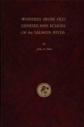
Early day history and folklore of the Idaho Panhandle, including Latah, Nez Perce, Idaho and Lewis counties. Preface by the author: "In writing the following pages I have been influenced by a desire to record for our sons and daughters, and their descendants, a written chronicle of the happenings of our lives, together with a mention of certain interesting events which occurred in the vicinity of Genesee during the pioneer days. As these events happened from sixty to seventy-five years ago, there may be some lapse of memory or wrong interpretations. I was only a small boy at the time the earlier events transpired, but they made such a deep impression on my mind that I have never forgotten them. This will not be a complete history – nor a literary masterpiece. It will contain some history, some biography, and perhaps a sprinkling of “blarney.” If the reader, as he peruses these pages, finds amusement, information or entertainment from my efforts, I will feel amply rewarded.” [7], 75, [6],46, [1] pages : illustrations, map, portraits ; 23 cm Non-circulating [ 1 ]
|
1959 |
|
Reports and letters of Herbert Beaver, 1836-1838, chaplain to the Hudson's Bay Company and missionary to the Indians at Fort Vancouver by Herbert Beaver, Hudson's Bay Company 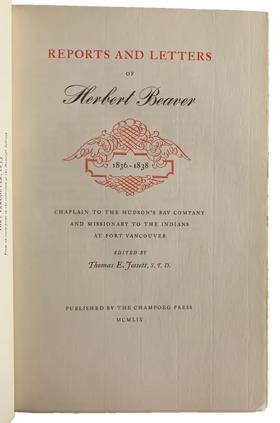
Herbert Beaver’s Reports and Letters chronicles the profound cultural collision that occurred when an inflexible British ecclesiastical framework was thrust into the profoundly isolated, geographically expansive trading empire of the Hudson’s Bay Company at Fort Vancouver. The text maps how the immense distances and unyielding topography of the Columbia River basin strictly dictated the outpost's pragmatic social structure, forcing the diverse frontier population to prioritize localized survival, massive agricultural self-sufficiency, and vital indigenous alliances over rigid metropolitan dogmas. By detailing Beaver’s vitriolic clashes with the fort's administration, the narrative illustrates how the sheer physical detachment from the European continent rendered traditional, uncompromising institutional infrastructure entirely incompatible with the severe environmental realities of the Pacific frontier. Ultimately, the account demonstrates that adapting to the immense scale and isolating geography of this critical riparian highway—often through localized, syncretic social customs—was the absolute prerequisite for maintaining a functional imperial foothold in the untamed western wilderness. xxiv, [2], 148, [5] pages : illustration ; 28 cm Non-circulating [ 1 ]
|
1959 |

"The McLoughlin Empire and Its Rulers reveals an amazing record of a lower Canada family of Scotch Protestant and Irish Catholic descent, which produced three remarkably astute and successful persons to guide the family destiny to a high point. Dr. John McLoughlin, trained as a physician, became the Chief Factor in the Columbia District of the Hudson's Bay Company, where he ruled a vast empire in the Northwest. Dr. David McLoughlin, his brother, also educated for a medical career, became a highly successful doctor in Paris, and personal physician to King Louis Philippe. Their sister, Marie Louise, as Sister St. Henry, found her success as the leading teacher and Mother Superior of the great Ursuline Monastery in Quebec, where she remained alert to the affairs of her family, educated her nieces, and aided in solving family problems. The story comes to light for the first time, through the discovery of a fascinating file of family correspondence, preserved by the Fraser family, relatives of the McLoughlins on their maternal side. It discloses a hitherto unknown side of the John McLoughlin saga - his personal finances, his children, his land holdings in the lower St. Lawrence River valley, and his prominent kin, both McLoughlin and Fraser. A carefully researched and well documented account is presented by Dr. Barker."--Publisher's description 370 pages illustrations, color coats of arms, facsimiles, genealogical table, 2 maps (1 folded) portraits 25 cm Non-circulating [ 1 ]
|
1959 |
|
Coastal exploration of Washington by Robert Ballard Whitebrook, Henry R. Wagner (Writer of introduction)
Robert Ballard Whitebrook’s Coastal Exploration of Washington provides a meticulous maritime chronicle of the initial European efforts to chart the treacherous and highly complex oceanic edge of the Pacific Northwest. The narrative maps how the formidable physical realities of the region—including dense, disorienting coastal fogs, violent Pacific surf, and an impenetrable coastal barrier of temperate rainforests—completely precluded overland discovery, forcing Spanish and British expeditions to rely entirely on vulnerable sailing vessels. By detailing the painstaking cartographic mastery of the labyrinthine, deep-water glacial fjords of the Strait of Juan de Fuca and Puget Sound, the text illustrates how early imperial strategies were strictly dictated by the severe environmental constraints of this volatile marine topography. Ultimately, the account demonstrates that navigating and documenting these dangerous aquatic highways was the absolute prerequisite for breaching the region's profound physical isolation and opening the untamed western frontier to global maritime commerce. xxv, 146 pages : illustrations, maps ; 24 cm Non-circulating [ 1 ]
|
1959 |
|
Fish and ships by Ralph W. Andrews, A. K. Larssen
Ralph W. Andrews and A. K. Larssen’s Fish and Ships chronicles the grueling industrial evolution of the commercial fishing fleets that extracted immense biological wealth from the violent, storm-battered marine topography of the North Pacific. The narrative maps how the severe environmental realities of treacherous coastal inlets and the unforgiving open ocean forced early maritime populations to engineer increasingly resilient vessels and mechanized harvesting infrastructure to survive these volatile aquatic environments. By detailing the transition from rudimentary pioneer techniques to massive, industrialized salmon and halibut operations, the text illustrates how a total reliance on mastering dangerous offshore currents strictly dictated the economic and physical survival of the region's isolated coastal settlements. Ultimately, the account demonstrates that conquering the extreme meteorological and oceanographic challenges of this rugged marine frontier was the absolute prerequisite for building a sustaining, export-driven maritime empire along the Pacific seaboard. 173 pages illustrations 23 cm Non-circulating [ 1 ]
|
1959 |
|
The Salmon King of Oregon R.D. Hume and The Pacific fisheries by Gordon B. Dodds 
Robert D. Hume, capitalist, pioneer in the development of the salmon-canning industry of the Pacific Coast, and one of America's first conservationists, was an entrepreneur whose activities illustrate much about the economy, politics, and society of the Northwest. 257 pages illustrations 23 cm Non-circulating [ 1 ]
|
1959 |
|
Nehalem Tillamook tales by Elizabeth derr Jacobs, Melville Jacobs 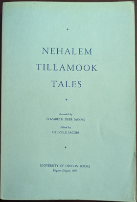
Elizabeth Derr Jacobs and Melville Jacobs’s Nehalem Tillamook Tales chronicles the oral traditions of an indigenous coastal society whose entire cultural and economic existence was forged by the rugged, rain-drenched topography of the northern Oregon seaboard. The recorded narratives map how the impenetrable barrier of the coastal temperate rainforest and the treacherous maritime climate forced the Nehalem Tillamook to orient their survival exclusively around the region's volatile estuarine networks and salmon-rich river systems. By preserving these ancestral accounts, the text illustrates how the mastery of advanced cedar-craft infrastructure—specifically the construction of monumental dugout canoes and weather-resilient plank houses—was strictly dictated by the necessity of navigating and enduring this wet, heavily timbered environment. Ultimately, the collection demonstrates that for these early maritime populations, profound physical and cultural adaptation to a geographically isolated, water-bound landscape was the absolute prerequisite for long-term endurance along the unforgiving Pacific edge. 216 s Non-circulating [ 1 ]
|
1959 |
|
A ram in the thicket the story of a roaming homesteader family on the Mormon frontier by Frank C. Robertson 
Frank Robertson's hard-edged autobiography about pioneering life in northern and southern Idaho in the 1890s appears in this reprint edition with an introduction by historian Charles S. Peterson, Professor Emeritus at Utah State University and Professor of History at Southern Utah University. Enmeshed in poverty, unremitting toil, and personal conflict, the Robertson family lived first in the wilderness near Moscow, Idaho, then subsequently converted to Mormonism and moved to Chesterfield, Idaho. The family continued to face financial hardships until 1922 when Frank Robertson sold his first short story. From then until his death in 1969, this prolific and popular western writer produced countless short stories and at least 150 books. Robertson's life story is a kind of regional history in itself, and his writing is firmly rooted in those experiences. He worked diligently at his writing, found what would sell, and won great popularity with American and European audiences. With a vigorous resurgence in western regionalism underway, republication of A Ram in the Thicket makes this man's remarkable autobiography available once again to interested readers.The Story of a Roaming Homesteader Family on the Mormon Frontier 311 pages illustrations 22 cm Desiderata
|
1959 |
|
Name calling notes on the discovery and exploration of the Olympic Peninsula by Robert Hitchman
|
1959 |
|
Milestones on Vancouver Island the story of this "Island to the West", its past, and its present by C. P. Lyons 
C. P. Lyons’s Milestones on Vancouver Island chronicles the grueling pioneer colonization and resource extraction of a massive, heavily forested landmass completely severed from the North American continent by the treacherous waters of the Pacific Ocean. The narrative maps how the island’s formidable topography—defined by an impassable, glaciated mountainous spine and impenetrable coastal rainforests—forced early settlements to cling precariously to the sheltered eastern shoreline along the Strait of Georgia. By detailing the massive industrial efforts required to exploit rich coal deposits and vast timber reserves, the text illustrates how establishing robust maritime infrastructure and localized logging rail networks was strictly dictated by the severe overland constraints of this rugged terrain. Ultimately, the account demonstrates that conquering the extreme geographic isolation and dense biological barriers of this offshore frontier was the absolute prerequisite for integrating its immense natural wealth into the broader Pacific maritime economy. viii, 315 pages : illustrations, maps ; 21 cm Non-circulating [ 1 ]
|
1958 |
|
Tosoiba by Lula Barnard, Faunda Bybee , Lola Walker , Daughters of Utah Pioneers Camp Meads
Lula Barnard, Faunda Bybee, and Lola Walker’s Tosoiba, compiled for the Daughters of Utah Pioneers, chronicles the grueling agrarian colonization of southeastern Idaho’s Gem Valley, an isolated, high-altitude basin defined by its rugged volcanic topography and punishing alpine climate. The collected narratives map how the severe environmental realities of this arid inland steppe forced early Mormon pioneers to rely on immediate, cooperative hydrological engineering, systematically diverting mountain runoff to establish vital crop irrigation networks. Ultimately, the account demonstrates that artificially mastering this localized hydrology and constructing robust communal infrastructure to endure the brutal winter extremes were the absolute prerequisites for transforming a forbidding high-desert expanse into a permanent, agriculturally self-sufficient frontier settlement. x, 326 pages : illustrations, portraits, map ; 23 cm Non-circulating [ 1 ]
|
1958 |
|
Search for the Northwest Passage by Lucile Saunders McDonald
Lucile Saunders McDonald’s Search for the Northwest Passage chronicles the centuries-long maritime struggle to locate a navigable oceanic corridor through the treacherous, ice-choked topography of the North American arctic and subarctic coasts. The narrative maps how the severe environmental realities of the northern latitudes—characterized by impenetrable glacial packs, disorienting coastal fogs, and violent storm systems—relentlessly battered early European exploratory fleets and thwarted global trading ambitions. By detailing the grueling, often fatal voyages of successive maritime expeditions, the text illustrates how the absolute physical barrier of the frozen continental landmass forced navigators to continuously engineer more resilient vessels and adapt to punishing aquatic extremes. Ultimately, the account demonstrates that the unrelenting, hostile marine geography of the northern frontier strictly dictated the pace of exploration, proving that imperial ambitions were fundamentally constrained by the formidable climatic realities of this isolated oceanic edge. 137 pages illustrations 23 cm Non-circulating [ 1 ]
|
1958 |
|
Clatsop County, Oregon a history by Emma Gene Miller
Emma Gene Miller’s Clatsop County, Oregon: A History chronicles the arduous pioneer settlement and industrial development of the extreme northwestern edge of the Oregon territory, a rugged coastal enclave defined by the violent collision of the Columbia River and the Pacific Ocean. The narrative maps how the impenetrable barrier of the coastal temperate rainforest severely obstructed early overland migration, forcing indigenous populations, fur traders, and subsequent settlers to rely entirely on navigating the treacherous aquatic highway of the Columbia River Bar. By detailing the transition from an isolated trading outpost to a booming epicenter for salmon canning and massive timber extraction, the text illustrates how engineering robust maritime infrastructure was strictly dictated by the severe environmental realities of this storm-battered estuarine topography. Ultimately, the account demonstrates that artificially stabilizing this hazardous navigational gateway and conquering the dense biological mass of the surrounding wilderness were the absolute prerequisites for anchoring a permanent, export-driven economy on this volatile oceanic frontier. 291 pages : illustrations ; 22 cm Non-circulating [ 1 ]
|
1958 |
|
Town where time stood still the story of Seabeck by Gordon R. Newell, Don Sherwood 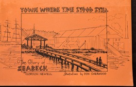
Gordon R. Newell and Don Sherwood’s Town Where Time Stood Still chronicles the rapid rise and sudden industrial collapse of Seabeck, an isolated pioneer mill town carved directly out of the dense temperate rainforests bordering Washington's Hood Canal. The narrative maps how the impenetrable overland topography of the Kitsap Peninsula forced early timber barons to rely exclusively on this sheltered, deep-water aquatic highway to export massive lumber harvests to global maritime markets. By detailing the settlement’s complete economic dependence on its centralized waterfront sawmill, the text illustrates how a singular reliance on highly localized resource extraction and vulnerable marine infrastructure dictated both its booming pioneer prosperity and its ultimate vulnerability. Ultimately, the account demonstrates how the inescapable geographic isolation that initially birthed this thriving lumber empire eventually ensured its demise following a catastrophic mill fire, freezing the bypassed coastal enclave in time as overland rail networks fundamentally reshaped the broader Pacific seaboard. 32 unnumbered pages : illustrations ; 14 x 21 cm Non-circulating [ 1 ]
|
1958 |
|
The golden land a history of Sherman County, Oregon by Giles French
Giles French’s The Golden Land chronicles the grueling agrarian transformation of Sherman County, a windswept, high-desert plateau severely isolated by the precipitous volcanic canyons of the Columbia, Deschutes, and John Day rivers. The narrative maps how the formidable topography and arid climatic realities of this rolling inland steppe initially restricted early pioneers to sparse livestock grazing, forcing them to endure an environment largely devoid of accessible surface water. By detailing the massive regional transition to mechanized dryland wheat farming, the text illustrates how the survival of the local economy was strictly dictated by the construction of localized rail spurs engineered to bridge the deep river gorges, finally connecting landlocked harvests to the Columbia River maritime highway. Ultimately, the account demonstrates that adapting to this rain-starved geography and conquering the profound physical barriers of its boundary canyons with heavy transit infrastructure were the absolute prerequisites for transforming a remote, sun-baked prairie into a lucrative, globally connected agricultural empire. [4], 237 pages, 9 unnumbered pages of plates : illustrations, portrait ; 25 cm Non-circulating [ 1 ]
|
1958 |
|
Land of giants the drive to the Pacific Northwest, 1750-1950 by David Lavender
David Lavender’s Land of Giants: The Drive to the Pacific Northwest, 1750-1950 chronicles the monumental, two-century imperial and industrial conquest of an impossibly scaled wilderness defined by impenetrable mountain barricades, towering temperate rainforests, and violent riverine highways. The narrative maps how the sheer physical magnitude of the region—stretching from the treacherous maritime choke point of the Columbia River Bar to the sheer alpine walls of the Rocky Mountains—initially dictated all human movement, forcing early explorers and overland pioneers to rely entirely on dangerous aquatic corridors for basic survival. By detailing the massive transition from rudimentary fur-trading outposts to a booming regional empire driven by mechanized timber extraction, transcontinental rail networks, and unprecedented hydroelectric dam construction, the text illustrates how the large-scale subjugation of this oversized topography was strictly governed by the severe environmental constraints of the Pacific edge. Ultimately, the account demonstrates that systematically breaching these massive continental barriers and artificially harnessing the region's volatile hydrology were the absolute prerequisites for transforming a geographically isolated frontier into the industrialized powerhouse of the modern Pacific seaboard. x pages, 2 unnumbered pages, 468 pages, 12 unnumbered leaves of plates : illustrations, maps ; 25 cm. Non-circulating [ 1 ]
|
1958 |
|
A bibliography of Pacific Northwest history by Oregon Historical Society (Compiler), Thomas Vaughan (Compiler), Priscilla Knuth (Compiler)
"This bibliography of Pacific Northwest history has been compiled by the staff of the Oregon Historical Society, especially for high school and college students and teachers. Necessarily the range is broad and qualified by what is available for various study levels. Included are books, articles and documents published up to the fall of 1957."--Page i 44 leaves ; 28 cm. Non-circulating [ 1 ]
|
1958 |
|
This was railroading by George B. Abdill 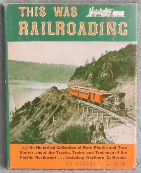
An Historical Collection of Rare Photos and True Stories about the Tracks, Trains and Trainmen of the Pacific Northwest including Northern California. 1958 First Edition. 192 pages : illustrations ; 28 cm Non-circulating [ 1 ]
|
1958 |
|
Dawson Creek, past and present an historical sketch by M. E. Coutts 
M. E. Coutts’s Dawson Creek, Past and Present chronicles the dramatic evolution of a remote agrarian outpost situated on the grueling ecological frontier where the fertile Peace River prairies collide with the unforgiving boreal wilderness of northern British Columbia. The narrative maps how profound continental isolation and punishing subarctic winters initially restricted early pioneers to localized survival, completely severed from southern markets by vast expanses of impenetrable muskeg and rugged alpine barriers. By detailing the explosive military engineering of the Alaska Highway, the text illustrates how the urgent geopolitical necessity to bridge these massive northern distances drove the rapid construction of an unprecedented overland transit corridor. Ultimately, the account demonstrates that deploying mechanized infrastructure to conquer this harsh, landlocked geography was the absolute prerequisite for transforming an isolated prairie settlement into the vital, industrialized gateway to the subarctic frontier. 115 pages : illustrations ; 28 cm Non-circulating [ 1 ]
|
1958 |
|
Blanket Bill Jarman northwest Washington mystery man : first pioneer settler in Whatcom and Skagit counties by Percival Robert Jeffcott 
Published in 1958, Percival Robert Jeffcott's book is a biographical account of William Robert "Blanket Bill" Jarman, recognized as the first white pioneer to settle in Washington's Whatcom and Skagit counties. The work seeks to untangle the factual history of Jarman's frontier life from the dense web of myths, legends, and tall tales that had grown around him over the decades. By meticulously cross-referencing interviews and local lore with documentary evidence—such as Hudson's Bay Company records—Jeffcott systematically investigates and debunks several exaggerated stories, including a famous tale about Jarman being ransomed. Ultimately, the text serves as both a detailed character study of an elusive regional figure and a rigorous examination of early Pacific Northwest pioneer folklore. xii, 202 p. : ill. ; 24 cm. Non-circulating [ 1 ]
|
1958 |
|
Milestones on the mighty Fraser by C. P. Lyons 
C. P. Lyons’s Milestones on the Mighty Fraser chronicles the grueling pioneer and industrial subjugation of British Columbia’s most violent riverine corridor, a massive hydrological artery carving through the sheer granite walls of the Coast Mountains. The narrative maps how the treacherous, raging rapids and precipitous, impassable canyons of the Fraser River initially dictated all movement, forcing early gold seekers and fur traders to navigate an unforgiving aquatic highway bordered by impenetrable alpine wilderness. By detailing the monumental, explosive engineering required to blast the Cariboo Wagon Road and subsequent transcontinental railways directly into the canyon's sheer cliff faces, the text illustrates how maintaining inland connectivity was strictly dictated by the severe topographical constraints of this narrow, volatile gorge. Ultimately, the account demonstrates that artificially bridging this treacherous waterway and deploying massive mechanized infrastructure to conquer its towering continental barriers were the absolute prerequisites for transforming an impenetrable natural obstacle into the vital commercial gateway connecting the Pacific seaboard to Canada's resource-rich interior. xxii, 130 pages, illustrations, maps Non-circulating [ 1 ]
|
1958 |
|
A History of Coquitlam and Fraser Mills, 1858-1958 by H. A. J. Monk, John Stewart 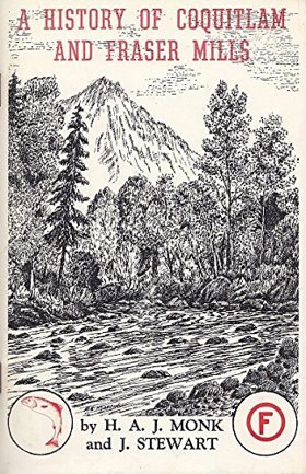
H. A. J. Monk and John Stewart’s A History of Coquitlam and Fraser Mills, 1858-1958 chronicles the explosive industrial colonization of a sprawling, heavily timbered riverine expanse located at the strategic confluence of the Coquitlam and Fraser rivers. The narrative maps how the impenetrable biological mass of the ancient coastal rainforest and the volatile, flood-prone hydrology of the lower Fraser delta initially choked overland movement, forcing early settlers and timber barons to rely exclusively on this massive aquatic highway to transport raw logs and export milled lumber. By detailing the monumental industrial effort required to construct Fraser Mills—which evolved into the largest lumber processing facility in the British Empire—and the grueling pioneer labor needed to clear the dense alluvial floodplains for viable agriculture, the text illustrates how large-scale economic expansion was strictly governed by the severe physical realities of this riparian topography. Ultimately, the account demonstrates that systematically harvesting these colossal timber stands and engineering robust mechanized milling infrastructure directly upon the riverbanks were the absolute prerequisites for transforming a rain-soaked, isolated wilderness into a globally dominant epicenter of Pacific seaboard timber manufacturing. 76 pages : illustrations, maps ; 23 cm Desiderata
|
1958 |
|
British investments and the American mining frontier, 1860-1901 by Clark C. Spence, American Historical Association 
This significant study offers information on the British investors who brought capital to America's mining industry in the late nineteenth century. The author devotes primary attention to the promotional activities that led to the organization and operation of more than 500 English joint venture stock companies between 1860 and 1901 ix, 288 pages : illustrations ; 24 cm Desiderata
|
1958 |
|
History of Alert Bay and district by Elizabeth Healey 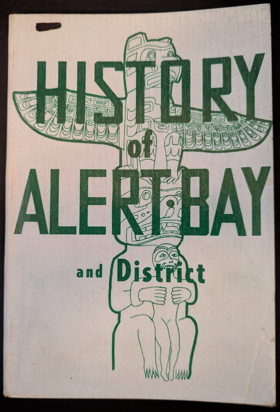
Elizabeth Healey’s History of Alert Bay and district chronicles the pioneer settlement and industrial expansion of a remote insular outpost entirely severed from the continental mainland by the treacherous waters of the Queen Charlotte Strait. The narrative maps how the severe geographic isolation of Cormorant Island and the impenetrable biological mass of the surrounding coastal rainforests forced both indigenous populations and European pioneers to rely exclusively on these volatile marine channels for basic survival and regional transit. By detailing the transformation of an ancestral maritime hub into a booming epicenter for commercial salmon canning and coastal logging operations, the text illustrates how the settlement's economic viability was strictly dictated by the necessity of engineering robust port infrastructure and mechanized fishing fleets. Ultimately, the account demonstrates that conquering the extreme oceanographic challenges of this rugged archipelago and extracting its immense biological wealth were the absolute prerequisites for sustaining a vital, export-driven community on the profoundly isolated northern Pacific edge. 101 pages illustrations, map Non-circulating [ 1 ]
|
1958 |
|
Quesnel commercial centre of the Cariboo gold colony by Gordon R. Elliott
Gordon R. Elliott’s Quesnel: Commercial Centre of the Cariboo Gold Colony stands as the foundational civic and economic study of the pivotal river hub located at the confluence of the Fraser and Quesnel rivers. Elliott chronicles how the ancestral river crossing and fishing territory of the Southern Carrier (Dakelh) people was converted into a bustling supply depot during the 1860s gold rush. The text details Quesnel’s strategic position as the inland terminus for Fraser River sternwheelers, where freight teams, pack trains, and stagecoaches assembled before making the final eastward ascent toward the Cariboo goldfields. Elliott traces the development of early agricultural benches across Bouchie Lake, Barlow Creek, and Red Bluff, while documenting the town’s enduring commercial evolution into a forestry and distribution centre following the arrival of the Pacific Great Eastern Railway. 62 pages : illustrations, maps, portraits ; 23 cm Desiderata
|
1958 |