Asotin County County
The county was created out of Garfield County on October 27, 1883 and derives its name from a Nez Perce word meaning "Eel Creek".
Mapped Location
Asotin County: The mapped location is an approximation and should not be used for navigation or wayfinding.
Information
General information on Asotin County
- Feature Type: County
- County Seat: City of Asotin
- Established: Saturday, October 27, 1883
Official, historical, colloquial and alternative toponyms for Asotin County
A brief list of names that this geographic feature has been named
| Name | Description |
|---|---|
| Asotin County | Official |
Origin Notes and History of Asotin County
References to Asotin County that document the origin of its place name

ASOTIN, a county, a town and a creek in the southeastern corner of the State. The name is from the Nez Perce language and means "eel creek" from the abundance of eels caught there. The town at the mouth of the creek, where it flows into Snake River, took the same name in 1878, as did the County when it was organized under the law of October 27, 1888.
Related Catalog Titles
A Bibliography for Asotin County, County
Just add water from barren Jawbone Flat to bountiful Clarkston, Washington, 1890-1940 by Carole Simon-Smolinski
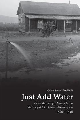
In her new book, “Just Add Water: From Barren Jawbone Flat to Bountiful Clarkston, Washington, 1890-1940,” area historian Carole Simon-Smolinski aims to shed new light on the creation story of Clarkston, Washington.
xii, 237 pages : illustrations, maps ; 23 cm
CIRC [ 1 ]
Lewiston/Clarkston by Samuel D. Hunter
"LEWISTON: Alice and Connor sit by their roadside stand selling cheap fireworks while developers swallow the land around them. Promised a condo in the new development, their future is secure. Enter Marnie, Alice's long-lost granddaughter, proposing to buy the land to save her family's legacy. Marnie and Alice will become reacquainted with each other's deeply held secrets, uncertain pasts, and hopeful futures. Hunter, a 2014 MacArthur Fellowship recipient, explores the emotional frontiers of a family struggling to make a home in the vastness of the American landscape with affection, poignancy, and a profound sense of empathy."-- Back cover
161 pages ; 21 cm.
CIRC [ 1 ]
Lyman's history of old Walla Walla County, embracing Walla Walla, Columbia, Garfield and Asotin counties by W. D. Lyman

Authored in 1918 by Whitman College professor William Denison Lyman, Lyman's History of Old Walla Walla County is an expansive, subscription-based chronicle of the agricultural and civic development of southeastern Washington. The multi-volume work traces the region's transformation from the fiercely contested era of early fur traders to its establishment as the prosperous, wheat-producing epicenter of the Inland Empire. Intertwining the history of early Protestant missionaries with hundreds of flattering biographical sketches of local pioneer patriarchs, the text actively mythologizes the Anglo-American conquest of the Columbia Basin. Typical of early twentieth-century regional literature, the book functions simultaneously as a sweeping civic monument and a commercial vanity project for the area's ruling merchant and agricultural elites. A keen insight drawn from the work is how early historians weaponized the trauma of pioneer martyrdom to morally anchor the colonization process; by framing the 1847 Whitman Massacre as a holy sacrifice that explicitly consecrated the land for white civilization, Lyman's narrative effectively rebranded the subsequent violent dispossession of the Cayuse and Walla Walla peoples as a righteous, divinely ordained destiny rather than an act of aggressive territorial conquest.
2 volumes : frontispiece, plates (illustrations, portraits) ; 28 cm
ONLINE CIRC [ 2 ]
An Illustrated history of southeastern Washington, including Walla Walla, Columbia, Garfield and Asotin counties, Washington by Frederic Ambrose Shaver, Richard F. Steele, Arthur P. Rose, Western Historical Publishing Company, Spokane, Wash
Published by the Western Historical Publishing Company and compiled by regional historians, An Illustrated History of Southeastern Washington provides an exhaustive, county-by-county chronicle of early pioneer settlement across Walla Walla, Columbia, Garfield, and Asotin counties. The massive volume details the region's transformation from indigenous territories and early missionary outposts into a dominant agricultural empire driven by dryland wheat farming and regional railroad expansion. Through detailed biographical sketches of prominent citizens and extensive civic records, the text serves as a foundational archive for understanding the economic ambitions and social structures of the inland Pacific Northwest. A keen insight drawn from the work is how subscription-based county histories operated as early forms of civic boosterism; by heavily emphasizing the successes of local patriarchs and agricultural wealth while marginalizing the indigenous displacement that made it possible, the volume illustrates how frontier communities intentionally curated their own historical memory to attract further investment and institutional legitimacy.
xxii, 874 p. illus., plates, ports. 31 x 25 cm.
ONLINE CIRC [ 1 ]
Last updated: 2025-09-23