Walla Walla County County
The county was formed on April 25, 1854 and is named after the Walla Walla tribe of Native Americans.
Mapped Location
Walla Walla County: The mapped location is an approximation and should not be used for navigation or wayfinding.
Information
General information on Walla Walla County
- Feature Type: County
- County Seat: City of Walla Walla
- Established: Tuesday, April 25, 1854
Official, historical, colloquial and alternative toponyms for Walla Walla County
A brief list of names that this geographic feature has been named
| Name | Description |
|---|---|
| Walla Walla County | Official |
Origin Notes and History of Walla Walla County
References to Walla Walla County that document the origin of its place name

WALLA WALLA is one of the most beautiful and best established Indian names in the geography of Washington.. It is applied to a county, city and river in the southeastern part of the State. The origin of the name is easily ascertained as it was recorded by the first white men who visited that region. Elliott Coues, the scholarly editor of the Lewis and Clark Journals, commenting on their entry for April 26, 1806, discusses the word as follows: "Here Lewis K 82 has Wollah Wollah; Clark Q 112 has Wallow Wallows; map has Wollaw Wollah; Clark elsewhere Woller Woller. As earlier observed in this work, the codices vary greatly in this slippery word, more than 20 forms of which are also found in print. Accepted forms are now [1893] Walla Walla, or Walla-walla, or Wallawalla. In several languages walla means running water, and reduplication of word diminutizes it; so Wallawalla is the small rapid river." (Volume III., page 969, note 22.) The word thus first recorded as the name of a tribe of Indians was soon naturally applied to the region occupied by them. In fact the name was taken by the Indians because it described the land where they lived. Rev. Myron Eells, who was born on Walker's Prairie, at the mission home of his father, Rev. Cushing Eells, and who died at the Twana Indian Mission, Hood Canal, in 1907, having devoted his life to work among Indians, wrote: "Walla Walla is a Nez Nerce and Cayuse word, the root of which is walatsa, which means 'running'; hence 'running water'. Two meanings of it are given, one being 'a small stream running into a large one' -- that is, the Walla Walla river emptying into the Columbia; another is 'ripple after ripple', 'fall after fall'. These meanings were given the writer by Mr. P. M. Whitman and Dr. W. C. McKay, who have lived among the Indians most of the time for over forty-five years, and speak the Walla Walla language as fluently as they do the English." (American .Anthropologist Volume V., January, 1892, page 34.) A later student says the Walla Walla Indians are known to the Nez Perces as Walawalapu, "Little River People". (E. S. Curtis, The North American Indian, Volume VIII., page 163.) The geographic name was thus first established for the valley and the river. Near the mouth of the river the North West Company of Montreal built their Fort Nez Perces in 1818, which has been known as "Old Fort Walla Walla." See Fort Walla Walla. The Territorial Legislature passed an act, approved on April 25, 1854, to organize Walla Walla County. On June 9, 1855, Isaac I. Stevens, Governor and Superintendent of Indian Affairs for Washington Territory, and Joel Palmer, Superintendent of Indian Affairs for Oregon Territory, concluded a treaty with the "Walla-Walla, Cayuses, and Umatilla Tribes and Bands of Indians in Washington and Oregon Territories." In that treaty the place of negotiation is given as "the treaty ground, Camp Stevens, in the Walla Walla valley." That site was within the present City of Walla Walla. Immediately following this and other treaties the Indian war broke out, during which Lieutenant Colonel Edward Jevnor Steptoe established Fort Walla Walla. On October 27, 1856, he wrote to his sister: "Do you know where this place is? Look up the Columbia River on the map till you see its tributary, the Walla Walla, and on this latter 'The Mission'. About five miles above the last place I am erecting a Post." (B. F. Manring, The Conquest of the Coeur D'Alenes, Spokanes and Palouses, pages 270-271.) Near that fort grew the City of Walla Walla, affectionately known as the "Garden City." Changes of name are well documented in the following quotation: "There was no town of Walla Walla in 1858; there was in 1859, and it came into existence through the ex parte rules of the first board of county commissioners. The first two meetings of the board were held March 15th and 26th, 1859. In their official record the place was referred to as Walla-Walla. And then, without further notice, we find that at their subsequent meetings January 6th and July 2d, it was called 'Steptoeville', in the record of the last named date appearing the following: 'On motion the name of the town of Steptoeville was changed to Wieletpu'. Despite this official action we find that at the meeting held September 5th, the county seat town is still referred to as Steptoeville. But at the next meeting, November 7th, the town is spoken of as Walla-Walla, and the following proceeding is recorded as regards the name: 'On motion the town of Wieletpu was changed to Walla-Walla.'" (History of Southeastern Washington, page 115.) By act of the Territorial Legislature, approved January 11, 1862, Walla Walla City was regularly incorporated.
Related Catalog Titles
A Bibliography for Walla Walla County, County
Becoming Walla Walla the transformation of cayuse country, 1805-1879 by Dennis Crockett
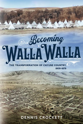
Becoming Walla Walla covers Walla Walla Valley history from the time of the Sahaptian Peoples’ first encounters with Euro-Americans to the initial expiration of the U.S. government’s treaty with the Cayuse, Walla Walla, and Umatilla. It sheds light on the city’s and reservation’s simultaneous development, re-animates the Walla Walla of the 1860s and 70s, reconsiders its status in early Washington Territory and Oregon State histories, and documents transformations of the region’s built and natural environments.
320 pages : illustrations
CIRC [ 0 ]
The Whitman Massacre by E. M. Saunders
Authored by E. M. Saunders, The Whitman Massacre provides a dramatic narrative account of the tragic 1847 attack on the Cayuse Indian mission at Waiilatpu by members of the Cayuse tribe, resulting in the deaths of Marcus and Narcissa Whitman and twelve others. The book explores the mounting racial tensions, cultural misunderstandings, and devastating epidemics—particularly measles—that fueled Indigenous resentment against encroaching American settlers. Drawing on historical documents and period accounts, the text examines how the missionary enterprise inadvertently triggered a catastrophic clash of worlds in southeastern Washington. A keen insight drawn from the work is how medical disparities served as the ultimate catalyst for frontier violence; because traditional Cayuse healing practices failed against introduced European diseases while white missionaries survived, the tribe perceived the plague as targeted biological warfare, turning a public health disaster into a fatal geopolitical flashpoint.
56 pages
CIRC [ 1 ]
The letters of Narcissa Whitman by Narcissa Prentiss Whitman
Authored by pioneer missionary Narcissa Prentiss Whitman, The Letters of Narcissa Whitman compiles her poignant, firsthand correspondence sent to family and friends in New York while living among the Cayuse people at the Waiilatpu Mission in southeastern Washington from 1836 until her tragic death in 1847. The letters document the staggering physical isolation, cultural clashes, and domestic struggles of being among the first white American women to cross the Rocky Mountains and settle in the Pacific Northwest. Through her eloquent and deeply personal accounts, the text offers an unvarnished window into the mindset of evangelical expansionism and the heavy psychological toll of frontier life. A keen insight drawn from the work is how domestic correspondence functioned as an ideological tether for women on the religious frontier; by meticulously chronicling her daily efforts to transplant Victorian domesticity into an Indigenous landscape, Whitman's letters reveal how female missionaries attempted to domesticate foreign geopolitical spaces through the sheer force of written narrative and cultural replication.
266 pages, 1 unnumbered leaf of plates : illustrations, portrait ; 24 cm
CIRC [ 0 ]
Walla Walla, a town built to be a city, 1900-1919 by Robert Allen Bennett
Journal of a Catholic bishop on the Oregon trail the overland crossing of the Rt. Rev. A.M.A. Blanchet, Bishop of Walla Walla, from Montreal to Oregon Territory, March 23, 1847 to January 23, 1851. Blackrobe buries Whitmans by Augustine Magloire Alexander Blanchet, Edward J. Kowrach, J. B. A. Brouillet
Waitsburg "one of a kind." by Vance Orchard
Lyman's history of old Walla Walla County, embracing Walla Walla, Columbia, Garfield and Asotin counties by W. D. Lyman

Authored in 1918 by Whitman College professor William Denison Lyman, Lyman's History of Old Walla Walla County is an expansive, subscription-based chronicle of the agricultural and civic development of southeastern Washington. The multi-volume work traces the region's transformation from the fiercely contested era of early fur traders to its establishment as the prosperous, wheat-producing epicenter of the Inland Empire. Intertwining the history of early Protestant missionaries with hundreds of flattering biographical sketches of local pioneer patriarchs, the text actively mythologizes the Anglo-American conquest of the Columbia Basin. Typical of early twentieth-century regional literature, the book functions simultaneously as a sweeping civic monument and a commercial vanity project for the area's ruling merchant and agricultural elites. A keen insight drawn from the work is how early historians weaponized the trauma of pioneer martyrdom to morally anchor the colonization process; by framing the 1847 Whitman Massacre as a holy sacrifice that explicitly consecrated the land for white civilization, Lyman's narrative effectively rebranded the subsequent violent dispossession of the Cayuse and Walla Walla peoples as a righteous, divinely ordained destiny rather than an act of aggressive territorial conquest.
2 volumes : frontispiece, plates (illustrations, portraits) ; 28 cm
ONLINE CIRC [ 2 ]
An Illustrated history of southeastern Washington, including Walla Walla, Columbia, Garfield and Asotin counties, Washington by Frederic Ambrose Shaver, Richard F. Steele, Arthur P. Rose, Western Historical Publishing Company, Spokane, Wash
Published by the Western Historical Publishing Company and compiled by regional historians, An Illustrated History of Southeastern Washington provides an exhaustive, county-by-county chronicle of early pioneer settlement across Walla Walla, Columbia, Garfield, and Asotin counties. The massive volume details the region's transformation from indigenous territories and early missionary outposts into a dominant agricultural empire driven by dryland wheat farming and regional railroad expansion. Through detailed biographical sketches of prominent citizens and extensive civic records, the text serves as a foundational archive for understanding the economic ambitions and social structures of the inland Pacific Northwest. A keen insight drawn from the work is how subscription-based county histories operated as early forms of civic boosterism; by heavily emphasizing the successes of local patriarchs and agricultural wealth while marginalizing the indigenous displacement that made it possible, the volume illustrates how frontier communities intentionally curated their own historical memory to attract further investment and institutional legitimacy.
xxii, 874 p. illus., plates, ports. 31 x 25 cm.
ONLINE CIRC [ 1 ]
An illustrated history of Walla Walla County, state of Washington by W. D. Lyman
Published in 1901, W. D. Lyman’s comprehensive volume chronicles the pioneer settlement, agricultural expansion, and civic maturation of Walla Walla County in southeastern Washington. A keen insight drawn from the text is how Walla Walla's strategic evolution from a chaotic gold-rush supply post into a highly stable, wheat-producing powerhouse allowed it to economically and politically dominate the early Washington Territory long before the rise of the Puget Sound cities. The narrative meticulously details this transformation alongside the complex pioneer interactions with Native American tribes, including the profound regional impact of the Whitman Massacre. Like similar historical works of its era, the book ultimately serves as a vital genealogical archive by preserving hundreds of detailed biographical sketches of the resilient farmers, merchants, and civic leaders who built the region.
ONLINE CIRC [ 1 ]
Historic sketches of Walla Walla, Whitman, Columbia and Garfield counties, Washington Territory, and Umatilla County, Oregon by Frank T. Gilbert
Published in 1882, Frank T. Gilbert's expansive regional history chronicles the rapid transformation of the Inland Empire—spanning eastern Washington and northeastern Oregon—from indigenous territory and fur-trade outposts to an agrarian powerhouse. The narrative meticulously details the violent conflicts of the Cayuse and Yakima Indian Wars, the establishment of early pioneer settlements, and the subsequent explosion of the region's lucrative dry-land wheat economy. A keen insight drawn from the text is how it perfectly exemplifies the Gilded Age "subscription history" model, where the grand, often brutal narrative of westward conquest was explicitly monetized by pairing regional chronicles with flattering biographical portraits of the affluent farmers and merchants who financed the publication. Consequently, while the volume remains an indispensable civic and genealogical archive, its historical framing intentionally sanitizes the systematic displacement of Native American tribes to celebrate the inevitable triumph of white, capitalist agriculture in the Columbia Basin.
447, [2], [449]-488, [12], 66 pages, [63] leaves of plates : illustrations, portraits ; 31 cm
ONLINE CIRC [ 1 ]
Walla Walla County
- Adkins
- Ash
- Attalia
- Ayer
- Babcock
- Baker-Langdon
- Berryman
- Bolles
- Burbank
- Burbank Heights
- Buroker
- Burr
- Calhounville
- Chew
- Climax
- Clyde
- City of College Place
- Coppei
- Dixie
- Dixie Crossing
- Eastman
- Elwood
- Ennis
- Eureka
- Five Points
- Gardena
- Garrett
- Gilliam
- Hadley
- Harbert
- Harsha
- Harvey
- Hatch
- Humorist
- Hunt
- Kibler
- Kooskooskie
- Lamar
- Langdon
- Le Grow
- Lee
- Lowden
- Magallon
- Matthew
- Minnick
- Mojonnier
- Paddock
- Page
- Pedigo
- Pickard
- Port Kelley
- City of Prescott
- Reese
- Rifton
- Robinson
- Rulo
- Russell
- Ruxby
- Sapolil
- Scott
- Sheffler
- Slater
- Stateline
- Sudbury
- Thiel
- Thomas
- Tompkins
- Touchet
- Tracy
- Two Rivers
- Valley Grove
- Villard Junction
- Waiilatpo (historical)
- City of Waitsburg
- Walker
- City of Walla Walla
- Wallula
- Wallula Junction
- Welland
- Whitman
- Zangar Junction
Political Boundaries
Last updated: 2025-09-23