Whitman County County
The county was formed out of Stevens County on November 29, 1871. It is named after Marcus Whitman, a Presbyterian missionary who, with his wife Narcissa, was killed in 1847 by members of the Cayuse tribe.
Mapped Location
Whitman County: The mapped location is an approximation and should not be used for navigation or wayfinding.
Information
General information on Whitman County
- Feature Type: County
- County Seat: City of Colfax
- Established: Wednesday, November 29, 1871
Official, historical, colloquial and alternative toponyms for Whitman County
A brief list of names that this geographic feature has been named
| Name | Description |
|---|---|
| Whitman County | Official |
Origin Notes and History of Whitman County
References to Whitman County that document the origin of its place name

WHITMAN COUNTY was organized by act of the Territorial Legislature approved November 29, 1871, and named in honor of the missionary, Dr. Marcus Whitman.
Related Catalog Titles
A Bibliography for Whitman County, County
CELEBRATING PALOUSE COUNTRY a history of the landscape in text and images by RICHARD SCHEUERMAN
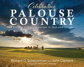
Enhanced with spectacular photographs from John Clement, travel through time among the Palouse Country’s beauty and expanse, starting with its First Peoples, then moving through distinct immigrant groups. Chapters cover events that prompted emigration, describe the settlers’ transitions and living conditions, chronicle significant people and families, discuss major influences that impacted the population, and recount how the communities grew and changed.
CIRC [ 0 ]
Cashup Davis the inspiring life of a secret mentor by Jeff Burnside , G. W. Davis
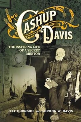
Enamored by the western frontier, British immigrant Cashup Davis, his wife Mary, and eleven children became one of the first white families to settle on the Palouse’s spectacular rolling hills in eastern Washington Territory. Living at first in a simple sod house, they turn their bunchgrass acreage into a farm, befriend Native Americans during a war ignited by the U.S. government’s treaty violations, and eventually open an immensely popular and prosperous stagecoach stop. But Cashup has another dream: he is resolutely determined to build a grand luxury hotel on one of the region’s highest points, the summit of Steptoe Butte. People tell him it is a ridiculous idea, but Cashup never listens to the doubters. He’s brash, confident, and full of charisma.
xv, 214 pages : illustrations, facsimiles, maps, portraits ; 23 cm
CIRC [ 0 ]
Wheat country railroad the Northern Pacific's Spokane & Palouse and competitors by Phil Beach
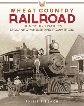
"A detailed history and reference work concerning railroads south of Spokane, Washington, and north of the Snake River."--Provided by publisher
xviii, 349 pages : illustrations, maps ; 29 cm
CIRC [ 0 ]
Whitman County from Abbieville to Zion by Edith E. Erickson
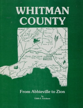
The authors interest spread to Whitman County as she uncovered information and felt others might be intrigued by the number of places that had at one time been named and have since disappeared. In order to make this book accurate, she used a variety of sources ranging from postal records to interviews with people who at tented some of the small and now consolidated schools. Contains bibliography and maps
[2], xxiii, 140 pages : illustrations, maps ; 28 cm
CIRC [ 1 ]
Colfax 100 plus by Edith E. Erickson
Historic sketches of Walla Walla, Whitman, Columbia and Garfield counties, Washington Territory, and Umatilla County, Oregon by Frank T. Gilbert

Published in 1882, Frank T. Gilbert's expansive regional history chronicles the rapid transformation of the Inland Empire—spanning eastern Washington and northeastern Oregon—from indigenous territory and fur-trade outposts to an agrarian powerhouse. The narrative meticulously details the violent conflicts of the Cayuse and Yakima Indian Wars, the establishment of early pioneer settlements, and the subsequent explosion of the region's lucrative dry-land wheat economy. A keen insight drawn from the text is how it perfectly exemplifies the Gilded Age "subscription history" model, where the grand, often brutal narrative of westward conquest was explicitly monetized by pairing regional chronicles with flattering biographical portraits of the affluent farmers and merchants who financed the publication. Consequently, while the volume remains an indispensable civic and genealogical archive, its historical framing intentionally sanitizes the systematic displacement of Native American tribes to celebrate the inevitable triumph of white, capitalist agriculture in the Columbia Basin.
447, [2], [449]-488, [12], 66 pages, [63] leaves of plates : illustrations, portraits ; 31 cm
ONLINE CIRC [ 1 ]
Whitman County
- Town of Albion
- Almota
- Alpowa
- Armstrong
- Balder
- Belmont
- Busby
- Cashup
- Chambers
- City of Colfax
- Town of Colton
- Crabtree
- Diamond
- Donahue
- Dusty
- Eden
- Elberton
- Town of Endicott
- Ewan
- Ewartsville
- Fairbanks
- Fallon
- Town of Farmington
- Flaig
- Town of Garfield
- Glenwood
- Gordon
- Grinnell
- Harpole
- Hay
- Hooper
- Huntley
- Jerita
- Johnson
- Juno
- Kenova
- Kitzmiller
- Town of LaCrosse
- Ladow
- Lairds
- Town of Lamont
- Lancaster
- Lavista
- Leon
- Lone Pine
- Madson
- Town of Malden
- Manning
- McCoy
- Mockonema
- Moses
- Town of Oakesdale
- City of Palouse
- Pampa
- Pandora
- Parvin
- Penawawa
- Peyton
- Pine City
- City of Pullman
- Pullman Junction
- Purrington
- Revere
- Ridpath
- Ringo
- Riparia
- Risbeck
- Robinson
- Town of Rosalia
- Town of Saint John
- Seltice
- Shawnee
- Shreck
- Sokulk
- Staley
- Steptoe
- Sunset
- Sunshine
- Sutton
- Swift
- City of Tekoa
- Thera
- Thornton
- Union Center
- Town of Uniontown
- Walters
- Warner
- Wawawai (historical)
- Whelan
- Whitlow
- Wilcox
- Willard
- Wilma (historical)
- Winona
Political Boundaries
Last updated: 2025-09-23