Village of Alert Bay Regional District of Mount Waddington, British Columbia
Village (1) - A populated place with legally defined boundaries, incorporated as a village municipality under the provincial Municipal Act. S side of Cormorant Island, just E off Port McNeill (municipality), Rupert Land District
Mapped Location
Village of Alert Bay: The mapped location is an approximation and should not be used for navigation or wayfinding.
Information
General information on Village of Alert Bay
- Feature Type: Incorporated
Official, historical, colloquial and alternative toponyms for Village of Alert Bay
A brief list of names that this geographic feature has been named
| Name | Description |
|---|---|
| Village of Alert Bay | Official |
Origin Notes and History of Village of Alert Bay
References to Village of Alert Bay that document the origin of its place name
Incorporated as a Village Municipality 14 January 1946.
Named in association with the water feature, Alert Bay, in turn named in 1860 by Captain Richards, HMS Plumper, after HM Alert, a screw corvette with 17 guns, which was the first steam vessel to call at Alert Bay. The Alert was built at Pembroke in 1856, and was on this station 1858-1861 under the command of Commander W.A.R. Pearse; the Alert returned to this station 1865-1869 under Commander Arthur John Innes, and in 1867 her officers were engaged in a resurvey of Alert Bay. See also the municipality's own website.
The original settlers were Messrs. Spencer and Huron, who originally located near the mouth of the Nimpkish River and established a fishing business, but good landings were hard to find and in 1870 they leased Cormorant Island and established a saltery there. They persuaded the Nimpkish River Indians to move over and establish a village near their plant. In 1878 they further persuaded Rev. Alfred James Hall, who had established a mission at Fort Rupert the previous year, to move to Alert Bay. Alert Bay Post Office was opened 1 October 1885. A school was built and in 1886-7 sufficient funds were secured to build a sawmill. The surrounding region gradually began to open up following the completion of construction of the CPR; there was now a market for lumber and fish, and regular communication with Vancouver after 1889 when the Union Steam Ship Company added Alert Bay to its itinerary. In 1902 B.C. Packers Association was formed and the original plant at Alert Bay was bought out. In 1908 the sawmill was leased from the Indians and functioned until 1928 when it was dismantled.
Kwak'wala name for the village is 'Yalis
A Selected Bibliography of Village of Alert Bay, Regional District of Mount Waddington, British Columbia
A compilation of essential readings detailing the history, geography, and culture of the region.
History of Alert Bay and district by Elizabeth Healey
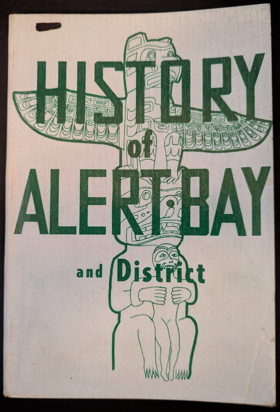
Elizabeth Healey’s History of Alert Bay and district chronicles the pioneer settlement and industrial expansion of a remote insular outpost entirely severed from the continental mainland by the treacherous waters of the Queen Charlotte Strait. The narrative maps how the severe geographic isolation of Cormorant Island and the impenetrable biological mass of the surrounding coastal rainforests forced both indigenous populations and European pioneers to rely exclusively on these volatile marine channels for basic survival and regional transit. By detailing the transformation of an ancestral maritime hub into a booming epicenter for commercial salmon canning and coastal logging operations, the text illustrates how the settlement's economic viability was strictly dictated by the necessity of engineering robust port infrastructure and mechanized fishing fleets. Ultimately, the account demonstrates that conquering the extreme oceanographic challenges of this rugged archipelago and extracting its immense biological wealth were the absolute prerequisites for sustaining a vital, export-driven community on the profoundly isolated northern Pacific edge.
101 pages illustrations, map
Non-circulating [ 1 ]
Regional District of Mount Waddington
- Village of Alert Bay
- Atluck
- Beaver Cove
- Benson Lake
- Bull Harbour
- Coal Harbour
- Cracroft
- Echo Bay
- Elephant Crossing
- Fort Rupert
- Health Bay
- Holberg
- Hopetown
- Hyde Creek
- Jeune Landing
- Karlukwees
- Kingcome
- Kingcome Inlet
- Kokish
- Mahatta River
- Meem Quam Leese
- Minstrel Island
- Mitchell Bay
- Nimpkish
- Nimpkish Heights
- Village of Port Alice
- District of Port Hardy
- Town of Port McNeill
- Quatsino
- Rumble Beach
- San Josef
- Scott Cove
- Shawl Bay
- Shushartie
- Simoom Sound
- Sointula
- Sullivan Bay
- Suquash
- Telegraph Cove
- Thompson Sound
- Warner Bay
- Winter Harbour
- Woss
- Yreka
Political Boundaries
Last updated: 2025-09-23