Fort Rupert Regional District of Mount Waddington, British Columbia
Community - An unincorporated populated place, generally with a population of 50 or more, and having a recognized central area that might contain a post office, store and/or community hall, etc, intended for the use of the general public in the region. On Fort Rupert IR #1, S side of Beaver Harbour just E of Port Hardy (municipality), Rupert Land District
Mapped Location
Fort Rupert: The mapped location is an approximation and should not be used for navigation or wayfinding.
Information
General information on Fort Rupert
- Feature Type: Place
Official, historical, colloquial and alternative toponyms for Fort Rupert
A brief list of names that this geographic feature has been named
| Name | Description |
|---|---|
| Fort Rupert | Official |
Origin Notes and History of Fort Rupert
References to Fort Rupert that document the origin of its place name
Fort Rupert (settlement) adopted 5 October 1946, as labelled on British Admiralty Chart #581, 1867 et seq. Form of name changed to Fort Rupert (community) 15 February 1983.
The HBC trading post was named after HRH Prince Rupert, the first governor of the Hudson's Bay Company.
The Hudson's Bay Company established Fort Rupert in 1849 as a base for developing nearby coal deposits. The Indian village established here, T'saxis ("stream running on beach") stretched out along the beach on either side of the Fort, and was utilized by the Kwakiutl, Kweeha, Komkiutis and Walas Kwakiutl. IR#1, alloted in 1886, included most of the western section of the village.
Related Catalog Titles
A Bibliography for Fort Rupert, Regional District of Mount Waddington, British Columbia
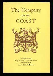
The Company on the coast by E. Blanche Norcross, Morag Maclachlan, Nanaimo Historical Society, Malaspina College
Regional District of Mount Waddington
- Village of Alert Bay
- Atluck
- Beaver Cove
- Benson Lake
- Bull Harbour
- Coal Harbour
- Cracroft
- Echo Bay
- Elephant Crossing
- Fort Rupert
- Health Bay
- Holberg
- Hopetown
- Hyde Creek
- Jeune Landing
- Karlukwees
- Kingcome
- Kingcome Inlet
- Kokish
- Mahatta River
- Meem Quam Leese
- Minstrel Island
- Mitchell Bay
- Nimpkish
- Nimpkish Heights
- Village of Port Alice
- District of Port Hardy
- Town of Port McNeill
- Quatsino
- Rumble Beach
- San Josef
- Scott Cove
- Shawl Bay
- Shushartie
- Simoom Sound
- Sointula
- Sullivan Bay
- Suquash
- Telegraph Cove
- Thompson Sound
- Warner Bay
- Winter Harbour
- Woss
- Yreka
Political Boundaries
Last updated: 2023-10-01