District of Port Hardy Regional District of Mount Waddington, British Columbia
District Municipality (1) - A populated place with legally defined boundaries, incorporated as a district municipality under the provincial Municipal Act. NE side Vancouver Island, NW of Port McNeill, Rupert Land District
Mapped Location
District of Port Hardy: The mapped location is an approximation and should not be used for navigation or wayfinding.
Information
General information on District of Port Hardy
- Feature Type: Incorporated
Official, historical, colloquial and alternative toponyms for District of Port Hardy
A brief list of names that this geographic feature has been named
| Name | Description |
|---|---|
| District of Port Hardy | Official |
Origin Notes and History of District of Port Hardy
References to District of Port Hardy that document the origin of its place name
Port Hardy (Post Office and Steamer Landing) adopted 10 May 1946 on 92L/11 as identified in 1909 BC Gazetteer and as labelled on BC map 2C, 1919. Incorporated as District Municipality 5 April 1966, covering two sites, collectively called District of Port Hardy; name confirmed in 1977 Supplement to the BC Gazetteer.
Named after Vice-Admiral Sir Thomas Masterman Hardy, Bart (1769-1839). As captain of H.M.S. Victory he held the dying Lord Nelson in his arms during the Battle of Trafalgar. After retiring from the sea he became governor of Greenwich Hospital, the home for old sailors maintained by the British government. (See Walbran's British Columbia Coast Names for additional biographical information.)
Related Catalog Titles
A Bibliography for District of Port Hardy, Regional District of Mount Waddington, British Columbia
North Coast odyssey the Inside Passage from Port Hardy to Prince Rupert by Kenneth Campbell
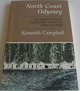
Published by Kenneth Campbell, North Coast Odyssey: The Inside Passage from Port Hardy to Prince Rupert captures the dramatic geography and rich maritime heritage of British Columbia's isolated northern marine highway. The book chronicles a coastal voyage through labyrinthine fjords, treacherous narrows, and wind-swept archipelagos, blending nautical adventure with local history, Indigenous lore, and observations of the region's abundant marine wildlife. Through vivid descriptive prose, the author details the weathered cannery towns, lighthouses, and remote settlements that cling to a magnificent yet unforgiving coastline. A keen insight drawn from the work is how the Inside Passage functions as a liquid highway that simultaneously isolates and connects; by relying entirely on maritime transit through a maze of stone and water, coastal inhabitants experience a profound sense of remoteness that can only be bridged by a deep, respectful attunement to the fickle rhythms of the Pacific tides.
202 pages : illustrations, maps, portrait ; 23 cm
CIRC [ 1 ]
Yesterday's promises a history of the district of Port Hardy by David Lewis

Regional District of Mount Waddington
- Village of Alert Bay
- Atluck
- Beaver Cove
- Benson Lake
- Bull Harbour
- Coal Harbour
- Cracroft
- Echo Bay
- Elephant Crossing
- Fort Rupert
- Health Bay
- Holberg
- Hopetown
- Hyde Creek
- Jeune Landing
- Karlukwees
- Kingcome
- Kingcome Inlet
- Kokish
- Mahatta River
- Meem Quam Leese
- Minstrel Island
- Mitchell Bay
- Nimpkish
- Nimpkish Heights
- Village of Port Alice
- District of Port Hardy
- Town of Port McNeill
- Quatsino
- Rumble Beach
- San Josef
- Scott Cove
- Shawl Bay
- Shushartie
- Simoom Sound
- Sointula
- Sullivan Bay
- Suquash
- Telegraph Cove
- Thompson Sound
- Warner Bay
- Winter Harbour
- Woss
- Yreka
Political Boundaries
Last updated: 2023-10-01