Regional District of Mount Waddington Regional District
The Regional District of Mount Waddington (RDMW) is a regional district in British Columbia, Canada. It is located in the northern third of Vancouver Island and part of the mainland coast. The RDMW was established in 1966 and is governed by a board of directors. The local history of the RDMW is rich and diverse. The area was originally inhabited by First Nations peoples, including the Kwakwaka'wakw, Nuu-chah-nulth, and Heiltsuk. European contact began in the early 1800s, and the area was later settled by fur traders, missionaries, and loggers. The RDMW is home to a number of important historical sites, including Fort Rupert, Alert Bay, and Cape Scott Provincial Park. The area is also known for its natural beauty, including Mount Waddington, the highest mountain in British Columbia.
Mapped Location
Regional District of Mount Waddington: The mapped location is an approximation and should not be used for navigation or wayfinding.
Information
General information on Regional District of Mount Waddington
- Feature Type: Regional District
- Regional District Administrative Centre: Town of Port McNeill
- Established: Monday, June 13, 1966
Official, historical, colloquial and alternative toponyms for Regional District of Mount Waddington
A brief list of names that this geographic feature has been named
| Name | Description |
|---|---|
| Regional District of Mount Waddington | Official |
Related Catalog Titles
A Bibliography for Regional District of Mount Waddington, Regional District
North Coast odyssey the Inside Passage from Port Hardy to Prince Rupert by Kenneth Campbell
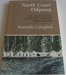
Published by Kenneth Campbell, North Coast Odyssey: The Inside Passage from Port Hardy to Prince Rupert captures the dramatic geography and rich maritime heritage of British Columbia's isolated northern marine highway. The book chronicles a coastal voyage through labyrinthine fjords, treacherous narrows, and wind-swept archipelagos, blending nautical adventure with local history, Indigenous lore, and observations of the region's abundant marine wildlife. Through vivid descriptive prose, the author details the weathered cannery towns, lighthouses, and remote settlements that cling to a magnificent yet unforgiving coastline. A keen insight drawn from the work is how the Inside Passage functions as a liquid highway that simultaneously isolates and connects; by relying entirely on maritime transit through a maze of stone and water, coastal inhabitants experience a profound sense of remoteness that can only be bridged by a deep, respectful attunement to the fickle rhythms of the Pacific tides.
202 pages : illustrations, maps, portrait ; 23 cm
CIRC [ 1 ]
Yesterday's promises a history of the district of Port Hardy by David Lewis

History of Alert Bay and district by Elizabeth Healey
Regional District of Mount Waddington
- Village of Alert Bay
- Atluck
- Beaver Cove
- Benson Lake
- Bull Harbour
- Coal Harbour
- Cracroft
- Echo Bay
- Elephant Crossing
- Fort Rupert
- Health Bay
- Holberg
- Hopetown
- Hyde Creek
- Jeune Landing
- Karlukwees
- Kingcome
- Kingcome Inlet
- Kokish
- Mahatta River
- Meem Quam Leese
- Minstrel Island
- Mitchell Bay
- Nimpkish
- Nimpkish Heights
- Village of Port Alice
- District of Port Hardy
- Town of Port McNeill
- Quatsino
- Rumble Beach
- San Josef
- Scott Cove
- Shawl Bay
- Shushartie
- Simoom Sound
- Sointula
- Sullivan Bay
- Suquash
- Telegraph Cove
- Thompson Sound
- Warner Bay
- Winter Harbour
- Woss
- Yreka
Political Boundaries
Last updated: 2025-09-23