Town of Gibsons Sunshine Coast Regional District, British Columbia
Town - A populated place with legally defined boundaries, incorporated as a town municipality under the provincial Municipal Act. W side of entrance to Howe Sound, New Westminster Land District
Mapped Location
Town of Gibsons: The mapped location is an approximation and should not be used for navigation or wayfinding.
Information
General information on Town of Gibsons
- Feature Type: Incorporated
Official, historical, colloquial and alternative toponyms for Town of Gibsons
A brief list of names that this geographic feature has been named
| Name | Description |
|---|---|
| Town of Gibsons | Official |
Origin Notes and History of Town of Gibsons
References to Town of Gibsons that document the origin of its place name
Incorporated as Gibsons Landing Village Municipality 4 March 1929. Incorrectly adopted as Gibsons Landing (Post Office) 12 December 1939 on 92 SE, then as Gibsons (Post Office) 3 July 1947 on 92 SE. Corrected to Gibsons Landing (Village) 3 April 1959 on 92G. Re-incorporated as Gibsons (Village Municipality) 5 April 1968. Re-incorporated as Gibsons (Town Municipality) 17 December 1982.
Howe Sound Post Office was opened in this location 1 October 1892. Re-opened as Gibsons Landing Post Office 1 October 1907, named after George William Gibson, the original postmaster. Changed to Gibsons Post Office 2 January 1948. See also the municipality's own website.
Related Catalog Titles
A Bibliography for Town of Gibsons, Sunshine Coast Regional District, British Columbia
The Sunshine Coast from Gibsons to Powell River by Howard White
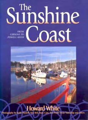
British Columbia's Sunshine Coast is a sublimely scenic 160-kilometre stretch of waterfront between Howe Sound and Desolation Sound, reached by a 40-minute ferry ride from West Vancouver. Join Howard White, award-winning humorist and lifelong coast denizen, on a guided tour from Gibsons, where the long-running TV series The Beachcombers was filmed, to Powell River, the largest community in the region. Along the way, sojourn in Roberts Creek, whose patron saint, the irrepressible Harry Roberts, invented the name "Sunshine Coast." Stop over in Sechelt, named for the Shi'sha'lh or Sechelt Nation who once occupied the bulk of the Sunshine Coast territory. Follow the seriously twisty highway to visit Pender Harbour, where some local fishing folk still do their Saturday shopping in kicker boats. Drop anchor in Princess Louisa Inlet, and discover why the likes of John Barrymore and Andrew Carnegie once came to marvel at its canyon-like splendour. With paintings by local artists, poems by local poets, tall tales by local characters, miracles by Sechelt medicine men, tips on predicting the weather, a fair share of risqué gossip about historical figures, a good mix of bold opinions and hard facts and over 150 beautiful colour photographs, The Sunshine Coast is a book to be treasured, not just by residents and visitors, but by anyone with an eye for fascinating places. First published in 1996, this fully revised edition contains updated text and all new photographs of coast life from the area's most talented photographers including Dean van't Schip and Keith Thirkell.
127 pages : illustrations (some color), color maps ; 29 cm
CIRC [ 1 ]
Related Online Resources
Átl’ka7tsem | Howe Sound Marine Reference Guide
A Marine Reference Guide (interactive map) that displays data associated with Átl’ka7tsem’s ocean and watersheds. This will support decision-making, marine spatial planning, and community education by visualizing how human and natural systems interact and overlap.
WEB LINK
Sunshine Coast Regional District
- Billings Bay
- Buccaneer Bay
- Camp Artaban
- Davis Bay
- Donnely Landing
- Doriston
- Earls Cove
- Eastbourne
- Egmont
- Ekins Point
- Elphinstone
- Gambier Harbour
- Garden Bay
- Town of Gibsons
- Granthams Landing
- Halfmoon Bay
- Hopkins Landing
- Irvines Landing
- Keats Island
- Kleindale
- Langdale
- Madeira Park
- McNab Creek
- New Brighton
- Pope Landing
- Port Mellon
- Redroofs
- Roberts Creek
- Seaside Park
- District of Sechelt
- Secret Cove
- Selma Park
- Tuwanek
- Twin Creeks
- Vaucroft Beach
- Welcome Beach
- Williamsons Landing
- Wilson Creek
Political Boundaries
Last updated: 2023-09-27