City of Waitsburg Walla Walla County, Washington
Mapped Location
City of Waitsburg: The mapped location is an approximation and should not be used for navigation or wayfinding.
Information
General information on City of Waitsburg
- Feature Type: Incorporated
Official, historical, colloquial and alternative toponyms for City of Waitsburg
A brief list of names that this geographic feature has been named
| Name | Description |
|---|---|
| City of Waitsburg | Official |
| Waitsburg | Official |
| Delta | Historical |
Origin Notes and History of City of Waitsburg
References to City of Waitsburg that document the origin of its place name

WAITSBURG, a town in the east central part of Walla Walla County, was named in honor of Sylvester M. Wait who built a mill there in 1864. The place was known as "Wait's Mill" A postoffice was secured in 1866 and, at the suggestion of the school teacher, William N. Smith, it was called "Delta." In 1868, the people voted to change it to Waitsburg and the Postoffice Department accepted the change. ( Illustrated History of Southeastern Washington, pages 154-156.)
A Selected Bibliography of City of Waitsburg, Walla Walla County, Washington
A compilation of essential readings detailing the history, geography, and culture of the region.
Waitsburg "one of a kind." by Vance Orchard
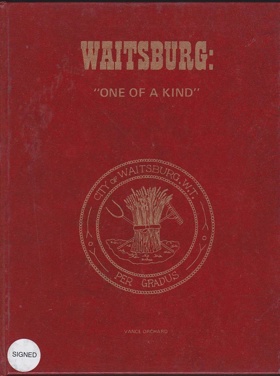
Waitsburg "one of a kind." chronicles the strategic agricultural settlement and early industrial milling development along the vital riparian corridors of the inland Columbia Basin. Orchard details how the region's formidable environmental constraints—specifically the sweeping, semi-arid rolling hills of the Walla Walla Valley and the profound reliance on the narrow, life-sustaining flow of the Touchet River—strictly dictated the margins of early pioneer survival and economic expansion. By mapping the immense physical labor required to harness the river's hydrological force for foundational gristmills and to carve expansive dryland wheat farms from the surrounding bunchgrass steppes, the narrative highlights the monumental effort necessary to anchor a permanent community in this demanding inland terrain. The absolute geographic necessity of securing this reliable water source amidst the vast, dry interior forced early homesteaders into a strict reliance on the valley's precise riparian geography, transforming a remote overland trail crossing into a critical agricultural processing chokepoint for the broader regional frontier. Ultimately, this local historical record serves as a deeply localized spatial history, demonstrating how the specific riverine topography and severe climatic realities of the inland Pacific Northwest fundamentally shaped the fiercely resilient, agriculturally dependent character of the Waitsburg settlement.
134 pages : illustrations, map, portraits ; 29 cm
Non-circulating [ 1 ]
Walla Walla County
- Adkins
- Ash
- Attalia
- Ayer
- Babcock
- Baker-Langdon
- Berryman
- Bolles
- Burbank
- Burbank Heights
- Buroker
- Burr
- Calhounville
- Chew
- Climax
- Clyde
- City of College Place
- Coppei
- Dixie
- Dixie Crossing
- Eastman
- Elwood
- Ennis
- Eureka
- Five Points
- Gardena
- Garrett
- Gilliam
- Hadley
- Harbert
- Harsha
- Harvey
- Hatch
- Humorist
- Hunt
- Kibler
- Kooskooskie
- Lamar
- Langdon
- Le Grow
- Lee
- Lowden
- Magallon
- Matthew
- Minnick
- Mojonnier
- Paddock
- Page
- Pedigo
- Pickard
- Port Kelley
- City of Prescott
- Reese
- Rifton
- Robinson
- Rulo
- Russell
- Ruxby
- Sapolil
- Scott
- Sheffler
- Slater
- Stateline
- Sudbury
- Thiel
- Thomas
- Tompkins
- Touchet
- Tracy
- Two Rivers
- Valley Grove
- Villard Junction
- Waiilatpo (historical)
- City of Waitsburg
- Walker
- City of Walla Walla
- Wallula
- Wallula Junction
- Welland
- Whitman
- Zangar Junction
Political Boundaries
Last updated: 2024-06-03