Wallula Junction Walla Walla County, Washington
Mapped Location
Wallula Junction: The mapped location is an approximation and should not be used for navigation or wayfinding.
Information
General information on Wallula Junction
- Feature Type: Place
Official, historical, colloquial and alternative toponyms for Wallula Junction
A brief list of names that this geographic feature has been named
| Name | Description |
|---|---|
| Wallula Junction | Official |
Origin Notes and History of Wallula Junction
References to Wallula Junction that document the origin of its place name

WALLULA, a town at the mouth of the Walla Walla River, in the southwestern part of Walla Walla County, occupies the site of the first or "old" Fort Walla Walla. The name means the same as the Nez Perce word Walla Walla but is in the Walla Walla language. (Rev. Myron Eells, in American Anthropologist for January, 1892.)
A Selected Bibliography of Wallula Junction, Walla Walla County, Washington
A compilation of essential readings detailing the history, geography, and culture of the region.
Forty years a pioneer business life of Dorsey Syng Baker,1848-1888 by W. W. Baker
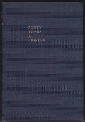
W. W. Baker’s Forty Years a Pioneer: Business Life of Dorsey Syng Baker 1848-1888 chronicles the ambitious frontier engineering that catalyzed the agricultural and industrial boom of the Inland Northwest. The biography details how Dr. Dorsey S. Baker constructed the region’s first railroad—the narrow-gauge Walla Walla and Columbia River line—by mapping its thirty-two miles of track directly onto the ancient Columbia Basin trade corridors long navigated by the Walla Walla, Cayuse, and Umatilla peoples. To overcome severe material shortages and sheer geographic isolation, Baker's enterprise relied on interdependent alliances and relentless cooperative labor, famously utilizing wooden rails temporarily capped with strap iron to successfully connect the inland agricultural settlements with the vital steamboat docks at Wallula. Ultimately, this historical account captures the intense physical reality of nineteenth-century pioneer development, demonstrating how the rapid superimposition of modern freight infrastructure onto established indigenous geography permanently transformed a remote inland territory into a massive wheat-exporting hub.
While the book traces his early origins in Illinois and his journey west via the Oregon Trail to an initial seven-year residence in Portland, Oregon, the vast majority of the narrative centers on Walla Walla, Washington. This is where "Doc" Baker eventually settled and built his regional business empire, which included agriculture, mercantilism, the first bank in Washington Territory, and the famous Walla Walla and Columbia River Railroad.
6 preliminary leaves, 257, [1] pages : illustrations, map (on lining papers) portraits 24 cm
Desiderata
Walla Walla County
- Adkins
- Ash
- Attalia
- Ayer
- Babcock
- Baker-Langdon
- Berryman
- Bolles
- Burbank
- Burbank Heights
- Buroker
- Burr
- Calhounville
- Chew
- Climax
- Clyde
- City of College Place
- Coppei
- Dixie
- Dixie Crossing
- Eastman
- Elwood
- Ennis
- Eureka
- Five Points
- Gardena
- Garrett
- Gilliam
- Hadley
- Harbert
- Harsha
- Harvey
- Hatch
- Humorist
- Hunt
- Kibler
- Kooskooskie
- Lamar
- Langdon
- Le Grow
- Lee
- Lowden
- Magallon
- Matthew
- Minnick
- Mojonnier
- Paddock
- Page
- Pedigo
- Pickard
- Port Kelley
- City of Prescott
- Reese
- Rifton
- Robinson
- Rulo
- Russell
- Ruxby
- Sapolil
- Scott
- Sheffler
- Slater
- Stateline
- Sudbury
- Thiel
- Thomas
- Tompkins
- Touchet
- Tracy
- Two Rivers
- Valley Grove
- Villard Junction
- Waiilatpo (historical)
- City of Waitsburg
- Walker
- City of Walla Walla
- Wallula
- Wallula Junction
- Welland
- Whitman
- Zangar Junction
Political Boundaries
Last updated: 2024-06-03