Fort Langley Metro Vancouver Regional District, British Columbia
Community - An unincorporated populated place, generally with a population of 50 or more, and having a recognized central area that might contain a post office, store and/or community hall, etc, intended for the use of the general public in the region. N side Langley (City), New Westminster Land District
Mapped Location
Fort Langley: The mapped location is an approximation and should not be used for navigation or wayfinding.
Information
General information on Fort Langley
- Feature Type: Place
Official, historical, colloquial and alternative toponyms for Fort Langley
A brief list of names that this geographic feature has been named
| Name | Description |
|---|---|
| Fort Langley | Official |
Origin Notes and History of Fort Langley
References to Fort Langley that document the origin of its place name
Fort Langley (Post Office) adopted in the 1930 BC Gazetteer. Confirmed 11 Februrary 1936 on 92 G/2. Form of name changed to Langley (Community) 31 December 1982 on 92 G/2.
Langley Post Office was opened 1 March 1875. Changed to Langley Fort Post Office 1 December 1912 and so-identified on BC Lands map 2B, 1915. Changed to Fort Langley Post Office 1 July 1925.
Named after Thomas Langley, Hudson Bay Company director (1800-30). In October 1824 Governor Simpson of the HBC, under the misapprehension that the Fraser River provided a navigable route to the Interior, wrote: "I imparted to Mr. McMillan my views in regard to extending the trade to the Northward of Fort George [Astoria] and pointed out to him the importance of having an Establishment at the mouth of Frazer's River [sic]....". Later this same year Chief Trader McMillan made a reconnaissance of the Lower Fraser Valley and in 1827 founded Fort Langley. In 1839 the original fort was abandoned and a new establishment [at the site of present-day Fort Langley] built.
Related Catalog Titles
A Bibliography for Fort Langley, Metro Vancouver Regional District, British Columbia
Fort Langley, birthplace of British Columbia by B. A. McKelvie, Charles Lillard
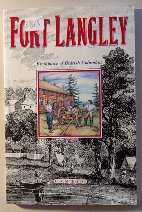
Co-authored by B.A. McKelvie and Charles Lillard, Fort Langley, Birthplace of British Columbia chronicles the foundational history of the Hudson's Bay Company fur-trading post established along the lower Fraser River in 1827. The book details how the fort evolved from a modest trading stockade dealing in salmon and beaver pelts into the geopolitical staging ground where British colonial rule was officially proclaimed in 1858. Drawing on historical journals and company records, the text illustrates the complex economic web linking fur traders, maritime supply ships, and local Indigenous populations. A keen insight drawn from the work is how the romantic narrative of a colony's "birthplace" obscures its corporate origins; by tracing British Columbia's administrative roots directly back to a commercial trading monopoly, the authors reveal that the region's political foundation was engineered less by heroic statecraft than by the ruthless logistical demands of the fur trade.
112 pages, [8] pages of plates : illustrations, maps ; 23 cm
CIRC [ 1 ]
The Company on the coast by E. Blanche Norcross, Morag Maclachlan, Nanaimo Historical Society, Malaspina College
Fort Langley outpost of Empire by B. A. McKelvie
An account of the Hudson's Bay Company's operation at Fort Langley in southern British Columbia in the early-to-mid 19th Century
ix, 98 pages illustrations (some color) maps (on lining-papers) 27 cm
CIRC [ 0 ]
Metro Vancouver Regional District
- Albion
- Alder Creek
- Aldergrove
- Altamont
- Ambleside
- Village of Anmore
- Anniedale
- Arbutus Ridge
- Austin Heights
- Barnet
- Barnston Island
- Beach Grove
- Village of Belcarra
- Belvedere
- Bergs
- Birchland Manor
- Blueridge
- Bowen Bay
- District of Bowen Island
- Brentwood Park
- Bridgeview
- Brighouse
- Brighton Beach
- British Properties
- Broadmoor
- Brookswood
- Brunette Creek
- Brunswick Beach
- Buckingham Heights
- Buntzen Bay
- Burkeville
- City of Burnaby
- Burnaby Heights
- Burquitlam
- Canyon Heights
- Capilano Highlands
- Capitol Hill
- Cariboo
- Carraholly
- Cascade
- Cascade Heights
- Cassin
- Caulfeild
- Cedardale
- Chineside
- Cleveland Park
- Cloverdale
- Coldwell Beach
- Connaught Heights
- Coombe
- City of Coquitlam
- Cosy Cove
- Cove Cliff
- Cowans Point
- Crescent
- Crescent Beach
- Cypress Park
- Dartmoor
- Deep Cove
- Delbrook
- District of Delta
- Delta
- Dollarton
- Douglas
- Dunbar-Southlands
- Dundarave
- Eagle Harbour
- Eagle Ridge
- Eastburn
- Elgin
- Essondale
- Fairview
- Fern Ridge
- Fernlee
- Fleetwood
- Forest Hills
- Forest Knolls
- Fort Langley
- Frames
- Fraser Heights
- Fraser Mills
- Garden Village
- Glen Valley
- Glenbrooke North
- Gleneagles
- Glenmore
- Grandview
- Grandview-Woodlands
- Granite Falls
- Guildford
- Haney
- Harbour Chines
- Harbour Village
- Hastings-Sunrise
- Hazelmere
- Hollyburn
- Hopington
- Horseshoe Bay
- Ioco
- Iron Bay
- Johnson
- Johnson Heights
- Keith-Lynn
- Kelvin
- Kensington-Cedar Cottage
- Kerrisdale
- Killarney
- Kitsilano
- Ladner
- Lake Buntzen
- City of Langley
- District of Langley
- Laurentian Belaire
- Lincoln Park
- Village of Lions Bay
- Lower Lonsdale
- Lynn Valley
- Lynnmour
- Maillardville
- City of Maple Ridge
- Maplewood
- Marpole
- Mary Hill
- Mayfair
- Meadowbrook
- Metrotown
- Middlegate
- Millers Landing
- Milner
- Mount Gardner
- Mount Pleasant
- Mud Bay
- Murrayville
- City of New Westminster
- Newton
- Norgate
- North Delta
- North Lonsdale
- City of North Vancouver
- District of North Vancouver
- North Woodlands
- Oakridge
- Ocean Park
- Orlomah Beach
- Oxford Heights
- Panorama Ridge
- Park Royal
- Parkdale Gardens
- Pasley Island
- Pemberton Heights
- City of Pitt Meadows
- Pitt Meadows
- Pleasantside
- City of Port Coquitlam
- Port Guichon
- Port Hammond
- Port Kells
- Port Mann
- City of Port Moody
- Queens Park
- Queensborough
- Ranch Park
- Renfrew-Collingwood
- City of Richmond
- Riley Park
- River Springs
- Ruskin
- Sandy Cove
- Sapperton
- Seafair
- Sentinel Hill
- Seymour Heights
- Seymour Landing
- Shaughnessy
- Silver Valley
- Snug Cove
- South Cambie
- South Slope
- South Surrey
- Southarm
- Steveston
- Strachan Creek
- Strathcona
- Strawberry Hill
- Sullivan
- Sullivan Heights
- Sun Valley
- Sunbury
- Suncrest
- Sunnyside
- Sunset
- Sunset Beach
- Sunshine
- Sunshine Hills
- City of Surrey
- Surrey
- Surrey Centre
- Thompson
- Thwaytes
- Tsawwassen
- Tsawwassen
- Twin Islands
- Tynehead
- University Hill
- Upper Lynn
- City of Vancouver
- Victoria-Fraserview
- Walnut Grove
- Websters Corners
- West Bay
- West End
- West End
- West Lynn
- West Point Grey
- District of West Vancouver
- Westmount
- Westridge
- Whalley
- City of White Rock
- Whonnock
- Whytecliff
- Wigwam Inn
- Willingdon Heights
- Windsor Park
- Woodhaven
- Woodlands
- Yennadon
Political Boundaries
Last updated: 2025-09-23