Galiano Island Feature
Island - Land area surrounded by water or marsh. One of the Gulf Islands, NE of Saltspring Island at S end of the Strait of Georgia, Cowichan Land District
Mapped Location
Galiano Island: The mapped location is an approximation and should not be used for navigation or wayfinding.
Information
General information on Galiano Island
- Feature Type: Feature
Official, historical, colloquial and alternative toponyms for Galiano Island
A brief list of names that this geographic feature has been named
| Name | Description |
|---|---|
| Galiano Island | Official |
Origin Notes and History of Galiano Island
References to Galiano Island that document the origin of its place name
Adopted in the 6th Report of the Geographic Board of Canada, 30 June 1906, as labelled on British Admiralty Chart 579, 1863 et seq, and on Trutch's 1871 map of British Columbia, etc.
"Named in 1859 by Captain Richards, HMS Plumper, after Commander ("captain de fragata") Dionisio Alcala Galiano, of the Spanish navy.... in the exploring vessel Sutil...[Galiano]... made an examination during the summer of 1792 of the channels between what is now Vancouver Island and the mainland, in company with Commander Valdes, in the Mexicana. Galiano and Valdes, the former in charge of the expedition, were sent from Mexico to this coast by order of the viceroy of Mexico to complete the exploration of Juan de Fuca strait. ...arrived at Nootka 12 May 1792... left Nootka for the strait 4 June 1792 and continued exploring the inner channels, where they met Vancouver and accompanied him for a portion of the cruise, until they came out into the Pacific 23 August...anchoring again at Nootka, Saturday 1 September 1792..."
...Galiano was killed fighting against the British in the Battle of Trafalgar, 1805.
Kilmorey Island was the Hudson's Bay Company name for Galiano Island. (from SHALE: Journal of the Gabriola Historial & Museum Society; Nick Doe editor)
A Selected Bibliography of Galiano Island, Feature
A compilation of essential readings detailing the history, geography, and culture of the region.
A Gulf Islands patchwork some early events on the islands of Galiano, Mayne, Saturma, North and South Pender by British Columbia Historical Association Gulf Islands Branch
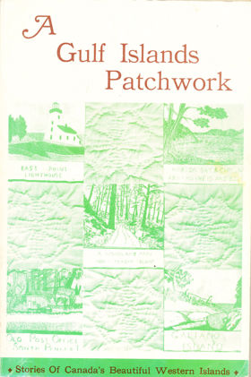
The British Columbia Historical Association’s A Gulf Islands Patchwork provides a fragmented but intimate pioneer chronicle of the sprawling Southern Gulf Islands archipelago, specifically detailing early settlement on Galiano, Mayne, Saturna, and the Penders. The narrative maps the defining, water-bound topography of these rugged landmasses, scattered across the treacherous tidal currents of the Strait of Georgia. By detailing the early establishment of remote lighthouses, coastal homesteads, and vital ferry landings, the book illustrates how the sheer physical isolation of this marine environment dictated every aspect of daily survival and community integration. The text highlights how early indigenous populations and subsequent pioneer settlers were forced to rely entirely on volatile aquatic highways—most notably navigating the violent, rip-tide currents of Active Pass—as dense, rocky interiors severely restricted overland transit and large-scale agriculture. Ultimately, the collection captures the profound environmental constraints of this coastal frontier, demonstrating how mastering complex maritime navigation and adapting to the unyielding isolation of a fractured island geography were the absolute prerequisites for establishing a viable, interconnected pioneer society along the remote Pacific seaboard.
192 pages : illustrations ; 23 cm
Non-circulating [ 1 ]
Last updated: 2026-10-14