Galiano Capital Regional District, British Columbia
Post Office - A Canada Post designation; the post office name may or may not be the same as the name of the place where it is located. At Sturdies Bay, SE side Galiano Island, Cowichan Land District
Mapped Location
Galiano: The mapped location is an approximation and should not be used for navigation or wayfinding.
Information
General information on Galiano
- Feature Type: Place
Official, historical, colloquial and alternative toponyms for Galiano
A brief list of names that this geographic feature has been named
| Name | Description |
|---|---|
| Galiano | Official |
Origin Notes and History of Galiano
References to Galiano that document the origin of its place name
Galiano Island (Steamer Landing) adopted 3 May 1951 on C.3450 at 48º 53'- 123º 19'. Galiano Post Office relocated here from elsewhere on the island (date not cited) and name subsequently changed to the dual form Sturdies Bay (Steamer Landing) - Galiano (Post Office) 1 October 1965 on C. 3452. Confirmed 29 May 1981 on 92B/4. Form of name changed to Sturdies Bay (Community) - Galiano (Post Office) 31 December 1982 on 92B/14. Dual name dismantled by Ottawa; BOTH to be labelled on BC maps.
A Selected Bibliography of Galiano, Capital Regional District, British Columbia
A compilation of essential readings detailing the history, geography, and culture of the region.
A Gulf Islands patchwork some early events on the islands of Galiano, Mayne, Saturma, North and South Pender by British Columbia Historical Association Gulf Islands Branch
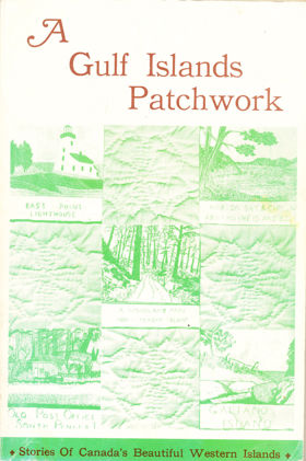
The British Columbia Historical Association’s A Gulf Islands Patchwork provides a fragmented but intimate pioneer chronicle of the sprawling Southern Gulf Islands archipelago, specifically detailing early settlement on Galiano, Mayne, Saturna, and the Penders. The narrative maps the defining, water-bound topography of these rugged landmasses, scattered across the treacherous tidal currents of the Strait of Georgia. By detailing the early establishment of remote lighthouses, coastal homesteads, and vital ferry landings, the book illustrates how the sheer physical isolation of this marine environment dictated every aspect of daily survival and community integration. The text highlights how early indigenous populations and subsequent pioneer settlers were forced to rely entirely on volatile aquatic highways—most notably navigating the violent, rip-tide currents of Active Pass—as dense, rocky interiors severely restricted overland transit and large-scale agriculture. Ultimately, the collection captures the profound environmental constraints of this coastal frontier, demonstrating how mastering complex maritime navigation and adapting to the unyielding isolation of a fractured island geography were the absolute prerequisites for establishing a viable, interconnected pioneer society along the remote Pacific seaboard.
192 pages : illustrations ; 23 cm
Non-circulating [ 1 ]
Capital Regional District
- Albert Head
- Ardmore
- Bear Mountain
- Beaver Lake
- Beaver Point
- Bedwell Harbour
- Belmont Park
- Braemar Heights
- Brentwood Bay
- Cadboro Bay
- District of Central Saanich
- Colquitz
- City of Colwood
- Cordova Bay
- Deep Cove
- East Sooke
- Township of Esquimalt
- Fairfield
- Fernwood
- Fulford Harbour
- Galiano
- Ganges
- Glen Lake
- Goldstream
- Gordon Head
- Happy Valley
- District of Highlands
- Hope Bay
- James Bay
- Keating
- Lake Hill
- City of Langford
- Leechtown
- Lighthouse Point
- Long Harbour
- Luxton
- Marigold
- Mayne Island
- District of Metchosin
- Millstream
- Milnes Landing
- Montague Harbour
- Musgrave Landing
- North Galiano
- District of North Saanich
- District of Oak Bay
- Otter Bay
- Pender Island
- Port Renfrew
- Port Washington
- Prospect Lake
- River Jordan
- Royal Oak
- District of Saanich
- Saanichton
- Saseenos
- Saturna
- Sevenoaks
- Shirley
- Town of Sidney
- District of Sooke
- Strawberry Vale
- Sturdies Bay
- Swartz Bay
- Tillicum
- Vesuvius
- City of Victoria
- Town of View Royal
- Village Bay
Political Boundaries
Last updated: 2025-09-23