Mayne Island Capital Regional District, British Columbia
Community - An unincorporated populated place, generally with a population of 50 or more, and having a recognized central area that might contain a post office, store and/or community hall, etc, intended for the use of the general public in the region. NW side of Mayne Island, facing Active Pass, Cowichan Land District
Mapped Location
Mayne Island: The mapped location is an approximation and should not be used for navigation or wayfinding.
Information
General information on Mayne Island
- Feature Type: Place
Official, historical, colloquial and alternative toponyms for Mayne Island
A brief list of names that this geographic feature has been named
| Name | Description |
|---|---|
| Mayne Island | Official |
Origin Notes and History of Mayne Island
References to Mayne Island that document the origin of its place name
Mayne (Post Office) adopted 12 December 1939, as labelled on BC Lands' map 2A, 1913 et seq. Form of name changed to Mayne (community) 29 November 1984 on Ottawa file 203-2. Form of name changed to Mayne Island (community) 19 November 2012, as requested by Islands Trust and endorsed by residents' groups and area representatives including Ratepayers Association, regional government, and elected provincial & federal representatives.
Plumper Pass Post Office was opened 1 November 1880; renamed Mayne Post Office 1 April 1900.
The island was named c1860 by Captain Richards after Lieutenant Richard Charles Mayne, RN, engaged in hydrographic surveys on this coast 1857-1861; died 1892.... [see Walbran for additional biographical detail]
Lieutenant Mayne's journal, 17 February 1857 - 31 December 1860 (while he was aboard HMS Plumper under Capt Richards), is held at the Provincial Archives (manuscript E/B/M45; also a typed transcript E/B/M45A). Lieut. Mayne's book "Four years in British Columbia and Vancouver Island: an account of their forests, rivers, coasts, gold-fields, and resources for colonisation" was published at London in 1862.
Related Catalog Titles
A Bibliography for Mayne Island, Capital Regional District, British Columbia
Mayne Island & the outer Gulf Islands a history by Marie Elliott
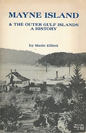
Mayne Island & the Outer Gulf Islands: A History by Marie Elliott chronicles roughly 120 years of social, economic, and political development across Mayne and its neighboring southern Gulf Islands. Drawing on archival records, oral histories, and pioneer accounts, Elliott highlights how maritime transportation fundamentally shaped local livelihoods—from early homesteading, logging, and hothouse tomato farming to postwar tourism. The book also examines the cultural fabric of these relatively remote communities, notably detailing the significant contributions of Japanese-Canadian settlers before their wartime internment. Finally, it traces the modern struggles over ferry service, rapid land development, and conservation that ultimately spurred the creation of the Islands Trust to protect the region.
x, 152 pages : illustrations ; 23 cm
CIRC [ 1 ]
A Gulf Islands patchwork some early events on the islands of Galiano, Mayne, Saturma, North and South Pender by British Columbia Historical Association Gulf Islands Branch
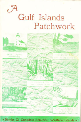
Stories and history of some of British Columbia's Gulf Islands. Contributions by many writers including Wilson Duff on, 'Indians of the Gulf islands'.
192 pages : illustrations ; 23 cm
CIRC [ 1 ]
Capital Regional District
- Albert Head
- Ardmore
- Bear Mountain
- Beaver Lake
- Beaver Point
- Bedwell Harbour
- Belmont Park
- Braemar Heights
- Brentwood Bay
- Cadboro Bay
- District of Central Saanich
- Colquitz
- City of Colwood
- Cordova Bay
- Deep Cove
- East Sooke
- Township of Esquimalt
- Fairfield
- Fernwood
- Fulford Harbour
- Galiano
- Ganges
- Glen Lake
- Goldstream
- Gordon Head
- Happy Valley
- District of Highlands
- Hope Bay
- James Bay
- Keating
- Lake Hill
- City of Langford
- Leechtown
- Lighthouse Point
- Long Harbour
- Luxton
- Marigold
- Mayne Island
- District of Metchosin
- Millstream
- Milnes Landing
- Montague Harbour
- Musgrave Landing
- North Galiano
- District of North Saanich
- District of Oak Bay
- Otter Bay
- Pender Island
- Port Renfrew
- Port Washington
- Prospect Lake
- River Jordan
- Royal Oak
- District of Saanich
- Saanichton
- Saseenos
- Saturna
- Sevenoaks
- Shirley
- Town of Sidney
- District of Sooke
- Strawberry Vale
- Sturdies Bay
- Swartz Bay
- Tillicum
- Vesuvius
- City of Victoria
- Town of View Royal
- Village Bay
Political Boundaries
Last updated: 2025-09-23