Catalog of British Columbiana and Pacific Northwest Americana
Encyclopedia Cascadia Catalog contains book titles of mostly non-fiction Pacific Northwest Coast of North America Titles (primarially British Columbia, Idaho, Oregon and Washington State) in an easy-to-understand title catalog. If you see a link with this badge ONLINE CIRC it means that there is an online institution that provides free access to that title. In some cases there may be more than one institution hosting the title digitally.
| Catalog Title | Published |
|---|---|
|
Beach of heaven a history of Wahkiakum County by Irene Martin 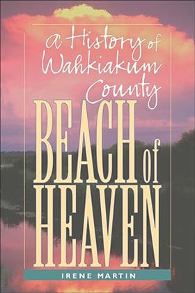
Beach of Heaven is a history of the earliest settled areas in Washington. As the birthplace of both the state's canned salmon industry and the cooperative extension movement, as well as Congresswoman Julia Butler Hansen, Wahkiakum County has a historical significance far beyond its borders. Today it stands at the cusp of major change as the rural occupations of fishing, farming, and logging, upon which the country has traditionally depended, suffer from outside influences and demographic shifts. Beach of Heaven documents these changes and looks ahead to future possibilities. This book is much more than a county history. It is a story of the development of a place, of the settlement of ethnic groups, of the establishment of social and transportation networks that made life livable in a wild and forested country. As Irene Martin writes, Beach of Heaven is "an emotional engagement with the place we call home." It will resonate for all who have a passion for the little places, the rural areas, the community values that are gradually passing into history. xiii, [1], 178 pages, 32 unnumbered pages of plates : illustrations, maps, portraits ; 23 cm CIRC [ 1 ]
|
1997 |
|
South of Seattle notes on life in the Northwest woods by James LeMonds 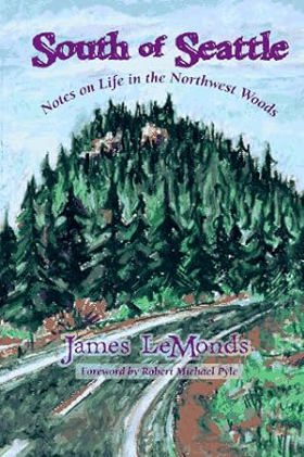
These fifteen essays invite readers in and make them feel at home in a small town in the Pacific Northwest. The straightforward and unpretentious writing carries the imagery and emotion of people and place in a way that defines a region xiv, 122 pages : illustrations ; 23 cm CIRC [ 1 ]
|
1997 |
|
Traders' tales narratives of cultural encounters in the Columbia Plateau, 1807-1846 by Elizabeth Vibert 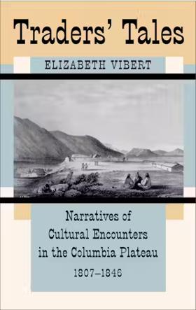
As the earliest "ethnographic" accounts of the Native peoples of northern North America, fur-trade records have long been mined for data by legal researchers, historians, and anthropologists. Traders' Tales provides the first sustained critical analysis of these fascinating historical documents. Drawing on the latest techniques in ethnohistory and cultural and literary theory, Elizabeth Vibert unpacks the assumptions behind traders' views - assumptions shaped by culture, gender, social class, and race. At the same time the author explores the responses of the Native Americans of the Plateau region to the pressures and changes wrought by this early colonial incursion into latter-day Washington, Oregon, Idaho, Montana, and British Columbia. The cultural perceptions of these white men in Indian country were open to inventive refashioning, and Native peoples played a central role in the encounter and in the way it was portrayed. Traders' Tales is both an analysis of fur-trader writings as a form of colonial discourse and a meticulous historical narrative providing significant new insights into early Native-white relations in a little-studied region of the West. A broadly comparative perspective and finely tuned critical skills enable Vibert to shed new light on the nature of colonial cultural relations, and to illuminate the ways in which racism and ethnocentrism are constructed historically xviii, 366 pages : illustrations, maps ; 23 cm CIRC [ 1 ]
|
1997 |
|
First across the continent Sir Alexander Mackenzie by Barry M. Gough 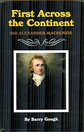
Seeking the Northwest Passage and the fabled link to Russia, Japan, and Cathay, Alexander Mackenzie drove himself and his men relentlessly, by canoe and portage, across the uncharted rivers, valleys, and mountains of North America. Mackenzie's 1789 journey to the Arctic Ocean and his arduous journey to the Pacific in 1793 predate the Lewis and Clark expedition. By the age of thirty-one, Alexander Mackenzie had become the first man to cross North America from the northwestern hub of the interior trade, Lake Athabasca, to the Pacific Ocean. He had opened the continent to trade and exploration. In his research, Barry Gough traveled from Mackenzie's birthplace to his tomb and from Montreal to both the Arctic Ocean and the Pacific. He takes the reader along with Mackenzie on his hazardous travels and voyages, using contemporary accounts to bring to life the perils faced by the young explorer. First Across the Continent reveals the international impact of Sir Alexander Mackenzie's expeditions and places him among the elite of New World Explorers, illuminating his vital role in the history of the fur trade and the American West xxi, 232 pages : illustrations ; 23 cm CIRC [ 1 ]
|
1997 |
|
Oceanic origin of the Kwakiutl-Nootka and Salish stocks of British Columbia by Charles Hill-Tout 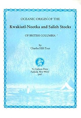
Authored by pioneering anthropologist Charles Hill-Tout, Oceanic Origin of the Kwakiutl-Nootka and Salish Stocks of British Columbia presents an early 20th-century linguistic and ethnological study exploring the ancestral roots of Pacific Northwest Indigenous peoples. The book investigates complex grammatical structures, cultural customs, and physical characteristics to argue for maritime migration theories linking Northwest Coast tribes to Pacific island populations. Through meticulous comparative analysis, the text reflects the ambitious scope of early anthropological attempts to map the peopling of the Americas. A keen insight drawn from the work is how obsolete scientific theories often inadvertently highlight the profound maritime orientation of coastal tribes; by obsessing over trans-oceanic origins to explain advanced coastal cultures, early researchers underscored a fundamental truth—that the Salish, Kwakiutl, and Nootka peoples treated the open ocean not as a barrier of isolation, but as a vast, unifying highway for human movement. 60 pages : illustrations ; 26 cm CIRC [ 1 ]
|
1997 |
|
The resettlement of British Columbia essays on colonialism and geographical change by Cole Harris 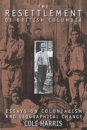
In this beautifully crafted collection of essays, Cole Harris reflect on the strategies of colonialism in British Columbia during the first 150 years after the arrival of European settlers. The pervasive displacement of Indigenous people by the newcomers, the mechanisms by which it was accomplished, and the resulting effects on the landscape social life, and history of Canada's western-most province are examined through the dual lenses of post-colonial theory and empirical data. By providing a compelling look at the colonial construction of the province, the book revises existing perceptions of the history and geography of British Columbia xxii, 314 pages : illustrations, maps ; 24 cm CIRC [ 1 ]
|
1997 |
|
The Indian history of British Columbia the impact of the white man by Wilson Duff, Royal British Columbia Museum 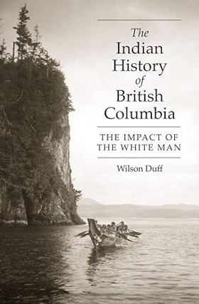
In The Impact of the White Man, Wilson Duff presents a clear and comprehensive summary of the effects of immigrant settlement on the population, culture, economy and religion of British Columbia's First Peoples. First published in 1964, this book has stood the test of time. With more than 15,000 copies in print, it remains an important anthropological and historical record up to the 1960s. Duff wrote The Impact of the White Man as the first of three volumes on the history of the First Peoples in B.C. He never completed the other two volumes, but this book, on its own, has become a classic of anthropology. The new edition retains the author's original text and features more photographs, an appendix updating the names and territories of First Nations in B.C., a new list of recommended reading, and an index 184 pages : illustrations, maps ; 23 cm CIRC [ 1 ]
|
1997 |
|
River of the west stories from the Columbia by Robert Clark 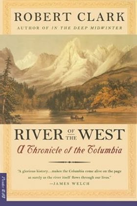
The mighty Columbia River encompasses not only the full range of American history but a geography of myth, hope, and tragedy. With the intricate detail of a scholar and the art of a storyteller, author Robert Clark captures the impact of Manifest Destiny, the conquest of native peoples, emigrants from the drought-ridden Midwest, and hydropowered New Deal dreams x, 406 pages ; 21 cm CIRC [ 1 ]
|
1997 |
|
Fire, faults & floods a road & trail guide exploring the origins of the Columbia River basin by Marge Mueller, Ted Mueller 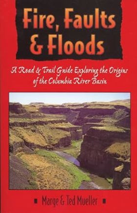
Fifty-three trips are targeted to assist readers in finding and understanding the area's major geologic features. Among the regions covered are: Missoula, Montana and the lower Clark Fork drainage; Grande Ronde and Joseph Creek Canyons on the borders of Washington, Oregon, and Idaho; the Columbia River Gorge; and the northern Oregon Coast. Includes b&w photos and maps. c. Book News Inc 288 pages : illustrations, maps ; 22 cm CIRC [ 1 ]
|
1997 |
|
Mazama the past 100 years : life and events in the upper Methow Valley & Early Winters by Doug Devin 
Authored by local historian Doug Devin, Mazama the Past 100 Years: Life and Events in the Upper Methow Valley & Early Winters chronicles the century-long social and environmental evolution of an isolated high-country community in north-central Washington. The book draws on oral histories, diaries, and archival photographs to document the arduous lives of early homesteaders, miners, and trappers who braved deep winter snows and rugged mountain terrain along the eastern slopes of the Cascade range. Through these collected records, the text captures how a sparse population of self-reliant outdoorsmen gradually transformed into a tight-knit recreational and residential valley. A keen insight drawn from the work is how seasonal isolation acts as a powerful community filter; the extreme winter climate of the upper Methow Valley routinely weeded out casual settlers, leaving behind a resilient population whose social cohesion was entirely dependent on mutual survival tactics and an enduring tolerance for wilderness seclusion. 155 pages : illustrations, maps ; 28 cm CIRC [ 1 ]
|
1997 |
|
Uncle Mike's guide to the real Oregon Coast by Michael Burgess , Steve McLeod (Illustrator) 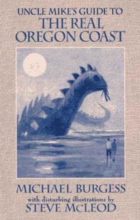
Authored by Michael Burgess and illustrated by Steve McLeod, Uncle Mike's Guide to the Real Oregon Coast offers an unconventional, highly personal travelogue that strips away polished resort gloss to reveal the quirky characters, hidden tide pools, and gritty working-waterfront towns of the Pacific Northwest shore. The book combines irreverent local lore, practical backroads navigation, and offbeat commentary to direct travelers toward authentic, uncommercialized coastal experiences. Through its humorous and direct prose, the text highlights the idiosyncratic cultural texture that survives just off the beaten highway. A keen insight drawn from the work is how true regional identity often exists in the overlooked margins between major tourist attractions; by celebrating the weathered fish shacks, eccentric locals, and forgotten roadside stops, the guide exposes how authentic coastal culture thrives precisely where commercial tourism fears to tread. xiii, 87 pages : illustrations ; 22 cm CIRC [ 1 ]
|
1997 |
|
The price of taming a river the decline of Puget Sound's Duwamish/Green waterway by Mike Sato 
The historical puzzle that is the Green River and its drainage basin, from Mount Rainier to Puget Sound, is carefully pieced together in this portrait of the people, events, and dramatic forces that have determined the fate of this once-powerful river. Beginning in the early years of this century, the Duwamish/Green waterway was rechanneled, dredged, dammed, and diked in an attempt to prevent flooding and salvage land for agriculture and industry. The "taming" of the river made a valuable stretch of land usable year-round but the consequences have been pollution and the destruction of the habitat it once provided for fish, shellfish, and wildlife. Ranging from prehistoric times to the present, from geologic forces to political and economic battles, The Price of Taming a River shows clearly what has been lost but also tells the compelling story of the individuals and communities who are working to restore and preserve the watershed. It is a story of small places and large issues, of bitter controversy and quiet victories, which presents a vision of what can be accomplished by those who choose to embrace their role as stewards of the river 107 pages : illustrations ; 21 cm CIRC [ 1 ]
|
1997 |
|
The Whitman Massacre by E. M. Saunders 
Authored by E. M. Saunders, The Whitman Massacre provides a dramatic narrative account of the tragic 1847 attack on the Cayuse Indian mission at Waiilatpu by members of the Cayuse tribe, resulting in the deaths of Marcus and Narcissa Whitman and twelve others. The book explores the mounting racial tensions, cultural misunderstandings, and devastating epidemics—particularly measles—that fueled Indigenous resentment against encroaching American settlers. Drawing on historical documents and period accounts, the text examines how the missionary enterprise inadvertently triggered a catastrophic clash of worlds in southeastern Washington. A keen insight drawn from the work is how medical disparities served as the ultimate catalyst for frontier violence; because traditional Cayuse healing practices failed against introduced European diseases while white missionaries survived, the tribe perceived the plague as targeted biological warfare, turning a public health disaster into a fatal geopolitical flashpoint. 56 pages CIRC [ 1 ]
|
1997 |
|
The lifeline of the Oregon Country the Fraser-Columbia brigade system, 1811-47 by James R. Gibson 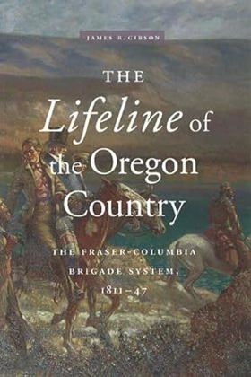
"Furs is what brings us," remarked an early trader in the Oregon Country. He added, however, that "the difficulty of getting the necessary supplies will continue to operate against it," located as it was "on the worst side of the Rocky Mountains." Fortunately, the discovery in 1805 by Lewis and Clark that the Columbia River was navigable by canoe or boat to the Pacific led to the logistical linking of the New Caledonia and Columbia Districts by means of the Fraser-Columbia brigade system xi, 292 pages : maps ; 24 cm CIRC [ 1 ]
|
1997 |
|
The Greater Vancouver book an urban encyclopedia by Chuck Davis 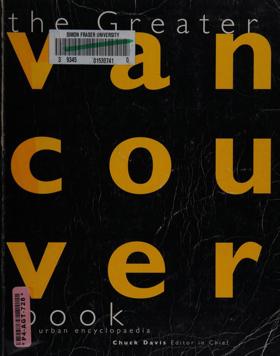
Covers the city of Vancouver and the surrounding metropolitan area primarily located in the Greater Vancouver Regional District xiii, 882 pages, 8 unnumbered pages of plates : illustrations (some color), color map ; 27 cm CIRC [ 1 ]
|
1997 |
|
British Columbia place names by G. P. V. Akrigg, Helen B. Akrigg 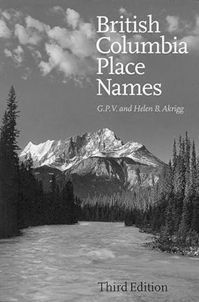
Elephant Crossing. Houdini Needles. Miniskirt, Tickletoeteaser Tower, and Why Not Mountain. These are just some of the many names of places, rivers, mountains, and lakes that you will come across in the newest edition of British Columbia Place Names. This classic which, in its various editions, has sold over 29,000 copies, covers about 2,500 geographical features, cities, towns, and smaller communities in the province. The book abounds with fascinating historical facts, stories, and remarkable characters involved with the names of towns, cities, rivers, lakes, mountains, and islands. The selection was determined by the geographical importance of the feature as well as story of the naming. In the introduction the authors deal with the stages by which B.C. acquired its place names, the history of research into those names, and the categories into which they fall. The latter range from the honorific and commemorative to the comic and disrespectful. Aboriginal names receive particular attention. The location of each place is clearly indicated and the text is accompanied by detailed maps. Brief biographical accounts of persons with places named after them as well as an abundance of anecdotes make this a fascinating book for browsers and an invaluable resource for historians. xxv, 304 pages : maps ; 24 cm CIRC [ 1 ]
|
1997 |
|
Rain people the story of Ocean Falls by Bruce Ramsey, Roland Neave 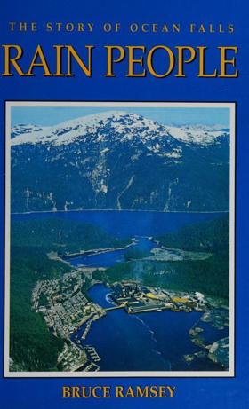
Authored by Bruce Ramsey and edited by Roland Neave, Rain People: The Story of Ocean Falls chronicles the rise and fall of the isolated, company-owned pulp and paper mill town nestled in the rugged coastal fjords of British Columbia. The book traces the community's mid-century heyday as a thriving industrial enclave accessible only by boat or plane, powered by torrential local rainfall and sustained by a tight-knit working-class population. Through archival photographs and personal accounts, the text details the sudden, devastating corporate closure that transformed a bustling boomtown into a damp ghost town. A keen insight drawn from the work is how corporate paternalism created a profound psychological vulnerability in remote industrial outposts; when distant executives pulled the plug on the mill, residents discovered that their entire social fabric, municipal infrastructure, and sense of identity had been built on foundation stones owned entirely by a corporation. xi, 240 p. : ill., maps (1 folded), ports. ; 22 cm. CIRC [ 1 ]
|
1997 |
|
Landscapes of promise the Oregon story, 1800-1940 by William G. Robbins 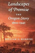
Landscapes of Promise is the first comprehensive environmental history of the early years of a state that has long been associated with environmental protection. Covering the period from early human habitation to the end of World War II, William Robbins shows that the reality of Oregon's environmental history involves far more than a discussion of timber cutting and land-use planning. Robbins demonstrates that ecological change is not only a creation of modern industrial society. Native Americans altered their environment in a number of ways, including the planned annual burning of grasslands and light-burning of understory forest debris. Early Euro-American settlers who thought they were taming a virgin wilderness were merely imposing a new set of alterations on an already modified landscape. Beginning with the first eighteenth-century traders on the Pacific Coast, alterations to Oregon's landscape were closely linked to the interests of global market forces. Robbins uses period speeches and publications to document the increasing commodification of the landscape and its products xvii, 392 pages, 16 unnumbered pages of plates : illustrations, maps ; 25 cm. CIRC [ 0 ]
|
1997 |
|
Silver Creek Idaho's fly fishing paradise by Dave Clark, Dave Glasscock 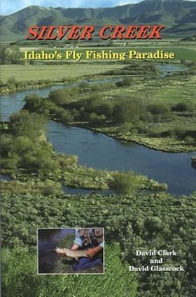
This is the story of one of the most revered trout fisheries in the world. The book includes color photographs, detailed Silver Creek area map, Nature Conservancy map, s-curves map, Silver Creek hatch chart, fly chart, and tips on equipment, flies, and techniques. xiv, 210 pages : illustrations (some color), maps ; 23 cm CIRC [ 0 ]
|
1997 |
|
The Milwaukee Road revisited by Stanley W. Johnson 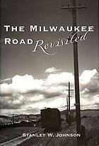
Stanley W. Johnson traces the ways that the Milwaukee Railroad shaped the lives of its employees and their families on its route from Three Forks, Montana, to Spokane, Washington 239 pages : illustrations, map ; 24 cm CIRC [ 0 ]
|
1997 |
|
River tales of Idaho by Darcy Williamson 
Idaho's history centers, in many regards, on its rivers. Idaho has more free flowing water than any other state in the continental US. Idaho rivers have played an important role in the state's history, travel and commerce. River Tales of Idaho includes fifty eight stories that illustrate the importance of the state's streams to Native Americans, explorers, settlers, industry and recreationists. xi, 342 pages : illustrations, maps ; 23 cm CIRC [ 0 ]
|
1997 |
|
Planning a new West the Columbia River Gorge National Scenic Area by Carl Abbott, Sy Adler, Margery Post Abbott 
With the recent decline of natural resource industries in the American West, a new economic future has dawned for the region, focused on tourism, service industries, and high technology. Affluent and articulate interests are shaping a New West on the foundations of the Old West, often against the wishes of some local residents. As former timber, farming, and mining landscapes are re-allocated for recreation, tourist facilities, environmental protection, and new residential development, the debate over who gets to shape and speak for the West intensifies. In the Columbia Gorge, the creation of a National Scenic Area in 1986 enjoined differences between the goals and values of the Old and New Wests. In Planning a New West the authors present a fast-paced account of the creation of the Columbia River Gorge National Scenic Area. As the nation's first multi-entity national scenic area — a regional land use planning effort mandated by the federal government in partnership with state and local governments — the Columbia River Gorge National Scenic Area is a revealing case study that explores what may be the future for protection of historical landscapes in the American West. Planning a New West explains the political battles over the future of the Gorge, including environmentalist concerns about logging, local property owners' worries about increasing population, and the invasion of windsurfers and other recreationalists. The authors describe the range of viewpoints and the disputes that raged between contending groups trying to shape the legislation. Finally, the book covers the legislation itself and examines what has been accomplished in the ten years since its passage. Throughout this volume, the authors address a key question: what happens when a coveted landscape becomes a battleground for two legitimate and compelling visions of the American West? In examining the origins and implementations of the Columbia River Gorge National Scenic Area, Planning a New West reveals a vast experiment in mediating between old and new. x, 210 pages : illustrations, map ; 26 cm. CIRC [ 0 ]
|
1997 |
|
Northwest birds in winter by Alan Contreras 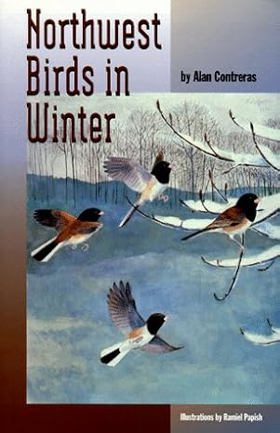
Observing birds in the Pacific Northwest in winter is both challenging and rewarding. Despite the weather and the fact that many birds are not in their brightest plumage, winter birding is growing increasingly popular. Unlike the breeding season, when many birds are territorial and observers must travel widely to see them, in winter many birds concentrate and a field trip can find amazing densities and species variety in a small area. Northwest Birds in Winter is the first guide to the distribution and abundance of birds that winter in Oregon, Washington, Idaho, and southern British Columbia. It offers a summary of winter status and distribution information for the nearly 380 regularly occurring species in the region. Detailed winter range maps and 30-year population trend data are provided for many of the species. In addition, the book includes suggestions as to the best winter birding sites in the Pacific Northwest and photographs of the region's most unusual winter birds. This seasonal guide is an essential addition to the literature on Northwest birds and a valuable new resource for birders in the Pacific Northwest. xxiv, 264 pages : illustrations, maps ; 22 cm CIRC [ 0 ]
|
1997 |
|
An annotated bibliography of Oregon bird literature published before 1935 by George A. Jobanek 
George Jobanek's exhaustive, richly annotated bibliography fills an important gap in Oregon bird literature and offers a valuable new resource for professional and informed amateur ornithologists, wildlife managers, biologists, ecologists, and anyone with a serious interest in the natural history of the Pacific Northwest. In compiling this unique book, George Jobanek carefully researched early ornithological, scientific, and natural history publications, from American Field to Zoe, for records of Oregon birds. Most of these early articles are today relatively rare; many were overlooked or ignored by previous bibliographers. In his annotations for each of the nearly two thousand entries, Jobanek conveys the salient points of each article and reveals its usefulness for contemporary readers. Direct quotations from the references allow for a glimpse of an earlier, golden age in ornithology. References are organized by author and cross-indexed by species (e.g., 86 entries for Sage Grouse), county (e.g., 220 entries for Klamath County), and key word (e.g., "behavior," "conservation," "distribution," "introduction," "migration," "nesting," "taxonomy"). A gazetteer identifies localities mentioned in the annotations. xii, 481 pages : illustrations ; 24 cm CIRC [ 0 ]
|
1997 |
|
The Official Illustrated Orcas-American Dictionary and Phrase Book and Gazetteer by Mike & Maxim Hurwicz 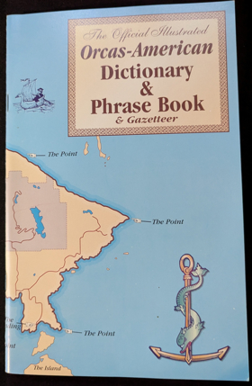
Authored by Mike and Maxim Hurwicz, The Official Illustrated Orcas-American Dictionary and Phrase Book and Gazetteer presents a witty, satirical lexicon capturing the distinct cultural quirks, local geography, and insider vernacular of Orcas Island in Washington's San Juan archipelago. Through humorous definitions, phrase guides, and custom illustrations, the book lampoons the everyday realities of ferry schedules, rainwater catchment systems, and the peculiar friction between lifelong islanders and seasonal newcomers. The text uses self-deprecating humor to decode the unwritten social codes of a fiercely independent, geographically isolated community. A keen insight drawn from the work is how regional dialects and specialized humor serve as cultural gatekeeping tools in rapidly gentrifying rural areas; by codifying local jargon into a satirical dictionary, island residents establish a linguistic boundary that playfully rebuffs outsiders while reinforcing a shared, resilient identity. 17 pages : portrait CIRC [ 1 ]
|
1997 |