Catalog of British Columbiana and Pacific Northwest Americana
Encyclopedia Cascadia Catalog contains book titles of mostly non-fiction Pacific Northwest Coast of North America Titles (primarially British Columbia, Idaho, Oregon and Washington State) in an easy-to-understand title catalog. If you see a link with this badge ONLINE CIRC it means that there is an online institution that provides free access to that title. In some cases there may be more than one institution hosting the title digitally.
| Catalog Title | Published |
|---|---|
|
Bittersweet oasis a history of Ashcroft and district, 1885-2002 by Brian Belton 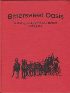
Bittersweet Oasis: A History of Ashcroft and District, 1885-2002, originally authored by Brian Belton, provides a comprehensive historical account of the development of the village of Ashcroft in British Columbia's Thompson region. The book chronicles Ashcroft's foundational years as the bustling "Gateway to the Cariboo," detailing how its position at the intersection of the Canadian Pacific Railway and the Cariboo Wagon Road fueled its early economic boom. It further explores the community's cultural and economic evolution, highlighting the vital contributions of early pioneers, Chinese laborers, and a thriving agricultural sector famous for its tomatoes and potatoes. Ultimately, the narrative captures the enduring resilience of the district's residents as they successfully navigated devastating fires, shifts in regional transportation routes, and changing industries over more than a century. 160 pages : illustrations, facsimiles, portraits ; 29 cm CIRC [ 1 ]
|
2002 |
|
Guide to ferryboats of Puget Sound past and present by Patricia Lander 
Published in local editions by Patricia Lander, Guide to Ferryboats of Puget Sound: Past and Present provides a comprehensive historical and structural inventory of the iconic vessels that have navigated the inland waters of Washington State. The book catalogs a diverse fleet ranging from the early mosquito fleet steamers to the modern auto-ferries that form an indispensable maritime highway across the Salish Sea. Through detailed vessel histories, operational timelines, and archival photographs, the text captures how these floating bridges shaped regional commerce, commuting, and coastal community-building. A keen insight drawn from the work is how Puget Sound ferries function as floating public town squares; by forcing diverse commuters, tourists, and islanders into shared, slow-paced transit, the ferry system preserves a unique communal culture that directly resists the anonymous speed of modern mainland highways. 145 pages : illustrations, maps ; 26 cm CIRC [ 1 ]
|
2002 |
|
Washington Territory by Robert E. Ficken 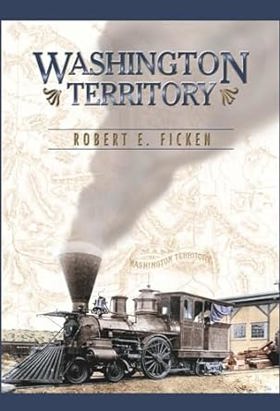
Established in 1853, Washington remained a Territory until admitted into the Union thirty-six years later in 1889. Few other territories in the American West languished longer in dependent status. Because of a dividing geographical barrier (the Cascade Range) and the lack of an adequate internal transportation system, Washington Territory made little practical sense as a social and economic entity. Western Washington actually was a satellite of San Francisco and Eastern Washington at Portland, until railroads were completed along the Columbia River and, especially, over the Cascades in the mid-1880s. Essentially, Washington was not qualified for statehood until very late in its territorial period when railway tracks finally unified the region. --From publisher's description [8], 288 pages, 8 unnumbered pages of plates : illustrations, map, portraits ; 24 cm CIRC [ 1 ]
|
2002 |
|
British Columbia an illustrated history by Geoff Molyneux 
This history of British Columbia celebrates an enigmatic and beautiful frontier. At the same time, author Geoffrey Molyneux delivers barbs about the corrupt politicians and bizarre development plans that have threatened to compromise this majestic region. With over 100 photographs and excerpts from writers Douglas Coupland and Terry Glavin, this book provides a short but engaging history of Canada's westernmost province 174 pages : illustrations, maps ; 23 cm CIRC [ 1 ]
|
2002 |
|
A traveller's guide to historic British Columbia by Rosemary Neering 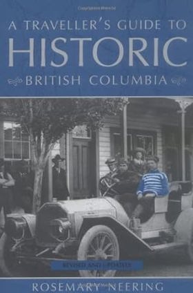
Published by Whitecap Books, Rosemary Neering's A Traveller's Guide to Historic British Columbia serves as an engaging geographical and historical companion that maps the province's rich tapestry of past human endeavors. The book navigates the reader across various regional landscapes—from the gold-rush trails of the Cariboo and the rugged mountain passes of the interior to coastal Indigenous settlements and early European trading posts. By intertwining travel logistics with historical vignettes, anecdotes, and archival context, the text brings physical landmarks and forgotten settlements vividly back to life. A keen insight drawn from the work is how travel guides to historical frontiers function as chronological bridges; by grounding sweeping provincial history in specific, visitable coordinates on a modern map, the book demonstrates that physical travel through British Columbia is inherently an act of temporal exploration across layers of competing human ambitions. xvii, 334 pages : illustrations (some color), maps ; 23 cm CIRC [ 1 ]
|
2002 |
|
History of Kellogg, Idaho, 1885-2002 by Ray Chapman 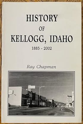
History of Kellogg, Idaho, 1885-2002 by Ray Chapman provides a localized account of a legendary Silver Valley mining town, drawing on the author's decades of firsthand experience working for the prominent Bunker Hill Company. The narrative traces the community's origins back to the famous 1885 "Jackass Legend," when prospector Noah Kellogg and his wandering burro purportedly discovered the ore deposits that sparked the region's massive boom. Chapman details the profound social and economic evolution of the Coeur d'Alene Mining District, exploring the growth of its prolific lead, zinc, and silver industries through the twentieth century. Ultimately, the book captures how this isolated Idaho enclave navigated over a century of economic triumphs, industry closures, and complex environmental legacies tied to one of the nation's largest mining operations. 59 pages : illustrations, map ; 28 cm CIRC [ 1 ]
|
2002 |
|
En la costa de la niebla el paisaje y el discurso etnográfico ilustrado de la expedición Malaspina en el Pacífico by Fernando Monge 
Published by Fernando Monge, En la costa de la niebla: el paisaje y el discurso etnográfico ilustrado de la expedición Malaspina en el Pacífico examines the late 18th-century scientific voyage led by Alejandro Malaspina along the fog-shrouded Pacific Northwest coast. The book analyzes the intricate intersection of Enlightenment-era exploration, landscape representation, and the visual ethnography captured by artists and naturalists documenting indigenous societies from Alaska down to the Spanish colonial outposts. Through a close reading of historical journals and newly contextualized illustrations, the text reveals how imperial ambition sought to categorize and control remote foreign geographies through the dual lens of science and art. A keen insight drawn from the work is how Enlightenment science in the Pacific was never truly neutral; rather, the detailed cataloging of local native cultures and misty coastlines served as an aesthetic tool of Spanish territorial claim-making, transforming indigenous homelands into legible imperial commodities. 238 pages ; 24 cm CIRC [ 1 ]
|
2002 |
|
The smiling country a history of the Methow Valley by Sally Portman 
Published by local presses, Sally Portman’s The Smiling Country: A History of the Methow Valley chronicles the colorful evolution of north-central Washington's dramatic river valley from its indigenous roots to its modern incarnation as a recreational haven. The book details the arduous lives of early homesteaders, gold miners, stockmen, and orchardists who carved a living out of a geographically isolated landscape defined by scorching summers and brutal winters. Through extensive oral histories and rich archival imagery, the text preserves the rugged character of communities like Winthrop and Twisp as they transitioned from extractive resource economies to tourism. A keen insight drawn from the work is how the valley's iconic moniker, "the smiling country," serves as a historical mask for the harsh economic realities of frontier survival; it reflects an enduring human impulse to romanticize an unforgiving high-desert ecosystem that frequently tested the limits of those who tried to tame it. 381 pages : illustrations ; 22 cm CIRC [ 1 ]
|
2002 |
|
Native river the Columbia remembered : Priest Rapids to the international boundary by William D. Layman 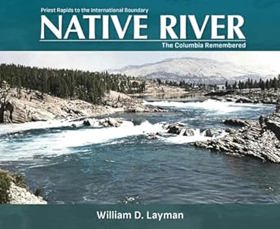
In images and narratives, Native River recreates the untamed Mid-Columbia--the river as it once was, before the building of seven major dams. Featuring a wealth of illustrations, maps, and photographs, many never before published, this finely crafted book focuses on the 350-mile reach of the middle Columbia River from Priest Rapids in south-central Washington to the U.S. Canadian border. William Layman affords each segment of this waterway with its own rich visual documentation, forming a backdrop to many absorbing river stories. -- Amazon xii, 195 pages : illustrations, maps ; 24 x 29 cm CIRC [ 1 ]
|
2002 |
|
Mapping the West America's westward movement 1524-1890 by Paul E. Cohen , David Rumsey (Writer of introduction) 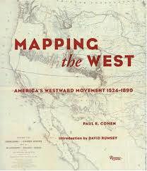
This collection chronicles the cartographic history of the western United States from 1524 to 1890. The book begins with a look at the European powers' (Spain, France, England) efforts to comprehend their far-flung colonies, then directs our attention toward U.S. Government and military maps made by such notables as Lewis and Clark, Robert E. Lee, and C.T. Beauregard. Also included are maps by American Indians, maps that highlight the epicenter of the California gold rush, and maps that delineate the proposed and final courses of the transcontinental railroad, to mention only a few of the areas discussed. Many maps are here shown for the first time, most for the first time in color. Filled with fascinating historical anecdote and detailed scholarship, this is a work for map lovers and history buffs alike.--From publisher description 208 pages : illustrations, maps (chiefly color) ; 28 cm CIRC [ 1 ]
|
2002 |
|
The Skagit collection first views : an early history of Skagit County, 1850-1899, vol. 2 by Theresa Trebon , Skagit Valley Herald
Published in local editions by archivist Theresa Trebon in cooperation with the Skagit Valley Herald, The Skagit Collection: First Views: An Early History of Skagit County, 1850-1899, Vol. 2 compiles rare historical photographs and local narratives documenting the formative decades of Washington's Skagit Valley. The volume captures the arduous daily lives of early homesteaders, loggers, and commercial fishermen who wrestled a tamed agricultural and industrial landscape out of dense river deltas and dense timberlands. Drawing heavily from archival images and early newspaper columns, the text preserves the visual and social fabric of communities navigating rapid frontier expansion. A keen insight drawn from the work is how late 19th-century local journalism and photography served as deliberate acts of community-building; by visually documenting fledgling settlements before they were fully established, pioneers used the camera to legitimize their presence and carve a permanent sense of permanence out of a fluid, flood-prone wilderness. xxiv, 143 pages : illustrations, portraits ; 20 cm CIRC [ 1 ]
|
2002 |
|
A point in time a history of Yarrow Point, Washington by Suzanne Knauss, Charles Pierce LeWarne, King County (Wash). Office of Cultural Resources, Yarrow Point History Project Committee (Wash), King County Landmarks and Heritage Commission (Wash) 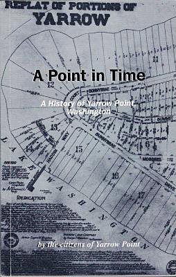
Published through collaborative efforts by the Yarrow Point History Project Committee, King County Office of Cultural Resources, and historians like Suzanne Knauss and Charles Pierce LeWarne, A Point in Time: A History of Yarrow Point, Washington chronicles the transformation of a quiet Lake Washington peninsula from a rugged wilderness into an exclusive residential enclave. The book traces the area's evolution from its early logging days and seasonal strawberry farms into a suburban sanctuary shaped by ferry access and the eventual construction of the floating bridges. Through local archives, oral histories, and photographs, the text details how residents deliberately cultivated a private, close-knit community while remaining tethered to the economic engine of nearby Seattle. A keen insight drawn from the work is how geographical isolation on a peninsula can be aggressively repurposed as a tool for modern exclusivity; by leveraging its distinct peninsular geography and limiting major thoroughfares, Yarrow Point successfully transformed a natural barrier into a socioeconomic filter that insulated its inhabitants from rapid urban sprawl. 174 pages : illustrations, maps ; 22 cm CIRC [ 1 ]
|
2002 |
|
Historic shipwrecks of the Sunshine Coast by Rick James, Jacques Marc, Underwater Archaeological Society of British Columbia 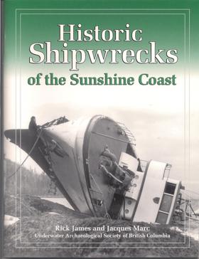
This UASBC regional inventory documents 12 of the most important shipwrecks in this easily accessible area north of Vancouver. Extensive archival research produced new details on the construction, operational history and loss of each vessel. Nine major wreck sites were explored and 3 deep water sidescan sonar searches were undertaken. A major accomplishment was the positive identification of the auxiliary schooner Malahat at Powell River. 2002, 8.5" x 11", 66 pages 66 p. : ill., map ; 28 cm. CIRC [ 0 ]
|
2002 |
|
Cool North wind Morley Nelson's life with birds of prey by Stephen Stuebner 
A freelance wildlife writer offers a biography of the life and work of Morley Nelson, a passionate defender of American birds of prey whose advocacy for conservation laws, as well as his achievements in the field of falconry, nature films, raptor rehabilitation, and related work are covered in the book, along with his years of WWII service as a company commander in the elite 10th Mountain Division in the Italian Alps. B & w photos, with a few in color xx, 429 pages : illustrations (some color) ; 24 cm CIRC [ 0 ]
|
2002 |
|
Chinatown, Boise, Idaho, 1870-1970 by Arthur A. Hart 
Boise's Chinatown was a rich and colorful part of community life for more than a century. Arthur A. Hart has devoted more than thirty years to researching Chinese people in Idaho, including Boise s Chinatown. You will learn why the Chinese came here, the prejudice and hardships they faced, and their important contributions to the city and the state. xiv, 144 pages : illustrations, maps, portraits ; 28 cm CIRC [ 0 ]
|
2002 |
|
The story of Idaho by Virgil M. Young 
A fourth-grade textbook presenting the history, geography, resources, government, traditions, and ethnology of Idaho 257 pages : illustrations, maps ; 29 cm CIRC [ 0 ]
|
2002 |
|
Lewis and Clark's mountain wilds a site guide to the plants and animals they encountered in the Bitterroots by Sharon A. Ritter 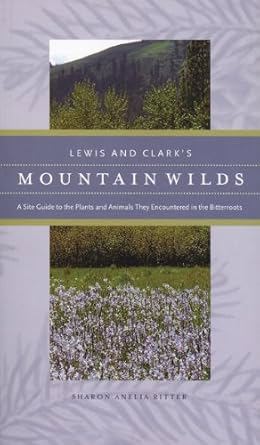
An indispensable and colorful site guide that any modern-day traveler can use to identify more than 100 species of native plants and animals first recorded by Lewis and Clark. Wildlife ecologist Sharon A. Ritter takes the reader from high on the Lolo Pass through the Bitterroot Mountains. xiii, 315 pages : illustrations (some color) ; 23 cm CIRC [ 0 ]
|
2002 |
|
Holy rollers murder and madness in Oregon's love cult by T. McCracken, Robert B. Blodgett 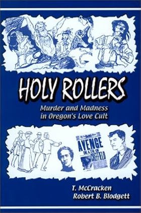
The story of a religious cult in Corvallis, Oregon which made headlines in 1903 xv, 295 pages : illustrations ; 23 cm CIRC [ 0 ]
|
2002 |
|
Exploring the Tualatin River Basin a nature and recreation guide by Susan Peter, Shirley Ewart, Tualatin Riverkeepers 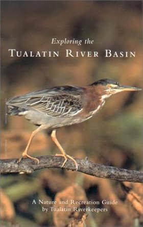
The Tualatin River Basin in Washington County, Oregon has some of the most appealing and least known natural areas in the greater Portland area, and nobody knows the territory better than Tualatin Riverkeepers. This informative, well-organized guide introduces 85 readily accessible sites throughout the Tualatin River Basin, from the River's tributaries in the Coast Range to its confluence with the Willamette River. The detailed site descriptions include directions, maps, and a wealth of information on the plants, wildlife, and natural attractions to be found. Also included are brief features on the flora, fauna, ecology, and history of the area. Hikers, canoeists, naturalists, birders, and outdoor enthusiasts of all kinds will find this unique field guide an essential companion as they explore the beautiful, meandering Tualatin River and its environs. xii, 162 pages : color illustrations ; ol. maps ; 22 cm CIRC [ 0 ]
|
2002 |
|
Forest and stream management in the Oregon coast range by Stephen D. Hobbs 
The Oregon Coast Range is an area that contains a diversity of plant and animal life and a wealth of natural resources. However, faced with a growing population and increasing demands on these resources, land managers today feel the need for new policies and practices aimed at ensuring their sustainability. Until recently there has been little scientific knowledge upon which to base these new approaches. In 1987 a major cooperative research effort called the Coastal Oregon Productivity Enhancement (COPE) Program was launched to fill this void. Forest and Stream Management in the Oregon Coast Range is the capstone of this effort and the synthesis of years of collaborative research. The book's ten chapters, written by scientists from leading research institutions, offer a thorough grounding in Coast Range geophysical processes, plant community ecology and dynamics, fisheries, wildlife, forest diseases, silviculture, and timber harvest operations. The book also describes a variety of management strategies and practices appropriate to the area and discusses the social and economic dimensions of sustainable management. Unlike other books dealing with natural resource management, this volume focuses exclusively on the Oregon Coast Range, an area of singular ecological assets and high economic importance. This has allowed the authors to provide specific and detailed information about the Coast Range and its particular resources and challenges. Written primarily for managers and resource specialists, the book will also appeal to resource scientists, forest landowners, the conservation community, and university students interested in forestry, fisheries, and wildlife sciences. This book is a result of the Coastal Oregon Productivity Enhancement (COPE) Program, a cooperative research and education effort between federal and state agencies, the forest products industry, city, county, and tribal governments, and small woodland owners. From 1987 to 1999, COPE sponsored 60 studies involving 130 researchers from 14 organizations and produced more than 300 publications. xii, 276 pages : illustrations (some color), maps (some color) ; 29 cm CIRC [ 0 ]
|
2002 |
|
The Arbutus/Madrone files reading the Pacific Northwest by Laurence Ricou 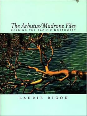
A lively and perceptive new look at twentieth-century Pacific Northwest writing, The Arbutus/Madrone Files explores the dynamics of this cross-border region using resonant quotations, poetry, song lyrics, and art to demonstrate and enhance author Laurie Ricou's critical readings and ideas. The Arbutus/Madrone Files is a wide-ranging, deeply felt meditation on the land, people, and literature of the U.S. and Canadian Pacific Northwest, gathered into twelve thematic essays or "files," including the Island File, Salmon File, Woodswords File, Sasquatch File, and, of course, the Rain File. A longtime student of literary regions, Ricou moves in this book from a scholarly perspective toward more personal and lyrical reflections about what constitutes "home" and "region." He explores the work of such Northwest authors as Emily Carr, H.L. Davis, David Guterson, Jack Hodgins, John Keeble, Ken Kesey, Joy Kogawa, Ursula Le Guin, John Okada, Kim Stafford, and David Wagoner, among others. This unique, stylishly written book will appeal to Pacific Northwest book-lovers interested in exploring the region's rich homegrown literature and art, and will be of great interest to scholars and students of regional literature, eco-criticism, and Pacific Northwest culture. xv, 239 pages : illustrations (some color), maps ; 23 cm CIRC [ 0 ]
|
2002 |
|
Crater Lake National Park a history by Rick Harmon 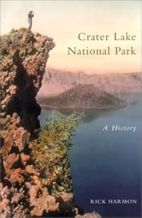
A lively and perceptive new look at twentieth-century Pacific Northwest writing, The Arbutus/Madrone Files explores the dynamics of this cross-border region using resonant quotations, poetry, song lyrics, and art to demonstrate and enhance author Laurie Ricou's critical readings and ideas. The Arbutus/Madrone Files is a wide-ranging, deeply felt meditation on the land, people, and literature of the U.S. and Canadian Pacific Northwest, gathered into twelve thematic essays or "files," including the Island File, Salmon File, Woodswords File, Sasquatch File, and, of course, the Rain File. A longtime student of literary regions, Ricou moves in this book from a scholarly perspective toward more personal and lyrical reflections about what constitutes "home" and "region." He explores the work of such Northwest authors as Emily Carr, H.L. Davis, David Guterson, Jack Hodgins, John Keeble, Ken Kesey, Joy Kogawa, Ursula Le Guin, John Okada, Kim Stafford, and David Wagoner, among others. This unique, stylishly written book will appeal to Pacific Northwest book-lovers interested in exploring the region's rich homegrown literature and art, and will be of great interest to scholars and students of regional literature, eco-criticism, and Pacific Northwest culture. 280 pages, 8 unnumbered pages of plates : illustrations (some color), maps ; 23 cm CIRC [ 0 ]
|
2002 |
|
Dispatches and dictators Ralph Barnes for the Herald Tribune by Barbara S. Mahoney 
Dispatches and Dictators uncovers the fascinating story of Oregon native Ralph Barnes, the New York Herald Tribune's European correspondent, who served in Paris, Rome, Moscow, Berlin, and London in the years between the two world wars. Barnes has been praised by colleagues and competitors alike as one of the best reporters of that pivotal era. But since his death in the 1940 crash of a British bomber in Yugoslavia, he has been largely forgotten. With persistence and unusually keen insight, Ralph Barnes reported on Fascism, Communism, Nazism, and the events leading to World War II. Stalin confined Barnes to Moscow for disclosing that millions were dying during the Soviet collectivization of agriculture, and Hitler expelled Barnes from Germany for predicting the Nazi attack on the Soviet Union. Recently, scholars have rediscovered Barnes, recognizing the perceptiveness of his observations about the nature of the Soviet regime, the centrality of anti-Semitism to the Nazis, and the descent into war. Drawing from Barnes's dispatches, his personal correspondence, and the recollections of his colleagues, Dispatches and Dictators offers a valuable perspective on the interwar period and on the challenges facing journalists covering the events of the time. Barnes's story also offers an intimate glimpse into one family's experience with the risks, hardships, and separations that belie the romantic popular image of the foreign correspondent. vi, 310 pages : illustrations ; 24 cm CIRC [ 0 ]
|
2002 |
|
Willamette River Basin planning atlas trajectories of environmental and ecological change by David Hulse, Stan Gregory, Joan P. Baker, Pacific Northwest Ecosystem Research Consortium 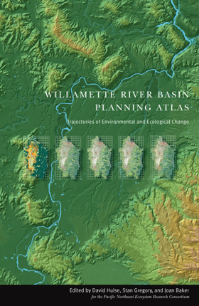
"The Willamette River Basin Planning Atlas offers a valuable resource for anyone interested in the region's past, present, and future. Using a variety of color maps, charts, and photographs, the Atlas presents a vast amount of information intended to provide a long-term, large-scale view of changes in human and natural systems within the Basin." "Five chapters provide information on current conditions and historical changes since 1850, focusing in turn on land forms and geology, water resources, plants and animals, land use, and human population." "Next, there is a detailed examination of how the Basin may change between now and 2050 under three alternative scenarios for future land and water use: one assuming a continuation of current land use and management policies, the second assuming a loosening of current policies to allow freer development, and the third assuming greater emphasis on ecosystem protection and restoration." ix, 178 pages : illustrations (some color), maps (some color) ; 44 cm ONLINE CIRC [ 1 ]
|
2002 |
|
Parallel destinies Canadian-American relations west of the Rockies by John M. Findlay, Kenneth Coates 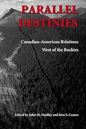
The Canadian West and the American Northwest offer a valuable setting for considering issues of borders and borderlands. The regions contain certain similarities, and during the first half of the nineteenth century they were even grouped together as a distinct political and economic unit, called the "Oregon Country" by Americans and the "Columbia Department" of the Hudson's Bay Company by the British. The essays in this volume -- which grew out of a conference commemorating the Oregon Treaty of 1846 -- view the boundary between Canada and the United States as a dividing line and also as a regional backbone, with people on each side of the border having key experiences and attitudes in common. In their eloquence and scope, they illustrate how historical study of Canadian-American relations in the West calls into question the parameters of the nation-state. The border has not had a single constant meaning; rather, its significance has changed over time and varied from group to group. The essays in Part One concern the movement of peoples and capital across a relatively permeable boundary during the nineteenth century. Many people in this era--especially Natives, miners, immigrants, and capitalists--did not regard the international boundary as particularly important. Part Two considers how the United States and Canada took pains to strengthen and enforce the international boundary during the twentieth century. In this era, the nation-state became more assertive about defining and defending the borderline. Part Three offers considerations of the distinctions, both real and imagined, that emerged during the nineteenth and twentieth centuries between Canada and the United States. Its essays examine different schools of history, divergent ideas toward wilderness, and the influence of anti-Americanism on Canadians' view of national development in North America. xxii, 302 pages : maps ; 24 cm CIRC [ 0 ]
|
2002 |