Vesuvius Capital Regional District, British Columbia
Landing (1) - A coastal or shore location where boats may put in to load or unload. On Ferry, W. side of Saltspring Island, Saltspring Island Land District
Mapped Location
Vesuvius: The mapped location is an approximation and should not be used for navigation or wayfinding.
Information
General information on Vesuvius
- Feature Type: Place
Official, historical, colloquial and alternative toponyms for Vesuvius
A brief list of names that this geographic feature has been named
| Name | Description |
|---|---|
| Vesuvius | Official |
Origin Notes and History of Vesuvius
References to Vesuvius that document the origin of its place name
Vesuvius Bay (Steamer Landing) adopted 3 May 1951 on C3450. Form of name changed to Vesuvius (Landing) 1 October 1965 on C3452.
Related Catalog Titles
A Bibliography for Vesuvius, Capital Regional District, British Columbia
Forgotten Cusheon Cove, Salt Spring Island by Charles Kahn, C. T. Hatfield
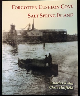
Imagine it's 1915 and you're on a small island in the Strait of Georgia with a population of just over 900. Now imagine a large sawmill with what was then state-of-the-art machinery on an isolated cove on the southeast side of the island. The mill employs up to 150 workers, many of them non-resident Norwe-gians, Swedes, Japanese, and Chinese. This is only a fragment of the story Chris Hatfield researched after he acquired the 100-acre site in 1984 and began finding items discarded by the different communities that had once lived there. Chris partly donated and partly sold most of the land to BC Parks in 2006. This little book explores the property's history.
53 p. : ill., maps, ports. ; 26 cm.
CIRC [ 1 ]
An historical guide to the landmarks, events, activities, parks, beaches, plants and wildlife, accommodations, restaurants, shops and services available on Salt Spring Island, British Columbia. This book features charming stories of the early pioneers and offers over 200 photographs, easy-to-read map, where to stay, shop, eat and explore, points of interest, how to get around, list of major island events and activities, as well as where to see plants and wildlife. This book presents Salt Spring Island in a way no other book has. Meet the postman of the 19th century and explore what Salt Spring has to offer today, while taking a trip back in time.
242 pages : illustrations ; 21 cm.
CIRC [ 1 ]
Salt Spring the story of an island by Charles Kahn
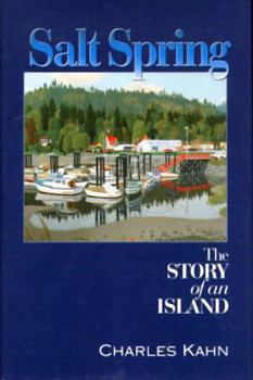
The largest of BC's southern Gulf Islands, beautiful Salt Spring Island has long been a favoured holiday destination and a prized real-estate area for those in search of an idyllic rural residence. Now available in trade paper, Salt Spring: The Story of an Island chronicles the island's rich history from the days when Coast Salish people inhabited Salt Spring's shores, through some 150 years of settlement by many diverse groups. Because of the island's rugged geography, the early story of Salt Spring is largely the story of hard-working people in small isolated communities industriously carving farms out of rough terrain. Many of the settlers who followed came to find a place where they could live their lives free of the constraints of most societies. This was as true for the African-Americans, many of whom were among the first non-aboriginal settlers to arrive in 1859, as it was for those fleeing conventional middleclass life and for Americans seeking to avoid the Vietnam War. And it's true of almost every new islander who arrives today with a unique personal dream.
344 pages : illustrations, maps, portraits ; 24 cm
CIRC [ 1 ]
Sitting on a salt spring by David Conover
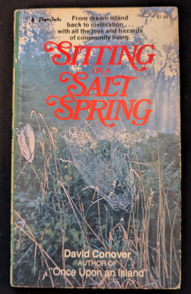
From dream island back to civilization ... with all of the joys and hazards of community living.
160 pages ; 18 cm
CIRC [ 1 ]
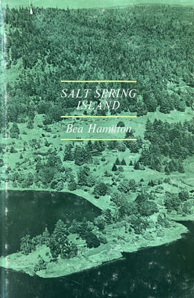
Salt Spring Island by Bea Hamilton
Salt Spring Island, British Columbia by Edward F. Wilson
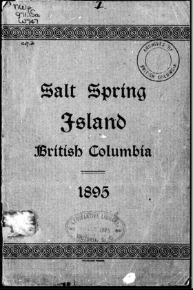
Originally marked on the naval charts of 1858 as "Admiral Island," it has of late years altogether dropped that name, and is now known both popularly, and also in the more recently published maps, as Salt Spring Island^ — the saline springs, of which there are some 14 or 15 on the island, being sufficient reason for its present name
30 pages : illustrations, map
ONLINE CIRC [ 1 ]
Capital Regional District
- Albert Head
- Ardmore
- Bear Mountain
- Beaver Lake
- Beaver Point
- Bedwell Harbour
- Belmont Park
- Braemar Heights
- Brentwood Bay
- Cadboro Bay
- District of Central Saanich
- Colquitz
- City of Colwood
- Cordova Bay
- Deep Cove
- East Sooke
- Township of Esquimalt
- Fairfield
- Fernwood
- Fulford Harbour
- Galiano
- Ganges
- Glen Lake
- Goldstream
- Gordon Head
- Happy Valley
- District of Highlands
- Hope Bay
- James Bay
- Keating
- Lake Hill
- City of Langford
- Leechtown
- Lighthouse Point
- Long Harbour
- Luxton
- Marigold
- Mayne Island
- District of Metchosin
- Millstream
- Milnes Landing
- Montague Harbour
- Musgrave Landing
- North Galiano
- District of North Saanich
- District of Oak Bay
- Otter Bay
- Pender Island
- Port Renfrew
- Port Washington
- Prospect Lake
- River Jordan
- Royal Oak
- District of Saanich
- Saanichton
- Saseenos
- Saturna
- Sevenoaks
- Shirley
- Town of Sidney
- District of Sooke
- Strawberry Vale
- Sturdies Bay
- Swartz Bay
- Tillicum
- Vesuvius
- City of Victoria
- Town of View Royal
- Village Bay
Political Boundaries
Last updated: 2025-09-23