Douglas County County
Douglas County was named for U.S. Senator Stephen A. Douglas, Abraham Lincoln’s opponent in the presidential election of 1860 and an ardent congressional advocate for Oregon. Douglas County was created in 1852 from the portion of Umpqua County which lay east of the Coast Range summit. In 1862, Douglas County absorbed what remained of Umpqua County.
Mapped Location
Douglas County: The mapped location is an approximation and should not be used for navigation or wayfinding.
Information
General information on Douglas County
- Feature Type: County
- County Seat: City of Roseburg
- Established: Wednesday, January 7, 1852
Official, historical, colloquial and alternative toponyms for Douglas County
A brief list of names that this geographic feature has been named
| Name | Description |
|---|---|
| Douglas County | Official |
Related Catalog Titles
A Bibliography for Douglas County, County
Umpqua the lost county of Oregon by Jerry Winterbotham
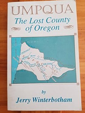
Authored by local historian Jerry Winterbotham, Umpqua: The Lost County of Oregon chronicles the short-lived history of a vast territorial district established in 1851 that eventually vanished from the map through political reorganization and county consolidation. The book details the struggles of early homesteaders, miners, and river merchants who attempted to build permanent communities along the rugged Umpqua River basin before the shifting political tides of the Oregon Territory absorbed their jurisdiction. Through legislative records and pioneer accounts, the text resurrects the forgotten administrative history of a frontier region swallowed by bureaucratic evolution. A keen insight drawn from the work is how county boundaries in the American West were ephemeral political constructs that often bore little relation to actual human geography; by tracing how a once-proud political entity was erased by administrative decree, the book reveals how early state-building frequently treated historic communities as mere ink on a map to be redrawn at the whim of distant territorial lawmakers.
iv, 156 pages : illustrations, maps ; 22 cm
CIRC [ 1 ]
Land of the Umpqua a history of Douglas County, Oregon by Stephen Dow Beckham
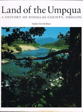
Umpqua Valley, Oregon, and its pioneers by Harold Avery Minter

Douglas County
- Anchor (historical)
- Anlauf
- Ash
- Azalea
- Booth (historical)
- Brockway
- Buck Fork (historical)
- Calkins
- Callahan
- Calvert (historical)
- Camas Valley
- City of Canyonville
- Civil Bend (historical)
- Clearwater
- Cleveland
- Coles Valley
- Comstock
- Cow Creek
- Curtin
- Dads Creek
- Days Creek
- Diamond Lake
- Dillard
- Dixonville
- City of Drain
- Drew
- East Gardiner
- Edenbower
- Elgarose
- Elkhead
- City of Elkton
- Fair Oaks
- Fernvale
- Fortune Branch
- Galesville
- Gardiner
- Gazley
- City of Glendale
- Glide
- Green
- Green Acres
- Gunter
- Hawthorne
- Hoaglin (historical)
- Idleyld Park
- Kellogg
- Lavadoure (historical)
- Leona
- Lookingglass
- Melrose
- Millwood
- Milo
- City of Myrtle Creek
- North Fork
- North Umpqua Village
- Nugget (historical)
- Oak Creek (historical)
- City of Oakland
- Oaks
- Olalla
- Old Town
- Peck
- Peel
- Perdue (historical)
- Porter Creek
- Quines Creek
- City of Reedsport
- Reston
- Rice Hill
- City of Riddle
- Riversdale
- Rockland (historical)
- City of Roseburg
- Round Prairie
- Scottsburg
- Steamboat
- Stephens
- Sunnydale
- Surprise Valley
- City of Sutherlin
- Tenmile
- Tiller
- Toketee Falls
- Tri City
- Tri-City
- Tyee
- Umpqua
- Umpqua City (historical)
- Union Gap
- Weaver
- Wilbur
- Willard (historical)
- Winchester
- Winchester Bay
- City of Winston
- City of Yoncalla
Political Boundaries
Last updated: 2013-01-08