Linn County County
Linn County was created in 1847 and named for U.S. Senator Lewis F. Linn of Missouri, who was the author of the Donation Land Act which provided free land to settlers in the West. Linn County is in the center of the Willamette Valley, with the Willamette River as its western boundary and the crest of the Cascades as its eastern boundary.
Mapped Location
Linn County: The mapped location is an approximation and should not be used for navigation or wayfinding.
Information
General information on Linn County
- Feature Type: County
- County Seat: City of Albany
- Established: Tuesday, December 28, 1847
Official, historical, colloquial and alternative toponyms for Linn County
A brief list of names that this geographic feature has been named
| Name | Description |
|---|---|
| Linn County | Official |
Related Catalog Titles
A Bibliography for Linn County, County
Historical atlas map of Marion & Linn Counties, Oregon by Edgar Williams & Co

Willamette landings, ghost towns of the river by Howard McKinley Corning, Federal Writers' Project (Or)
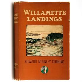
A history of the towns and landings on the Willamette River that were serviced by steamboats prior to the advent of railroads. Includes an index of almost 200 landings, as compiled by Capt. Arthur Riggs in 1940. Howard McKinley Corning (1896-1977) was a poet and historian. During the 1930s he served as an editor and supervisor for the Oregon Writers' Project of the Works Progress Administration, the work for which led to his writing of both this book (1947) and A Dictionary of Oregon History (1956).
vi, 224 pages illustrations 23 cm
CIRC [ 2 ]
Linn County
- City of Albany
- Anidem (historical)
- Berlin
- City of Brownsville
- Bryant City (historical)
- Burlington (historical)
- Calapooia
- Cascadia
- Central (historical)
- Crabtree
- Crawfordsville
- Crowfoot
- Dotyville (historical)
- Draperville
- Evansville (historical)
- Fairview
- Fords Mill
- Foster
- Fox Valley
- Greenville
- City of Halsey
- City of Harrisburg
- Holley
- Jordan
- Kingston
- Lacomb
- City of Lebanon
- Liberty
- City of Lyons
- Marion Forks
- City of Mill City
- City of Millersburg
- New Idanha
- Peoria
- Riverside
- Santiam Terrace
- City of Scio
- Shedd
- Shelburn
- City of Sodaville
- South Lebanon
- City of Sweet Home
- City of Tangent
- Union Point (historical)
- Upper Soda
- Town of Waterloo
- West Scio
- Whitaker
Political Boundaries
Last updated: 2025-09-23