Polk County County
Polk County was created from the original Yamhill district in 1845 by the Provisional Legislature. It was named for then President James Knox Polk. The first county seat was at Cynthia Ann. City officials later changed its name to Dallas, after Vice-President George M. Dallas, and moved the community about a mile to improve its water supply.
Mapped Location
Polk County: The mapped location is an approximation and should not be used for navigation or wayfinding.
Information
General information on Polk County
- Feature Type: County
- County Seat: City of Dallas
- Established: Monday, December 22, 1845
Official, historical, colloquial and alternative toponyms for Polk County
A brief list of names that this geographic feature has been named
| Name | Description |
|---|---|
| Polk County | Official |
Related Catalog Titles
A Bibliography for Polk County, County
History of Polk County, Oregon by Polk County Historical Society (Polk County, Or)
Polk County, Oregon, place names by Gordon W. Clarke
Willamette landings, ghost towns of the river by Howard McKinley Corning, Federal Writers' Project (Or)
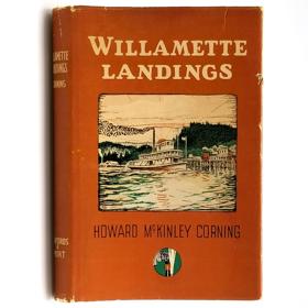
A history of the towns and landings on the Willamette River that were serviced by steamboats prior to the advent of railroads. Includes an index of almost 200 landings, as compiled by Capt. Arthur Riggs in 1940. Howard McKinley Corning (1896-1977) was a poet and historian. During the 1930s he served as an editor and supervisor for the Oregon Writers' Project of the Works Progress Administration, the work for which led to his writing of both this book (1947) and A Dictionary of Oregon History (1956).
vi, 224 pages illustrations 23 cm
CIRC [ 2 ]
Polk County Centennial souvenir booklet and program by Polk County Centennial Committee, Dallas, Or, Wes Sherman

Polk County
- Airlie
- Ballston
- Bethel
- Bethel Heights
- Black Rock
- Bowersville (historical)
- Bridgeport
- Broadmead
- Brush College
- Buell
- Buena Vista
- Carey (historical)
- Chapman Corner
- Cochrane (historical)
- City of Dallas
- Ellendale
- Eola
- City of Falls City
- Ferns (historical)
- Fir Villa
- Fort Hill Census Designated Place
- Grand Ronde
- Hopville
- City of Independence
- Kingwood Park (historical)
- Lewisville
- Lincoln
- McCoy
- Modeville
- City of Monmouth
- Oakdale
- Parker
- Pedee
- Perrydale
- Putnam (historical)
- Rickreall
- Salemtowne
- Stapleton
- Suver
- Tucker (historical)
- Valley Junction
- Valsetz (historical)
- Zena
Political Boundaries
Last updated: 2025-09-23