City of Gig Harbor Pierce County, Washington
Mapped Location
City of Gig Harbor: The mapped location is an approximation and should not be used for navigation or wayfinding.
Information
General information on City of Gig Harbor
- Feature Type: Incorporated
Official, historical, colloquial and alternative toponyms for City of Gig Harbor
A brief list of names that this geographic feature has been named
| Name | Description |
|---|---|
| City of Gig Harbor | Official |
| Gig Harbor | Official |
Origin Notes and History of City of Gig Harbor
References to City of Gig Harbor that document the origin of its place name

GIG HARBOR, a small harbor and town opposite Point Defiance, Pierce County. It was named by the Wilkes Expedition, 1841, saying "has a sufficient depth of water for small vessels." (Hydrography, page 319.)
A Selected Bibliography of City of Gig Harbor, Pierce County, Washington
A compilation of essential readings detailing the history, geography, and culture of the region.
An excellent little bay A history of Gig Harbor Peninsula by J. A. Eckrom , Gig Harbor Peninsula Historical Society & Museum (Publisher)
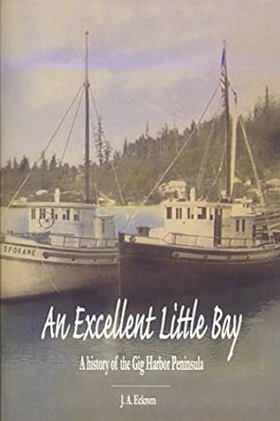
An Excellent Little Bay covers the history of the Gig Harbor peninsula up to 1967, one hundred years after the first non-native settlers arrived in the harbor. In 1867, three fishermen rowed their way into the calm waters of Gig Harbor, Washington, in search of salmon. They decided to stay and call the harbor home. Living alongside the resident Nisqually Indians, these white settlers, and those that soon followed, established roots of what would become a thriving commercial fishing and agricultural community. From the early steamboats of the Mosquito Fleet that moved residents and cargo back and forth across Puget Sound, to one of the largest fishing fleets on the west coast, this book tells the story of the people and events that made the Gig Harbor Peninsula what it is today. Author Jerry Eckrom weaves this history into an entertaining and enlightening read while documenting the important milestones through in-depth research and personal interviews.
2 volumes : illustrations, map ; 23 cm
Non-circulating [ 1 ]
Along the waterfront a history of Gig Harbor and Key Peninsula areas by Goodman Middle School, Gig Harbor, Wash
Along the waterfront: a history of Gig Harbor and Key Peninsula areas chronicles the grueling pioneer settlement and early resource extraction across the deeply indented, heavily forested aquatic terrain of the southern Puget Sound. The students and contributors of Goodman Middle School detail how the region's formidable physical barriers—specifically the treacherous, violent tidal currents of the Tacoma Narrows, the dense, impenetrable coastal temperate rainforests, and the labyrinthine aquatic topography of the deeply incised peninsulas—strictly dictated the margins of early human survival and economic expansion. By mapping the immense physical labor required to establish precarious maritime enclaves, carve massive timber from the steep coastal bluffs, and construct specialized commercial fishing fleets directly within the sheltered deepwater bays, the narrative highlights the monumental effort necessary to anchor permanent communities in this demanding maritime environment. The utter lack of viable overland routes to the mainland initially forced these remote, waterbound homesteads into an absolute reliance on the marine highway, completely anchoring their commercial existence and social connectivity to the precarious navigation of the Puget Sound "mosquito fleet" and the severe tidal hydrology of the inland sea. Ultimately, this educational and civic historical record serves as a deeply localized spatial history, demonstrating how the complex, highly fractured aquatic geography and immense forested shorelines of this Pacific Northwest frontier fundamentally shaped the fiercely resilient, strictly maritime-dependent character of the Gig Harbor and Key Peninsula communities.
Compiled and written by students of 1974-1975 Goodman Middle School. Gig Harbor, Washington.
130 pages : illustrations ; 21 cm
Non-circulating [ 1 ]
Pierce County
- Alder
- Alderton
- Allison
- American Lake Garden Tract
- Arletta
- Artondale
- Ashford
- Bayview
- Bee
- Benroy
- Berkeley
- City of Bonney Lake
- Brookdale
- Browns Point
- City of Buckley
- Burnett
- Caledonia
- Canterwood
- Town of Carbonado
- Cascade Junction
- Castlenook (historical)
- Cebalop (historical)
- Cedar View
- Clay City
- Clinton Park
- Clover Park
- Croker
- Cromwell
- Custer
- Dash Point
- Dieringer
- City of DuPont
- East Cromwell
- Eastward
- Town of Eatonville
- Eatonville Junction
- City of Edgewood
- Elbe
- Electron
- Elk Plain
- Excelsior
- Fairfax
- City of Fife
- Fife Heights
- City of Fircrest
- Forest Beach
- Fort Nisqually
- Fox Island
- Fox Island
- Frederickson
- Gertrude
- City of Gig Harbor
- Glencove
- Graham
- Greenwater
- Herron
- Hillhurst
- Hillside
- Home
- Hope
- Interlaken
- Jims Corner
- Johnson Landing
- Johnsons Corner
- Kapowsin
- Ketron
- Key Center
- La Grande
- Lake Bay
- Lake City
- Lakebay
- Lakeview
- City of Lakewood
- Larchmont
- Leber
- Longbranch
- Longmire
- Loveland
- Magnolia Heights
- Maplewood
- McKenna
- McMillin
- Meridian
- Midland
- Midway
- City of Milton
- Minter
- Mock City
- Monta Vista
- National
- New Reliance
- Nisqually Vista
- North Puyallup
- Oakland
- Ohop
- Ohop Bob
- Old Tacoma
- City of Orting
- Paradise
- Park Junction
- Parkland
- Peach Acres
- Pioneer
- Ponderosa Estates
- Ponders Corner
- Prairie Ridge
- Purdy
- City of Puyallup
- Puyallup River Junction
- Reliance
- Rhododendron Park
- Rocky Ridge
- Rosedale
- City of Roy
- Town of Ruston
- Shore Acres
- Snoquera
- South Hill
- Town of South Prairie
- Spanaway
- Town of Steilacoom
- Summit
- City of Sumner
- Sunrise
- Sunrise Beach
- Sunset Beach
- Sunshine Beach
- Surprise Valley
- Swede Hill
- City of Tacoma
- Tanwax
- Thrift
- Tillicum
- City of University Place
- Upper Fairfax
- Vaughn
- Voss Resort
- Waller
- Warren
- Wauna
- Town of Wilkeson
- Wollochet
- Yoman
Political Boundaries
Last updated: 2025-09-23