City of University Place Pierce County, Washington
Mapped Location
City of University Place: The mapped location is an approximation and should not be used for navigation or wayfinding.
Information
General information on City of University Place
- Feature Type: Incorporated
Official, historical, colloquial and alternative toponyms for City of University Place
A brief list of names that this geographic feature has been named
| Name | Description |
|---|---|
| City of University Place | Official |
| University Place | Official |
A Selected Bibliography of City of University Place, Pierce County, Washington
A compilation of essential readings detailing the history, geography, and culture of the region.
Day Island a glimpse of the past by Marcia Willoughby Tucker
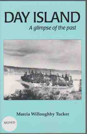
Marcia Willoughby Tucker’s Day Island: A Glimpse of the Past provides a granular local and spatial chronicle of Day Island, a small tidal landform situated along the turbulent waters of the Tacoma Narrows in southern Puget Sound. The volume documents how late-nineteenth-century homesteads, summer cottages, and small-craft boatyards were systematically superimposed onto the estuarine shoreline, seasonal shellfish beds, and fishing corridors traditionally stewarded by the Puyallup and Southern Coast Salish peoples. Tucker details the evolution of the island’s maritime logistics, illustrating how early residents navigated the treacherous tidal currents of the Narrows, established mosquito fleet launch connections to Tacoma, and eventually engineered permanent bridge transit to the Pierce County mainland. Ultimately, the narrative captures the transition of an exposed tidal waypoint into a specialized maritime and residential enclave, illustrating how early twentieth-century coastal communities remained fundamentally shaped by the natural marine hydrology of the Salish Sea.
xiii, 98 pages : illustrations ; 22 cm
Desiderata
Pierce County
- Alder
- Alderton
- Allison
- American Lake Garden Tract
- Arletta
- Artondale
- Ashford
- Bayview
- Bee
- Benroy
- Berkeley
- City of Bonney Lake
- Brookdale
- Browns Point
- City of Buckley
- Burnett
- Caledonia
- Canterwood
- Town of Carbonado
- Cascade Junction
- Castlenook (historical)
- Cebalop (historical)
- Cedar View
- Clay City
- Clinton Park
- Clover Park
- Croker
- Cromwell
- Custer
- Dash Point
- Dieringer
- City of DuPont
- East Cromwell
- Eastward
- Town of Eatonville
- Eatonville Junction
- City of Edgewood
- Elbe
- Electron
- Elk Plain
- Excelsior
- Fairfax
- City of Fife
- Fife Heights
- City of Fircrest
- Forest Beach
- Fort Nisqually
- Fox Island
- Fox Island
- Frederickson
- Gertrude
- City of Gig Harbor
- Glencove
- Graham
- Greenwater
- Herron
- Hillhurst
- Hillside
- Home
- Hope
- Interlaken
- Jims Corner
- Johnson Landing
- Johnsons Corner
- Kapowsin
- Ketron
- Key Center
- La Grande
- Lake Bay
- Lake City
- Lakebay
- Lakeview
- City of Lakewood
- Larchmont
- Leber
- Longbranch
- Longmire
- Loveland
- Magnolia Heights
- Maplewood
- McKenna
- McMillin
- Meridian
- Midland
- Midway
- City of Milton
- Minter
- Mock City
- Monta Vista
- National
- New Reliance
- Nisqually Vista
- North Puyallup
- Oakland
- Ohop
- Ohop Bob
- Old Tacoma
- City of Orting
- Paradise
- Park Junction
- Parkland
- Peach Acres
- Pioneer
- Ponderosa Estates
- Ponders Corner
- Prairie Ridge
- Purdy
- City of Puyallup
- Puyallup River Junction
- Reliance
- Rhododendron Park
- Rocky Ridge
- Rosedale
- City of Roy
- Town of Ruston
- Shore Acres
- Snoquera
- South Hill
- Town of South Prairie
- Spanaway
- Town of Steilacoom
- Summit
- City of Sumner
- Sunrise
- Sunrise Beach
- Sunset Beach
- Sunshine Beach
- Surprise Valley
- Swede Hill
- City of Tacoma
- Tanwax
- Thrift
- Tillicum
- City of University Place
- Upper Fairfax
- Vaughn
- Voss Resort
- Waller
- Warren
- Wauna
- Town of Wilkeson
- Wollochet
- Yoman
Political Boundaries
Last updated: 2017-01-14