City of Lake Forest Park King County, Washington
Mapped Location
City of Lake Forest Park: The mapped location is an approximation and should not be used for navigation or wayfinding.
Information
General information on City of Lake Forest Park
- Feature Type: Incorporated
Official, historical, colloquial and alternative toponyms for City of Lake Forest Park
A brief list of names that this geographic feature has been named
| Name | Description |
|---|---|
| City of Lake Forest Park | Official |
| Lake Forest Park | Official |
A Selected Bibliography of City of Lake Forest Park, King County, Washington
A compilation of essential readings detailing the history, geography, and culture of the region.
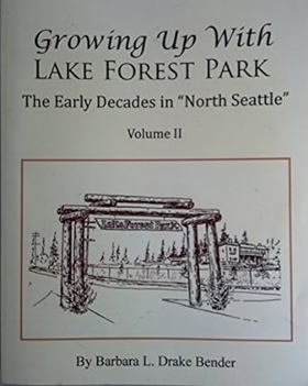
Growing up with Lake Forest Park the early decades in "North Seattle" : Vol II by Barbara L. Drake Bender
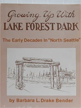
Growing up with Lake Forest Park the early decades in "North Seattle" : Vol I by Barbara L. Drake Bender
The Lake Washington story a pictorial history by Lucile Saunders McDonald
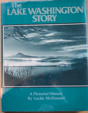
The Lake Washington Story offers a rich visual and historical account of the expansive freshwater lake that serves as the geographic heart of the Seattle metropolitan area in Washington State. The narrative meticulously traces the early development along the lake's shores, highlighting the nascent logging and shipbuilding hubs of Kirkland and Renton, as well as the densely forested, isolated enclaves of Mercer Island prior to the modern era of floating bridges. McDonald places special emphasis on the dramatic topographical engineering of the region, particularly detailing the construction of the Lake Washington Ship Canal and the Montlake Cut, which permanently lowered the lake's water level and physically connected it to the saltwater of Puget Sound. Through its extensive photographic archive, the book captures the physical transformation of this vital aquatic corridor from a remote pioneer waterway navigated by steamboats into the defining geographic boundary separating Seattle from the Eastside suburbs.
160 pages : illustrations ; 28 cm
Non-circulating [ 1 ]
Shoreline memories Volume 1 by Shoreline Historical Society
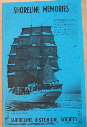
Shoreline memories Volume 1 chronicles the grueling agricultural transformation and gradual civic expansion across the heavily forested glacial plateaus and steep coastal bluffs overlooking Puget Sound. The Shoreline Historical Society details how the region's formidable physical barriers—specifically the towering, impenetrable stands of old-growth Douglas fir, the heavily compacted, unyielding glacial till soils, and the deep, rugged ravines that sharply bisected overland routes—strictly dictated the margins of early human survival, agrarian development, and eventual community integration. By mapping the immense physical labor required to painstakingly extract massive deep-rooted stumps from the damp earth, break the rocky soil for rudimentary farming, and cut precarious plank roads through the dense wilderness toward the burgeoning port of Seattle, the narrative highlights the monumental cooperative effort necessary to forcibly convert this rugged terrain into habitable homesteads and interconnected neighborhoods. The initial geographic isolation from the established urban core forced these remote pioneer enclaves into a strict reliance on the precise topography of the Puget Sound shoreline for early "mosquito fleet" maritime transportation, completely anchoring their physical survival and early commercial existence to the arduous overland transport and the severe maritime realities of the coastal bluffs. Ultimately, this civic and historical record serves as a deeply localized spatial history, demonstrating how the immense botanical density and challenging glacial topography of this Pacific Northwest frontier fundamentally shaped the fiercely resilient, highly adaptable character of the early Shoreline community before its transition into a permanent suburban expanse.
2 volumes : illustrations ; 21 cm
Non-circulating [ 1 ]
Shoreline memories Volume 2 by Shoreline Historical Society
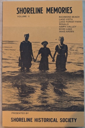
Shoreline memories Volume 2 continues to chronicle the grueling infrastructural expansion and gradual suburban integration across the heavily forested glacial plateaus and steep coastal bluffs overlooking Puget Sound. The Shoreline Historical Society details how the region's formidable physical barriers—specifically the deeply incised ravines bisecting the coastal plain, the heavily compacted, unyielding glacial till, and the persistent, dense coastal brush—strictly dictated the margins of ongoing civic development and overland connectivity. By mapping the immense physical labor required to force permanent highway grades and interurban rail lines through the rugged topography, bridge the precipitous coastal gullies, and transform precarious pioneer tracts into structured commercial corridors, the narrative highlights the monumental cooperative effort necessary to forcibly bind this demanding environment to the expanding metropolis. The fading geographic isolation from the Seattle urban core shifted these remote enclaves into a strict reliance on the precise topography of the north-south transit corridors, completely anchoring their mid-century economic existence and civic identity to the relentless paving and grading of the glacial plateau. Ultimately, this civic and historical record serves as a deeply localized spatial history, demonstrating how the challenging glacial geography, heavy maritime precipitation, and immense physical labor of this Pacific Northwest frontier fundamentally shaped the fiercely resilient, highly adaptable character of the Shoreline community as it cemented its permanent suburban landscape.
2 volumes : illustrations ; 21 cm
Non-circulating [ 1 ]
King County
- Adams
- Adelaide
- Adelaide
- City of Algona
- Alki
- Allentown
- Ames Lake
- Arcadia
- Ashwood
- Atkinson
- City of Auburn
- Avondale
- Bagley Junction
- Bandera
- Baring
- Barneston
- Bayne
- Bayne Junction
- Beacon Hill
- Beaumont
- Town of Beaux Arts Village
- City of Bellevue
- Belltown
- Belridge
- Benson Hill
- Berrydale
- Bethel Park
- Beverly Park
- Biloxi
- Birch
- Bitter Lake
- City of Black Diamond
- Blue Ridge
- Boddy
- Boise
- Boulevard Park
- Briarcliff
- Briarcrest
- Broadview
- Bryant
- Bryn Mawr
- Buenna
- City of Burien
- Burton
- Camelot
- Campton
- Carlton Park
- City of Carnation
- Cedar Falls
- Cedar Grove
- Cedar Mountain
- Cedar Park
- Cedarhurst
- Chautauqua
- Chelsea
- Cherokee Bay Park
- Christopher
- Clyde
- City of Clyde Hill
- Coal Creek
- Coalfield
- Columbia City
- Colvos
- Cottage Lake
- Cougar Hills
- Cove
- City of Covington
- Cowley
- Crossroads
- Cumberland
- Danville
- Day City (historical)
- Denny Creek
- Denny Regrade
- City of Des Moines
- Dilworth
- Dockton
- Dorre Don
- Dunlap
- Durham
- City of Duvall
- Duwamish
- East Hill
- East Renton Highlands
- East Seattle
- Eastland
- Echo Lake
- Edgewater (historical)
- Edgewick
- Elliott
- Ellisport
- Ellisville
- Endolyne
- City of Enumclaw
- Ernies Grove
- Evansville
- Evergreen
- Factoria
- Fairwood
- Fall City
- Fauntleroy
- City of Federal Way
- Feriton
- Fern Heath
- Firloch
- Five Corners
- Fortuna
- Foy
- Franklin
- Garcia
- Georgetown
- Glen Acres
- Glendale
- Green Lake
- Green River
- Gregory Heights
- Grotto
- Harbor Heights
- Harman Heights
- Hawthorne Hills
- Hazelwood
- Henrys
- High Point
- High Valley
- Highlands
- Highlands Park
- Highline
- Hillman City (historical)
- Hilltop
- Hobart
- Holly Park
- Hollywood
- Hollywood Hill
- Hongking (historical)
- Humphrey
- Town of Hunts Point
- Inglesea
- City of Issaquah
- Jovita
- Juanita
- Junction
- Kanaskat
- Kanaskat Junction
- Kangley
- Kenilworth
- City of Kenmore
- Kennydale
- City of Kent
- Kenwood
- Kerriston
- City of Kirkland
- Kitts Corner
- Klahanie
- Krain
- Kummer
- Lake Desire
- City of Lake Forest Park
- Lake Heights
- Lake Marcel
- Lake Morton
- Lake Park
- Lakeland
- Lakeridge
- Lakewood
- Lakota
- Landsburg
- Latona
- Latona (historical)
- Lavilla
- Lawton
- Lawtonwood
- Lemolo
- Lester
- Lisabeula
- Lowman Beach Park
- Luana Beach
- Lucerne
- Madrona
- Magnolia Beach
- Magnolia Bluff
- Manitou
- Mann
- Manzanita
- Maple Hills
- City of Maple Valley
- Maple Valley Heights
- Maplewood Heights
- Matthews Beach
- Maury
- May Creek
- Maywood
- McGilvara
- McMicken Heights
- McVan
- Meadowbrook
- City of Medina
- Mercer Heights
- City of Mercer Island
- Mercer Island Town
- Meridian
- Meridian Heights
- Metum
- Midlakes
- Mileta
- Miller River
- Mint Grove
- Mirror Lake
- Mirrormont
- Mirrormount Estates
- Montlake
- Moorland
- Moorlands
- Mount Baker
- Mount View
- Naco
- Nagrom
- Newaukum
- City of Newcastle
- Newport Hills
- Newport Shores
- Noble
- Nordrum (historical)
- City of Normandy Park
- North Beach
- City of North Bend
- North Broadway
- North College Park
- Northgate
- Northrup
- Novelty
- Olympic Hills
- One Hundred One Pines
- Orchard Grove
- Osceola
- Oskams Corner
- Overlake
- City of Pacific
- Page
- Palmer
- Palmer Junction
- Paramount Park
- Parkwood
- Phinney Ridge
- Pinehurst
- Pines
- Pleasant Hill
- Pontiac
- Portage
- Portage Bay
- Preston
- Raeco
- Ragnar
- Rainier Beach
- Rainier Valley
- Ravenna
- Ravensdale
- City of Redmond
- Redondo
- City of Renton
- Ridgecrest
- Riverbend
- Riverton
- Roanoke
- Rockdale
- Ronald
- Roosevelt
- Rose Hill
- Rosehilla
- Ross (historical)
- Roxbury Heights
- City of Sammamish
- Sand Point
- Seahurst
- City of SeaTac
- City of Seattle
- Selleck
- Seola Beach
- Seward Park
- Shawnee
- Shore Acres
- City of Shoreline
- Shorewood
- Town of Skykomish
- Skyway
- Snoose Junction
- City of Snoqualmie
- Snoqualmie Falls
- Snyders Corner
- Somerset
- South Park
- South Seattle
- Southern Heights
- Spring Beach
- Spring Beach
- Spring Glen
- Stampede
- Star Lake
- Stevens
- Stillwater
- Stuart
- Stuck
- Summerhurst
- Summit
- Sunnydale
- Sunset Village
- Tahlequah
- Tahoma
- Tamill
- Tanner
- The Highlands
- Thomas
- Timberlane
- Tokul
- Trude
- City of Tukwila
- University District
- University Village
- Upper Mill
- Upper Preston
- Van Asselt
- Vasa Park
- Vashon
- Vashon Heights
- Veazie
- Vermontville (historical)
- Victory Heights
- Wabash
- Wayne
- West Woodland
- White
- White Center
- Wilderness
- Willows
- Windermere
- City of Woodinville
- Woodridge
- Wynaco
- Town of Yarrow Point
- York
- Youngstown
- Zenith
Political Boundaries
Last updated: 2017-01-14