Marion County County
Marion County, then called Champooick, was created by the Provisional Government in 1843, 16 years before Oregon gained statehood. In 1849, the name was changed to Marion in honor of General Francis Marion.
Mapped Location
Marion County: The mapped location is an approximation and should not be used for navigation or wayfinding.
Information
General information on Marion County
- Feature Type: County
- County Seat: City of Salem
- Established: Wednesday, July 5, 1843
Official, historical, colloquial and alternative toponyms for Marion County
A brief list of names that this geographic feature has been named
| Name | Description |
|---|---|
| Marion County | Official |
A Selected Bibliography of Marion County, County
A compilation of essential readings detailing the history, geography, and culture of the region.
Not on a silver platter settling the Willamette Valley and Salem, Oregon, 1858-1904 by Beatrice L. Bliss White

Beatrice L. Bliss White’s Not on a silver platter: settling the Willamette Valley and Salem, Oregon, 1858-1904 chronicles the grueling agrarian labor and civic perseverance required to cultivate the fertile floodplains and dense woodlands of central Oregon. Set against the defining waterways of the Willamette River and the distant backdrop of the Cascade foothills, the narrative details how subsequent waves of pioneer families navigated the physical hardships of clearing untamed acreage to establish viable farming claims. By chronicling the shared seasonal harvests and the collaborative construction of early Salem's commercial and educational institutions, the text reveals how these dispersed rural homesteaders forged tight-knit kinship networks to survive the demanding transition from frontier subsistence to agricultural prosperity. Ultimately, this local history documents how the cooperative stewardship of the valley floor and deeply rooted family alliances successfully transformed a rugged pioneer territory into the enduring, cohesive civic center that anchored Oregon's early statehood.
"The Adams family's new life in Oregon, the Territory and the new state."
498 pages : illustrations ; 24 cm
Non-circulating [ 1 ]
Historical atlas map of Marion & Linn Counties, Oregon by Edgar Williams & Co
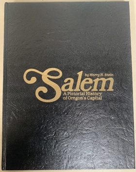
Salem, a pictorial history of Oregon's capital by Harry H. Stein
Willamette landings, ghost towns of the river by Howard McKinley Corning, Federal Writers' Project (Or)
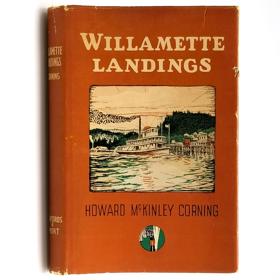
A history of the towns and landings on the Willamette River that were serviced by steamboats prior to the advent of railroads. Includes an index of almost 200 landings, as compiled by Capt. Arthur Riggs in 1940. Howard McKinley Corning (1896-1977) was a poet and historian. During the 1930s he served as an editor and supervisor for the Oregon Writers' Project of the Works Progress Administration, the work for which led to his writing of both this book (1947) and A Dictionary of Oregon History (1956).
vi, 224 pages illustrations 23 cm
Non-circulating [ 2 ]
Champoeg place of transition; a disputed history by John A. Hussey, Oregon State Highway Commission, United States National Park Service

John A. Hussey’s Champoeg: Place of Transition chronicles the pivotal historical events centered at this vital riverside settlement nestled within Oregon’s fertile Willamette Valley. The narrative maps the strategic geography of the French Prairie region along the banks of the Willamette River, which served as a crucial gathering point for early French-Canadian trappers and American pioneers. By detailing the legendary 1843 meetings where settlers voted to establish the Pacific Northwest's first provisional government, the text highlights the townsite's role as an early political and economic hub. Ultimately, the book vividly captures the transformation of this specific Oregon landscape from an isolated trading outpost into the foundational cornerstone of the larger Oregon Territory.
xvi, 404 pages illustrations, maps, portraits 24 cm
Non-circulating [ 1 ]
Men of Champoeg a record of the lives of the pioneers who founded the Oregon government by Caroline C. Dobbs
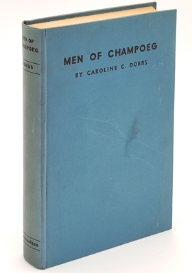
Published in 1932 by Caroline C. Dobbs, Men of Champoeg: A Record of the Lives of the Pioneers Who Founded the Oregon Government is a highly romanticized biographical encyclopedia dedicated to the region's Anglo-American founding fathers. The text meticulously catalogs the lives of the fifty-two men who famously voted on May 2, 1843, at the Champoeg meetings to establish the Provisional Government of Oregon, a critical political maneuver that helped secure the territory for the United States against the interests of the British Hudson's Bay Company. Through glowing pioneer hagiography, Dobbs compiles their genealogies, overland migration struggles, and civic achievements, deliberately elevating a makeshift, ad-hoc frontier assembly into a sacred, foundational moment of democratic destiny on par with the American Revolution.
A keen insight drawn from the work is how the meticulous cultivation of a localized founding myth functioned to legally and morally erase pre-existing Indigenous sovereignty. By hyper-focusing the narrative of Oregon's political genesis exclusively on a singular, dramatic legislative vote between white American settlers and French-Canadian trappers, Dobbs conceptually redefines the Willamette Valley as a vacant geopolitical chessboard contested only by European powers. This historiographical maneuver successfully transforms the establishment of the Provisional Government into the miraculous birth of civilization out of an imagined wilderness, actively demanding that readers revere the architects of the pioneer state while completely obscuring the systemic dispossession of the Kalapuya people, whose ancestral lands served as the very stage for this celebrated frontier democracy.
6 preliminary leaves, 218 pages, 1 leaf, 9 unnumbered pages of plates : frontispiece, illustrations, portraits ; 21 cm
Non-circulating [ 1 ]
Marion County
- Ale (historical)
- City of Aumsville
- City of Aurora
- Badger Corner
- Belle Passi (historical)
- Bethany
- Bethel Gospel Park
- Breitenbush
- Breitenbush Hot Springs
- Brooks
- Butteville
- Champoeg
- Chemawa
- Clear Lake
- Clymer (historical)
- Dencer (historical)
- City of Detroit
- Dominic (historical)
- City of Donald
- Downs
- Drake Crossing
- Elkhorn
- Elkhorn Woods
- Fairfield
- Four Corners
- Fruitland
- City of Gates
- City of Gervais
- Grabenhorst Corner
- Hayesville
- Hazel Green
- Highland Station (historical)
- City of Hubbard
- Hullt (historical)
- City of Idanha
- Jawbone Flats (historical)
- City of Jefferson
- City of Keizer
- Labish Center
- Labish Village
- Lachmund (historical)
- Lakebrook
- Liberty
- Macleay
- Marion
- McKee
- Mehama
- Middle Grove
- Monitor
- City of Mount Angel
- Niagara
- Noble (historical)
- North Howell
- Oak Park
- Pratum
- Roberts
- Rosedale
- Saint Louis
- City of Saint Paul
- City of Salem
- Salem Station (historical)
- Santiam City (historical)
- City of Scotts Mills
- Shaw
- Sidney
- City of Silverton
- City of Stayton
- City of Sublimity
- Sunnyside
- Talbot
- City of Turner
- West Stayton
- West Woodburn
- Willard (historical)
- City of Woodburn
- Young
Political Boundaries
Last updated: 2025-09-23