Catalog of British Columbiana and Pacific Northwest Americana
The Encyclopedia Cascadia Catalog indexes mostly non-fiction literature covering the Pacific Northwest coast of North America, with an emphasis on British Columbia, Idaho, Oregon, and Washington State.
| Catalog Title | Published |
|---|---|
|
The salmon people the story of Canada's West Coast salmon fishing industry by Hugh W. McKervill 
Hugh W. McKervill’s The Salmon People provides a comprehensive historical account of the commercial fishing industry that fundamentally shaped the coastal geography of British Columbia. The narrative maps the perilous maritime routes and remote, isolated inlets, stretching from the massive, teeming salmon runs of the Fraser River delta northward through the jagged, forested archipelagos of the Pacific coast. By chronicling the establishment of pioneer canneries and the arduous daily lives of the diverse fleets navigating the tempestuous waters of the open ocean, the text illustrates the profound human reliance on the region's marine ecosystems. Ultimately, the book vividly captures how the intricate aquatic topography of Canada's western shoreline served as the vital cultural and industrial lifeblood of this Pacific Northwest province. 198 pages illustrations, maps 23 cm Non-circulating [ 1 ]
|
1967 |
|
Champoeg place of transition; a disputed history by John A. Hussey, Oregon State Highway Commission, United States National Park Service
John A. Hussey’s Champoeg: Place of Transition chronicles the pivotal historical events centered at this vital riverside settlement nestled within Oregon’s fertile Willamette Valley. The narrative maps the strategic geography of the French Prairie region along the banks of the Willamette River, which served as a crucial gathering point for early French-Canadian trappers and American pioneers. By detailing the legendary 1843 meetings where settlers voted to establish the Pacific Northwest's first provisional government, the text highlights the townsite's role as an early political and economic hub. Ultimately, the book vividly captures the transformation of this specific Oregon landscape from an isolated trading outpost into the foundational cornerstone of the larger Oregon Territory. xvi, 404 pages illustrations, maps, portraits 24 cm Non-circulating [ 1 ]
|
1967 |
|
Empire of the Columbia a history of the Pacific Northwest by Dorothy O. Johansen, Charles M. Gates
Dorothy O. Johansen and Charles M. Gates's Empire of the Columbia serves as a foundational historical text that frames the sprawling Pacific Northwest through the unifying geographic force of the Columbia River basin. The comprehensive narrative maps the region's physical development, tracing early exploration from the rugged maritime outposts of the British Columbia coast and Washington's Puget Sound, eastward across the towering Cascade Mountains into the vast, arid interior plateaus of Oregon and Idaho. By detailing the arduous overland pioneer migrations and the modern industrialization of the mighty Columbia and Snake river watersheds via railroads and massive hydroelectric dams, the authors illustrate how human settlement adapted to and ultimately reshaped this diverse topography. Ultimately, the book captures the immense geographic scale of the region, demonstrating how interconnected aquatic networks and formidable mountain ranges dictated the political and economic destiny of these western territories. xiii, 654 pages : illustrations, maps ; 24 cm Non-circulating [ 2 ]
|
1967 |
|
Britannia the story of a Canadian mine by Bruce Ramsey
Bruce Ramsey’s Britannia: The Story of a Canadian Mine provides an industrial and social history of the Britannia copper empire, which operated on the eastern shoreline of Howe Sound from 1904 to 1974. Ramsey chronicles how mineral deposits discovered on Britannia Mountain were developed into one of the largest copper producers in the British Commonwealth, mapping deep underground workings, aerial tramways, and gravity mills directly into the coastal mountains. The text examines the isolated coastal logistics of the community, detailing how mine workers and their families depended exclusively on Union Steamship vessels running between Vancouver, Porteau, Minaty Bay, Furry Creek, and Britannia Beach prior to the completion of the railway and highway. Ramsey documents the devastating 1915 Jane Mine avalanche and the catastrophic 1921 flood and fire, highlighting the corporate resilience, multi-ethnic labor forces, and technological adaptations that sustained operations across seven decades. viii, 177 pages : illustrations, maps ; 24 cm Desiderata
|
1967 |
|
Victoria the fort by Derek Pethick 
Victoria: The Fort by Derek Pethick is a 1968 historical account detailing the early, formative years of British Columbia's capital city. The book chronicles Victoria's rapid transformation from its origins as a remote Hudson's Bay Company fur-trading post in 1843 through the frantic expansion of the regional gold rushes. Pethick offers a well-researched exploration of the pivotal figures and economic shifts that defined the colonial era and laid the foundation for the modern urban center. 287 pages illustrations, portraits 24 cm Non-circulating [ 1 ]
|
1968 |
|
Fur trade and empire George Simpson's journal entitled Remarks connected with the fur trade in the course of a voyage from York Factory to Fort George and back to York Factory 1824-25, with related documents by George Simpson , Frederick Merk (Editor, Writer of introduction)
Simpson's reorganization of Oregon Territory after amalgamation with the Northwest Company. First published in 1931 lxii, 370 pages : folded map ; 24 cm Non-circulating [ 1 ]
|
1968 |
|
Romantic Vancouver Island Victoria yesterday and today by Dorothy Abraham 
Dorothy Abraham’s Romantic Vancouver Island: Victoria Yesterday and Today provides a geographical and historical portrait of British Columbia’s capital city and its surrounding maritime landscapes. The narrative contrasts the original footprint of Fort Victoria—an isolated Pacific Northwest fur-trading outpost on the island's southern tip—with the cultivated gardens and urban development of the modern coastal city. Expanding beyond the capital, the book maps the broader terrain of Vancouver Island, documenting the pioneer settlements, rugged shorelines, and dense timberlands that define this massive Canadian landmass. Through this localized lens, Abraham captures the physical transformation of this prominent British Columbia island from a wild frontier into an established cultural hub. 120 pages illustrations, map, portraits 23 cm Non-circulating [ 1 ]
|
1968 |
|
Ranch under the rimrock by Dorothy Lawson McCall
Dorothy Lawson McCall’s memoir, Ranch Under the Rimrock, chronicles her dramatic transition from high-society Boston to the rugged high desert of Central Oregon in 1911. The narrative is deeply rooted in the dramatic geography of the Crooked River canyon, where imposing basalt cliffs and arid sagebrush flats defined her unforgiving new environment. Centered on her family's sprawling agricultural estate near Prineville, the book vividly details the physical challenges of adapting to this remote, inland Pacific Northwest landscape. Through her pioneering experiences, McCall maps the harsh but beautiful terrain of Oregon's rimrock country during the early twentieth century. xiii, 166 pages : illustrations, portraits ; 23 cm Non-circulating [ 1 ]
|
1968 |
|
Island County a world beater by E.M. Hawes and Lou Clark
E.M. Hawes and Lou Clark’s Island County: A World Beater serves as a vivid promotional and historical portrait of this unique geography nestled in the heart of Washington State's Puget Sound. The narrative focuses extensively on the prominent landmasses of Whidbey Island and Camano Island, detailing their extensive shorelines and vital maritime waterways. By highlighting the region's exceptionally fertile agricultural valleys and historic coastal settlements, the text underscores the economic potential drawn directly from the local terrain. Ultimately, the book captures the distinct, isolated beauty and natural abundance of this vital marine enclave within the Pacific Northwest. First published and written by E.M. Hawees and Lou Clark, 1911 iii, 55 pages illustrations, map, portraits 17 x 25 cm Non-circulating [ 1 ]
|
1968 |
|
Dryden's history of Washington by Cecil P. Dryden
Cecil P. Dryden’s Dryden's History of Washington provides a comprehensive geographic and historical overview of the state's development from early exploration to modern industrialization. The narrative sweeps across the diverse landscapes of the region, tracing maritime discoveries along the jagged coastlines of Puget Sound and mapping the vital fur trade routes established at Fort Vancouver along the lower Columbia River. Dryden also details the arduous overland pioneer migrations and subsequent agricultural booms that transformed the arid plains and fertile valleys of eastern Washington, particularly around Walla Walla and the Inland Empire. By chronicling the transition of these untamed coastal rainforests and eastern high deserts into a unified political entity, the book captures the expansive environmental diversity that shaped this cornerstone of the Pacific Northwest. 412 pages illustrations, map 23 cm Non-circulating [ 1 ]
|
1968 |
|
Of yesterday and the river by June Crithfield
June Crithfield's Of Yesterday and the River provides a localized history of the early agricultural communities and transportation networks nestled along the dramatic gorges of the Snake River in eastern Washington. The narrative focuses extensively on Whitman and Garfield counties, capturing the daily life and commerce of bustling, yet remote, pioneer river ports such as Wawawai and Almota. By chronicling the construction of the ingenious bucket tramways and grain chutes—most notably the Mayview and Interior tramways—that moved harvested wheat from the steep Palouse bluffs down to waiting steamboats, the book vividly maps how settlers adapted to the severe topography of this vital inland Pacific Northwest waterway. 1 online resource (iv, 116 pages) illustrations, facsimiles, portraits Non-circulating [ 1 ]
|
1968 |
|
The fourth corner highlights from the early Northwest by Lelah Jackson Edson, Whatcom Museum of History and Art 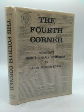
Lelah Jackson Edson’s The Fourth Corner: Highlights from the Early Northwest chronicles the pioneer history and coastal geography of the extreme upper-left corner of Washington State. The narrative focuses extensively on the early settlements of Whatcom County, tracing the development of communities nestled along the shores of Bellingham Bay and beneath the towering peak of Mount Baker. By documenting the establishment of outposts like Fort Bellingham and the challenging expansion of local railroad networks, the book vividly maps how settlers adapted to this rugged maritime terrain just south of the British Columbia border. xxiii, 298 pages illustrations, facsimile, maps, plans, portraits 27 cm Non-circulating [ 1 ]
|
1968 |
|
A bibliography of British Columbia laying the foundations, 1849-1899 by Barbara J. Lowther (Compiler), Muriel Laing (Compiler), University of Victoria (B.C.). Social Sciences Research Centre
Compiled by Barbara J. Lowther and Muriel Laing, A Bibliography of British Columbia: Laying the Foundations, 1849-1899 serves as a comprehensive guide to the historical texts documenting the province's formative half-century. The catalogued works extensively map the colonial expansion across this rugged Pacific Northwest terrain, from the early maritime hub of Victoria on Vancouver Island to the burgeoning mainland ports of the Burrard Inlet. Furthermore, the bibliography highlights literature detailing the arduous inland routes forged by prospectors navigating the treacherous Fraser River canyon and the remote Cariboo goldfields. Through its exhaustive collection of early regional literature, the book offers a foundational literary geography of how British Columbia transitioned from isolated coastal fur-trading outposts into a unified Canadian province. Every effort has been made to include the government publications of the two colonies of Vancouver Island and British Columbia and, after their union in 1866, of the united colony of British Columbia to 1871. xii, 328 pages ; 29 cm ONLINE Circulation [ 1 ] Non-circulating [ 1 ]
|
1968 |
|
Oregon imprints 1845-1870 by George N. Belknap
An expansion of McMurtrie's 1950 bibliography of early Oregon printing. 305 pages 1,521 entries of books, pamphlets, and broadsides printed in Oregon through 1870, and index, plus 16 pages of facsimile broadsides and title pages 305 pages : facsimiles ; 26 cm Desiderata
|
1968 |
|
Names of Idaho Counties by Lalla Phipps Boone
Article from Names publication in 1968 where author discusses the origin of Idaho County names. pp 19-26 Non-circulating [ 1 ]
|
1968 |
|
Oregon imprints 1845-1870 by George N. Belknap
George N. Belknap's Oregon Imprints 1845-1870 provides a comprehensive bibliographic record of the earliest printed materials produced within the pioneer settlements of the Oregon Territory. The catalog maps the geographic spread of early printing presses, highlighting their emergence in the foundational riverfront communities nestled within the fertile Willamette Valley. By chronicling the literary and political output originating from burgeoning frontier towns like Oregon City, Salem, and Portland, the text illustrates how communication networks expanded alongside physical settlement. Ultimately, this exhaustive directory serves as a literary geography of western Oregon's transition from an isolated Pacific Northwest outpost into a deeply rooted pioneer society. 305 pages : facsimiles ; 26 cm Non-circulating [ 1 ]
|
1968 |
|
Shipwrecks off Juan de Fuca by Jim Gibbs
Jim Gibbs's Shipwrecks off Juan de Fuca chronicles the perilous maritime history of the treacherous strait separating Washington's Olympic Peninsula from British Columbia's Vancouver Island. The narrative maps the notorious western approaches often dubbed the "Graveyard of the Pacific," detailing catastrophic maritime disasters along the unforgiving coastlines of Cape Flattery and the rugged shores of southwestern British Columbia. By documenting the severe navigational hazards posed by dense fog, violent Pacific storms, and hidden reefs, the book highlights the lethal geographical challenges intrinsic to this vital coastal environment. Through vivid accounts of lost vessels, the text ultimately captures the historical significance of the Strait as a dangerous but essential arterial route connecting the open ocean to the sheltered harbors of Puget Sound and the broader Salish Sea. xiv, 240 pages illustrations, portraits 23 cm Non-circulating [ 1 ]
|
1968 |
|
Crisis on the Columbia by Oral Bullard 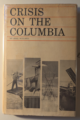
Oral Bullard's 1968 book, Crisis on the Columbia, examines the profound ecological and cultural transformations inflicted upon the Columbia River basin by rapid hydroelectric dam construction. The narrative heavily focuses on the river's path forming the border of Oregon and Washington, where structures like the Bonneville Dam near Portland inundated historical Aboriginal fishing sites. Further upstream into eastern Washington, Bullard maps the devastating environmental consequences of the massive Grand Coulee Dam, which flooded ancestral homelands, destroyed the vital Kettle Falls fishery, and permanently blocked salmon migration to the upper river. By detailing these massive engineering projects along the Columbia's course, the book captures the geographical and biological crisis that reshaped this central aquatic artery of the Pacific Northwest. 151, [5] pages illustrations, facsimiles, maps, portraits 24 cm Non-circulating [ 1 ]
|
1968 |
|
Sandy the true story of a rare sandhill crane who joined our family by Dayton O. Hyde 
On a wilderness ranch in southern Oregon nearly a century ago, Dayton Hyde dove into a rushing river to rescue the threatened nest of a sandhill crane. The egg saved from the nest hatched into a bird, and also into an amazing story. "Sandy" the crane grew up in Hyde's household as a member of the family and had to be taught she was really a bird. Hyde served as parent, companion, dietitian, even flight instructor to Sandy, and eventually watched over her mate and fledglings as well. Over the years, he had to learn a lot about sandhills. In return, the cranes taught him quite a bit about what it is to be wild. More than an animal story, Sandy is the true account of an individual who dedicated himself to saving an endangered species. Hyde shares his totally charming, often hilarious stories of Sandy and the other wild pets, showing us how one man's heroic act to save an unhatched egg blossomed into a lifetime of conservation activities. First published over 30 years ago, Sandy contains a message more urgent today as civilization sprawls without regard for wilderness. It shows what private landowners can do to help wildlife conservation — that ranches, when run with an understanding of whole ecosystems, can serve as miniature wildlife sanctuaries that address the concerns of ranchers and environmentalists alike. 214 pages illustrations 24 cm Desiderata
|
1968 |
|
Steamboats in the timber by Ruby El Hult 
In the heyday of its water commerce, Lake Coeur d'Alene in northern Idaho was the scene of more steamboating than any other lake, salt or fresh, west of the Great Lakes. The old steamers brought gold, silver, and lead from the mines; lumber from the forests; mail to lonely homesteaders; and romance down the shadowy St. Joe River, whose silken waters flow into the Coeur d'Alene. The old steamboats are gone now from the lake-but here is their story, exciting, nostalgic and complete. Across Lake Coeur d'Alene, in the early days, the big mining boom in the Coeur d'Alene Mountains was carried out, and the ore-hauling steamers came and went. Across the lake later went the timber seekers in their rush to grab the white pine riches of the St. Joe country; and a new fleet of steamers carried timber barons, homesteaders and lumberjacks up the twisting, cottonwood-shaded St. Joe. Here you will visit the bustling waterfront boom towns of Coeur d'Alene, Harrison, St. Maries, Ferrell, and St. Joe, just as they were in the glory days of steamboating, and as they are today. Romantic and factual history skill-fully merge as the old towns, the rivermen, and the boats glide by in easy, informed narrative. 209 pages, [7] leaves of plates : illustrations, map (on lining paper) ; 23 cm Desiderata
|
1968 |
|
Reminiscences of Washington Territory by Charles Prosch
Reminiscences of Washington Territory examines the pioneering journalism, foundational civic organizing, and early urban development situated across the rapidly evolving, heavily timbered maritime macro-geography of the Puget Sound basin. Prosch details how the region's formidable topography—specifically the dense, old-growth forests that choked the shoreline, the vast, intricate network of deep-water marine highways, and the profound physical isolation from eastern commercial centers—strictly dictated the margins of early press operations, political institution-building, and localized community survival. By mapping the establishment of territorial newspapers and the arduous efforts to link scattered frontier settlements through primitive trails and coastal steam navigation, the narrative highlights how this specific challenging, water-bound geography anchored a profoundly communicative, politically ambitious pioneer society. Ultimately, this historical and autobiographical record serves as a localized spatial history, demonstrating how the severe overland barriers, vital marine waterways, and immense botanical scale of this Pacific Northwest landscape fundamentally shaped the highly connected, civic-minded character of early Washington Territory. 128 pages, 26 unnumbered pages of plates : illustrations ; 25 cm Non-circulating [ 1 ]
|
1969 |
|
Idaho a descriptive tour by C. Aubrey Angelo
C. Aubrey Angelo's 1865 account, Idaho: A Descriptive Tour, chronicles the rugged landscapes and burgeoning mining districts of the Idaho Territory during the height of the inland gold rush. The narrative guides readers through early boomtowns and perilous pioneer trails across the Boise Basin, the Owyhee Mountains, and the remote Salmon River country. By detailing the challenging overland transportation routes from neighboring Pacific Northwest hubs—such as Portland, Oregon and Walla Walla, Washington—into Idaho's interior valleys, Angelo maps the commercial arteries of the frontier era. Ultimately, the text provides a vivid geographic snapshot of Idaho's river systems and mineral-rich mountain ranges just as they were opening to widespread settlement. [6], 52, [6] pages ; 23 cm Non-circulating [ 1 ]
|
1969 |
|
Tendoy, chief of the Lemhis by David L. Crowder
David L. Crowder's Tendoy, Chief of the Lemhis traces the life of the prominent Shoshone leader against the dramatic backdrop of Idaho's Lemhi Valley and the rugged Salmon River country. The biographical narrative is deeply anchored in this specific Pacific Northwest geography, detailing the tribe's ancestral homelands nestled beneath the towering Bitterroot Mountains. Crowder chronicles Tendoy's diplomatic efforts to maintain peace as waves of miners and settlers encroached upon these vital eastern Idaho waterways and valleys during the late nineteenth century. Ultimately, the book describes the heartbreaking forced relocation of Tendoy's people from their beloved northern territories to the arid plains of the Fort Hall Indian Reservation in southeastern Idaho. 139 pages : illustrations, 3 maps, portraits ; 23 cm Non-circulating [ 1 ]
|
1969 |
|
Voyages of the Columbia to the northwest coast, 1787-1790 and 1790-1793 Columbia Rediviva (Ship) by F. W. Howay, Robert Haswell, John Box Hoskins, John Boit, Massachusetts Historical Society
Voyages of the Columbia to the Northwest Coast chronicles the pioneering maritime fur trade expeditions of the Columbia Rediviva along the rugged and unmapped coastlines of present-day Oregon, Washington, and British Columbia. The firsthand journals extensively document the crew's anchorages and interactions with Indigenous peoples at key Vancouver Island harbors, particularly Nootka Sound and Clayoquot Sound, where they established winter encampments. The narrative also details the ship's historic explorations further south, capturing the treacherous discovery of Grays Harbor in Washington and Captain Robert Gray's monumental crossing of the Columbia River bar along the Oregon-Washington border. By mapping these perilous inlets and river mouths, the book provides a foundational geographic portrait of the Pacific Northwest's coastal frontier before widespread land settlement. xxvii, 518 pages 12 illustrations, facsimile, 3 maps, 4 portraits 25 cm. Non-circulating [ 1 ]
|
1969 |
|
The Bohemia story by Wally Hunter
Wally Hunter's The Bohemia Story chronicles the rise and operations of the Bohemia Lumber Company, deeply rooting its narrative in the heavily forested landscapes of western Oregon. The historical account centers on Lane County, specifically detailing the bustling mill operations and logging camps that thrived in Cottage Grove and along the banks of the Row River in Culp Creek. Through the lens of this pioneering timber venture, the book maps the rugged foothills of the Oregon Cascades where the extraction of timber fueled the region's mid-century economy. Ultimately, the text provides a vivid geographic snapshot of how these specific inland Oregon valleys were transformed into vital, bustling hubs of the Pacific Northwest's logging industry. 61 pages map Non-circulating [ 1 ]
|
1969 |