Catalog of British Columbiana and Pacific Northwest Americana
Encyclopedia Cascadia Catalog contains book titles of mostly non-fiction Pacific Northwest Coast of North America Titles (primarially British Columbia, Idaho, Oregon and Washington State) in an easy-to-understand title catalog. If you see a link with this badge ONLINE CIRC it means that there is an online institution that provides free access to that title. In some cases there may be more than one institution hosting the title digitally.
| Catalog Title | Published |
|---|---|
|
History of Benton County, Oregon by David D. Fagan 
including its geology, topography, soil and productions, together with the early history of the Pacific Coast, compiled from the most authentic sources : a full political history ... incidents of pioneer life and biographical sketches of early and prominent citizens : also containing the history of the cities, towns, churches, schools, secret societies, etc. .. 532 pages : illustrations ; 30 cm ONLINE CIRC [ 1 ]
|
1885 |
|
History of Alturas and Blaine counties, Idaho by George A. McLeod
|
1938 |
|
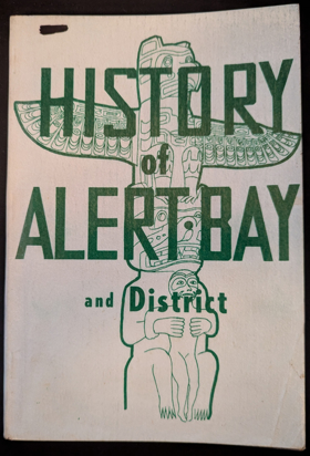
History of Alert Bay and district by Elizabeth Healey
|
1958 |
|
History of Adams County, Washington by Adams County Historical Society (Wash) (Publisher) 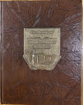
History of Adams County, Washington by the Adams County Historical Society is a comprehensive 1986 local history compiled to preserve the pioneer heritage and development of this east-central Washington region. The substantial volume offers detailed accounts of the county's agricultural roots, the growth of its civic institutions, and the enduring legacies of its founding residents. Ultimately, featuring extensive family genealogies, historical photographs, and records of early schools and churches, it serves as an invaluable, community-driven resource for genealogists and researchers seeking to understand the grassroots legacy and rural settlement of the Columbia Basin. 2 volumes : illustrations, portraits ; 29 cm CIRC [ 0 ]
|
1986 |
|
History and folklore of the Cowichan Indians by Martha Douglas Harris, Margaret C. Maclure (Illustrator) 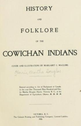
In the late 1800s, Martha Douglas Harris, the daughter of the former governor of British Columbia, observed that "civilization" was destroying the "native dignity and wholesome life" of the Cowichan tribe of Vancouver, "substituting much evil for the real good found in their former customs and character." She herself was part Cree Indian-a fact that her father was none too eager to make public. But he and her mother had long since passed away, and so she wrote this book of 20 folktales in 1901, partly to honor her Native American heritage 89, [1] pages frontispiece, illustrations 21 cm ONLINE CIRC [ 1 ]
|
1901 |
|
|
1990 |
|
Historical sketches of the Catholic Church in Oregon by Francis Norbert Blanchet, Edward J. Kowrach 
Originally published: Portland, Ore., 1878 163 pages : illustrations, maps, portraits ; 27 cm CIRC [ 1 ]
|
1983 |
|
Historical images of the Illlinois Valley 1870's to present by Dennis Strayer (Compiler), Kerbyville Museum (Kerby, Or) (Issuing body, Publisher) 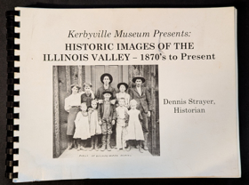
The historic images contained in this book provide a unique look into the past, when a slower pace of life existed long before electricity, cars, or computers. The Illinois Valley is located in the southern part of Josephine County, Oregon. Like most of Southern Oregon, mountains and high hills surround the valley on the west, south and east, which in both prehistoric and historic times made getting in and out of our valley a real challenge. We hope that you enjoy this "step back in time" when the horse served as the main mode of transportation and electricity was just an idea. 190 pages : chiefly illustrations, portraits ; 22 x 28 cm CIRC [ 1 ]
|
2016 |
|
Historical highlights of Washington State by Washington (State).
|
1950 |
|
Historical dictionary of the discovery and exploration of the Northwest Coast of America by Robin Inglis 
The Northwest Coast of America, ranging from northern California through Oregon, Washington, and British Columbia, all the way up to Alaska, was the last temperate coastline to be placed on the world map. First visited by Russians in 1741 and thought to contain a navigable passage between the Pacific and the Atlantic, it was systematically revealed during an intense period of exploratory and commercial activity from the 1770s to the 1790s. Subsequently, the imperial ambitions of Russia, Spain, and Britain, and an assumption of manifest destiny by the United States led to further exploration and ensured that the region would become disputed territory before national boundaries were determined in the mid-19th century. The Historical Dictionary of the Discovery and Exploration of the Northwest Coast of America tells of the heroic endeavors and remarkable achievements, the endless speculation about a northwest passage, and the fighting and manipulation for commercial advantage that surrounded this terrain. This is done through an introductory essay, a detailed chronology, an extensive bibliography, modern maps and selected historical maps and drawings, and over 400 cross-referenced dictionary entries. Entries cover the native people encountered; the scientists and artists who left an invaluable documentary and visual record of people, places, flora, and fauna; the numerous voyages taken by men such as Vitus Bering, James Cook, Juan Francisco de la Bodega y Quadra, and George Vancouver; overland expeditions like those of Alexander Mackenzie, Simon Fraser, Meriwether Lewis and William Clark, and David Thompson; and maritime fur traders, including George Dixon, Grigorii Shelikhov, Robert Gray and William Sturgis. No other dictionary exists that is dedicated solely to the coverage of this region. lxxv, 429 pages : illustrations, maps ; 23 cm. CIRC [ 1 ]
|
2008 |
|
Historical celebrations a handbook for organizers of Diamond Jubilees, Centennials, and other community anniversaries by Keith C. Petersen 
This book is full of suggestions and checklists as well as sample press releases and a list of resources. A handbook for organizers of Diamond Jubilees, Centennials, and other community anniversaries. xxiv, 118 pages : illustrations ; 23 cm CIRC [ 0 ]
|
1986 |
|
Historical atlas of Washington and Oregon by Derek Hayes, Iva Cheung 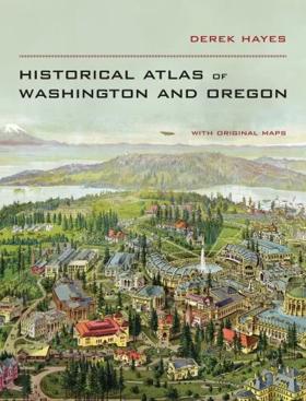
This gorgeous atlas, illustrated throughout with more than 500 colorful images and maps, provides a visually rich and textually engaging history of the states of Oregon and Washington. Derek Hayes brings his enthusiasm and expertise to a full range of topics, beginning with the first inhabitants and tracing the westward expansion, conflict between settlers and Native Americans, and the establishment of the Oregon Trail. We see in vivid images, old maps, and lively text the coming of the railroads and the rapid establishment of the coastal ports, northwest cities and roads, the fur and lumber industries, and the large farms. We also witness the twentieth-century development of the war industries, the establishment of the aviation industry, and the celebratory 1962 Seattle World’s Fair. At once a valuable reference and an exhilarating adventure through history, the Historical Atlas of Washington and Oregon presents readers with a fascinating chronicle of how these proud states came into their own and how they each look toward the future. 240 pages : illustrations (some color), maps (some color) ; 33 cm CIRC [ 1 ]
|
2011 |
|
Historical atlas of Washington by James William Scott, Roland L. De Lorme , Ted R. Brandt, Patrick S. Grant 
In 77 maps and accompanying texts, this atlas presents the history of Washington state from prehistoric times to the present, Beginning with Washington’s terrain climate, vegetation, and hydrography, it then displays and records the evolution of both Indian and white settlements, the development of the state’s modern economy, and the progress of society and culture from Indian times to the present. Some of the maps in the atlas cover major historical events or specific periods; other show present-day patterns of activity and deal with the historical background in the accompanying commentary. Selective bibliographies refer readers to further readings on the subject of each map 1 atlas (xxix, [181] pages) : illustrations, maps ; 32 cm CIRC [ 1 ]
|
1988 |
|
Historical atlas of Vancouver and the Lower Fraser Valley by Derek Hayes 
Map researcher and collector Derek Hayes here presents the sixth in a series of critically acclaimed, award-winning historical atlases. Gathered together in a single volume for the first time, here are the maps that shaped Vancouver and the surrounding Lower Fraser Valley. More than 370 original maps chart the region’s development beginning with the years of discovery and exploration. They depict its days as a fledgling colonial outpost, its appearance on the world scene after the arrival of the Canadian Pacific Railway, through to its emergence as a postwar Pacific metropolis. These maps evoke such historic events and developments as the founding of Fort Langley, the first settlements on the inlet, and the filling in of False Creek, along with more recent aspects of this richly diverse area such as the real estate boom and the explosive growth of Vancouver. Included are many fascinating plans for schemes that never got off the drawing board. 192 p. : ill. ; 30 cm. CIRC [ 1 ]
|
2007 |
|
Historical atlas of the Pacific Northwest maps of exploration and discovery : British Columbia, Washington, Oregon, Alaska, Yukon by Derek Hayes 
Reproduces and profiles more than 320 sixteenth- to twentieth-century maps of this region of the U.S. and Canada, including famous explorations, the purchase of Alaska, and the 1897 Klondike gold rush 1 atlas (208 pages) : illustrations (some color), maps (some color) ; 33 cm CIRC [ 1 ]
|
1999 |
|
Historical atlas of the North Pacific Ocean maps of discovery and scientific exploration, 1500-2000 by Derek Hayes, North Pacific Marine Science Organization 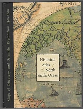
Map junkies rejoice! Derek Hayes, author of Historical Atlas of the Pacific Northwest, delivers another stunning atlas filled with stories of explorations and exquisite historical maps. Over five hundred years of maps depicting the North Pacific Ocean and the lands that border itthe United States, Canada, Alaska, Russia, Japan, Korea, and Chinahave been collected into this new atlas. From antique maps of the sixteenth century to modern satellite images, this volume covers all the major explorations, such as Magellan, Bering, Cook, and Vancouver; Perrys opening of Japan; and the U.S. North Pacific Exploring Expedition. It also includes modern maps that use the latest technology to show ocean currents, fault lines, and the seabed in astounding detail. 1 atlas (224 pages) : illustrations, color maps ; 33 cm CIRC [ 1 ]
|
2001 |
|
Historical atlas map of Marion & Linn Counties, Oregon by Edgar Williams & Co
|
1981 |
|
Historic sketches of Walla Walla, Whitman, Columbia and Garfield counties, Washington Territory, and Umatilla County, Oregon by Frank T. Gilbert
Published in 1882, Frank T. Gilbert's expansive regional history chronicles the rapid transformation of the Inland Empire—spanning eastern Washington and northeastern Oregon—from indigenous territory and fur-trade outposts to an agrarian powerhouse. The narrative meticulously details the violent conflicts of the Cayuse and Yakima Indian Wars, the establishment of early pioneer settlements, and the subsequent explosion of the region's lucrative dry-land wheat economy. A keen insight drawn from the text is how it perfectly exemplifies the Gilded Age "subscription history" model, where the grand, often brutal narrative of westward conquest was explicitly monetized by pairing regional chronicles with flattering biographical portraits of the affluent farmers and merchants who financed the publication. Consequently, while the volume remains an indispensable civic and genealogical archive, its historical framing intentionally sanitizes the systematic displacement of Native American tribes to celebrate the inevitable triumph of white, capitalist agriculture in the Columbia Basin. 447, [2], [449]-488, [12], 66 pages, [63] leaves of plates : illustrations, portraits ; 31 cm ONLINE CIRC [ 1 ]
|
1882 |
|
Historic Silver City the story of the Owyhees by Mildretta Adams
|
1960 |
|
Historic shipwrecks of the Sunshine Coast by Rick James, Jacques Marc, Underwater Archaeological Society of British Columbia 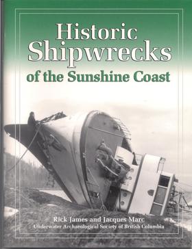
This UASBC regional inventory documents 12 of the most important shipwrecks in this easily accessible area north of Vancouver. Extensive archival research produced new details on the construction, operational history and loss of each vessel. Nine major wreck sites were explored and 3 deep water sidescan sonar searches were undertaken. A major accomplishment was the positive identification of the auxiliary schooner Malahat at Powell River. 2002, 8.5" x 11", 66 pages 66 p. : ill., map ; 28 cm. CIRC [ 0 ]
|
2002 |
|
Historic shipwrecks of the central coast of British Columbia by Rick James , Jacques F. Marc , Underwater Archaeological Society of British Columbia 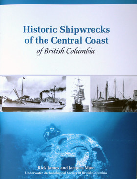
In this latest UASBC publication a fascinating marine history of BC's Central Coast is reflected in the stories of 13 shipwrecks surveyed by the UASBC over a 10 year period. The latest publication examines the area between Cape Caution and Prince Rupert. Each shipwreck story is illustrated with a site plan and photographs. 8.5" x 11", 76 pages. 76 p. : ill., maps ; 28 cm CIRC [ 0 ]
|
2010 |
|
Historic houses of the Pacific Northwest by Daphne Reece 
Historic Houses of the Pacific Northwest by Daphne Reece is a comprehensive 1985 architectural and regional history guide published by Chronicle Books. The volume serves as an expansive directory of preserved pioneer cabins, opulent Victorian mansions, and early commercial estates that are open to the public across Washington, Oregon, Idaho, British Columbia, and Alaska. By meticulously detailing the distinct architectural styles, family genealogies, and localized settlement lore associated with each property, Reece provides a tangible, room-by-room link to the domestic realities and economic ambitions of the region's early frontier leaders. Ultimately, it functions as both an engaging travelogue and a valuable educational resource for preservationists and regional historians seeking to physically explore the diverse, built heritage of the Pacific Northwest. vii, 170 pages : illustrations, maps ; 21 cm CIRC [ 1 ]
|
1985 |
|
Historic Friday Harbor on foot. Tour one, Historic downtown by San Juan Historical Society 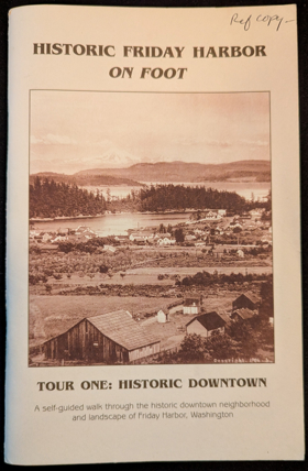
Published by the San Juan Historical Society, Historic Friday Harbor on Foot: Tour One, Historic Downtown serves as an engaging architectural and social walking guide through the core of San Juan Island's primary port town. The booklet outlines a structured route past surviving 19th- and early 20th-century commercial buildings, detailing their original uses as saloons, canneries, and mercantile shops that served the bustling maritime frontier. Through vintage photographs and concise structural histories, the text traces how a modest Coast Salish fishing camp and pioneer trading post evolved into a permanent island hub. A keen insight drawn from the guide is how localized historic walking tours function as physical acts of civic storytelling; by anchoring abstract regional heritage directly to surviving brick-and-mortar storefronts, the narrative transforms everyday streetscapes into tangible archives that invite modern visitors to inhabit the past. 40 unnumbered pages : illustrations, map ; 22 cm CIRC [ 1 ]
|
2006 |
|
Historic Boise an introduction to the architecture of Boise, Idaho, 1863-1938 by Arthur A. Hart, Boise City Historic Preservation Commission 
This is a brief introduction to the architectural legacy of Idaho's capital city, from its founding in 1863 to the eve of World War II. It is cultural history at its best because it shows that buildings have dimensions beyond descriptions of size or style. 82 pages : illustrations ; 21 cm CIRC [ 0 ]
|
1979 |
|
Hiking Washington's history by Judith M Bentley , Craig Romano 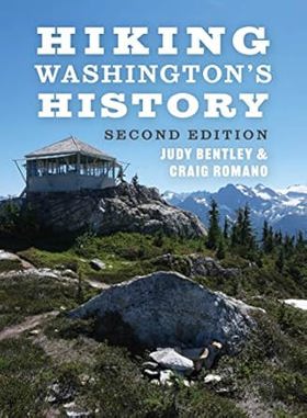
"For thousands of years people have traveled across Washington's spectacular terrain, establishing footpaths and roads to reach hunting grounds and coal mines high in the mountains, fishing sites and trade emporiums on the rivers, forests of old growth, and homesteads and towns on prairies. These traditional routes have been preserved in national parks, restored by cities and towns, salvaged from old railroad tracks, and opened to hikers by Indigenous communities. In this new, full-color edition of the first-ever hiking guide to650 the state's historic trails, historian and hiker Judy Bentley teams up with veteran guidebook author Craig Romano to lead adventurers of all abilities along trails on the coast, over mountains, through national forests, across plateaus, and on the banks of the Columbia River. Features include: 44 hikes, including 12 new additions Full-color trail maps A trails timeline that connects hikes to key events Updated trail descriptions Accounts from diaries, journals, and archives Historical overviews of 8 regions of the state Contemporary and historical photographs Bentley and Romano offer an essential boots-on-the ground history of some of the state's most fascinating places"-- Provided by publisher 336 pages : illustrations, maps ; 19 cm CIRC [ 0 ]
|
2021 |