Village of Harrison Hot Springs Fraser Valley Regional District, British Columbia
Village (1) - A populated place with legally defined boundaries, incorporated as a village municipality under the provincial Municipal Act. S end Harrison Lake, N of Chilliwack, New Westminster Land District
Mapped Location
Village of Harrison Hot Springs: The mapped location is an approximation and should not be used for navigation or wayfinding.
Information
General information on Village of Harrison Hot Springs
- Feature Type: Incorporated
Official, historical, colloquial and alternative toponyms for Village of Harrison Hot Springs
A brief list of names that this geographic feature has been named
| Name | Description |
|---|---|
| Village of Harrison Hot Springs | Official |
Origin Notes and History of Village of Harrison Hot Springs
References to Village of Harrison Hot Springs that document the origin of its place name
Harrison Hot Springs (Post Office) adopted 6 October 1936 on Geological Survey sheet 422A, Hope, as labelled on BC Lands' map 2B, 1914. Incorporated as a Village Municipality 27 May 1949. Name changed per Order in Council #1160, 2 December 2004, from "Corporation of the Village of Harrison Hot Springs" to "Village of Harrison Hot Springs".
Townsite plan deposited 5 October 1888 by Joseph C. Armstrong. Harrison Hot Springs Post Office was opened 22 March 1889.
Related Catalog Titles
A Bibliography for Village of Harrison Hot Springs, Fraser Valley Regional District, British Columbia
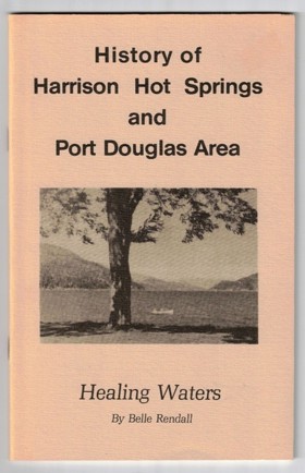
History of Harrison Hot Springs and Port Douglas area healing waters by Belle Rendall, Harrison Lake Historical Society
Fraser Valley Regional District
- City of Abbotsford
- Abbotsford
- Aberdeen
- Agassiz
- Alvin
- Arnold
- Atchelitz
- Barrowtown
- Bear Creek
- Boothroyd
- Boston Bar
- Bradner
- Bridal Falls
- Canyon Alpine
- CFB Chilliwack
- Chapmans
- Chaumox
- Cheam View
- City of Chilliwack
- Chilliwack
- Choate
- Clayburn
- Clearbrook
- Cultus Lake
- Deroche
- Dewdney
- Dogwood Valley
- Durieu
- Fairfield
- Floods
- Gifford
- Greendale
- Haig
- Village of Harrison Hot Springs
- Harrison Mills
- Hatzic
- Hells Gate
- Hemlock Valley
- District of Hope
- District of Kent
- Kilgard
- Laidlaw
- Lake Errock
- Lindell
- Lindell Beach
- Matsqui
- Minto Landing
- Miracle Valley
- District of Mission
- Mission
- Mount Lehman
- North Bend
- North Poplar
- Othello
- Popkum
- Port Douglas
- Promontory
- Ridgedale
- Rosedale
- Ruby Creek
- Ryder Lake
- Sardis
- Silver Creek
- Silver River
- Silverhill
- Skookumchuck
- Slesse Park
- South Poplar
- South Sumas
- Spuzzum
- Squeah
- Stave Falls
- Steelhead
- Straiton
- Sunshine Valley
- Tipella
- Vedder Crossing
- West Heights
- Williams Landing
- Yale
- Yarrow
Political Boundaries
Last updated: 2023-09-30