Port Douglas Fraser Valley Regional District, British Columbia
Locality - A named place or area, generally with a scattered population of 50 or less. E side Lillooet River, just N of N end Harrison Lake, New Westminster Land District
Mapped Location
Port Douglas: The mapped location is an approximation and should not be used for navigation or wayfinding.
Information
General information on Port Douglas
- Feature Type: Place
Official, historical, colloquial and alternative toponyms for Port Douglas
A brief list of names that this geographic feature has been named
| Name | Description |
|---|---|
| Port Douglas | Official |
Origin Notes and History of Port Douglas
References to Port Douglas that document the origin of its place name
Previously adopted as "Douglas", as labelled on Trutch's 1871 map of British Columbia, BC map 2B, 1914. Name changed to Port Douglas (settlement) 3 April 1959 on 92G, as labelled on Gustavus Epner's 1862 Map of the Gold Regions of BC. Form of name changed to Port Douglas (community) 9 September 1925. Form of name changed to Port Douglas (locality) 29 November 1984 by Ottawa [no record of change in BC files.]
Labelled "Port Douglas" on Epner's 1862 Map of the Gold Regions of BC, but identified as just "Douglas" on accompanying index in margin ("New Westminster to Douglas...95 miles").
Named for Sir James Douglas, Governor of British Columbia and Vancouver Island, who - confronted with the all-but-impassible Fraser Canyon above Yale - sponsored contruction of an overland route to access the Cariboo gold fields utilizing the HBC-located trail from the north end of Harrison Lake via Pemberton, Anderson and Seton Lakes to Cayoosh (Lillooet). From 1858 to 1965, Port Douglas, with hotels, stores, wagon-makers, sawmill & shipping facilities, thrived as the southern terminus for this first route to the Cariboo goldfields. Douglas Post Office was opened 19 August 1859, W.H. Franklyn, postmaster; post office was closed March or April 1867. By then the Cariboo Wagon Road from Fort Yale to Lillooet had been completed, and miners and provisioners abandoned Douglas and the Harrison Lake route. The Victoria Colonist newspaper carried the final advertisement for a hotel at Douglas in August 1866, identified a single resident in a November 1874 article, and in September 1898 reported that "historic Fort [sic] Douglas" had been destroyed by fire. Logging operations have headquartered here at various times since WW II. According to Mr. Simmons, Water Rights Branch, who visited the area in 1955, Port Douglas has a store, school, church, Imperial Oil tanks, a logging camp (about 30 people) and a total population of about 100, plus a docking facility for the thrice-weekly Harrison Lake ferry run. By 1997, the Government Agent at Chilliwack and BC Forest Service at Squamish advised that there are only 2 or 3 (family?) groups living at Port Douglas. See also T.W. Patterson's "Ghost Towns & Mining Camps of British Columbia," Langley, 1980, for photographs and excerpts from early letters.
"....In December [1858], Douglas was able to report that the townsite, named after himself, had been laid out and seventy lots were occupied. Today there is only a logging depot here."
Ptékvl's is the Ucwalmícwts name - the language of the Lower Lillooet people - for today's Port Douglas. The village formerly located here was call nkenq (June 2007 advice from Maurice DePaoli, Cultural Researcher and Heritage Resources Advisor for In-SHUCK-ch Nation.) [Pronunciation and origin information to follow.]
Related Catalog Titles
A Bibliography for Port Douglas, Fraser Valley Regional District, British Columbia
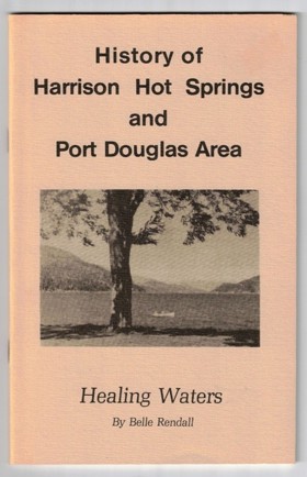
History of Harrison Hot Springs and Port Douglas area healing waters by Belle Rendall, Harrison Lake Historical Society
Fraser Valley Regional District
- City of Abbotsford
- Abbotsford
- Aberdeen
- Agassiz
- Alvin
- Arnold
- Atchelitz
- Barrowtown
- Bear Creek
- Boothroyd
- Boston Bar
- Bradner
- Bridal Falls
- Canyon Alpine
- CFB Chilliwack
- Chapmans
- Chaumox
- Cheam View
- City of Chilliwack
- Chilliwack
- Choate
- Clayburn
- Clearbrook
- Cultus Lake
- Deroche
- Dewdney
- Dogwood Valley
- Durieu
- Fairfield
- Floods
- Gifford
- Greendale
- Haig
- Village of Harrison Hot Springs
- Harrison Mills
- Hatzic
- Hells Gate
- Hemlock Valley
- District of Hope
- District of Kent
- Kilgard
- Laidlaw
- Lake Errock
- Lindell
- Lindell Beach
- Matsqui
- Minto Landing
- Miracle Valley
- District of Mission
- Mission
- Mount Lehman
- North Bend
- North Poplar
- Othello
- Popkum
- Port Douglas
- Promontory
- Ridgedale
- Rosedale
- Ruby Creek
- Ryder Lake
- Sardis
- Silver Creek
- Silver River
- Silverhill
- Skookumchuck
- Slesse Park
- South Poplar
- South Sumas
- Spuzzum
- Squeah
- Stave Falls
- Steelhead
- Straiton
- Sunshine Valley
- Tipella
- Vedder Crossing
- West Heights
- Williams Landing
- Yale
- Yarrow
Political Boundaries
Last updated: 2023-09-30