Fraser Valley Regional District Regional District
The Fraser Valley Regional District (FVRD) in British Columbia, Canada has a long and rich history. The area was first inhabited by the Sto:lo people, who have lived in the valley for thousands of years. In the 1800s, the Fraser Valley became a major transportation hub for fur traders and settlers. The region's agricultural potential was also recognized early on, and the valley became a major producer of fruits, vegetables, and dairy products. The FVRD was formed in 1995 by the amalgamation of three regional districts: Fraser-Cheam, Dewdney-Alouette, and Central Fraser Valley. The FVRD is now home to over 337,000 people and covers an area of 13,361 square kilometers. The region is a major economic hub for British Columbia, and is home to a number of industries, including agriculture, tourism, and manufacturing. The FVRD is also home to a number of historical sites, including Fort Langley, the Fraser Canyon, and the Agassiz Fossil Beds. The region is also a popular destination for outdoor recreation, with opportunities for hiking, camping, fishing, and boating.
Mapped Location
Fraser Valley Regional District: The mapped location is an approximation and should not be used for navigation or wayfinding.
Information
General information on Fraser Valley Regional District
- Feature Type: Regional District
- Regional District Administrative Centre: City of Chilliwack
- Established: Tuesday, December 12, 1995
Official, historical, colloquial and alternative toponyms for Fraser Valley Regional District
A brief list of names that this geographic feature has been named
| Name | Description |
|---|---|
| Fraser Valley Regional District | Official |
Related Catalog Titles
A Bibliography for Fraser Valley Regional District, Regional District
The Fraser Valley a history by John A. Cherrington
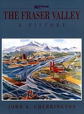
One of the world's most fertile agricultural regions, the Fraser Valley is in the midst of explosive change from the pressures of technology and urbanization. The author follows the Valley's history from the eighteenth century when Stalo natives were constantly on guard against visits from raiding Yacultas, through the Victorian era, when waves of settlers fought harsh winters, floods and mosquitoes to build a new community in the Valley, to the twentieth century, when the depredations of two world wars and the impact of the automobile changed the Valley forever. Throughout, Cherrington reminds us that beneath the serene, increasingly urbanized surface of the Fraser Valley, there is a turbulent past of Sasquatches and steamships, fur traders and fishermen, priests and prospectors - a recent past that, in an era of freeways and microchips, seems increasingly remote.
391 pages : illustrations, maps ; 29 cm
CIRC [ 1 ]
Gold along the Fraser by Lorraine Harris
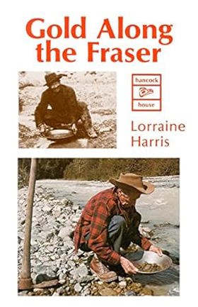
The cry of "gold along the Fraser!" Hured men from around the world. By 1858, 25000 had swarmed into the new colony of British Columbia. Some were experienced prospectors, some dreamers; all were hoping for instant wealth.
Gold Along the Fraser details the experiences-the successes and failures-of these adventurers.
64 pages : illustrations ; 22 cm
CIRC [ 1 ]
The Fraser canyon story, illustrated by Donald E. Waite
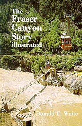
Constable John Kirkup was called to a 'gambling and whiskey drive' in Yale, B.C. He wound up arresting the nude hostess. Kirkup, the local newspaper editor, and the pastor fought for abstinence while the unruly workers fought and laid railway tracks. Further up the canyon, the great railwayman Andrew Onderdonk was daring the little steamship Kuzzy through the impenetrable Hell's Gate. Don Waite also recounts the adventures of the gold rush, the fur brigade trails, and Cariboo wagon road.
96 p. : ill., ports. ; 22 cm.
CIRC [ 1 ]
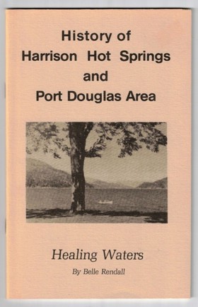
History of Harrison Hot Springs and Port Douglas area healing waters by Belle Rendall, Harrison Lake Historical Society
Five corners the story of Chilliwhack by Bruce Ramsey

Fraser Valley Regional District
- City of Abbotsford
- Abbotsford
- Aberdeen
- Agassiz
- Alvin
- Arnold
- Atchelitz
- Barrowtown
- Bear Creek
- Boothroyd
- Boston Bar
- Bradner
- Bridal Falls
- Canyon Alpine
- CFB Chilliwack
- Chapmans
- Chaumox
- Cheam View
- City of Chilliwack
- Chilliwack
- Choate
- Clayburn
- Clearbrook
- Cultus Lake
- Deroche
- Dewdney
- Dogwood Valley
- Durieu
- Fairfield
- Floods
- Gifford
- Greendale
- Haig
- Village of Harrison Hot Springs
- Harrison Mills
- Hatzic
- Hells Gate
- Hemlock Valley
- District of Hope
- District of Kent
- Kilgard
- Laidlaw
- Lake Errock
- Lindell
- Lindell Beach
- Matsqui
- Minto Landing
- Miracle Valley
- District of Mission
- Mission
- Mount Lehman
- North Bend
- North Poplar
- Othello
- Popkum
- Port Douglas
- Promontory
- Ridgedale
- Rosedale
- Ruby Creek
- Ryder Lake
- Sardis
- Silver Creek
- Silver River
- Silverhill
- Skookumchuck
- Slesse Park
- South Poplar
- South Sumas
- Spuzzum
- Squeah
- Stave Falls
- Steelhead
- Straiton
- Sunshine Valley
- Tipella
- Vedder Crossing
- West Heights
- Williams Landing
- Yale
- Yarrow
Political Boundaries
Last updated: 2025-09-23