Sardis Fraser Valley Regional District, British Columbia
Community - An unincorporated populated place, generally with a population of 50 or more, and having a recognized central area that might contain a post office, store and/or community hall, etc, intended for the use of the general public in the region. Within Chilliwack District Municipality, N of Vedder Crossing, New Westminster Land District
Mapped Location
Sardis: The mapped location is an approximation and should not be used for navigation or wayfinding.
Information
General information on Sardis
- Feature Type: Place
Official, historical, colloquial and alternative toponyms for Sardis
A brief list of names that this geographic feature has been named
| Name | Description |
|---|---|
| Sardis | Official |
A Selected Bibliography of Sardis, Fraser Valley Regional District, British Columbia
A compilation of essential readings detailing the history, geography, and culture of the region.
Syuwén ct:sununéymuxw mulstímuxw, Methodist ťiwi'ulhéwtxw 'u Kanata, Coqualeetza ťakw 'i' skwool The history that we share by Robert Janning , Adam Manson (Translator)
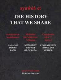
"In The History That We Share, historian Robert Janning presents a clear and comprehensive depiction of the relationship that existed between the Snuneymuxw First Nation and the Methodist Church of Canada from the time of contact to the day Snuneymuxw children were first sent to the Coqualeetza Residential School, in Sardis, British Columbia. This book gives readers an opportunity to learn what day to day life was like in a First Nation community prior to the implementation of the Indian residential school system in British Columbia. Despite the fact that fear, guilt and shame have for many years conspired to conceal much of the history that we share, an immense body of documentation chronicling our past has been left to collect dust on the shelves of archives and libraries for a century or more. Driven by a consuming desire to better understand how we became who we are today, Janning launched an investigation that took five years to complete. After collecting and chronologically arranging his findings, he was determined that the evidence would get to see the light of day. After all, if it is the truth that will set us free, then is it not high time we took a long look in our rearview mirror?" -- Back cover
xxx, 317 pages : maps, portraits, black and white photographs ; 29 cm
Desiderata
Fraser Valley Regional District
- City of Abbotsford
- Abbotsford
- Aberdeen
- Agassiz
- Alvin
- Arnold
- Atchelitz
- Barrowtown
- Bear Creek
- Boothroyd
- Boston Bar
- Bradner
- Bridal Falls
- Canyon Alpine
- CFB Chilliwack
- Chapmans
- Chaumox
- Cheam View
- City of Chilliwack
- Chilliwack
- Choate
- Clayburn
- Clearbrook
- Cultus Lake
- Deroche
- Dewdney
- Dogwood Valley
- Durieu
- Fairfield
- Floods
- Gifford
- Greendale
- Haig
- Village of Harrison Hot Springs
- Harrison Mills
- Hatzic
- Hells Gate
- Hemlock Valley
- District of Hope
- District of Kent
- Kilgard
- Laidlaw
- Lake Errock
- Lindell
- Lindell Beach
- Matsqui
- Minto Landing
- Miracle Valley
- District of Mission
- Mission
- Mount Lehman
- North Bend
- North Poplar
- Othello
- Popkum
- Port Douglas
- Promontory
- Ridgedale
- Rosedale
- Ruby Creek
- Ryder Lake
- Sardis
- Silver Creek
- Silver River
- Silverhill
- Skookumchuck
- Slesse Park
- South Poplar
- South Sumas
- Spuzzum
- Squeah
- Stave Falls
- Steelhead
- Straiton
- Sunshine Valley
- Tipella
- Vedder Crossing
- West Heights
- Williams Landing
- Yale
- Yarrow
Political Boundaries
Last updated: 2023-09-30