Chilliwack Fraser Valley Regional District, British Columbia
Community - An unincorporated populated place, generally with a population of 50 or more, and having a recognized central area that might contain a post office, store and/or community hall, etc, intended for the use of the general public in the region. On CNR, S. of junction of Harrison and Fraser Rivers, New Westminster Land District
Mapped Location
Chilliwack: The mapped location is an approximation and should not be used for navigation or wayfinding.
Information
General information on Chilliwack
- Feature Type: Place
Official, historical, colloquial and alternative toponyms for Chilliwack
A brief list of names that this geographic feature has been named
| Name | Description |
|---|---|
| Chilliwack | Official |
Origin Notes and History of Chilliwack
References to Chilliwack that document the origin of its place name
"Chilliwack (Town) not Chilliwak, Chilliwhack, Chilukweyuk nor Chiloweyuck" adopted in the 15th Report of the Geographic Board of Canada, 31 March 1917. Re-incorporated as a District Municipality 1 January 1980, being an amalgamation of the City of Chilliwack and the Corporation of the Township of Chilliwhack, the new entity to be called District of Chilliwack.
A Selected Bibliography of Chilliwack, Fraser Valley Regional District, British Columbia
A compilation of essential readings detailing the history, geography, and culture of the region.
Five corners the story of Chilliwhack by Bruce Ramsey
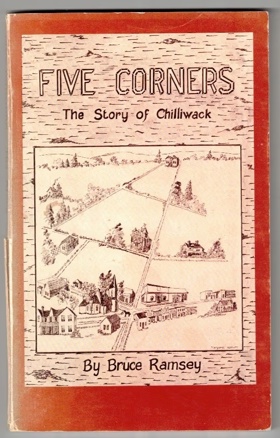
Five corners: the story of Chilliwhack chronicles the grueling agricultural transformation and isolated pioneer settlement situated within the vast, flood-prone alluvial floodplain of the lower Fraser Valley in British Columbia. Ramsey details how the region's formidable physical barriers—specifically the massive, unpredictable seasonal inundations of the Fraser River, the dense, waterlogged riparian forests of the valley floor, and the towering, impenetrable peaks of the surrounding Cascade and Coast mountains—strictly dictated the margins of early human survival and agrarian expansion. By mapping the immense physical labor required to painstakingly construct extensive earthen dikes against the swelling river currents, drain the marshy lowlands for cultivation, and carve rudimentary overland wagon routes through the dense brush to establish the vital "Five Corners" intersection, the narrative highlights the monumental cooperative effort necessary to forcibly convert this volatile riparian environment into highly productive agricultural tracts. The initial geographic isolation from the deepwater coastal ports forced these remote farming homesteads into a strict reliance on the precise topography of the Fraser River for transportation, completely anchoring their early commercial existence and civic development to the precarious navigation of shallow-draft sternwheelers and the severe hydrological realities of the basin. Ultimately, this local historical record serves as a deeply localized spatial history, demonstrating how the extreme riverine geography, heavy seasonal flooding, and immense physical labor of this Pacific Northwest frontier fundamentally shaped the fiercely resilient, tightly knit, and strictly agriculturally dependent character of the Chilliwack settlement.
xii, 96 pages : illustrations, maps, portraits ; 22 cm
Non-circulating [ 1 ]
Fraser Valley Regional District
- City of Abbotsford
- Abbotsford
- Aberdeen
- Agassiz
- Alvin
- Arnold
- Atchelitz
- Barrowtown
- Bear Creek
- Boothroyd
- Boston Bar
- Bradner
- Bridal Falls
- Canyon Alpine
- CFB Chilliwack
- Chapmans
- Chaumox
- Cheam View
- City of Chilliwack
- Chilliwack
- Choate
- Clayburn
- Clearbrook
- Cultus Lake
- Deroche
- Dewdney
- Dogwood Valley
- Durieu
- Fairfield
- Floods
- Gifford
- Greendale
- Haig
- Village of Harrison Hot Springs
- Harrison Mills
- Hatzic
- Hells Gate
- Hemlock Valley
- District of Hope
- District of Kent
- Kilgard
- Laidlaw
- Lake Errock
- Lindell
- Lindell Beach
- Matsqui
- Minto Landing
- Miracle Valley
- District of Mission
- Mission
- Mount Lehman
- North Bend
- North Poplar
- Othello
- Popkum
- Port Douglas
- Promontory
- Ridgedale
- Rosedale
- Ruby Creek
- Ryder Lake
- Sardis
- Silver Creek
- Silver River
- Silverhill
- Skookumchuck
- Slesse Park
- South Poplar
- South Sumas
- Spuzzum
- Squeah
- Stave Falls
- Steelhead
- Straiton
- Sunshine Valley
- Tipella
- Vedder Crossing
- West Heights
- Williams Landing
- Yale
- Yarrow
Political Boundaries
Last updated: 2023-09-30