Town of Oliver Regional District of Okanagan-Similkameen, British Columbia
Town - A populated place with legally defined boundaries, incorporated as a town municipality under the provincial Municipal Act. W side of Okanagan River, N of Osoyoos Lake, Similkameen Division Yale Land District
Mapped Location
Town of Oliver: The mapped location is an approximation and should not be used for navigation or wayfinding.
Information
General information on Town of Oliver
- Feature Type: Incorporated
Official, historical, colloquial and alternative toponyms for Town of Oliver
A brief list of names that this geographic feature has been named
| Name | Description |
|---|---|
| Town of Oliver | Official |
Origin Notes and History of Town of Oliver
References to Town of Oliver that document the origin of its place name
Oliver (town) adopted 6 October 1936 on Geological Survey sheet 420A. Incorporated as a Village Municipality 31 December 1945. Re-incorporated as a Town Municipality 1 January 1991; Oliver (Town) confirmed 8 November 1991 on 82E/4.
Oliver Post Office was opened 1 May 1921. See also the municipality's own website.
Named after "Honest John" Oliver (1856 - 1927), premier of British Columbia when the province carried out the irrigation and land settlement scheme here 1919-1921. (12th Report of the Okanagan Historical Society, 1948).
Related Catalog Titles
A Bibliography for Town of Oliver, Regional District of Okanagan-Similkameen, British Columbia
Popular Day Hikes: South-Central Okanagan Kelowna, Penticton, Oliver by Gerry Shea
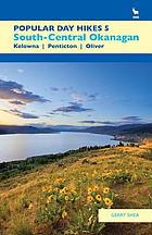
Gerry Shea’s Popular Day Hikes: South-Central Okanagan serves as an accessible, comprehensive trail guide for exploring the diverse landscapes stretching from Kelowna and Penticton down to Oliver. The book details 35 distinct routes through the region, providing practical maps, elevation profiles, and trailhead directions across a striking cross-section of semi-arid bunchgrass, ponderosa pine forests, and dramatic canyon country. A keen insight drawn from the text is how outdoor recreation guidebooks in the interior Pacific Northwest function as quiet instruments of ecological management; by systematically channeling foot traffic onto designated paths, the guide helps protect fragile desert-ecosystem flora and sensitive wildlife habitats from the pressures of a booming regional tourism economy.
143 pages : colour illustrations, maps ; 22 cm.
CIRC [ 0 ]
Regional District of Okanagan-Similkameen
- Allenby
- Allison Lake
- Apex Mountain
- Bankeir
- Blakeburn
- Cawston
- Chute Lake
- Coalmont
- Copper Mountain
- Crescent Beach
- Eagle Bluff
- East Osoyoos
- Eastgate
- Fairview
- Garnet Valley
- Hedley
- Inkaneep
- Jellicoe
- Jura
- Kaleden
- Village of Keremeos
- Manning Park
- Manning Park
- Marron Valley
- Naramata
- Okanagan Falls
- Olalla
- Town of Oliver
- Town of Osoyoos
- Osprey Lake
- City of Penticton
- Poplar Grove
- Prairie Valley
- Town of Princeton
- Shingle Creek
- District of Summerland
- Trout Creek
- Tulameen
- West Bench
- Willowbrook
Political Boundaries
Last updated: 2023-10-01