Regional District of Okanagan-Similkameen Regional District
The Regional District of Okanagan-Similkameen (RDOS) is a regional district in southern British Columbia, adjacent to the U.S. state of Washington. The area was first inhabited by Indigenous peoples, including the Okanagan, Similkameen, and Sinixt peoples. The first European settlers arrived in the early 1800s, and the region was incorporated as a regional district in 1966. The RDOS is home to a variety of historical sites, including the Penticton Museum and Archives, the Osoyoos Desert Centre, and the Keremeos Heritage Village. The district is also known for its natural beauty, including Okanagan Lake, the Similkameen River, and the Cascade Mountains.
Mapped Location
Regional District of Okanagan-Similkameen: The mapped location is an approximation and should not be used for navigation or wayfinding.
Information
General information on Regional District of Okanagan-Similkameen
- Feature Type: Regional District
- Regional District Administrative Centre: City of Penticton
- Established: Friday, March 4, 1966
Official, historical, colloquial and alternative toponyms for Regional District of Okanagan-Similkameen
A brief list of names that this geographic feature has been named
| Name | Description |
|---|---|
| Regional District of Okanagan-Similkameen | Official |
A Selected Bibliography of Regional District of Okanagan-Similkameen, Regional District
A compilation of essential readings detailing the history, geography, and culture of the region.
Popular Day Hikes: South-Central Okanagan Kelowna, Penticton, Oliver by Gerry Shea
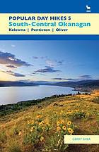
Gerry Shea’s Popular Day Hikes: South-Central Okanagan serves as an accessible, comprehensive trail guide for exploring the diverse landscapes stretching from Kelowna and Penticton down to Oliver. The book details 35 distinct routes through the region, providing practical maps, elevation profiles, and trailhead directions across a striking cross-section of semi-arid bunchgrass, ponderosa pine forests, and dramatic canyon country. A keen insight drawn from the text is how outdoor recreation guidebooks in the interior Pacific Northwest function as quiet instruments of ecological management; by systematically channeling foot traffic onto designated paths, the guide helps protect fragile desert-ecosystem flora and sensitive wildlife habitats from the pressures of a booming regional tourism economy.
143 pages : colour illustrations, maps ; 22 cm.
Desiderata
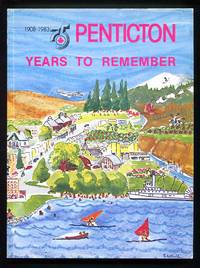
Penticton 75 years to remember, 1908-1983 by A. David MacDonald
Mapping the frontier Charles Wilson's diary of the survey of the 49th parallel, 1858-1862, while secretary of the British Boundary Commission by Charles William Wilson
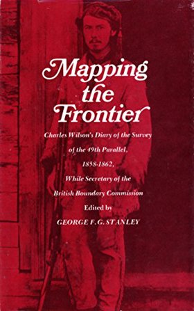
Mapping the frontier Charles Wilson's diary of the survey of the 49th parallel, 1858-1862 examines the grueling imperial cartography and immense logistical struggle situated across the profoundly rugged, trans-mountain macro-geography of the US-British Columbia borderlands. Wilson details how the region's formidable topography—specifically the impenetrable, old-growth temperate rainforests of the coastal slope, the sheer, glaciated alpine barricades of the Cascade and Rocky Mountains, and the deep, turbulent river chasms cutting perpendicular to the border—strictly dictated the margins of early scientific reconnaissance, precarious overland supply chains, and the immense physical labor required to physically mark the wilderness. By mapping the Boundary Commission's arduous effort to impose a rigid, abstract political line across violently fractured terrain—requiring the literal chopping of massive forest swaths, precarious high-altitude ascents, and constant battles with severe winter isolation—the narrative highlights how this specific unforgiving, mountainous geography anchored a profoundly grueling, highly isolated feat of imperial engineering. Ultimately, this diaristic and cartographic record serves as a macro-level spatial history, demonstrating how the immense alpine barricades, severe botanical density, and unrelenting climatic extremes of this Pacific Northwest landscape fundamentally shaped the highly arduous, geographically defiant character of the 49th parallel boundary survey.
182 pages : maps, portrait ; 22 cm
Non-circulating [ 1 ]
Regional District of Okanagan-Similkameen
- Allenby
- Allison Lake
- Apex Mountain
- Bankeir
- Blakeburn
- Cawston
- Chute Lake
- Coalmont
- Copper Mountain
- Crescent Beach
- Eagle Bluff
- East Osoyoos
- Eastgate
- Fairview
- Garnet Valley
- Hedley
- Inkaneep
- Jellicoe
- Jura
- Kaleden
- Village of Keremeos
- Manning Park
- Manning Park
- Marron Valley
- Naramata
- Okanagan Falls
- Olalla
- Town of Oliver
- Town of Osoyoos
- Osprey Lake
- City of Penticton
- Poplar Grove
- Prairie Valley
- Town of Princeton
- Shingle Creek
- District of Summerland
- Trout Creek
- Tulameen
- West Bench
- Willowbrook
Political Boundaries
Last updated: 2023-08-03