Catalog of British Columbiana and Pacific Northwest Americana
The Encyclopedia Cascadia Catalog indexes mostly non-fiction literature covering the Pacific Northwest coast of North America, with an emphasis on British Columbia, Idaho, Oregon, and Washington State.
| Catalog Title | Published |
|---|---|
|
Colonization of Vancouver's Island by Hudson's Bay Company Ltd. 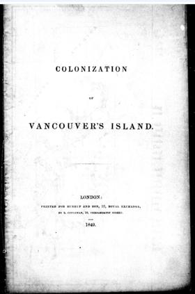
"Written to encourage emigrants to obtain land from the Hudson's Bay Company for settlement, the work outlines conditions of land purchase and quotes published sources as to the suitability of Vancouver Island for colonization." -- Lowther, B. J., & Laing, M. (1968). A bibliography of British Columbia: Laying the foundations, 1849-1899. Victoria, BC: University of Victoria, p. 2. 28 pages map 22 cm ONLINE Circulation [ 1 ]
|
1849 |
Four years after Lewis and Clark stimulated American interest in the far western reaches of the continent, John Jacob Astor, a New York businessman, dispatched an overland expedition to establish a fur-trading post on the Columbia River. A second group traveled by sea aboard the Tonquin, among them Alexander Ross, a clerk in Astor's Pacific Fur Company. Adventures of the First Settlers is a vivid account of the expedition and its struggles to establish a successful trading venture. Ross details the Tonquin's dangerous voyage and documents the Astorians' painstaking struggles to clear the land and build a new trading post. Their settlement, Astoria, became the first American outpost on the Pacific Slope. Although the Astorians were aggressive in expanding their presence in the Columbia River country, their enterprise was short-lived. Ross chronicles their competition with the rival North West Company for furs and empire, the colorful and hazardous exploits of the fur trappers, and the eventual transfer of Astoria to the north West Company in the midst of the War of 1812. His detailed descriptions of the Columbia River Indians reveal Ross to be an astute and informed observer. In a new introduction to a book he calls "one of the charter literary documents for the Pacific Northwest," historian William Robbins considers the relationship between exploration, commerce, and empire in the Astorians' experience. An appendix containing a Chinook vocabulary and a table of weather conditions at Astoria in 1811. xv, 352 pages, 1 unnumbered folded leaf of plates + 16 pages advertisements : 1 map ; 19 cm ONLINE Circulation [ 1 ]
|
1849 |
|
A narrative of events and difficulties in the colonization of Oregon, and the settlement of California by Hall J Kelley 
Published as a bitter retrospective by early American expansionist Hall J. Kelley, this narrative details his obsessive, decades-long crusade to promote the American colonization of the Oregon Country during the 1820s and 1830s. The text chronicles his arduous journey to the Pacific Northwest, his near-fatal experiences in California, and his intense clashes with the British Hudson's Bay Company, whom he accused of actively thwarting his utopian settlement plans. Throughout the volume, Kelley airs his profound grievances against both the British monopoly and the United States government, demanding recognition and financial compensation for his role in sparking the mass migration that eventually secured the territory. A keen insight drawn from the text regarding Oregon is how Kelley's fanaticism highlights the paradoxical nature of early frontier boosterism; while his relentless printed propaganda successfully catalyzed the "Oregon Fever" that ultimately flooded the Willamette Valley with American pioneers, his own lack of pragmatic leadership and profound paranoia rendered him a tragic, marginalized figure in the very colonization movement he helped create. 92 pages ONLINE Circulation [ 1 ]
|
1852 |
|
Adventures in Seattle in 1851-53 by Katharine Berry Judson
Katharine Berry Judson’s brief archival manuscript, Adventures in Seattle in 1851-53, offers a distilled, localized account of the initial Euro-American encampments along the densely forested shores of Elliott Bay. The text outlines how the foundational pioneer enterprise—most notably the Denny Party's relocation from Alki Point and the establishment of Henry Yesler’s steam sawmill—was mapped directly onto the established coastal maritime routes and winter villages long utilized by the Duwamish and Suquamish peoples. Judson captures the profound physical and logistical vulnerability of these early territorial claims, demonstrating how the isolated settlers relied entirely on deep community bonds, intense cooperative labor, and interdependent alliances with local indigenous leaders to survive their precarious first winters. Ultimately, this concise historical snapshot illustrates the rapid superimposition of frontier timber infrastructure onto an ancient indigenous geography, catalyzing Seattle's emergence as the primary civic anchor of the Puget Sound region. 6 leaves ; 28 cm Desiderata
|
1853 |
|
Narrative of a Voyage to the Northwest Coast of America in the Years 1811, 1812, 1813, and 1814 The First American Settlement on the Pacific by Gabriel Franchère, translated by J.V. Huntington
The author, a Canadian, was one of the party sent out by John Jacob Astor to establish his colony at Astoria and he describes the voyage up the Columbia 376 pages, 4 unnumbered leaves of plates + 8 unnumbered pages of publisher's advertisements : frontispiece, illustrations (plates) ; 19 cm ONLINE Circulation [ 1 ]
|
1854 |
|
The fur hunters of the far West a narrative of adventures in the Oregon and Rocky Mountains by Alexander Ross 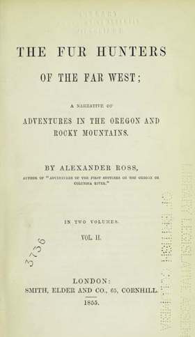
Alexander Ross’s 1855 narrative, The Fur Hunters of the Far West, provides an indispensable firsthand account of inland fur trade logistics, corporate maneuvers, and territorial diplomacy across the Columbia River basin and the northern Rocky Mountains. Chronicling his service with the North West Company and subsequently the Hudson’s Bay Company, Ross details the establishment and operation of key interior outposts—most notably Fort Nez Percés (Walla Walla), Fort Okanagan, and Spokane House—which were systematically constructed at strategic river confluences, traditional salmon fisheries, and seasonal gathering grounds long stewarded by the Cayuse, Walla Walla, Nez Perce, Spokane, and Syilx (Okanagan) peoples. The text illuminates the profound operational vulnerability of interior fur brigades, showing how overland transport and the grueling Snake River trapping expeditions were utterly dependent on negotiated interdependent alliances with regional Plateau and equestrian nations to secure vital pack horse herds, seasonal dried provisions, and navigational guides. Ross’s granular documentation of river rapids, overland trail corridors, and volatile trade councils exposes the fragile mechanics of early corporate resource extraction, illustrating how the fur companies were forced to superimpose their inland supply networks directly onto an established, deeply defended Indigenous geography. 1 online resource (2 volumes) : map, portrait ONLINE Circulation [ 1 ]
|
1855 |
|
The Northwest coast, or, Three years' residence in Washington Territory by James Gilchrist Swan
Published in 1857, James Gilchrist Swan's The Northwest Coast provides a vivid, firsthand account of early pioneer life and indigenous culture during his three-year residence around Shoalwater Bay in the Washington Territory. The narrative details the grueling yet lucrative early oyster trade that connected the isolated coastal settlements to San Francisco, while simultaneously offering meticulous records of the daily customs, language, and social structures of the local Chinook and Chehalis tribes. A keen insight drawn from the text is how Swan's approach profoundly contrasted with the era's prevailing settler hostility; rather than viewing Indigenous peoples merely as obstacles to Manifest Destiny, he actively integrated into their communities and learned the Chinook Jargon, rendering his account an exceptionally rare and empathetic ethnographic record of pre-reservation coastal life. Ultimately, the book stands as an indispensable primary source that captures the complex, interdependent, and multicultural reality of the Pacific Northwest frontier before large-scale American colonization fundamentally altered the region. xxiii, 435 pages : illustrations ; 21 cm ONLINE Circulation [ 1 ]
|
1857 |
|
The new El Dorado, or, British Columbia by Kinahan Cornwallis, Great Britain Colonial Office Library (Former owner)
A glowing description of British Columbia and its settlement possibilities, written by an Englishman who arrived in Victoria from San Francisco in June 1858 to prospect for Fraser River gold xxviii, 405 pages, 2 unnumbered leaves of plates (1 folded) : illustrations, map ; 20 cm ONLINE Circulation [ 2 ]
|
1858 |
|
The natural history of Washington Territory and Oregon with much relating to Minnesota, Nebraska, Kansas, Utah, and California between the thirty-sixth and forty-ninth parallels of latitude by George Suckley, J. G. Cooper, United States War Department 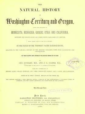
The final reports on the survey of the Northern Pacific Railroad route, relating to the natural history of the regions explored, with full catalogues and descriptions of the plants and animals collected from 1853 to 1860 xvii, 72, 399 pages, 58 unnumbered leaves of plates : illustrations (some color) ; 31 cm ONLINE Circulation [ 1 ]
|
1860 |
|
A glance at British Columbia and Vancouver's Island in 1861 by Alfred J. Langley
Published in London in 1862, Alfred J. Langley’s pamphlet A Glance at British Columbia and Vancouver's Island in 1861 serves as a classic piece of colonial booster literature explicitly designed to attract British emigrants and investment to the Pacific Northwest. The text outlines the region's physical geography, favorable climate, and abundant natural resources, with a particular emphasis on the explosive wealth generated by the Cariboo Gold Rush and the availability of agricultural land. It captures a pivotal moment of transition as the British administration actively sought to shift the region away from the monopolistic fur-trade economy of the Hudson's Bay Company toward a permanent, settler-driven society. A keen insight drawn from the publication is how Langley’s promotional rhetoric conceptually maps the rugged frontier strictly through the lens of capitalist extraction, systematically minimizing the existing Indigenous presence in order to aggressively market the region as an "empty" wilderness ripe for immediate white settlement and industrial exploitation. 44 pages ; 19 cm ONLINE Circulation [ 1 ]
|
1862 |
|
Grammar and dictionary of the Yakama language by Charles Marie Pandosy, John Gilmary Shea, George Gibbs
Published in 1862, Grammar and Dictionary of the Yakama Language originated from the field notes of Catholic Oblate missionary Charles Marie Pandosy, whose French manuscript was subsequently translated and edited by federal ethnologist George Gibbs and historian John Gilmary Shea. The volume stands as the first formal linguistic documentation of the Sahaptin language spoken by the Yakama people of eastern Washington, detailing its intricate grammatical syntax alongside a comprehensive bilingual lexicon. A keen insight drawn from the publication is how the collaboration between a proselytizing missionary and a government ethnologist illustrates the profound entanglement of religion and colonial statecraft, demonstrating how linguistic reference materials originally designed to facilitate spiritual assimilation were systematically repurposed by officials like Gibbs to execute federal treaty negotiations and accelerate indigenous displacement. 59 pages ; 26 cm. ONLINE Circulation [ 1 ]
|
1862 |
|
Four years in British Columbia and Vancouver Island an account of their forests, rivers, coasts, gold fields and resources for colonisation by Richard C. Mayne, John Murray (Firm) (Publisher), William Clowes and Sons (Printer), Northern Pacific Railroad Company (Former owner), Northern Transcontinental Survey (Associated name) 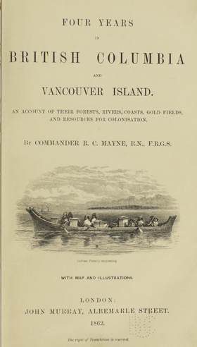
Published in 1862, Royal Navy Commander Richard C. Mayne’s Four Years in British Columbia and Vancouver Island provides a detailed firsthand account of the region's geography, indigenous populations, and natural resources during the height of the Fraser River Gold Rush. Based on his extensive coastal and inland surveying expeditions aboard the HMS Plumper and Hecate, the narrative captures the rapid transformation of the territory from a remote fur-trade outpost into an actively managed British colony. A keen insight drawn from the text is how Mayne's meticulous cartographic and resource-focused observations demonstrate the Royal Navy's crucial role as agents of colonial statecraft, systematically converting a rugged, Indigenous-inhabited landscape into a legible, commodified space designed specifically for imperial investment. Furthermore, the volume's historical provenance as property of the Northern Pacific Railroad Company perfectly illustrates how these early military surveys ultimately functioned as direct strategic blueprints for subsequent corporate and infrastructural expansion across the Pacific Northwest. xi, 468 pages, 20 unnumbered pages of plates + 32 pages publisher's ads : illustrations, maps (1 folded) ; 23 cm ONLINE Circulation [ 1 ]
|
1862 |
|
Vancouver Island and British Columbia their history, resources and prospects by Matthew Macfie
Published in London in 1865 after the author's five-year residency in Victoria, Matthew Macfie’s Vancouver Island and British Columbia offers a comprehensive geographical, historical, and economic assessment of the twin Pacific colonies during the transformative Cariboo Gold Rush. A keen insight drawn from the text is how Macfie strategically weaponizes his critique of the monopolistic Hudson's Bay Company, arguing that true imperial prosperity and a robust defense against American expansionism required both the immediate political union of the two colonies and the construction of a transcontinental railway. Functioning as sophisticated promotional literature for prospective British emigrants, the volume meticulously catalogs the region's agricultural, mining, and timber potential while actively minimizing the complex realities of the existing Indigenous and growing Chinese populations. Consequently, the book stands as a quintessential artifact of Victorian colonial boosterism that accurately forecasted the infrastructural and political integration that would ultimately define western Canada. xxi, 574 pages, 2 unnumbered pages, 3 leaves of plates (2 folded) : illustrations, frontispiece, 2 color maps ; 23 cm ONLINE Circulation [ 1 ]
|
1865 |
|
|
1865 |
|
Pacific coast. Coast pilot of California, Oregon, and Washington Territory by United States Coast Survey, George Davidson
Published in 1869 by the United States Coast Survey under the direction of George Davidson, this exhaustive maritime manual provided the first rigorous, scientific hydrographic documentation of the American Pacific seaboard. The guide meticulously details the treacherous coastal geography, hazardous river bars, and nascent lighthouse infrastructure of Oregon and Washington, offering critical navigational instructions for surviving the notoriously deadly Columbia River entrance. A keen insight drawn from the text is how Davidson's exhaustive scientific cartography functioned as essential state-building infrastructure; by mathematically mapping and demystifying the hazardous "Graveyard of the Pacific," the survey directly catalyzed the Pacific Northwest's economic integration into the broader global maritime trade network. 262 pages plates 27 cm ONLINE Circulation [ 1 ]
|
1869 |
|
A history of the San Juan water boundary question, as affecting the division of territory between Great Britain and the United States by William Fitzwilliam Milton 
Published in 1869, Viscount William Fitzwilliam Milton’s treatise provides a detailed, staunchly British perspective on the diplomatic stalemate over the San Juan archipelago, a territorial dispute famously ignited by the 1859 "Pig War." The text meticulously dissects the geographic and legal ambiguities of the 1846 Oregon Treaty, which vaguely established the international water boundary through the "middle of the channel" separating Vancouver Island from the mainland. Milton forcefully argues that the boundary must follow the Rosario Strait rather than the Haro Strait, a cartographic interpretation that would have permanently placed San Juan, Lopez, and Orcas islands under the British Crown. A keen insight drawn from the volume is how Milton's exhaustive legal arguments inadvertently reveal the profound anxieties driving British imperial strategy in the Pacific Northwest. By framing the retention of the archipelago not merely as a matter of territorial pride but as an absolute naval necessity to protect the sea lanes to Victoria, the book illustrates how these local island channels and ferry routes briefly became the high-stakes geopolitical linchpin for controlling the entire Puget Sound. 446 pages : 2 folded maps ; 23 cm ONLINE Circulation [ 1 ]
|
1869 |
|
A history of Oregon, 1792-1849 : drawn from personal observation and authentic information by William Henry Gray
This work grew out of a series of articles published in the Astoria Marine Gazette, 1865-1866, ref. Pref. "Mr. Gray, a missionary, reached Oregon in 1838. His history has been mercilessly criticized by Hubert Howe Bancroft [no.25] who declares that it would take a work equally as large to correct the mistakes in it" Published in 1870, William Henry Gray’s A History of Oregon, 1792-1849 provides a highly subjective, firsthand account of the territory's early pioneer era, the establishment of Protestant missions, and the contentious formation of the 1843 Provisional Government. Drawing upon his own experiences as a member of the 1836 Whitman missionary party, Gray chronicles the region's development while aggressively championing the American Protestant settlers as the sole heroic founders of the state. A keen insight drawn from the text is how its notorious lack of objectivity transforms the book from a reliable historical record into a fascinating psychological artifact of frontier sectarian paranoia. By conspiratorially blaming the British Hudson’s Bay Company and Catholic missionaries for instigating the tragic 1847 Whitman Massacre, Gray's narrative vividly exposes the intense, deeply ingrained religious and nationalist hostilities that fundamentally shaped early American colonization efforts in the Pacific Northwest. pages 624. frontispiece 8vo ONLINE Circulation [ 1 ]
|
1870 |
|
Washington territory west of the Cascade mountains by Ezra Meeker 
Ezra Meeker’s Washington territory west of the Cascade mountains explores the active pioneer settlement, agricultural development, and collaborative community building within the dense, maritime landscapes of the Puget Sound basin. The narrative illustrates how the profound environmental realities of this coastal topography—defined by towering, rain-swept timberlands, fertile but heavily forested river valleys, and the intricate, navigable waterways of the Salish Sea—required immense physical resilience and shared daily adaptation from early homesteaders. By detailing the gradual transition from the grueling communal labor of clearing old-growth forests to the cooperative establishment of thriving agricultural enterprises and vital maritime trade networks, the text highlights how the region's early prosperity relied heavily on community-driven responses to its immense natural abundance. Ultimately, the account demonstrates that patiently cultivating the rich valley soils and cooperatively harnessing the region's vast timber and maritime resources were essential steps in transforming a dense, isolated frontier into a highly connected, culturally enduring civic heartland of the Pacific Northwest. Containing a description of Puget Sound, and rivers emptying into it, the Lower Columbia, Shoalwater Bay, Gray's Harbor, Timber, Lands, Climate, Fisheries, Ship Building, Coal Mines, Market Reports, Trade, Labor, Poupluation, Wealth and Resources. 52 pages : tables ; 21 cm ONLINE Circulation [ 1 ]
|
1870 |
|
A dictionary of the Chinook jargon, or Indian trade language, of the north Pacific Coast by George Gibbs
Published in 1863 by the Smithsonian Institution, George Gibbs’s A Dictionary of the Chinook Jargon serves as a foundational linguistic catalog of the widespread pidgin used for commerce and communication between Indigenous tribes and European settlers across the Pacific Northwest. The text systematically standardizes the vocabulary of this highly adaptable contact language, meticulously tracing the etymological roots of its words back to their original Nuu-chah-nulth, lower Chinookan, French, and English sources. A keen insight drawn from the publication is how Gibbs’s rigorous codification of the Jargon was not merely a disinterested scholarly exercise, but a highly utilitarian tool designed to serve the federal government's expansionist agenda. By formalizing a fluid trade pidgin into a standardized, legible dictionary, Gibbs provided federal agents and treaty commissioners with the exact linguistic infrastructure required to efficiently negotiate the sweeping land cessions that systematically dispossessed the region's Indigenous populations 29 pages 21 cm ONLINE Circulation [ 1 ]
|
1871 |
|
History of the Provisional Government of Oregon by J. Quinn Thorton
Written by former Provisional Supreme Judge J. Quinn Thornton, this historical account chronicles the 1843 establishment of Oregon's Provisional Government at Champoeg and its subsequent legislative evolution. The narrative details the transition of the Willamette Valley from a loosely governed frontier outpost into an organized American political entity, emphasizing the drafting of its organic laws and the urgent lobbying for official U.S. territorial recognition. A keen insight drawn from the text is how Thornton’s intense personal vanity and staunchly anti-British prejudices transform this administrative history into a highly subjective, partisan autobiography. By actively framing himself as the indispensable architect of the 1848 Territorial Act and the primary crusader responsible for explicitly banning slavery in the region, Thornton weaponizes the historical record to settle old political vendettas and artificially inflate his own legacy in Pacific Northwest statecraft. 54 p. ONLINE Circulation [ 1 ]
|
1873 |
|
Reisebilder und Skizzen aus Amerika by Theodor Kirchhoff 
Published in 1875, Theodor Kirchhoff's Reisebilder und Skizzen aus Amerika offers a rich, descriptive travelogue of the American West as observed by a German immigrant, poet, and former Pacific Northwest shopkeeper. The narrative vividly captures the rapid economic and infrastructural transformation of the frontier, documenting early transit oddities like the primitive Walla Walla and Columbia River Railroad alongside the bustling, chaotic atmosphere of regional gold rush boomtowns like The Dalles. A keen insight drawn from the text is how Kirchhoff's position as a European intellectual provides a refreshing outsider's perspective on American expansion; unburdened by the nationalistic mythology of Manifest Destiny, he documents the eccentricities, raw commercialism, and unvarnished realities of the Pacific Northwest with a critical, cosmopolitan detachment often completely absent from domestic colonial boosterism. 2 volumes 19 cm ONLINE Circulation [ 2 ]
|
1875 |
|
Fusang The discovery of America by Chinese Buddhist priests in the fifth century by Charles G. Leland
This book, first published in 1875 and reissued in 1973, analyses the limited evidence from the works of early Chinese historians that explorers from China had discovered a country they called Fusang – possibly western America, and in all probability Mexico. The original document on which Chinese historians based their accounts of Fusang was the report of a Buddhist monk called Hoei-shin, who, in the year 499 AD, returned from a long journey to the east. xix, 212 pages ONLINE Circulation [ 1 ]
|
1875 |
|
Oregon there and back in 1877 by Wallis Nash 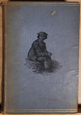
Nash, a prominent London attorney, came to Oregon in 1877 to investigate possibilities for railroad building and land development. When he returned to England, he wrote this book, here reprinted with a foreword and notes. Wallis Nash, a native of England, was a Benton County lawyer and entrepreneur. He was on the initial Board of Regents for Oregon Agricultural College (now Oregon State University). xviii pages, 2 leaves, 285 pages including frontispiece, illustrations, plates, double map 20 cm Desiderata
|
1878 |
|
Historic sketches of Walla Walla, Whitman, Columbia and Garfield counties, Washington Territory, and Umatilla County, Oregon by Frank T. Gilbert 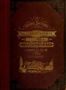
Published in 1882, Frank T. Gilbert's expansive regional history chronicles the rapid transformation of the Inland Empire—spanning eastern Washington and northeastern Oregon—from indigenous territory and fur-trade outposts to an agrarian powerhouse. The narrative meticulously details the violent conflicts of the Cayuse and Yakima Indian Wars, the establishment of early pioneer settlements, and the subsequent explosion of the region's lucrative dry-land wheat economy. A keen insight drawn from the text is how it perfectly exemplifies the Gilded Age "subscription history" model, where the grand, often brutal narrative of westward conquest was explicitly monetized by pairing regional chronicles with flattering biographical portraits of the affluent farmers and merchants who financed the publication. Consequently, while the volume remains an indispensable civic and genealogical archive, its historical framing intentionally sanitizes the systematic displacement of Native American tribes to celebrate the inevitable triumph of white, capitalist agriculture in the Columbia Basin. 447, [2], [449]-488, [12], 66 pages, [63] leaves of plates : illustrations, portraits ; 31 cm ONLINE Circulation [ 1 ]
|
1882 |
|
Two years in Oregon by Wallis Nash 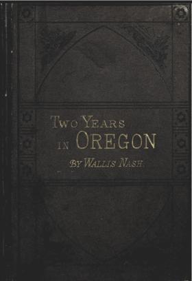
‘The evening is closing in; the sun has set, leaving a hot, red glow, where his copper disk has just sunk beyond the Pacific horizon; and the eye wanders out from the infant waves, at foot just tinged with red, and reflecting the light as they move up in turn to catch it, to the blue and still darker blue water beyond, out to the sharp indigo line where sky and water meet.' And so Wallis Nash concludes his brief passage on his brief expedition to hack off rock oysters, along the coast toward the Yaquina Head lighthouse. For anyone interested in the early history of Oregon, Wallis Nash's Two Years in Oregon is a mine of information. In an easy and highly readable narrative, Nash provides extensive detail on society, farming, hunting, fishing and community life. He wrote the book in 1882 after his first two years of residence whilst the initial impressions were still sharp in his mind. [2], 311 pages, 8 unnumbered leaves of plates + 9 pages press notes : frontispiece, illustrations (plates) ; 20 cm ONLINE Circulation [ 1 ]
|
1882 |