Catalog of British Columbiana and Pacific Northwest Americana
Encyclopedia Cascadia Catalog contains book titles of mostly non-fiction Pacific Northwest Coast of North America Titles (primarially British Columbia, Idaho, Oregon and Washington State) in an easy-to-understand title catalog. If you see a link with this badge ONLINE CIRC it means that there is an online institution that provides free access to that title. In some cases there may be more than one institution hosting the title digitally.
| Catalog Title | Published |
|---|---|
|
Blakely Island in time by JoAnn Roe 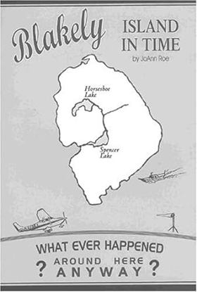
Blakely Island is typical of many other islands in the San Juans and adjacent Gulf Islands of Canada. What is fascinating is that pioneers found them in their isolated maritime settings, made homes and schools, and developed a living for families. In the late 20th century, several of the islands such as Blakely have become sites for vacation homes, as well. The author tells a lively tale of the people, both pioneers and modern dwellers, who have dealt with the problems inherent in island life, especialy an island accessed only by air or sea. Read about the Spencer Mill, winter storms, humorous interactions with animals, pranks, early air services, and environmental and political issues--P. [4] of cover v, 151 pages : illustrations ; 23 cm CIRC [ 1 ]
|
2005 |
|
A journey with E.J. Hughes one collector's odyssey by Jacques Barbeau, E. J. Hughes, Ian M. Thom 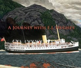
From the moment Jacques Barbeau fell in love with his first E.J. Hughes painting in 1958, he never waivered in his certainty that Hughes would one day become an iconic figure on the Canadian art scene. Barbeau's voice, however, was in the minority and for many years he was one of only a handful of adventuresome collectors who sought out the artist's works. Eventually, the marketplace validated Barbeau's opinion and when Fishboats, Rivers Inlet (1946, oil on canvas) sold at auction for $920,000 in 2004, it served to solidify Hughes' place amongst the great artists of his time. Through the centuries, the passionate collector has always been central to the emergence of important artists. A Journey with E.J. Hughes provides an insightful look into the world of the collector, the artist and where their realms intersect. This very human story of art as master sheds important new light on Hughes and his work. Publisher's note xi, 180 pages : illustrations (some color) ; 24 x 28 cm CIRC [ 1 ]
|
2005 |
|
British Columbia land of promises by Patricia Roy, John Herd Thompson 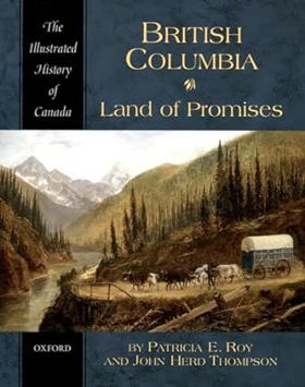
"For more than two centuries, people from around the world have been irresistibly drawn to British Columbia. Some have sought to make their fortunes in furs, or gold, or lumber, some have dreamt of establishing utopian communities, many others have hoped simply to find a steady job, or a piece of land to farm and raise a family on. At times BC has lived up to the most extravagant expectations. But at times it has not, and in either case the costs have often been high, especially for the region's First Nations. In British Columbia: Land of Promises Patricia E. Roy and John Herd Thompson trace the social, economic, and political history of the province through a lively narrative and a wealth of carefully annotated illustrations, including maps, paintings, photographs, and cartoons."--Jacket 216 pages, 10 unnumbered pages of plates : illustrations (some color), maps (some color), portraits (some color) ; 24 cm CIRC [ 1 ]
|
2005 |
|
Lewis and Clark down and up the Columbia River a unique fold-out guide, mapping day-by-day Lewis and Clark's journey from the Rocky Mountains to the Pacific Ocean-- and back by Rex Ziak (Cartographer) 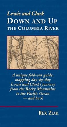
Published in 2005 by cartographer and historian Rex Ziak, Lewis and Clark Down and Up the Columbia River is an innovative, double-sided fold-out guide that meticulously maps the Corps of Discovery's day-by-day journey from the Rocky Mountains to the Pacific Ocean and back. The unique format functions as both a portable pocket book and a sprawling seven-foot map, charting every single campsite and chronicling the dual phases of the voyage using precise historical journal excerpts. By allowing readers to trace the westbound expedition on one side and flip it to follow the eastbound return, the guide transforms historical cartography into an interactive landscape experience. A keen insight drawn from the work is how spatial format alters historical comprehension; by physically separating the outward struggle against the current from the swift return journey on a continuous timeline, the map highlights the profound geographical and psychological shifts the explorers experienced upon reaching the tidal mouth of the Columbia 1 volume (folded map) : color maps ; 19 cm CIRC [ 1 ]
|
2005 |
This book explains the missing month of Lewis and Clark history that occurred when they reached the Pacific Ocean and has completely redefined the expedition's history. Ziak's research - detailed in this book - resulted in the creation of United States newest national park -the Lewis and Clark National Park located in Oregon and Washington states. xviii, 219 pages : color illustrations, color maps ; 26 cm CIRC [ 1 ]
|
2005 |
|
The mapmaker's eye David Thompson on the Columbia Plateau by Jack Nisbet 
"David Thompson is a hero in Canada, yet has remained largely unknown in the United States. Between 1801 and 1812, this fur trader, explorer, and cartographer established two viable trade routes across the Rocky Mountains in Canada and systematically surveyed the entire 1,250-mile course of the Columbia River. In succeeding years he distilled his mathematical notations from dozens of journal notebooks into the first accurate maps of the northwest quadrant of North America. Information from some of his earlier mapwork was even used by the Lewis and Clark Expedition." xii, 180 pages : illustrations (some color), facsimiles, maps (some color), portraits ; 27 cm CIRC [ 1 ]
|
2005 |
|
Pendleton a short history of a real western town by Keith F. May, Christina Rae May 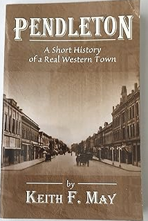
Published by Keith F. May and Christina Rae May, Pendleton: A Short History of a Real Western Town explores the dynamic evolution of this iconic Oregon community from its origins as a frontier trading post into a bustling agricultural and cultural hub. The book chronicles the town's rich heritage, highlighting the impact of the Oregon Trail, the arrival of the railroad, and the establishment of its famous woolen mills and annual Round-Up celebration. Through local anecdotes and historical highlights, the authors capture the rugged spirit and enduring character that distinguish Pendleton from standard suburban settlements. A keen insight drawn from the text is how communities like Pendleton leverage theatrical traditions like the rodeo not just for entertainment, but as vital cultural anchors that allow a changing rural economy to publicly perform and preserve its foundational mythos. 124 pages : illustrations, maps, portrait ; 22 cm CIRC [ 1 ]
|
2005 |
|
Pioneer Square Seattle's oldest neighborhood by Mildred Tanner Andrews , Leonard Garfield (Writer of introduction), Karin Murr Link (Contributor), Marc K. Blackburn (Contributor), Dana Cox (Contributor) 
Presents the history of Pioneer Square, weaving together first-person accounts, photographs, and varied cultural perspectives to shed light on the birthplace of modern Seattle. This book reveals that Pioneer Square has always been a barometer of Seattle's health and an incubator for trends that characterize the city today. xvi, 235 pages : illustrations, maps ; 26 cm CIRC [ 1 ]
|
2005 |
|
Moving Washington timeline the first century of the Washington State Department of Transportation, 1905-2005 by Walt Crowley, Kit Oldham , HistoryLink (Firm) (Publisher), Washington (State). Department of Transportation 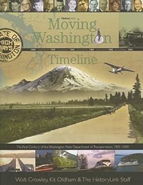
"This book retraces how the leaders and employees of the Washington State Department of Transportation and their predecessors helped to shape Washington's transportation system during a century of technological revolution and dramatic transformation of its communities and landscapes." "Moving Washington Timeline was prepared for the Washington State Department of Transportation with the support of private donors and a Federal Highway Administration grant to commemorate the creation of the 127, [1] pages : illustrations (some color), maps (some color), portraits (some color) ; 22 cm CIRC [ 1 ]
|
2005 |
|
The Wenatchee Valley and its first peoples thrilling grandeur, unfulfilled promise by Richard D. Scheuerman, John Clement, Clifford E. Trafzer, Wenatchee Valley Museum and Cultural Center 
Published by the Wenatchee Valley Museum and Cultural Center, The Wenatchee Valley and its First Peoples: Thrilling Grandeur, Unfulfilled Promise by Richard D. Scheuerman, John Clement, and Clifford E. Trafzer examines the complex cultural history of Washington's mid-Columbia region. The book juxtaposes the awe-inspiring geography of the high-desert river valley with the tragic history of displacement experienced by its original indigenous inhabitants, particularly the Wenatchi people. Through historical accounts, archival photographs, and cultural analysis, the authors trace how rapid Euro-American settlement and irrigation projects transformed the landscape while frequently breaking solemn treaties. A keen insight drawn from the text is how the subtitle's reference to "unfulfilled promise" operates as a poignant critique of manifest destiny; it highlights how the modern agricultural bounty of the Wenatchee apple capital was built directly upon the unfulfilled legal and moral guarantees made to the valley's original stewards. xxii, 145 pages : color illustrations, map, portraits ; 23 x 29 cm CIRC [ 1 ]
|
2005 |
|
The world of the Kalapuya a native people of western Oregon by Judy Rycraft Juntunen, May D. Dasch, Ann Bennett Rogers, Benton County Historical Society and Museum (Or) 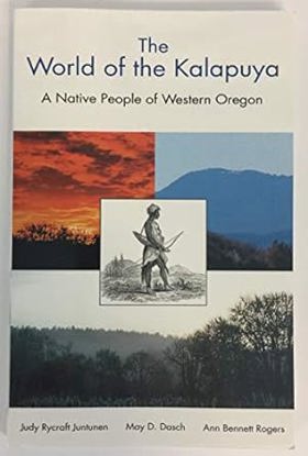
Published by the Benton County Historical Society and Museum, The World of the Kalapuya: A Native People of Western Oregon explores the rich history, culture, and lifeways of the indigenous inhabitants of the Willamette Valley prior to and following Euro-American settlement. Drawing on archaeological evidence, ethnohistorical records, and oral traditions, the authors detail the Kalapuya’s sophisticated land management practices—such as controlled burning to maintain open oak savannas—and their deep spiritual connection to the valley's seasonal rhythms. The volume highlights how the introduction of disease and forced displacement by pioneers devastatingly fractured a culture that had thrived in the region for millennia. A keen insight drawn from the text is how the Kalapuya's deliberate, centuries-old use of fire challenges the modern myth of the Pacific Northwest as a pristine, untouched wilderness; it reveals that the lush prairies encountered by early pioneers were actually meticulously cultivated cultural landscapes shaped by indigenous stewardship. 128 pages : illustrations, map ; 22 cm CIRC [ 1 ]
|
2005 |
|
Oregon this storied land by William G. Robbins 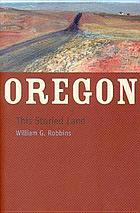
Oregon is a landscape of brilliant waterfalls, towering volcanoes, productive river valleys, and far-reaching high deserts. It is also a land of stories. People have lived on the Oregon landscape for at least twelve thousand years, and during that time they have established communities, built railroads, harvested fish and timber, and made laws that both protected and threatened the land. Oregon, This Storied Land tells many of those stories, giving us a broad, sweeping history of a state that has resisted being made into a stereotype xviii, 219 pages : illustrations, maps ; 23 cm CIRC [ 0 ]
|
2005 |
|
Place matters geospatial tools for marine science, conservation, and management in the Pacific Northwest by Dawn J. Wright, Astrid J. Scholz 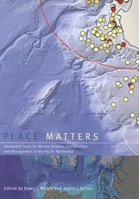
Although the ocean provides living space for about 97% of life on Earth, less than 5% of the ocean below the surface has actually been seen, let alone explored. Now, using the geographic information system (GIS), marine scientists are gaining new insights into a once-mysterious world. A technologically sophisticated information-management and analysis system, GIS holds tremendous potential for mapping, interpreting, and managing ocean environments- from the seafloor to the shoreline. Place Matters explores how marine GIS is contributing to the understanding, management, and conservation of the shores and ocean of the Pacific Northwest, where scientists, resource managers, and conservationists- often in collaboration- are making advances in the way that data are collected, documented, used, shared, and saved. The contributors to Place Matters show how together they are using GIS to handle and exploit present and future data streams from observatories, experiments, numerical models, simulations, and other sources, yielding fresh insights into oceanographic, ecological, and socioeconomic conditions of the marine environment. The book includes a conceptual framework that lays out selected methods and models for conservation-based marine GIS, working examples of marine GIS tools and large-scale implementations, and a section on the use of GIS by environmental advocacy and local citizens' organizations. A companion website includes GIS maps and databases, as well as extensive Web-based resources. With its unique focus on the use of GIS to solve marine conservation problems, Place Matters offers an important new resource for all who study and work to protect the world's oceans. xii, 305 pages : maps (some color) ; 26 cm CIRC [ 0 ]
|
2005 |
|
The sandal & the cave the Indians of Oregon by Luther S. Cressman 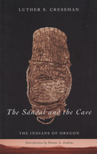
Luther Cressman's 1938 discovery of a 9,000-year-old sandal in Fort Rock Cave revolutionized accepted theories of western prehistory. The recovery of the woven sagebrush-bark sandal, found buried under a layer of volcanic ash from the eruption of Mount Mazama, established a human presence in the Oregon Country much earlier than previously thought. Through six decades of scientific investigation, Cressman worked to uncover the history of the first Oregonians. In The Sandal and the Cave, he offers a brief, lucid introduction to the prehistory of Oregon Indians. Cressman describes their diverse cultures, highlighting similarities and differences between the peoples of various regions: the Oregon Coast, the Klamath Highland, the Northern Great Basin, and the Columbia Plateau. In a new introduction to Cressman's classic work, Dennis Jenkins provides a short biographical profile of the "father of Oregon archaeology" and discusses the importance of Cressman's excavation results and interpretations. Jenkins also offers a concise summary of recent archaeological research in the Northern Great Basin, bringing readers the most up-to-date information about the oldest known sites in Oregon. About the author: Luther S. Cressman (1897-1994) joined the University of Oregon faculty in 1929 and, in addition to his pioneering work as a field archaeologist, was instrumental in establishing the Department of Anthropology and the UO Museum of Natural History. His other books are Prehistory of the Far West: Homes of Vanished Peoples and A Golden Journey: Memoirs of an Archaeologist. xxxiii, 142 pages : illustrations, maps ; 22 cm. CIRC [ 0 ]
|
2005 |
|
Good wood growth, loss, and renewal by Steven R. Radosevich 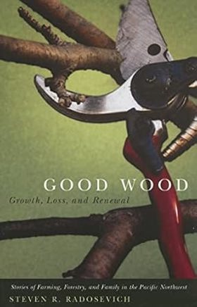
Good Wood is a clear-eyed, finely hewed collection of personal essays on farming, forestry, and family in the Pacific Northwest. As a young man, Steve Radosevich learned to prune trees by watching his grandfather. Working in the apple orchards of the struggling family farm, he saw that "every cut was a decision, conscious and deliberate, about the health of the trees and their coming crops." In Good Wood, Radosevich examines the choices we make in life and how those choices affect the health of people and places. Radosevich draws on his experiences on two farms-the "homeplace," a family farm in Washington's Yakima Valley, and Kla-kla-nee, his small vineyard in Oregon's Willamette Valley. Radosevich is also a professor of forestry, and his commitment to sustainable forestry informs his writings. His book seamlessly combines recollections of tending smudge pots on freezing spring nights east of the Cascades with discussions about the flooding of Native fishing grounds at Celilo Falls and clearcuts in the Oregon Coast Range. "All these losses," writes Radosevich, "have been decisions too, made consciously I think, but with less deliberation than the forethought of a farmer pruning his orchard." As keeper of the old family orchard and tender of a new family farm, Radosevich reveals in these stories his deliberate choices and his hopes for the world of his children and grandchildren. xii, 136 pages ; 22 cm CIRC [ 0 ]
|
2005 |
|
Jumptown the golden years of Portland jazz, 1942-1957 by Robert Dietsche 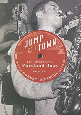
A fascinating blend of music, politics, and social history, Jumptown sheds light on a time and place overlooked by histories of Portland and jazz. For a golden decade following World War II, a thriving African American neighborhood—that would soon be bulldozed for urban renewal—spawned a jazz heyday rarely rivaled on the West Coast. Such luminaries as Duke Ellington, Charlie Parker, Oscar Peterson, Dave Brubeck, and Wardell Gray headlined Portland clubs and traded chops with the up-and-coming local talent. The Dude Ranch. Lil' Sandy's. McClendon's Rhythm Room. The Frat Hall. The Chicken Coop. The Uptown Ballroom. Jazz historian Bob Dietsche leads a guided tour of the main jazz spots—from supper club to dance hall—capturing the emotion, excitement, and energy of an evening on the town. His book for the first time collects hundreds of pieces of local jazz history—photographs, personal recollections, reviews, handbills—to create "an anatomy of a jazz village." Dietsche's compendium of stories and moments brings to life the citizens of this jazz village—the musicians and dancers, the disc jockeys and promoters, the critics and music teachers, the club owners and patrons. Jumptown celebrates and preserves this rich cultural past and showcases its continuing influence. In an afterword, Lynn Darroch recaps the highlights in Portland jazz during the past 40 years and shows how “Portland's 21st century jazz scene reflects the city's original golden age, and the spirit of the Avenue remains in the sounds of today.” xiii, 229 pages : illustrations, 1 map ; 26 cm CIRC [ 0 ]
|
2005 |
|
Becoming citizens family life and the politics of disability by Susan Schwartzenberg 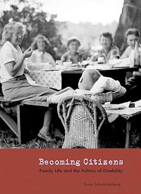
Following the Second World War, a generation of Seattle parents went against conventional medical wisdom and chose to bring up their children with developmental disabilities in the community. This book presents a stunning visual narrative of thirteen of these remarkable families. With a rich array of interviews, photographs, newspaper clippings, official documents, and personal mementos, photographer Susan Schwartzenberg captures moving recollections of the struggle and perseverance of these parents. Becoming Citizens traces their dogged determination to make meaningful lives for their children in the face of an often hostile system. Breaking the silence that characterizes the history of disability in the United States, Becoming Citizens is a substantive contribution to social and regional history. It demonstrates the ways in which personal experiences can galvanize communities for political action. The centerpiece of the book is the story of four mothers-turned-activists who coauthored Education for All, a crucial piece of Washington State legislation that was a precursor to the national law securing educational rights for every person with a disability in America. Becoming Citizens is a deeply compassionate testament to the experience of family life and disability, as it is to the ways in which ordinary citizens become activists. It will be important to anyone interested in disability studies, including teachers, friends, and families of those with disabilities. xix, 113 pages : illustrations (some color) ; 28 cm CIRC [ 0 ]
|
2005 |
|
Bringing Indians to the book by Albert Furtwangler 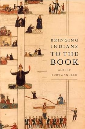
In 1831 a delegation of Northwest Indians reportedly made the arduous journey from the shores of the Pacific to the banks of the Missouri in order to visit the famous explorer William Clark. This delegation came, however, not on civic matters but on a religious quest, hoping, or so the reports ran, to discover the truth about the white men's religion. The story of this meeting inspired a drive to send missionaries to the Northwest. Reading accounts of these souls ripe for conversion, the missionaries expected a warmer welcome than they received, and they recorded their subsequent disappointments and frustrations in their extensive journals, letters, and stories. Bringing Indians to the Book recounts the experiences of these missionaries and of the explorers on the Lewis and Clark Expedition who preceded them. Though they differed greatly in methods and aims, missionaries and explorers shared a crucial underlying cultural characteristic: they were resolutely literate, carrying books not only in their baggage but also in their most commonplace thoughts and habits, and they came west in order to meet, and attempt to change, groups of people who for thousands of years had passed on their memories, learning, and values through words not written, but spoken or sung aloud. It was inevitable that, in this meeting of literate and oral societies, ironies and misunderstandings would abound. A skilled writer with a keen ear for language, Albert Furtwangler traces the ways in which literacy blinded those Euro-American invaders, even as he reminds us that such bookishness is also our own. xii, 226 pages, 8 unnumbered pages of plates : illustrations, map ; 23 cm CIRC [ 0 ]
|
2005 |
|
Vigilante newspapers a tale of sex, religion, and murder in the Northwest by Gerald J. Baldasty 
A powerful and instructive story of how intolerant and sensational newspapers in Corvallis and Seattle encouraged vigilante violence, murder, and lawlessness toward and Oregon religious cult viii, 189 pages : illustrations ; 23 cm CIRC [ 0 ]
|
2005 |
|
Frank Okada the shape of elegance by Kazuko Nakane, Frank S. Okada, Museum of Northwest Art 
"Artist Frank Okada played a significant role in the modern art history of the Pacific Northwest. Born a Nisei in 1931, he was raised in Seattle's International District. Throughout his life he retained its influences and expressed his vivid memories in his art. From his first painting award - received at the Washington State fair - until his death in 2000 at the age of sixty-nine, he worked at the confluence of regional art, Asian culture, and national art movements." "At the beginning of his career, Okada received a series of prominent fellowships - John Hay Whitney in 1957, Fulbright in 1959, and Guggenheim in 1966-67. He was greatly influenced by the artists he met and was a close observer of the art scenes in New York, Paris, and Kyoto in an effort to find his own style of painting and how to be a painter. He began teaching painting at the University of Oregon in 1969, a tenure that lasted thirty years. His work from the seventies, eighties, and nineties balanced forms and colors in intensely worked surfaces. The color blocks gradually became more intellectually structured and his compositions more expressive as he made his colors more powerful. As Nakane notes, without recognizable reference to nature or his own personality, he created a texture that brought light to a field of color. The build-up of color dots underneath and extensive small textural stories across large canvases made progress slow. In order to appreciate his paintings, one needs to spend time observing how the colors respond to the charges of light throughout the day."--Jacket 80 pages : color illustrations ; 23 cm CIRC [ 0 ]
|
2005 |
|
Keeping it living traditions of plant use and cultivation on the Northwest Coast of North America by Douglas Deur, Nancy J. Turner 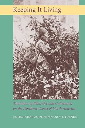
The European explorers who first visited the Northwest Coast of North America assumed that the entire region was virtually untouched wilderness whose occupants used the land only minimally, hunting and gathering shoots, roots, and berries that were peripheral to a diet and culture focused on salmon. Colonizers who followed the explorers used these claims to justify the displacement of Native groups from their lands. Scholars now understand, however, that Northwest Coast peoples were actively cultivating plants well before their first contact with Europeans. This book is the first comprehensive overview of how Northwest Coast Native Americans managed the landscape and cared for the plant communities on which they depended. Bringing together some of the world's most prominent specialists on Northwest Coast cultures, Keeping It Living tells the story of traditional plant cultivation practices found from the Oregon coast to Southeast Alaska. It explores tobacco gardens among the Haida and Tlingit, managed camas plots among the Coast Salish of Puget Sound and the Strait of Georgia, estuarine root gardens along the central coast of British Columbia, wapato maintenance on the Columbia and Fraser Rivers, and tended berry plots up and down the entire coast. With contributions from ethnobotanists, archaeologists, anthropologists, geographers, ecologists, and Native American scholars and elders, Keeping It Living documents practices, many unknown to European peoples, that involve manipulating plants as well as their environments in ways that enhanced culturally preferred plants and plant communities. It describes how indigenous peoples of this region used and cared for over 300 different species of plants, from the lofty red cedar to diminutive plants of backwater bogs. xi, 404 pages : illustrations, 1 map ; 25 cm CIRC [ 0 ]
|
2005 |
|
When the river ran wild! Indian traditions on the Mid-Columbia and the Warm Springs Reservation by George Aguilar 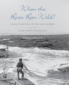
"Nearly seventy-five years of my lifetime have come and gone since hearing of the sparse historical events from the old-timers," American Indian elder George Aguilar tells us. "It’s my turn now." When the River Ran Wild! is Aguilar's recounting of events he heard about while watching his grandmother make moccasins by the light of a coal-oil lamp and while strapped to the back of his aunt's horse on the way to the huckleberry grounds. He learned them at Coyote's Fishing Place, where his uncles built scaffolds and taught him how to use traditional technologies to catch salmon as they made their seasonal runs up the river. In this remarkable personal memoir and tribal history, we learn about Aguilar's people, the Kiksht-speaking Eastern Chinookans, who lived and worked for centuries connected to the rhythms and resources of the great fishing grounds of the Columbia River at Five Mile Rapids. When the River Ran Wild! is the story of a culture and a community that has undergone tremendous change since 1805, when the River People encountered Meriwether Lewis and William Clark as they traveled down the Columbia River on their way to the Pacific Ocean. To find the stories of that change, Aguilar draws on the journals and diaries of early White missionaries and settlers, such as Gabriel Franchere, Rev. Henry Perkins of Wascopum Mission, and A. B. Meacham. He found other stories in anthropological papers and historical studies that recorded the voices of people who practiced and remembered ceremonies and traditions that were lost or changed during the difficult years of removal to the Warm Springs Reservation in north-central Oregon. He heard yet others from tribal elders who have kept the history and stories of the River People in their memories. When the River Ran Wild! is the history of names and naming, of deep family connections, and of traditional customs. It is a descriptive catalogue of the plants the River People used for sustenance and medical purposes, and it is a detailed guide on how to pack out an elk and how to tan a hide. Aguilar retells the stories and myths of the river, the stories that "are now infrequent and told from books in the English language," the stories whose "body language, animal mimicry, and facial expressions are gone." Aguilar has written this book to help us know what the River People have lost on the Columbia River over the decades, but he also gives testimony to what has been conserved and enlivened by a people who love the land and who honor tradition and those who came before. He takes us, perhaps better than anyone else can, back to a time when the river ran wild. xviii, 252 pages : illustrations ; 23 cm CIRC [ 0 ]
|
2005 |
|
Boise, Idaho, 1882-1910 prosperity in isolation by Carol Lynn MacGregor 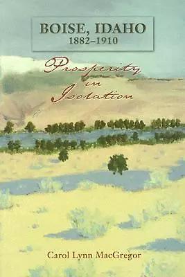
MacGregor's study of Boise begins with the removal of the Northern Shoshoni and follows the progress of government, infrastructure, business, and social institutions in the area. Along the way, MacGregor (history, Boise State) describes Boise's architecture, arts, culture and changing demographics. She creates in all its details the peculiar history of this unusually prosperous and progressive city. The text includes photographs and maps of the evolving city. Annotation ©2006 Book xiv, 306 pages : illustrations, maps ; 23 cm CIRC [ 1 ]
|
2006 |
|
Getting to the water's edge on Whidbey & Camano islands by Sarah Schmidt, Dan Pederson, Stacey Neumiller, WSU Beach Watchers, Washington State University Extension 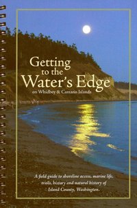
Published by Washington State University Extension and the WSU Beach Watchers, Getting to the Water’s Edge on Whidbey & Camano Islands serves as an exhaustive field guide to public shoreline access, marine life, and coastal trails across Island County. Compiled through extensive community research, the book details dozens of specific beaches, boat launches, and parks while weaving in rich context on local geology, natural history, and indigenous heritage. It bridges the gap between a practical recreational map and an environmental manual by emphasizing responsible stewardship of the fragile Salish Sea ecosystem. A keen insight drawn from the work is how citizen-science guidebooks function as powerful grassroots conservation tools; by meticulously cataloging public access points and educating visitors on local ecological sensitivities, the text transforms recreational day-trippers into active defenders of the regional shoreline. ix, 166 pages : color illustrations, color maps ; 22 cm CIRC [ 1 ]
|
2006 |
|
The Columbia River Highway from the sea to the wheatfields of eastern Oregon by Clarence E. Mershon 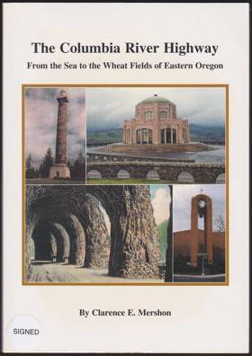
Published in 2007 by Clarence E. Mershon, The Columbia River Highway from the Sea to the Wheatfields of Eastern Oregon chronicles the grand engineering vision and historical evolution of one of America's most scenic roadways. The book details the monumental construction efforts led by Samuel C. Lancaster to carve a paved highway through the formidable cliffs of the Columbia River Gorge, connecting Portland's maritime climate to the vast agricultural interior. Through detailed historical narratives and vintage photographs, the text illustrates how the highway fundamentally transformed regional travel, commerce, and tourism by replacing precarious riverboats with a unified overland route. A keen insight drawn from the work is how the highway's pioneering design philosophy deliberately prioritized aesthetic wonder over pure utilitarian efficiency, transforming a piece of heavy civic infrastructure into a monumental landscape architecture project meant to romanticize the Pacific Northwest frontier for early motorists. x, 274 pages : illustrations, maps ; 26 cm CIRC [ 1 ]
|
2006 |