Village of Ashcroft Thompson-Nicola Regional District, British Columbia
Village (1) - A populated place with legally defined boundaries, incorporated as a village municipality under the provincial Municipal Act. E side of Thompson River, below (W of) Kamloops Lake, Kamloops Division Yale Land District
Mapped Location
Village of Ashcroft: The mapped location is an approximation and should not be used for navigation or wayfinding.
Information
General information on Village of Ashcroft
- Feature Type: Incorporated
Official, historical, colloquial and alternative toponyms for Village of Ashcroft
A brief list of names that this geographic feature has been named
| Name | Description |
|---|---|
| Village of Ashcroft | Official |
Origin Notes and History of Village of Ashcroft
References to Village of Ashcroft that document the origin of its place name
Ashcroft (Post Office) adopted 6 October 1936 on Geological survey sheet 408A, as labelled on Kamloops sheet 111, 1916. Incorporated as a Village Municipality 27 June 1952. Ashcroft (Village) confirmed 31 May 1982 on 92I/11. Boundary extention per Order in Council 288, 25 March 2004, to include the area known as "Ashcroft Ranch".
Ashcroft PO opened 13 July 1865, Clement Francis Cornwall, postmaster.
The Cornwall brothers who established their ranch, "Ashcroft" in 1862, came originally from the village of Ashcroft in Gloucestershire, where their father had been vicar. When the CPR adopted the name Ashcroft for their station just east of the ranch (and what would become the townsite), the Cornwall's added "Manor" to the name of their home, making it Ashcroft Manor. See also the municipality's website.
Named after a ranch in the vicinity, the home of the Honourable Clement Francis Cornwall (1836-1910), Lieutenant Governor of British Columbia from 1881 to 1887, and his brother Henry Pennant Cornwall. Together they had settled here in 1862 as farmers and stock raisers. The ranch in turn was named for their ancestral home, Ashcroft, Gloucestershire. CFC was schooled at Cambridge and had been successful as a barrister before coming to British Columbia; member of the Legislative Council of Colongy of British Columbia 1864-66; senator 1871-81; lieutenant-governor 1881-87; judge, County of Cariboo 1889-1906. HPC was appointed Indian Agent at Kamloops, 1881.
Related Catalog Titles
A Bibliography for Village of Ashcroft, Thompson-Nicola Regional District, British Columbia
Bittersweet oasis a history of Ashcroft and district, 1885-2002 by Brian Belton
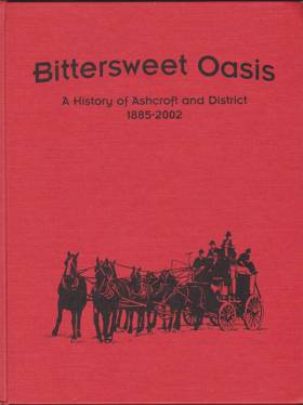
Bittersweet Oasis: A History of Ashcroft and District, 1885-2002, originally authored by Brian Belton, provides a comprehensive historical account of the development of the village of Ashcroft in British Columbia's Thompson region. The book chronicles Ashcroft's foundational years as the bustling "Gateway to the Cariboo," detailing how its position at the intersection of the Canadian Pacific Railway and the Cariboo Wagon Road fueled its early economic boom. It further explores the community's cultural and economic evolution, highlighting the vital contributions of early pioneers, Chinese laborers, and a thriving agricultural sector famous for its tomatoes and potatoes. Ultimately, the narrative captures the enduring resilience of the district's residents as they successfully navigated devastating fires, shifts in regional transportation routes, and changing industries over more than a century.
160 pages : illustrations, facsimiles, portraits ; 29 cm
CIRC [ 1 ]
Thompson-Nicola Regional District
- 70 Mile House
- Aberdeen
- Adams Lake
- Agate
- Village of Ashcroft
- Aspen Grove
- Avola
- Barnhartvale
- District of Barriere
- Batchelor Hills
- Beresford
- Bestwick
- Big Bar Creek
- Birch Island
- Black Pines
- Blackloam
- Blackpool
- Blucher Hall
- Blue River
- Boston Flats
- Brigade Lake
- Brocklehurst
- Brookmere
- Village of Cache Creek
- Cahilty
- Campbell Creek
- Canford
- Village of Chase
- Chasm
- Cherry Creek
- Chinook Cove
- Chu Chua
- Clapperton
- District of Clearwater
- Village of Clinton
- Collettville
- Copper Creek
- Coutlee
- Coyle
- Criss Creek
- Dallas
- Darfield
- Douglas Lake
- Duck Range
- Dufferin
- Exlou
- Heffley Creek
- Holmwood
- Jesmond
- Juniper Ridge
- City of Kamloops
- Kanaka Bar
- Kelly Lake
- Knutsford
- Lac Le Jeune
- Little Fort
- District of Logan Lake
- Loon Lake
- Louis Creek
- Lower Nicola
- Village of Lytton
- Martin Prairie
- McLure
- City of Merritt
- Monte Creek
- Monte Lake
- Nicola
- North Bonaparte
- North Kamloops
- Oak Hills
- Pinantan Lake
- Powers Addition
- Pritchard
- Quilchena
- Rayleigh
- Sahali
- Savona
- Shulus
- Shuswap
- Six Mile Ranch
- Spatsum
- Spences Bridge
- Stillwater
- Stump Lake
- Sun Peaks Mountain Resort Municipality
- Tobiano
- Tranquille
- Turtle Valley
- Valleyview
- Vavenby
- Vidette
- Vinsulla
- Walhachin
- Westsyde
- Westwold
Political Boundaries
Last updated: 2023-10-02