Yale Fraser Valley Regional District, British Columbia
Mapped Location
Yale: The mapped location is an approximation and should not be used for navigation or wayfinding.
Information
General information on Yale
- Feature Type: Place
Official, historical, colloquial and alternative toponyms for Yale
A brief list of names that this geographic feature has been named
| Name | Description |
|---|---|
| Yale | Official |
A Selected Bibliography of Yale, Fraser Valley Regional District, British Columbia
A compilation of essential readings detailing the history, geography, and culture of the region.
The Fraser canyon story, illustrated by Donald E. Waite
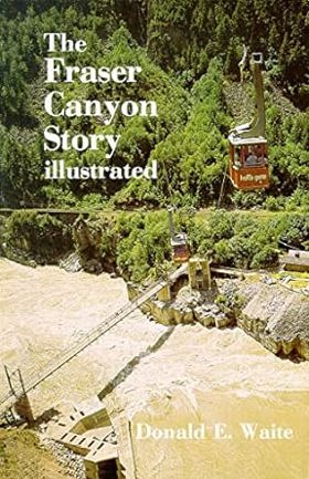
Constable John Kirkup was called to a 'gambling and whiskey drive' in Yale, B.C. He wound up arresting the nude hostess. Kirkup, the local newspaper editor, and the pastor fought for abstinence while the unruly workers fought and laid railway tracks. Further up the canyon, the great railwayman Andrew Onderdonk was daring the little steamship Kuzzy through the impenetrable Hell's Gate. Don Waite also recounts the adventures of the gold rush, the fur brigade trails, and Cariboo wagon road.
96 p. : ill., ports. ; 22 cm.
Non-circulating [ 1 ]
Fraser Valley Regional District
- City of Abbotsford
- Abbotsford
- Aberdeen
- Agassiz
- Alvin
- Arnold
- Atchelitz
- Barrowtown
- Bear Creek
- Boothroyd
- Boston Bar
- Bradner
- Bridal Falls
- Canyon Alpine
- CFB Chilliwack
- Chapmans
- Chaumox
- Cheam View
- City of Chilliwack
- Chilliwack
- Choate
- Clayburn
- Clearbrook
- Cultus Lake
- Deroche
- Dewdney
- Dogwood Valley
- Durieu
- Fairfield
- Floods
- Gifford
- Greendale
- Haig
- Village of Harrison Hot Springs
- Harrison Mills
- Hatzic
- Hells Gate
- Hemlock Valley
- District of Hope
- District of Kent
- Kilgard
- Laidlaw
- Lake Errock
- Lindell
- Lindell Beach
- Matsqui
- Minto Landing
- Miracle Valley
- District of Mission
- Mission
- Mount Lehman
- North Bend
- North Poplar
- Othello
- Popkum
- Port Douglas
- Promontory
- Ridgedale
- Rosedale
- Ruby Creek
- Ryder Lake
- Sardis
- Silver Creek
- Silver River
- Silverhill
- Skookumchuck
- Slesse Park
- South Poplar
- South Sumas
- Spuzzum
- Squeah
- Stave Falls
- Steelhead
- Straiton
- Sunshine Valley
- Tipella
- Vedder Crossing
- West Heights
- Williams Landing
- Yale
- Yarrow
Political Boundaries
Last updated: 2016-08-28