Okanogan County County
Okanogan County was formed out of Stevens County on February 2, 1888. The name derives from the Okanagan language place name uk?naqín. The name Okanogan (Okanagan) also refers to the region that encompasses part of southern British Columbia.
Mapped Location
Okanogan County: The mapped location is an approximation and should not be used for navigation or wayfinding.
Information
General information on Okanogan County
- Feature Type: County
- County Seat: City of Okanogan
- Established: Wednesday, February 22, 1888
Official, historical, colloquial and alternative toponyms for Okanogan County
A brief list of names that this geographic feature has been named
| Name | Description |
|---|---|
| Okanogan County | Official |
Origin Notes and History of Okanogan County
References to Okanogan County that document the origin of its place name

OKANOGAN, a river flowing from British Columbia southward to the Columbia River through the central part of Okanogan County. A tribe of Indians bore the same name. The word means "rendezvous" and was applied to the head of the river at Osoyoos Lake where the Indians of British Columbia and Washington often gathered for the annual potlatch and to lay in supplies of fish and game. (Rev. Myron Eells, in American Anthropologist, January, 1892.) The name has had many spellings such as "Oakinacken" by Alexander Ross; "Ookenaw," by David Thompson and Alexander Henry, the Younger; "Okenaken," by Gabriel Franchere; "Okinakane," in the Pacific Railroad Reports; and other forms, most of which aim at the same sounds. J. K. Duncan, the topographer with the Pacific Railroad survey, calls the main river through and above the lakes, "Sahtlilkwu" and the Similkameen he calls "Millakitekwa." (Pacific Railroad Reports, Volume I, chapter 18, page 214.) A town by the name of Okanogan is located on the bank of the river in the central part of Okanogan County.
A Selected Bibliography of Okanogan County, County
A compilation of essential readings detailing the history, geography, and culture of the region.
A view of the Methow from Moccasin Lake Ranch by James C. Pigott
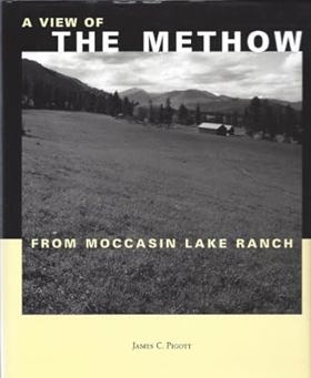
Published in local editions, James C. Pigott’s A View of the Methow from Moccasin Lake Ranch offers an evocative reflection on the landscape, history, and stewardship of Washington’s rugged Methow Valley. The book weaves personal memoir with regional lore, capturing the distinct seasonal rhythms of high-desert ranching, wildlife conservation, and the quiet isolation of the north-central Cascades. Through detailed observations of the local terrain and watershed, Pigott chronicles the delicate balance required to live harmoniously within a stunning yet demanding environment. A keen insight drawn from the text is how multi-generational ranching memoirs serve as intimate ecological barometers; by documenting decades of subtle shifts in local water availability and wildlife patterns, the author reveals that true land stewardship requires a profound, lived surrender to the cyclical limits of the natural world rather than attempts to conquer it.
167 pages : color illustrations, maps ; 25 cm
Non-circulating [ 1 ]
The smiling country a history of the Methow Valley by Sally Portman

Published by local presses, Sally Portman’s The Smiling Country: A History of the Methow Valley chronicles the colorful evolution of north-central Washington's dramatic river valley from its indigenous roots to its modern incarnation as a recreational haven. The book details the arduous lives of early homesteaders, gold miners, stockmen, and orchardists who carved a living out of a geographically isolated landscape defined by scorching summers and brutal winters. Through extensive oral histories and rich archival imagery, the text preserves the rugged character of communities like Winthrop and Twisp as they transitioned from extractive resource economies to tourism. A keen insight drawn from the work is how the valley's iconic moniker, "the smiling country," serves as a historical mask for the harsh economic realities of frontier survival; it reflects an enduring human impulse to romanticize an unforgiving high-desert ecosystem that frequently tested the limits of those who tried to tame it.
381 pages : illustrations ; 22 cm
Non-circulating [ 1 ]
Mazama the past 100 years : life and events in the upper Methow Valley & Early Winters by Doug Devin
Authored by local historian Doug Devin, Mazama the Past 100 Years: Life and Events in the Upper Methow Valley & Early Winters chronicles the century-long social and environmental evolution of an isolated high-country community in north-central Washington. The book draws on oral histories, diaries, and archival photographs to document the arduous lives of early homesteaders, miners, and trappers who braved deep winter snows and rugged mountain terrain along the eastern slopes of the Cascade range. Through these collected records, the text captures how a sparse population of self-reliant outdoorsmen gradually transformed into a tight-knit recreational and residential valley. A keen insight drawn from the work is how seasonal isolation acts as a powerful community filter; the extreme winter climate of the upper Methow Valley routinely weeded out casual settlers, leaving behind a resilient population whose social cohesion was entirely dependent on mutual survival tactics and an enduring tolerance for wilderness seclusion.
155 pages : illustrations, maps ; 28 cm
Non-circulating [ 1 ]
Postmarked Washington Okanogan County by Guy Reed Ramsey, Okanogan County Historical Society
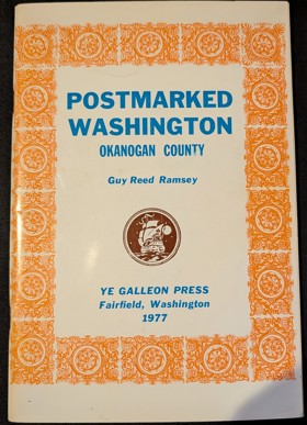
Postmarked Washington: Okanogan County by Guy Reed Ramsey is a 1966 local history, famously the first book ever published by the Okanogan County Historical Society, that details the region's early pioneer communication networks. The work meticulously chronicles the establishment, operation, and eventual closure of every frontier post office that existed within the county's borders. Ultimately, it serves as an essential genealogical and historical reference for understanding the rural development and the pioneer postmasters who connected this rugged area of North Central Washington.
60 pages : illustrations, map ; 23 cm
Non-circulating [ 1 ]
Mapping the frontier Charles Wilson's diary of the survey of the 49th parallel, 1858-1862, while secretary of the British Boundary Commission by Charles William Wilson
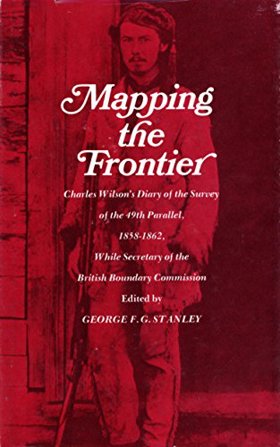
Mapping the frontier Charles Wilson's diary of the survey of the 49th parallel, 1858-1862 examines the grueling imperial cartography and immense logistical struggle situated across the profoundly rugged, trans-mountain macro-geography of the US-British Columbia borderlands. Wilson details how the region's formidable topography—specifically the impenetrable, old-growth temperate rainforests of the coastal slope, the sheer, glaciated alpine barricades of the Cascade and Rocky Mountains, and the deep, turbulent river chasms cutting perpendicular to the border—strictly dictated the margins of early scientific reconnaissance, precarious overland supply chains, and the immense physical labor required to physically mark the wilderness. By mapping the Boundary Commission's arduous effort to impose a rigid, abstract political line across violently fractured terrain—requiring the literal chopping of massive forest swaths, precarious high-altitude ascents, and constant battles with severe winter isolation—the narrative highlights how this specific unforgiving, mountainous geography anchored a profoundly grueling, highly isolated feat of imperial engineering. Ultimately, this diaristic and cartographic record serves as a macro-level spatial history, demonstrating how the immense alpine barricades, severe botanical density, and unrelenting climatic extremes of this Pacific Northwest landscape fundamentally shaped the highly arduous, geographically defiant character of the 49th parallel boundary survey.
182 pages : maps, portrait ; 22 cm
Non-circulating [ 1 ]
From Copenhagen to Okanogan the autobiography of a pioneer by U. E. Fries
U. E. Fries’s From Copenhagen to Okanogan: The autobiography of a pioneer chronicles the arduous pioneer colonization and rigorous agricultural subjugation of a violently exposed, deeply isolated frontier carved into the rugged northern reaches of the Columbia Plateau. The narrative maps how the severe environmental realities of this unforgiving inland topography—defined by vast, sun-baked steppes, plunging, ice-choked riverine trenches, and brutal winter extremes—initially completely paralyzed efficient terrestrial transit and dictated a profoundly disconnected, precarious pioneer existence. By detailing the grueling transition from vulnerable, isolated homesteads reliant on fragile pack-mule supply lines to the aggressive clearing of the valley floors and the eventual deployment of mechanized irrigation and robust overland wagon infrastructure, the text illustrates how the physical and economic survival of the settlement was strictly governed by the urgent necessity of artificially domesticating this harsh geographic void. Ultimately, the account demonstrates that violently breaking the arid soil of the Okanogan Valley and systematically imposing a heavily integrated agrarian and transit grid to conquer the region's profound continental detachment were the absolute prerequisites for binding a desolate hinterland to the broader commercial machinery of the inland empire.
[2], 437 pages, [32 leaves of plates : illustrations, map (on lining papers), portraits ; 24 cm
Non-circulating [ 1 ]
Early Okanogan history by William C. Brown
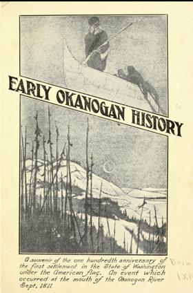
A souvenir of the one hundredth anniversary of the first settlement in the State of Washington under the American flag. An event which occurred at the mouth of the Okanogan River in Sept 1811.
27 pages : illustrations, portraits ; 23 cm
ONLINE Circulation [ 1 ]
An illustrated history of Stevens, Ferry, Okanogan and Chelan counties, state of Washington by Western Historical Publishing Company
Published in 1904 by the Western Historical Publishing Company, this comprehensive volume chronicles the pioneer settlement, civic foundation, and industrial emergence of four rugged counties in northern Washington state. A keen insight drawn from the text is how the sudden, controversial opening of former Native American reservation lands (such as the Colville Reservation) to white prospectors triggered explosive mining booms, acting as the primary catalyst that rapidly transformed this isolated northern frontier into permanent communities. The narrative details the distinct economic drivers across the region, from the rich mineral districts of Ferry and Stevens to the vast cattle ranges and early orchard irrigation projects of Okanogan and Chelan counties. Furthermore, the book preserves the area's pioneer legacy by featuring hundreds of detailed biographical sketches of the resilient prospectors, ranchers, and civic leaders who built these foundational settlements.
xxii, 867 pages, 43 unnumbered leaves of plates : illustrations, portraits ; 31 cm
ONLINE Circulation [ 1 ]
Okanogan County
- Aeneas
- Anglin
- Barker
- Belvedere
- Bodie
- City of Brewster
- Brown Lake
- Carlton
- Cherokee
- Chesaw
- Chillowist
- Chopaka
- Chopaka
- Town of Conconully
- Cordell
- Town of Coulee Dam
- Disautel
- Ellisforde
- Town of Elmer City
- Enterprise
- Epley (historical)
- Gilbert
- Havillah
- Janis
- Keystone
- Koontzville
- Lone Pine
- Loomis
- Loop Loop (historical)
- Malott
- Mason City (historical)
- Mazama
- Methow
- Molson
- Monse
- Mowich Illahee
- Town of Nespelem
- Nighthawk
- North Omak
- City of Okanogan
- Old Toroda
- Old Wauconda
- Olema
- City of Omak
- Ophir
- City of Oroville
- Paradise Hill
- City of Pateros
- Town of Riverside
- Ruby
- Seatons Grove
- Starr
- Synarep
- Thompson (historical)
- City of Tonasket
- Town of Twisp
- Vanderpool Crossing
- Virginia City (historical)
- Wakefield
- Wauconda
- Town of Winthrop
Political Boundaries
Last updated: 2017-06-28