Catalog of British Columbiana and Pacific Northwest Americana
The Encyclopedia Cascadia Catalog indexes mostly non-fiction literature covering the Pacific Northwest coast of North America, with an emphasis on British Columbia, Idaho, Oregon, and Washington State.
| Catalog Title | Published |
|---|---|
|
Memories of the Skeena by Walter Wicks 
Memories of the Skeena chronicles the grueling industrial expansion and precarious pioneer settlement along the turbulent, deeply carved river valleys of northern British Columbia's Skeena watershed. Wicks details how the region's formidable physical barriers—specifically the sheer, impenetrable slopes of the Coast Mountains and the treacherous, rapid-choked currents of the Skeena River itself—strictly dictated the margins of human survival and commercial salmon extraction. By mapping the arduous daily labor within isolated, water-bound canneries and the dangerous navigation of shallow-draft sternwheelers fighting upstream against massive seasonal floods, the narrative highlights the immense physical endurance required to carve an economy from this unforgiving northern environment. The utter lack of viable overland routes initially forced these remote outposts into an absolute reliance on the riverine and marine highways, completely anchoring their existence to the cyclical rhythms of the Pacific salmon runs and the severe coastal climate. Ultimately, this autobiographical record serves as a deeply localized spatial history, demonstrating how the immense hydrological force and extreme, mountainous topography of this Pacific Northwest river basin inherently shaped the fiercely resilient, strictly water-dependent character of the Skeena frontier. 215 pages, 16 unnumbered leaves of plates : illustrations ; 23 cm Non-circulating [ 1 ]
|
1976 |
|
Men, mules, and mountains Lieutenant O'Neil's Olympic expeditions by Robert L. Wood
Accounts of an 1885 expedition led by Lt. Joseph P. O'Neil to make a reconnaissance of the northeastern section of the Olympics and an 1890 expedition that explored the region more in depth. Based mainly on O'Neil's manuscripts and and a hand-written account by Private Harry Fisher xx, 483 pages, 11 unnumbered leaves of plates : illustrations ; 21 cm Non-circulating [ 1 ]
|
1976 |
|
Kittitas frontiersmen by Earl T. Glauert , Merle H. Kunze
Kittitas frontiersmen chronicles the grueling pioneer settlement and early resource extraction across the sweeping, wind-swept basins and rugged alpine corridors of central Washington. Glauert and Kunze detail how the region's formidable physical barriers—specifically the massive, impenetrable eastern slopes of the Cascade Range, the severe climatic extremes created by the mountain rain shadow, and the imposing, semi-arid ridges encircling the Kittitas Valley—strictly dictated the margins of overland migration, early cattle ranching, and human survival. By mapping the arduous physical labor required to drive livestock across treacherous alpine passes, extract deep-seam coal from the precipitous upper mountain flanks, and engineer vital irrigation networks drawing from the Yakima River, the narrative highlights the monumental effort necessary to anchor permanent communities in this demanding inland environment. The profound geographic isolation created by the towering mountain divides initially forced early homesteaders into a strict reliance on the precise topography of the valley floor and its narrow river canyons, completely anchoring their commercial and agricultural existence to the severe intermountain climate. Ultimately, this historical record serves as a deeply localized spatial history, demonstrating how the immense geological barriers and harsh environmental realities of this Pacific Northwest inland basin fundamentally shaped the fiercely resilient, highly adaptable character of the Kittitas frontier. x, 219 pages : illustrations, maps, portraits ; 29 cm Non-circulating [ 1 ]
|
1976 |
|
Isle of the sea breezers by Roland Carey
Isle of the sea breezers examines the precarious pioneer settlement and gradual civic development across the heavily forested, deeply indented landmass of Vashon Island in central Puget Sound. Carey details how the region's formidable physical barriers—specifically the steep, heavily timbered coastal bluffs and the deep, tide-swept marine channels permanently severing the island from the mainland—strictly dictated the margins of early human survival and economic expansion. By mapping the immense physical labor required to carve landlocked agricultural communities from the dense upland plateaus and establish vital deepwater docks along the sheltered shores of Quartermaster Harbor, the narrative highlights the monumental logistical effort necessary to anchor a permanent society in this demanding maritime environment. The absolute geographic isolation from viable overland routes initially forced these remote homesteaders into a strict reliance on the deepwater marine highway, completely anchoring their commercial and communication lifelines to the perilous, weather-dependent navigation of the Puget Sound "mosquito fleet" steamboats. Ultimately, this historical record serves as a deeply localized spatial history, demonstrating how the severe aquatic isolation and complex island topography of this Pacific Northwest frontier fundamentally shaped the fiercely resilient, strictly maritime-dependent character of the Vashon community. 135 pages : illustrations ; 24 cm Non-circulating [ 1 ]
|
1976 |
|
My Ain folk Denman Island 1875-1975 by Winnifred A. Isbister
My Ain folk: Denman Island 1875-1975 chronicles the grueling agricultural transformation and isolated pioneer settlement across the heavily timbered, sea-swept terrain of the Northern Gulf Islands. Isbister details how the region's formidable physical barriers—specifically the treacherous tidal currents of the Strait of Georgia, the deep aquatic trench of Baynes Sound permanently severing the island from the Vancouver Island mainland, and the dense, impenetrable coastal rainforests—strictly dictated the margins of early human survival and economic expansion. By mapping the immense physical labor required to clear towering old-growth timber to carve out precarious subsistence farms and to establish vital deepwater landings along the rocky, indented shorelines, the narrative highlights the monumental effort necessary to anchor a permanent community in this demanding maritime environment. The absolute geographic isolation initially forced these remote island homesteaders into a strict reliance on the deepwater marine highway, completely anchoring their commercial, social, and agricultural lifelines to unpredictable maritime weather patterns and the precarious arrival of vital coastal steamships. Ultimately, this local historical record serves as a deeply localized spatial history, demonstrating how the severe aquatic isolation and rugged, forested topography of this Pacific Northwest frontier fundamentally shaped the fiercely resilient, tightly knit, and strictly maritime-dependent character of the Denman Island settlement. 206 pages : illustrations, maps, portraits ; 23 cm Non-circulating [ 1 ]
|
1976 |
|
Preserving Washington's history a Bicentennial report by Washington State Parks and Recreation Commission
Preserving Washington's history: a Bicentennial report examines the comprehensive preservation of early pioneer settlement, military fortification, and resource extraction across the vast, environmentally fractured landscape of the Pacific Northwest. The Washington State Parks and Recreation Commission details how the state's formidable physical barriers—specifically the towering, volcanic spine of the Cascade Range, the treacherous maritime chokepoints of Puget Sound, and the sweeping, semi-arid expanses of the inland Columbia Basin—strictly dictated the initial margins of human survival and territorial expansion. By mapping the immense physical labor required to establish the diverse heritage sites now protected within the parks system—ranging from isolated coastal artillery batteries lashed by Pacific storms to precarious dryland agricultural outposts—the narrative highlights the monumental effort necessary to anchor permanent communities within these demanding, highly varied environments. The profound geographic disparities across the territory initially forced early homesteaders and garrisons into a strict reliance on their immediate microclimates, completely anchoring their survival to either the deepwater marine highways of the western shores or the severe hydrological realities of the eastern river valleys. Ultimately, this institutional record serves as a macro-level spatial history, demonstrating how the severe climatic dualities, immense physical scale, and rugged topographical extremes of Washington fundamentally shaped the fiercely resilient, geographically partitioned character of the frontier sites preserved today. 93 pages : illustrations ; 22 cm Non-circulating [ 1 ]
|
1976 |
|
Skeena country the people and the landscape by Provincial Archives of British Columbia Aural History
Skeena country: the people and the landscape chronicles the grueling pioneer settlement and massive resource extraction along the turbulent, glacier-fed river valleys of northwestern British Columbia. The Provincial Archives of British Columbia Aural History details how the region's formidable physical barriers—specifically the massive, impenetrable peaks of the Coast Mountains and the violent, rapid-choked currents of the Skeena River itself—strictly dictated the margins of early human survival, overland travel, and economic expansion. By mapping the immense physical labor required to carve precarious salmon canneries along the treacherous estuary shorelines and to push fragile sternwheeler and rail supply lines deep into the precipitous inland river canyons, the narrative highlights the monumental effort necessary to anchor permanent outposts in this demanding northern environment. The utter lack of viable overland routes to the southern population centers initially forced these remote, resource-dependent communities into an absolute reliance on the perilous riverine highway and deepwater maritime ports, completely anchoring their commercial existence to the severe hydrological force and unpredictable northern climate. Ultimately, this aural and historical record serves as a deeply localized spatial history, demonstrating how the immense hydrological power and rugged intermountain topography of this northern Pacific Northwest frontier fundamentally shaped the fiercely resilient, strictly resource-dependent character of the Skeena country communities. vi, 47 pages : illustrations, maps. Non-circulating [ 1 ]
|
1976 |
|
First approaches to the Northwest coast by Derek Pethick
First approaches to the Northwest coast examines the precarious maritime exploration and strategic imperial expansion along the treacherous, storm-battered shorelines and labyrinthine archipelagos of the Pacific frontier. Pethick details how the region's formidable physical barriers—specifically the violent, unpredictable squalls of the North Pacific, the dense, blinding fog banks, and the jagged, uncharted reefs guarding impenetrable coastal rainforests—strictly dictated the margins of early European navigation and initial Indigenous contact. By mapping the immense navigational skill required to pilot fragile, wind-powered sailing vessels through the deep, tide-swept fjords and hidden aquatic chokepoints of the Inside Passage, the narrative highlights the monumental endurance necessary to chart and survive this demanding maritime environment. The absolute geographic isolation from established global ports initially forced these remote maritime expeditions into a strict reliance on the precise topography of sheltered coastal bays for temporary anchorage and refitting, completely anchoring their diplomatic and commercial missions to the severe marine climate and complex tidal hydrology. Ultimately, this historical record serves as a macro-level spatial history, demonstrating how the immense hydrological force and rugged coastal extremes of the Pacific Northwest fundamentally shaped the fiercely resilient, strictly maritime-dependent character of the region's earliest global exploration. xix, 232 pages : illustrations ; 24 cm Non-circulating [ 1 ]
|
1976 |
|
British Columbia a history by Margaret A. Ormsby
British Columbia: a history examines the complex territorial expansion and arduous pioneer settlement across a vast, fractured landscape defined by extreme topographical and climatic divides. Ormsby details how the region's formidable physical barriers—specifically the massive, impenetrable spine of the Rocky Mountains that effectively severs the province from the rest of the continent, alongside the steep, heavily timbered Coast Mountains and the violent, rapid-choked currents of the Fraser River Canyon—strictly dictated the margins of overland migration, resource extraction, and human survival. By mapping the immense physical labor required to carve precarious gold rush trails deep into the rugged Cariboo interior and to blast transcontinental railway lines through sheer alpine gorges, the narrative highlights the monumental effort necessary to anchor permanent communities within this demanding, highly varied environment. The profound geographic isolation and utter lack of viable east-west overland routes initially forced the early coastal enclaves into an absolute reliance on the perilous deepwater marine highway of the Pacific, while anchoring interior outposts to the severe hydrological realities of the inland river systems. Ultimately, this comprehensive historical record serves as a macro-level spatial history, demonstrating how the severe geological extremes, immense physical scale, and rugged intermountain topography of this Pacific Northwest frontier fundamentally shaped the fiercely resilient, geographically partitioned character of British Columbia. 566 pages : illustrations, maps Non-circulating [ 1 ]
|
1976 |
|
The Princess story a century and a half of West Coast shipping by Norman R. Hacking, William Kaye Lamb, Mitchell Press (Publisher)
The Princess story: a century and a half of West Coast shipping examines the precarious maritime navigation and strategic commercial integration across the deeply indented, storm-battered archipelagos and fjords of the Pacific frontier. Hacking and Lamb detail how the region's formidable physical barriers—specifically the treacherous, tide-swept aquatic chokepoints of the Inside Passage, the violent, blinding fog banks of the open Pacific, and the steep, impenetrable coastal rainforests that rendered overland transit virtually impossible—strictly dictated the margins of regional connectivity and economic expansion. By mapping the immense navigational skill and industrial effort required to deploy and maintain a massive, reliable fleet of coastal steamships through this labyrinthine marine topography, the narrative highlights the monumental logistical endurance necessary to supply and anchor permanent, isolated communities in this demanding maritime environment. The absolute geographic isolation of remote coastal settlements, logging camps, and salmon canneries initially forced these enclaves into a strict reliance on the deepwater marine highway, completely anchoring their physical survival and commercial existence to the predictable arrival of the "Princess" ships and the mastery of the severe tidal hydrology. Ultimately, this maritime and historical record serves as a macro-level spatial history, demonstrating how the complex aquatic geography and severe coastal extremes of this Pacific Northwest frontier fundamentally shaped the fiercely resilient, strictly maritime-dependent character of the region's coastal transportation networks. [8], 360 s. : il. ; 23 cm. Non-circulating [ 1 ]
|
1976 |
|
The Chinook Indians traders of the Lower Columbia River by Robert H. Ruby, John A. Brown
The Chinook Indians: traders of the Lower Columbia River examines the strategic economic dominance and deep environmental adaptation of an Indigenous population positioned at the most critical aquatic chokepoint of the Pacific Northwest. Ruby and Brown detail how the region's formidable physical barriers—specifically the turbulent, massive tidal estuary of the lower Columbia River, the treacherous, storm-battered Columbia Bar, and the impenetrable surrounding coastal rainforests—strictly dictated the flow of both inland and maritime commerce. By mapping the tribe's mastery of this severe estuarine topography and their specialized deployment of massive ocean-going cedar canoes, the narrative highlights the immense navigational skill required to bridge the vast maritime trade networks of the Pacific coast with the deep interior riverine routes of the Columbia Basin. The strategic utilization of this extreme hydrology—leveraging the precise geographic convergence of river and ocean to control the movement of goods, European explorers, and neighboring tribes—underscores a profound, pre-existing mastery of the unforgiving coastal environment. Ultimately, this ethnohistorical record serves as a deeply localized spatial history, demonstrating how the immense hydrological force and treacherous aquatic topography of this Pacific Northwest river mouth fundamentally shaped the fiercely resilient, commercially dominant footprint of the Chinook people. xvi, 349 pages, 24 unnumbered pages of plates : illustrations, map, portraits ; 25 cm. Non-circulating [ 2 ]
|
1976 |
|
Equality on the Oregon frontier Jason Lee and the Methodist Mission, 1834-43 by Robert J. Loewenberg
Equality on the Oregon frontier: Jason Lee and the Methodist Mission, 1834-43 examines the grueling ideological adaptation and precarious pioneer settlement of an early religious outpost situated within the isolated, fertile river corridors of the Willamette Valley. Loewenberg details how the region's formidable physical barriers—specifically the immense, continental overland distances separating the mission from eastern supply lines, the towering spine of the Cascade Range, and the dense, rain-drenched temperate environment of the Pacific slope—strictly dictated the margins of early human survival, agricultural expansion, and institutional focus. By mapping the immense physical labor required to clear heavy riparian forests, cultivate the waterlogged soils of the valley floor, and establish vital agrarian self-sufficiency, the narrative highlights the monumental effort necessary to anchor a permanent, sustainable community in this demanding, deeply remote frontier environment. The absolute geographic isolation from established American infrastructure initially forced these idealistic missionaries into a strict reliance on the precise topography of the Willamette watershed, completely anchoring their daily physical survival and evolving secular politics to the localized agricultural dictates and hydrological realities of the valley. Ultimately, this historical record serves as a deeply localized spatial history, demonstrating how the immense physical isolation and specific riverine geography of this early Pacific Northwest frontier fundamentally shaped the fiercely resilient, highly pragmatic, and agriculturally dependent character of the Methodist Mission's foundational settlement. xi, 287 pages ; 24 cm Non-circulating [ 1 ]
|
1976 |
|
50 years on the Klamath by John C. Boyle 
1982 marked the 50th anniversary for the Boyd family on the Klamath River. The family has continued to visit the camp in almost all of the years between then and today. This book tells many stories and tells of many events and happenings that occurred during these years: the burgeoning growth of the families, the construction of additional cabins at the camp, good fishing years and not so good years, and the varied and interesting experiences of life at the Klamath. Most importantly, this book portrays the incalculable value that spending time with family and friends at a place without electricity, television, phones, computers or other modern distractions provides to both young and old. 59, [8] pages of plates : illustrations, maps (some folded) ; 26 cm Non-circulating [ 1 ]
|
1976 |
|
Portrait of Lynden by Dorothy Koert
Portrait of Lynden chronicles the grueling agricultural transformation and isolated pioneer settlement situated within the flood-prone river corridors and dense lowland forests of northwestern Washington. Koert details how the region's formidable physical barriers—specifically the towering, impenetrable old-growth timber of the Nooksack River valley, the waterlogged, marshy soils, and the unpredictable, heavy maritime precipitation—strictly dictated the margins of early human survival and agrarian expansion. By mapping the immense physical labor required to painstakingly extract massive cedar and fir stumps from the damp earth and to engineer vital drainage networks across the floodplain, the narrative highlights the monumental cooperative effort necessary to forcibly convert this dense temperate rainforest into highly productive dairy and agricultural pastureland. The absolute geographic isolation from the deeper marine ports of Puget Sound initially forced these remote homesteaders into a strict reliance on the precise topography of the Nooksack River for early transportation, completely anchoring their commercial existence and tightly knit community structure to the severe hydrological realities of the river basin. Ultimately, this civic and historical record serves as a deeply localized spatial history, demonstrating how the extreme physical labor, dense forested topography, and specific riverine geography of this Pacific Northwest frontier fundamentally shaped the fiercely resilient, strictly agriculturally dependent character of the Lynden settlement. 163 pages : illustrations ; 26 cm Non-circulating [ 1 ]
|
1976 |
|
Along the waterfront a history of Gig Harbor and Key Peninsula areas by Goodman Middle School, Gig Harbor, Wash 
Along the waterfront: a history of Gig Harbor and Key Peninsula areas chronicles the grueling pioneer settlement and early resource extraction across the deeply indented, heavily forested aquatic terrain of the southern Puget Sound. The students and contributors of Goodman Middle School detail how the region's formidable physical barriers—specifically the treacherous, violent tidal currents of the Tacoma Narrows, the dense, impenetrable coastal temperate rainforests, and the labyrinthine aquatic topography of the deeply incised peninsulas—strictly dictated the margins of early human survival and economic expansion. By mapping the immense physical labor required to establish precarious maritime enclaves, carve massive timber from the steep coastal bluffs, and construct specialized commercial fishing fleets directly within the sheltered deepwater bays, the narrative highlights the monumental effort necessary to anchor permanent communities in this demanding maritime environment. The utter lack of viable overland routes to the mainland initially forced these remote, waterbound homesteads into an absolute reliance on the marine highway, completely anchoring their commercial existence and social connectivity to the precarious navigation of the Puget Sound "mosquito fleet" and the severe tidal hydrology of the inland sea. Ultimately, this educational and civic historical record serves as a deeply localized spatial history, demonstrating how the complex, highly fractured aquatic geography and immense forested shorelines of this Pacific Northwest frontier fundamentally shaped the fiercely resilient, strictly maritime-dependent character of the Gig Harbor and Key Peninsula communities. Compiled and written by students of 1974-1975 Goodman Middle School. Gig Harbor, Washington. 130 pages : illustrations ; 21 cm Non-circulating [ 1 ]
|
1976 |
|
McMurray-- gone with the trees by Varee A. Bandazy
McMurray—gone with the trees chronicles the grueling industrial timber extraction and inevitable economic decline of an isolated mill town situated around a remote inland lake in the dense lowland forests of northwestern Washington. Bandazy details how the region's formidable physical barriers—specifically the massive, impenetrable old-growth cedar and fir canopies, the rugged, rain-drenched foothills of the Cascade Range, and the waterlogged, marshy terrain surrounding the lake—strictly dictated the margins of early human survival and aggressive resource exploitation. By mapping the immense physical labor required to lay precarious logging railroads deep into the steep, heavily timbered slopes and to process millions of board feet of lumber directly on the shores of Lake McMurray, the narrative highlights the monumental effort necessary to anchor a thriving community in this demanding temperate environment. The profound geographic isolation from major marine ports initially forced these remote lumber camps into a strict reliance on the precise topography of the lake for timber sorting and water supply, completely anchoring their fleeting commercial existence to the absolute exhaustion of the surrounding forest canopy. Ultimately, this local historical record serves as a deeply localized spatial history, demonstrating how the immense botanical density and specific lacustrine geography of this Pacific Northwest frontier fundamentally shaped the fiercely resilient, strictly resource-dependent character of the McMurray settlement before its eventual return to the forest. McMurray and Medina are former logging towns in Skagit County, Washington ix, 181 pages : illustrations, maps, portraits ; 21 cm Non-circulating [ 1 ]
|
1976 |
|
Mac & the Princess the story of Princess Louisa Inlet and James F. Macdonald by Bruce Calhoun
Mac & the Princess: the story of Princess Louisa Inlet and James F. Macdonald chronicles the precarious maritime navigation and dedicated, isolated stewardship of a deeply entrenched, sheer-walled glacial fjord on the remote coast of British Columbia. Calhoun details how the region's formidable physical barriers—specifically the treacherous, violent tidal currents of Malibu Rapids guarding the narrow entrance, the massive, impenetrable granite cliffs rising thousands of feet directly from the deepwater channel, and the dense, rain-drenched coastal wilderness—strictly dictated the margins of human survival, maritime access, and eventual conservation. By mapping the immense physical labor and precise navigational skill required to pilot fragile vessels through the chaotic marine chokepoint and to carve a sustainable, solitary homestead at the base of roaring Chatterbox Falls, the narrative highlights the monumental effort necessary to anchor a permanent human presence in this demanding, sublime maritime environment. The utter lack of viable overland routes forced Macdonald and early boaters into a strict reliance on the perilous marine highway, completely anchoring their physical survival and profound connection to the inlet to the severe hydrological forces and unpredictable weather patterns of the coastal channels. Ultimately, this biographical and historical record serves as a deeply localized spatial history, demonstrating how the immense geological scale, extreme tidal geography, and profound aquatic isolation of this Pacific Northwest frontier fundamentally shaped the fiercely resilient, fiercely protective, and strictly maritime-dependent legacy of Princess Louisa Inlet. 130 pages : illustrations ; 23 cm Non-circulating [ 1 ]
|
1976 |
|
Old Yamhill the early history of its towns and cities by Yamhill County Historical Society
Old Yamhill: the early history of its towns and cities chronicles the grueling agricultural transformation and early pioneer settlement situated within the fertile but heavily untamed river corridors of the western Willamette Valley. The Yamhill County Historical Society details how the region's formidable physical barriers—specifically the steep, heavily timbered eastern foothills of the Coast Range, the unpredictable winter flooding of the meandering Yamhill River, and the dense, waterlogged riparian zones of the valley floor—strictly dictated the margins of overland migration and initial agrarian expansion. By mapping the immense physical labor required to clear thick stands of valley brush, drain the marshy lowlands, and painstakingly carve productive agricultural tracts from the damp earth, the narrative highlights the monumental cooperative effort necessary to forcibly convert this dense temperate environment into a highly structured farming grid. The profound lack of viable overland roads during the severe, rain-drenched winters initially forced these remote homesteaders into a strict reliance on the precise topography of the Yamhill River for transportation, completely anchoring their commercial existence and early civic development to the precarious navigation of shallow-draft steamboats and the severe hydrological realities of the basin. Ultimately, this civic and historical record serves as a deeply localized spatial history, demonstrating how the specific riverine geography, heavy maritime precipitation, and immense physical labor of this Pacific Northwest frontier fundamentally shaped the fiercely resilient, tightly knit, and strictly agriculturally dependent character of the Yamhill County communities. 106 pages : illustrations, maps ; 28 cm Non-circulating [ 1 ]
|
1976 |
|
From wilderness to suburbia an illustrated history of Parkland, Washington by Richard D. Osness
From wilderness to suburbia: an illustrated history of Parkland, Washington chronicles the grueling agricultural transformation and gradual civic expansion across the dense glacial outwash plains and heavily timbered lowlands of the southern Puget Sound. Osness details how the region's formidable physical barriers—specifically the towering, impenetrable stands of old-growth Douglas fir, the dense, root-choked prairie brush, and the heavily compacted, rocky glacial till soils—strictly dictated the margins of early human survival and initial agrarian development. By mapping the immense physical labor required to painstakingly extract massive stumps from the damp earth, break the unyielding glacial soil for rudimentary farming, and cut precarious plank roads through the dense wilderness toward the deepwater port of Tacoma, the narrative highlights the monumental cooperative effort necessary to forcibly convert this rugged terrain into a structured, habitable grid. The initial geographic isolation from established urban centers forced these remote pioneer homesteads and early institutional outposts into a strict reliance on the immediate topographical resources, completely anchoring their physical survival and gradual suburban integration to the arduous overland transport through the heavy maritime precipitation and muddy, forested corridors. Ultimately, this illustrated and civic record serves as a deeply localized spatial history, demonstrating how the immense botanical density and challenging glacial topography of this Pacific Northwest frontier fundamentally shaped the fiercely resilient, highly adaptable character of the Parkland community as it transitioned from an isolated forested enclave into a permanent suburban expanse. viii, 132 pages : illustrations, portraits ; 28 cm Non-circulating [ 1 ]
|
1976 |
|
Beckoning the bold story of the dawning of Idaho by Rafe Gibbs 
Idaho…it has one of the most colorful pasts of all the last-frontier states, and the color has not faded with the sunsets of yesteryear. Indeed, the bold pioneers who defied the mighty mountains and parched plains in quest of fortune—and new homes—left sharply etched, as if on stone, their marks of rugged individualism. And the only rubbing off has been on the people who live there today. Idaho is well worth knowing, for to know it is not only to understand how the West was won but why it was worth the winning. v, 266 pages, 8 unnumbered leaves of plates : illustrations ; 24 cm Desiderata
|
1976 |
|
Fields & pine trees by Opal Lambert Ross, Kenneth Platt 
Published in 1977 as Local History Paper No. 2 by the Latah County Historical Society. The tide of pioneer settlers that swept into the Palouse Country a hundred years ago came from the west. [. . .] The first lappings of this tide reached Idaho in 1869-70, touching at Pine Creek in the north end of what is now Latah County, at Kennedy Ford and Moscow in the middle, and at Genesee at the south end. The account given by Opal Lambert Ross covers the Pine Creek community. There, on January 1, 1872, Lyman Davenport made the first homestead entry registered in Latah County. [. . .] Mrs. Ross ably tells the story in a microcosmic record of the Pioneer period. Her tracing of each homestead down to its present ownership is a further service to history, as well as a benchmark for possible future study. -The Editor 71 pages : illustrations, maps, portraits ; 29 cm Non-circulating [ 1 ]
|
1976 |
|
Idaho place names of French, Spanish, and Indian origin by Grangeville H.S. Foreign Language Club 
Idaho place names of French, Spanish, and Indian origin examines the grueling linguistic mapping and precarious early exploration across the vast, deeply fractured alpine ranges and sheer river canyons of the inland Pacific Northwest. The Grangeville H.S. Foreign Language Club details how the region's formidable physical barriers—specifically the massive, impenetrable granite peaks of the Bitterroot and Sawtooth mountains, the violent, rapid-choked trenches of the Salmon and Snake rivers, and the sweeping, semi-arid expanses of the high-desert plains—strictly dictated the margins of early human survival, indigenous migration, and fur-trade navigation. By mapping the immense physical labor required by Native American tribes, French-Canadian voyageurs, and early frontiersmen to forge precarious overland trails through dense alpine wilderness and to survive the severe intermountain climate, the narrative highlights the monumental effort necessary to permanently chart and name this demanding environment. The profound geographic isolation and treacherous overland routes initially forced these diverse early populations into a strict reliance on the precise topography of the river corridors and mountain passes for basic navigation, completely anchoring their enduring cultural and linguistic footprints to the severe hydrological and geological realities of the territory. Ultimately, this toponymic and historical record serves as a macro-level spatial history, demonstrating how the immense geological scale and extreme intermountain geography of this Pacific Northwest frontier fundamentally shaped the fiercely resilient, culturally layered, and strictly terrain-dependent character of Idaho's earliest named landscape. 10 pages illustrations Non-circulating [ 1 ]
|
1976 |
|
Underneath the bough collected poems of Kenneth B. Platt by Kenneth B. Platt 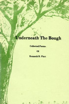
A collection of poems by Moscow resident and long-time Latah County Historical Society volunteer Kenneth B. Platt. It includes a section of sheet music to accompany various poems. 92 pages, 11 unnumbered leaves of plates, [18] pages (folded) : illustrations, music ; 22 cm Desiderata
|
1976 |
|
Seattle, past to present by Roger Sale 
Seattle, Past to Present, interprets the history of the foremost city in the Northwest and traces the implications of that history for the city's present and future. In the process Seattle emerges not as a rough, half-formed frontier town but as a soft city of streets and houses, middle-class in aspiration and achievement; Roger Sale asks how it came to be that way. Roger Sale’s Seattle, Past to Present has become a beloved reflection of Seattle’s history and its possible futures as imagined in 1976, when the book was first published. Drawing on demographic analysis, residential surveys, portraiture, and personal observation and reflection, Sale provides his take on what was most important in each of Seattle’s main periods, from the city’s founding, when settlers built a city great enough that the railroads eventually had to come; down to the post-Boeing Seattle of the 1970s, when the city was coming to terms with itself based on lessons from its past. Along the way, Sale touches on the economic diversity of late nineteenth-century Seattle that allowed it to grow; describes the major achievements of the first boom years in parks, boulevards, and neighborhoods of quiet elegance; and draws portraits of people like Vernon Parrington, Nellie Cornish, and Mark Tobey, who came to Seattle and flourished. The result is a powerful assessment of Seattle’s vitality, the result of old-timers and newcomers mixing both in harmony and in antagonism. xx, 273 pages, 12 unnumbered leaves of plates : illustrations ; 24 cm Desiderata
|
1976 |
|
A pioneer gentlewoman in British Columbia the recollections of Susan Allison by Susan Allison, Margaret A. Ormsby 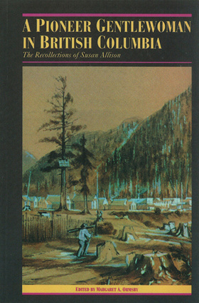
In 1860, at the age of fourteen, Susan Louisa Moir left England for British Columbia. After settling initially at Hope, she lived briefly in both Victoria and New Westminster, then B.C.’s two most important settlements. Returning to Hope, she helped her mother open the community’s first school, and in 1868 she married John Fall Allison, riding on her honeymoon over the Allison Trail into the unsettled Similkameen Valley. Her record of the voyage, of Victoria, New Westminster, and Hope as they were in the 1860s, and her memories of the isolated but fulfilling life she, her husband, and their fourteen children led in the Similkameen and Okanagan Valleys provide a unique view of the pioneer mind and spirit. There were exciting moments – a horseback journey to Hope through a forest fire that made the Skagit River boil, her husband’s boat nearly crushed by a gigantic ice floe on Lake Okanagan – but setting the tone of the whole account is an abiding natural curiosity and respect for both of her closest neighbours – the Similkameen and Okanagan Indians and the wilderness itself. It is these qualities, expressed in forceful, uncomplicated prose, that make Susan Allison’s Recollections a major addition to Canadian pioneer literature. li, 210 pages, 6 unnumbered leaves of plates : illustrations ; 24 cm Desiderata
|
1976 |