Catalog of British Columbiana and Pacific Northwest Americana
The Encyclopedia Cascadia Catalog indexes mostly non-fiction literature covering the Pacific Northwest coast of North America, with an emphasis on British Columbia, Idaho, Oregon, and Washington State.
| Catalog Title | Published |
|---|---|
|
Coal towns in the Cascades a centennial history of Roslyn and Cle Elum, Washington by John C. Shideler 
From Coal Mine to Recreational In the early 1880s, the Northern Pacific Railroad discovered coal in Roslyn, Washington. By 1886, mining coal in Roslyn became the company's top priority. The coal mines attracted a diverse workforce from across America and Europe. Each group, along with their hopes and dreams for a better life, brought their own culture, cuisine and customs, many of which are still in evidence today.Coal mining operations ceased in 1963. After more than 63 million tons of coal had been mind from the Roslyn coal field, Roslyn became a town with no industry. Over time, Seattlites, seeking sunny skies and fresh mountain air stimulated an increased demand for recreational property. As people began to discover the great natural beauty of the areas close to Seattle, tourism began to grow. People became enchanted with the area's history and its four-season recreational opportunities.The resort community of Suncadia was created on a 6,300-acre piece of property, southwest of Roslyn, which includes Mines No. 9 and No. 10. Suncadia is owned by subsidiaries of JELD-WEN, PacTrust and Lowe Enterprises. The goal of Suncadia LLC was to develop a four-season destination resort, while preserving the beauty and history of the land. An important component of the resort is the Rope Rider golf course, so named as a tribute to the coal miners, who precariously balanced themselves on the coal cars that maneuvered the steep slopes of the mine shafts. The enduring legacy of the Rope Riders is woven into the design, architecture and personality of the Roper Rider Clubhouse. [8], 151 pages : illustrations, chart, portraits; 29 cm Non-circulating [ 1 ]
|
1986 |
|
Closing time prohibition, rum-runners, and border wars by Daniel Francis 
Canadians have long associated Prohibition with the colorful history of the Jazz Age in the United States. But even before the American ban that was in place from 1920 to 1933, Canada initiated its own Prohibition. The so-called Cold Water Army was led by zealots and prudes preaching hellfire and damnation, but also by committed social reformers who recognized the ill effects of excessive drinking. In March 1918, the federal government banned the manufacture and importation of liquor. For the next 21 months, Canada was as dry as any law could make it, which admittedly was not very dry. Closing Time tells the story of this fascinating attempt to control the social habits of Canadian citizens. It began as a popular crusade to cleanse society of a widespread evil, but instead became an opportunity for larceny, profit, and violence on a grand scale. 186 pages : illustrations (some colour), maps, portraits ; 24 cm. Desiderata
|
2014 |
|
Clifford Gleason the promise of paint by Roger Hull , Clifford Gleason (Artist), Hallie Ford Museum of Art (Host institution) 
Clifford Gleason (1913-1978), who grew up in Salem and spent his adult life in both Salem and Portland, was a talented and highly original artist whose work remains of keen interest to a small and loyal group of collectors and artists but whose accomplishments are less generally known than those of other Oregon mid-century artists. Clifford Gleason: The Promise of Paint' serves as both an introduction and a definitive study of an 'artist's artist,' who until now has not received the sustained attention that he and his work are due. It traces his career from the 1930s until the last months of his difficult life-difficult because of alcoholism, near poverty, and homosexuality in a repressive era. In paint, Gleason found the only realm in which he felt competent, confident, and successful; paint offered the promise of accomplishment.0Roger Hull's knowledgeable text offers a chronological study combining biography, analysis of Gleason's artworks, and assessment of his place within the broader context of contemporary and Pacific Northwest art.0Published in conjunction with an exhibition at the Hallie Ford Museum of Art at Willamette University, this richly illustrated monograph examines Gleason's identity as a modern artist as he responded to the rapid changes in artistic modernism from the late 1930s, when he studied with Louis Bunce at the Salem Federal Art Center, to the 1970s, when he rethought the legacy of Abstract Expressionism in works that are unique to him, visually beautiful and poetically expressive. Exhibition: Hallie Ford Museum of Art, Salem, USA (20.08-31.10.2020) 95 pages : illustrations (chiefly color) ; 32 cm Desiderata
|
2020 |
|
Clearwater steam, steel, & spirit by Carole Simon-Smolinski, Anne Weatherill (Illustrator) 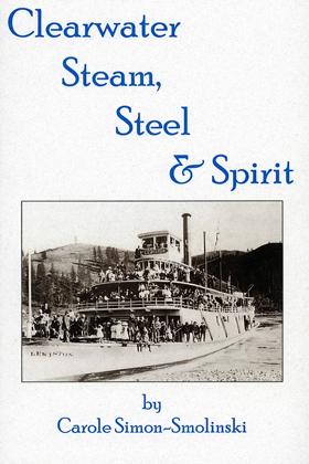
The era of stern-wheel steamboats on the Clearwater River, Idaho, speaks of a quieter time. Sometimes we long to return to that age. Railroads, which played such an important part in the development of that region, are now as much a part of the past as the steamers. Nostalgia carries our thoughts back to those years as well, when time moved slower in a more peaceful setting. But looking back distorts reality. Stern-wheelers and railroad trains moved clocks rapidly forward, catching the wilderness of North Central Idaho up with the modern times of early 20th century America. They played an important role in the development of the Clearwater Country, just as the pioneer spirit left its important legacy. They must not be forgotten. - author v, 101, [1] pages + [1] page advertisement : illustrations, map, portraits ; 14 x 19 cm Non-circulating [ 1 ]
|
1984 |
|
Clearwater country! the travelers' historical and recreational guide, Lewiston, Idaho--Missoula, Montana by Borg Hendrickson, Linwood Laughy 
Few special places lie hidden in America, left much as they have been for centuries. Among them are the mountains, meadows, forests and streams of Clearwater Country. Here can be found the entire saga of the American west - from missionaries to miners, settlers to soldiers, outlaws and vigilantes, generals and war chiefs and more. The reader can follow in the footsteps of explorers Meriwether Lewis, William Clark and Sacagawea; missionaries Henry and Eliza Spalding; Nez Perce Chiefs Twisted Hair, Lawyer, Looking Glass and Joseph; General O.O. Howard; outlaw Henry Plummer - and dozens of other figures who wove the rich tapestry of Clearwater Country's historical past. This book will also help you discover Clearwater Country's wild and beautiful natural world - its flora and fauna, streams and rivers, beaches and hot springs, campgrounds and hiking trails. In addition to the historical and recreation guides, six additional chapters provide background information for! armchair historians and present or future visitors. The book includes maps, historical photos and original artwork. iv, 230 pages : illustrations, maps ; 22 cm Non-circulating [ 1 ]
|
1999 |
|
Clatsop County, Oregon a history by Emma Gene Miller 
Emma Gene Miller’s Clatsop County, Oregon: A History chronicles the arduous pioneer settlement and industrial development of the extreme northwestern edge of the Oregon territory, a rugged coastal enclave defined by the violent collision of the Columbia River and the Pacific Ocean. The narrative maps how the impenetrable barrier of the coastal temperate rainforest severely obstructed early overland migration, forcing indigenous populations, fur traders, and subsequent settlers to rely entirely on navigating the treacherous aquatic highway of the Columbia River Bar. By detailing the transition from an isolated trading outpost to a booming epicenter for salmon canning and massive timber extraction, the text illustrates how engineering robust maritime infrastructure was strictly dictated by the severe environmental realities of this storm-battered estuarine topography. Ultimately, the account demonstrates that artificially stabilizing this hazardous navigational gateway and conquering the dense biological mass of the surrounding wilderness were the absolute prerequisites for anchoring a permanent, export-driven economy on this volatile oceanic frontier. 291 pages : illustrations ; 22 cm Non-circulating [ 1 ]
|
1958 |
|
Clackamas County historical, 1966-1967 history of Willamette Falls by Clackamas County Historical Society
The Clackamas County Historical Society's Clackamas County Historical, 1966-1967: History of Willamette Falls provides a detailed chronicle of the monumental waterfall situated along the Willamette River in northwestern Oregon. The narrative centers on the dramatic basalt horseshoe of the falls, mapping how this vital geographical chokepoint spurred the development of pioneer settlements like Oregon City and West Linn on opposing riverbanks. By documenting early industrial power generation, indigenous fishing encampments, and the construction of navigational locks, the text highlights the falls as a crucial artery connecting the fertile Willamette Valley to the broader Columbia River basin. Ultimately, this historical account vividly captures the profound physical and economic impact of this specific aquatic landmark on the early expansion of the Oregon Territory. 60 pages : illustrations ; 22 cm Non-circulating [ 1 ]
|
1967 |
|
Civil government of Idaho for the use of schools by Clinton Emmett Rose
Authored by prominent educator Clinton Emmett Rose, Civil Government of Idaho for the Use of Schools served as a foundational civic textbook designed to instruct early 20th-century students on the structural mechanisms of their newly established state. The volume systematically details the constitutional framework, legislative processes, and local administrative duties that governed Idaho, translating complex legal statutes into standardized classroom lessons. Through its pedagogical focus on civic duty and institutional mechanics, the book aimed to mold the children of frontier settlers and diverse immigrants into a unified, patriotic citizenry. A keen insight drawn from the work is how progressive-era public education functioned as a powerful instrument of state legitimization; by teaching Idaho’s legal and political frameworks as the absolute, unquestionable culmination of civilized order, early textbooks actively normalized settler-colonial authority for the next generation while completely erasing the pre-existing Indigenous governance structures that the new state had so recently displaced. 151 pages ; 19 cm ONLINE Circulation [ 2 ] Non-circulating [ 1 ]
|
1912 |
|
City of dreams a guide to Port Townsend by Peter Simpson, Robin Biffle 
City of Dreams: A Guide to Port Townsend, edited by Peter Simpson in collaboration with Robin Biffle and other local writers, is a 1986 regional history and cultural guide published by Bay Press. The book explores the vibrant heritage of this prominent Olympic Peninsula seaport, famously nicknamed the "City of Dreams" due to early pioneer speculation that it would become the largest harbor on the West Coast. Blending local history, architectural appreciation, and community lore, the volume chronicles Port Townsend's boom-and-bust economic cycles, its preservation of late 19th-century Victorian architecture, and its enduring maritime traditions. Ultimately, it serves as an engaging and comprehensive resource for understanding the historical forces and distinct cultural identity that shaped one of Washington's most picturesque and architecturally significant coastal cities. 330 pages : illustrations, maps ; 24 cm Non-circulating [ 1 ]
|
1986 |
|
City limits walking Portland's boundary by David Oates 
"I walked all the way around Portland, along the invisible line called the Urban Growth Boundary. Where the dotted line followed rivers--the Sandy, the Clackamas, the Willamette, the Columbia--I went in a kayak. But it was mostly just a long walk on city streets and rural two-lanes… I journeyed intermittently for two years and two months." Portland's Urban Growth Boundary (UGB) was designed to hold the bursting metropolitan area in check while protecting Willamette Valley orchards and fields from sprawling suburbia. Since the inception of growth boundaries as a key component of Oregon's progressive land-use system in the 1970s, Portland has evolved into one of the nation's most successful and distinctive cities. David Oates traveled the 260-mile boundary that defines Portland to discover how the UGB has contributed to that success. City Limits is his engaging and thought-provoking record of the journey. From conversations with the people he encounters on his walks, Oates comes to view the UGB as a long-running experiment in community control over development. But in recent years, the growth boundary has come under fire from developers, property rights advocates, and other critics. Just after Oates completed his walks, a statewide vote gutted Oregon's land-use laws. Oates explores these issues of community and conflict on the UGB in the company of various individuals he sometimes invites along for the day's walk--artists, writers, urban planners, environmentalists, developers, a politician, a wine grape grower. Reflecting Oates's belief in the power of community and collaboration, many of their thoughts and writings about the experience are included in the book. 125 pages : map ; 23 cm Desiderata
|
2006 |
|
Circling north by Charles Lillard
|
1988 |
|
Circle of silver a history of the Lardeau and Trout Lake by Milton Parent
Milton Parent’s Circle of Silver: A History of the Lardeau and Trout Lake provides an exhaustive chronicle of the hard-rock silver and lead mining rushes that swept the northern Lardeau district during the late nineteenth and early twentieth centuries. Parent traces how remote boomtown settlements—most notably Trout Lake City, Ferguson, and Camborne—were rapidly carved from dense mountain forests along the Incomappleux (Fish) River and Lardeau River drainages. The text details the complex transportation lifelines required to support isolated mining camps, documenting the packaging of ore by pack trains over precipitous mountain passes, the construction of the Arrowhead and Kootenay railway branch, and the essential steamship connection at the head of Northeast Arm at Beaton that barged ore down to southern smelters. Richly supported by mining company records, claim maps, and archival photographs, the book documents both the frenzy and inevitable decline of an iconic interior mining frontier. 392 pages : illustrations, maps, portraits ; 29 cm Desiderata
|
2000 |
|
Chuckanut chronicles by Robert B. Thomas
Chuckanut chronicles examines the precarious coastal settlement and intensive resource extraction situated along the steep, heavily timbered coastal mountains of northwestern Washington's Puget Sound. Thomas details how the region's formidable coastal topography—specifically the sheer sandstone cliffs plunging directly into the marine waters of Samish and Bellingham Bays, the dense, rain-soaked coniferous forests of the Chuckanut Range, and the narrow, treacherous littoral edge—strictly dictated the margins of early pioneer homesteading, precarious overland transit, and massive sandstone quarrying operations. By mapping the extraction of the region's highly valued structural sandstone—shipped almost entirely via waterborne transit prior to the arduous, cliff-side carving of Chuckanut Drive—and the tenuous clinging of early communities to the precipitous shoreline, the narrative highlights how this specific vertical geography anchored a profoundly rugged, resource-dependent maritime enclave. Ultimately, this regional record serves as a localized spatial history, demonstrating how the severe topographic constraints, vital deep-water access, and rich geological deposits of this Pacific Northwest landscape fundamentally shaped the highly resilient, extraction-driven character of the early Chuckanut coast. 64 pages illustrations Non-circulating [ 1 ]
|
1971 |
|
Chuck Davis' guide to Vancouver by Chuck Davis
|
1975 |
|
Chiru sakura = falling cherry blossoms a mother and daughter's journey through racism, internment and oppression by Grace Eiko Thomson , Meg Yamamoto 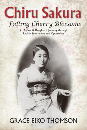
"At eight years old, Grace Eiko Nishikihama was forcibly removed from her Vancouver home and interned with her parents and siblings in the BC Interior. Chiru Sakura--Falling Cherry Blossoms is a moving and politically outspoken memoir written by Grace, now a grandmother, with passages from a journal kept by her late mother, Sawae Nishikihama. An educated woman, Sawae married a naturalized Canadian man and immigrated to Canada in 1930. They came with great hopes and dreams of what Canada could offer them. However, within just a little more than a decade after settling happily in Paueru Gai (Powell Street) area, her dreams, and those of her husband's, were completely shattered. It was 1942 and more than 22,000 Japanese Canadians on the West Coast were interned and had their belongings, property and homes confiscated, and then sold off by the Government of Canada. After the war ended, restrictions on Japanese Canadians' movement continued for another four years and the Government ordered anyone of Japanese ancestry to move 'east of the Rockies,' or be deported to Japan. There was nothing on the West Coast to return to, so the Nishikihama family moved first to rural Manitoba and, when government restrictions were lifted, later to Winnipeg. At eighty-four years of age, Sawae began writing her memories for her children, ensuring they would know their family's story. While translating her mother's journal, Grace began to add her own experiences alongside her mother's, exploring how generational trauma can endure, and how differently she and her mother interpreted those years of struggle. Despite her years spent studying art and working as a gallery director and curator, translating her mother's writings, and her country's perceived efforts to simply move on from a dark period in Canada's history, Grace continues to seek an understanding of her past, while facing both sexism and racism. As an advocate for reconciliation, she openly shares her story with the next generations; throughout, Grace returns to her mother's teachings of hope and resilience symbolized in the cherry blossoms around what was once their home."-- Provided by publisher 198 pages : illustrations, portraits (black and white) ; 23 cm Desiderata
|
2021 |
|
Chinuk Wawa kakwa nsayka ulman-tilixam laska munk-kemteks nsayka = as our elders teach us to speak it by Chinuk Wawa Dictionary Project (Compiler), Confederated Tribes of the Grand Ronde Community of Oregon (Publisher) 
Chinuk Wawa (also known as Jargon and Chinook Jargon) is a hybrid lingua franca consisting of simplified Chinookan, combined with contributions from Nuuchahnulth (Nootkan), Canadian French, English, and other languages. It originated on the lower Columbia River, where it once was the predominant medium of intertribal and interethnic communication. Even after English came into general use on the lower Columbia, Chinuk Wawa survived for generations in families and communities shaped by the meeting of the region's historically diverse tribes and races. This Chinuk Wawa dictionary is based primarily on records from one such community, the Confederated Tribes of Grand Ronde, Oregon, where Chinuk Wawa is taught as a community heritage language. 494 pages : illustrations, maps ; 25 cm Desiderata
|
2012 |
|
Chinookan peoples of the lower Columbia by Robert T. Boyd , Kenneth M. Ames , Tony A. Johnson 
"Chinookan peoples have lived on the Lower Columbia River for millennia. Today they are one of the most significant Native groups in the Pacific Northwest, although the Chinook Tribe is still unrecognized by the United States government. In Chinookan Peoples of the Lower Columbia, scholars provide a deep and wide-ranging picture of the landscape and resources of the Chinookan homeland and the history and culture of a people over time, from 10,000 years ago to the present. They draw on research by archaeologists, ethnologists, scientists, and historians, inspired in part by the discovery of several Chinookan village sites, particularly Cathlapotle, a village on the Columbia River floodplain near the Portland-Vancouver metropolitan area. Their accumulated scholarship, along with contributions by members of the Chinook and related tribes, introduces readers to Chinookan history and culture in rich and sometimes surprising ways."--Back covers xix, 419 pages, 18 unnumbered pages of plates : illustrations, maps, portraits ; 23 cm Non-circulating [ 1 ]
|
2015 |
|
Chinook texts by Franz Boas, Charles Cultee 
Published in 1894, Chinook Texts is a foundational ethnolinguistic work compiled by anthropologist Franz Boas, who meticulously transcribed the myths, historical narratives, and cultural traditions of the Lower Chinook people directly from Charles Cultee, one of the last living fluent speakers. A keen insight drawn from the text is how the urgency of Boas's "salvage anthropology" highlights the devastating impact of colonization, demonstrating how the preservation of an entire linguistic system ultimately relied on the extraordinary memory of a single indigenous informant. By presenting the original phonetically transcribed Chinookan dialect alongside literal English translations, the volume rigorously documents the complex grammatical syntax and nuanced worldview of the lower Columbia River tribes. Consequently, the book stands not merely as a collection of regional folklore, but as an indispensable archival record that permanently secured the heritage of a vanishing Pacific Northwest civilization. 1 preliminary leaf, 278 pages, 2 leaves of plates : portraits ; 24 cm ONLINE Circulation [ 1 ]
|
1894 |
|
Chinook texts by Franz Boas 
Franz Boas’s 1894 compilation, Chinook texts, provides an essential linguistic and ethnographic rescue of the Lower Chinookan oral traditions, preserving the worldview of the preeminent mercantile power at the mouth of the Columbia River. Transcribed from Charles Cultee—one of the last fluent speakers of the language—the narratives function as an intricate geographic ledger that maps the ancient tidewater trade routes, seasonal salmon-fishing encampments, and navigation corridors governing the region's coastal economy. The text illustrates how the Chinook maintained control over this vital riverine choke point through complex trade negotiations and deep interdependent alliances with both interior nations and coastal neighbors. For historians of frontier settlement, Boas’s compilation underscores that the early maritime fur trade and subsequent pioneer infrastructure—most notably the establishment of Fort Astoria—were deliberately mapped directly onto this highly organized indigenous mercantile geography, proving that early Euro-American logistics were entirely dependent on established Chinookan river networks and territorial knowledge. 278 pages frontispiece (portrait) ; 25 cm. ONLINE Circulation [ 1 ]
|
1894 |
|
Chinook resilience heritage and cultural revitalization on the lower Columbia River by Jon Darin Daehnke 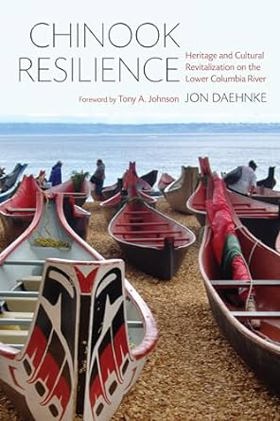
The Chinook Indian Nation--whose ancestors lived along both shores of the lower Columbia River, as well as north and south along the Pacific coast at the river's mouth--continue to reside near traditional lands. Because of its nonrecognized status, the Chinook Indian Nation often faces challenges in its efforts to claim and control cultural heritage and its own history and to assert a right to place on the Columbia River. Chinook Resilience is a collaborative ethnography of how the Chinook Indian Nation, whose land and heritage are under assault, continues to move forward and remain culturally strong and resilient. Jon Daehnke focuses on Chinook participation in archaeological projects and sites of public history as well as the tribe's role in the revitalization of canoe culture in the Pacific Northwest. This lived and embodied enactment of heritage, one steeped in reciprocity and protocol rather than documentation and preservation of material objects, offers a tribally relevant, forward-looking, and decolonized approach for the cultural resilience and survival of the Chinook Indian Nation, even in the face of federal nonrecognition xix, 233 pages : illustrations, maps ; 24 cm. Non-circulating [ 1 ]
|
2017 |
|
Chinook a history and dictionary by Edward Harper Thomas
Chinook a history and dictionary examines the rapid linguistic synthesis and sprawling intercultural trade networks situated across the profoundly fractured, multi-linguistic macro-geography of the Pacific Northwest coast and interior. Thomas details how the region's formidable topography—specifically the deeply isolated river valleys that historically fostered immense indigenous linguistic diversity, the vast maritime trading corridors of the coastal waterways, and the sprawling trans-mountain fur routes—strictly dictated the margins of intercultural diplomacy, commercial bartering, and the absolute necessity of a highly adaptable frontier pidgin. By mapping the rapid dissemination of Chinook Jargon—a utilitarian trade language that bridged the severe communicative divides between diverse Native populations, European maritime explorers, and overland fur trappers navigating this immense, compartmentalized terrain—the narrative highlights how this specific highly fragmented geography anchored a profoundly interconnected, linguistically pragmatic commercial network. Ultimately, this linguistic and historical record serves as a macro-level spatial history, demonstrating how the immense topographic barriers, vital commercial riverine routes, and intense cultural convergences of this Pacific Northwest landscape fundamentally shaped the highly practical, cross-cultural character of early frontier communication. xi, [1], 171 pages : portraits ; 23 cm Non-circulating [ 1 ]
|
1970 |
|
Chinese opium in America, 1850-1920 by Bennet Bronson , Chuimei Ho 
"Many Chinese-American historians have tended to shy away from the subject of Chinese opium use in 19th century North America entirely and so have their counterparts in Asia. Opium use among Chinese immigrants was widespread, economically important, and -- until 1908-9 -- perfectly legal in most parts of the United States and Canada. Opium made hard lives more bearable and, perhaps due to easy availability and modest prices, seems not to have caused nearly as much violent crime as alcohol did then or as opioid drugs like heroin and fentanyl do nowadays. Our discussion focused on the abundant texts and artifacts relating to opium found at Chinese sites on this continent. As of now, more hard data on Chinese opium use is available at those sites than anywhere else in the world, including China itself. We have made several important discoveries when summarizing that data. For one thing, opium was not a profitable commodity in the U.S. and Canada during the 19th century. For another, as has not been previously recognized, the containers and equipment associated with the drug can quite easily be traced to their sources. Historians and archaeologists will find such information essential to their work"-- Provided by publisher xiv, 199 pages : illustrations, maps ; 26 cm Desiderata
|
2023 |
|
Chinatown, Boise, Idaho, 1870-1970 by Arthur A. Hart 
Boise's Chinatown was a rich and colorful part of community life for more than a century. Arthur A. Hart has devoted more than thirty years to researching Chinese people in Idaho, including Boise s Chinatown. You will learn why the Chinese came here, the prejudice and hardships they faced, and their important contributions to the city and the state. xiv, 144 pages : illustrations, maps, portraits ; 28 cm Desiderata
|
2002 |
|
China doctor of John Day by Jeffrey G. Barlow, Christine Richardson 
The remarkable story of Ing Hay, the "China Doctor" who became the most famous and capable frontier physician in the John Day country of Eastern Oregon. Serving patients from the late 19th century to 1948, he was a traditional Chinese physician who, with his herbal medicines, worked more cures than the laboratory-oriented doctors of the area. Illustrated. 160 pages. ix, 118 pages : illustrations ; 22 cm Desiderata
|
1979 |
|
Chimacum In the valley near the water by Nancy L. McDaniel 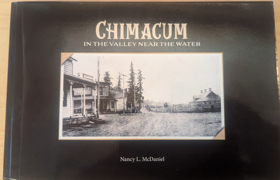
"In the Valley, Near the Water" are the first words of Chimacum High School's Alma Mater song. Written by Duane Montgomery, cherished music director, those words have a special meaning for Chimacum residents. Published in 2023 by local historian Nancy L. McDaniel, Chimacum: In the Valley Near the Water provides an intimate local history of the Chimacum Valley and its surrounding agricultural communities on Washington's Olympic Peninsula. The narrative chronicles the area's transition from ancestral indigenous homelands to a bustling hub of pioneer farming, timber harvesting, and dairy production driven by 19th-century homesteaders. Drawing on extensive family archives, oral histories, and photographs, the book meticulously reconstructs the daily lives, schoolhouses, and community networks of early settlers. A keen insight drawn from the text is how its granular, bottom-up preservation of rural genealogy reveals the quiet, persistent labor required to carve an agrarian society out of a heavily forested frontier, offering a localized counterweight to grand narratives of Pacific Northwest expansion. 277 pages Non-circulating [ 1 ]
|
2023 |