Catalog of British Columbiana and Pacific Northwest Americana
The Encyclopedia Cascadia Catalog indexes mostly non-fiction literature covering the Pacific Northwest coast of North America, with an emphasis on British Columbia, Idaho, Oregon, and Washington State.
| Catalog Title | Published |
|---|---|
|
A history of southeastern Idaho an intimate narrative of peaceful conquest by empire builders by Merrill D. Beal 
Merrill D. Beal’s A history of southeastern Idaho: an intimate narrative of peaceful conquest by empire builders explores the steady pioneer settlement and enduring agricultural development of the arid, volcanic plains and high-altitude valleys of the upper Snake River basin. The narrative illustrates how the challenging environmental realities of this inland topography—defined by vast expanses of sun-baked sagebrush, stark lava fields, and the vital but unpredictable waters of regional rivers—initially required immense resilience and cooperative effort from early agrarian homesteaders. By detailing the gradual transition from isolated frontier encampments to the collaborative establishment of robust farming colonies and the thoughtful expansion of essential railway and irrigation networks, the text highlights how the region's prosperity relied on community-driven adaptation to a demanding landscape. Ultimately, the account demonstrates that cooperatively harnessing the limited water resources and patiently cultivating the high-desert soil were essential steps in transforming a remote, rugged frontier into a thriving, deeply interconnected agricultural heartland of the intermountain West. 443 pages : illustrations, map ; 20 cm Non-circulating [ 1 ]
|
1942 |
|
Archaeology of the upper Columbia region by Donald Collier , Alfred E. Hudson , Arlo Ford 
Donald Collier, Alfred E. Hudson, and Arlo Ford’s Archaeology of the upper Columbia region explores the deep historical presence and profound environmental adaptation of the indigenous communities residing along the vast, arid reaches of the upper Columbia River basin. The narrative illustrates how the demanding environmental realities of this inland topography—defined by deep, plunging riverine trenches, expansive sagebrush plateaus, and the dramatic seasonal fluctuations of the region's hydrology—required immense ingenuity, resilience, and a deep, localized ecological knowledge from the area's earliest inhabitants. By detailing the careful archaeological recovery of material culture—including specialized aquatic harvesting technologies, complex semi-subterranean winter dwellings, and intricate tools for processing indigenous flora and fauna—the text highlights how these societies flourished by thoughtfully harmonizing their daily lifeways with the river's vital rhythms. Ultimately, the account demonstrates that collaboratively managing the seasonal abundance of the natural waterways and patiently utilizing the resources of the Columbia Plateau were essential elements in sustaining vibrant, enduring cultures deeply rooted in this rugged environment long before the era of modern industrialization. 176, [1] pages : including illustrations (including maps, plans) XXII plates, tables, profiles ; 26 cm Non-circulating [ 1 ]
|
1942 |
|
British Columbia and the United States the north Pacific slope from fur trade to aviation by H. F. Angus , F. W. Howay, W. N. Sage 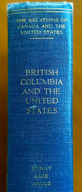
The region dealt with contains those parts of North Pacific Slope where British interests have prevailed. Before the year 1846 this included the valley of the Columbia River, and also, in a sense, the Snake River Country. The backbone of the narrative, which extends from the early maritime fur-trade days of the eighteenth century down to the present, is largely economic in character. xv, 408 pages illustrations (maps) 25 cm Desiderata
|
1942 |
|
At the end of the car line by Ben Hur Lampman 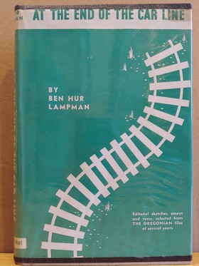
At the End of the Car Line, published in 1942 by Binfords & Mort in Portland, Oregon, is a collection of editorial sketches, essays, and verses originally written by Ben Hur Lampman for The Oregonian, where he was a longtime columnist and associate editor. Lampman, a celebrated Oregon writer and the state’s poet laureate from 1951 until his death in 1954, was known for his lyrical yet accessible style, capturing the everyday life and natural beauty of the Pacific Northwest. This book reflects his versatility as a writer—blending prose and poetry to explore themes close to his heart. 1 preliminary leaf, 191, [1] pages : frontispiece (illustration) ; 21 cm Desiderata
|
1942 |
|
Esquimalt naval base a history of its work and its defences by F. V. Longstaff 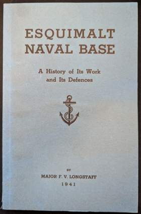
Esquimalt Naval Base: A History of Its Work and Its Defences by Major F. V. Longstaff is a detailed 1941 historical account chronicling the establishment, growth, and strategic significance of the British and Canadian naval presence on Vancouver Island. The book explores the evolution of the base from its early days in the 19th century through the World Wars, offering an in-depth look at its fortifications, engineering achievements, and role in Pacific maritime defense. 189 pages frontispiece, XII plates on 6 leaves 23 cm Non-circulating [ 1 ]
|
1942 |
|
Chief Seattle by Eva Greenslit Anderson, Fern Cousineau Duncan (Illustrator) 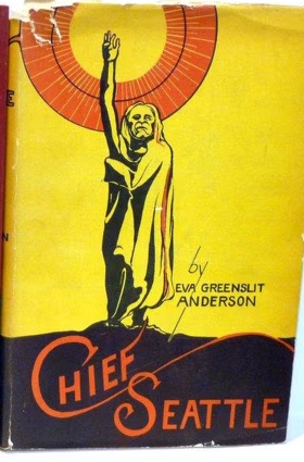
Eva Greenslit Anderson’s Chief Seattle explores the profound cultural transition and complex diplomacy that defined the early pioneer settlement of the resource-rich Puget Sound maritime basin. The narrative illustrates how the dynamic environmental realities of this coastal landscape—defined by dense, towering old-growth forests, intricate tidal estuaries, and the deeply ingrained seasonal rhythms of the Suquamish and Duwamish peoples—required profound mutual adaptation upon the arrival of the first American settlers. By detailing Chief Seattle's pragmatic leadership and his deliberate efforts to foster peaceful coexistence rather than conflict, the text highlights how the early physical survival of the Elliott Bay enclave relied heavily on cross-cultural cooperation and the sharing of essential indigenous knowledge regarding local waterways and aquatic subsistence. Ultimately, the account demonstrates that thoughtfully navigating these delicate cultural intersections and collaboratively adapting to the shared maritime environment were essential steps in establishing the foundational civic roots of the region. 390 pages, 3 unnumbered leaves of plates : illustrations (some color), genealogical tables, maps, portraits ; 24 cm Non-circulating [ 1 ]
|
1943 |
|
The ports of British Columbia by Agnes Rothery
Agnes Rothery’s The ports of British Columbia explores the dynamic maritime development and enduring economic integration of the rugged, resource-rich coastal hubs of Victoria and Vancouver. The narrative illustrates how the challenging environmental realities of this northern Pacific landscape—defined by intricate island archipelagos, deep-water fjords, and the imposing forested barricades of the Coast Mountains—initially required immense navigational skill and resilience from early maritime traders and settlers. By detailing the steady transition from isolated Hudson's Bay Company trading posts and scattered lumber camps to the collaborative construction of massive modern docklands and transcontinental rail termini, the text highlights how the region's prosperity relied on thoughtfully harnessing its strategic coastal geography. Ultimately, the account demonstrates that cooperatively bridging the vast oceanic distances and integrating robust, global shipping infrastructure were essential steps in transforming these distant colonial enclaves into thriving, interconnected maritime anchors of the Pacific seaboard. vii, 279 pages, 7 unnumbered pages of plates : illustrations ; 23 cm Non-circulating [ 1 ]
|
1943 |
|
Sacajawea of the Shoshones by Della Gould Emmons
Della Gould Emmons’s Sacajawea of the Shoshones explores the remarkable resilience and vital cross-cultural mediation that defined the Lewis and Clark Expedition's groundbreaking transit across the vast, unmapped expanse of the American West. The narrative illustrates how the profound environmental realities of this continental landscape—spanning the towering alpine barricades of the Bitterroot Range, the rushing torrents of the Columbia River basin, and the sheer distances of the high plains—demanded immense adaptability and endurance from the explorers. By detailing Sacajawea’s indispensable role as a guide, translator, and diplomatic liaison, the text highlights how the physical survival and navigational success of the party relied heavily on the sharing of deep, localized indigenous knowledge and established intertribal networks. Ultimately, the account demonstrates that thoughtfully navigating these delicate cultural intersections and cooperatively adapting to a daunting, multifaceted wilderness were essential to peacefully bridging the immense geographical divide between the continental interior and the Pacific seaboard. 316 pages ; 21 cm Non-circulating [ 1 ]
|
1943 |
|
The Pacific coast ranges by Roderick Peattie , Donald Culross Peattie (Contributor), Archie Binns (Contributor), John Walton Caughey (Contributor), Lois Crisler (Contributor), Aubrey Drury (Contributor), Idwal Jones (Contributor), Judy Van der Veer (Contributor), Thomas Emerson Ripley (Contributor), Daniel E. Willard (Contribu
A now-historical look at the people, culture, and geography of the US Pacific Coast ranges from California to Washington State xviii, 402 pages, frontispiece, 16 unnumbered pages of plates : illustrations, maps ; 24 cm Non-circulating [ 1 ]
|
1946 |
|
Maquinna the magnificent by B. A. McKelvie 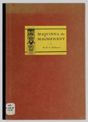
A history of the early interactions between the aboriginal residents of Vancouver Island and the European visitors and settlers, centred on the life of Chief Maquinna and the Spanish post at Nootka ix, 65 pages color ; 27 cm ONLINE Circulation [ 1 ]
|
1946 |
|
Beyond the Garden Gate by Sophus Keith Winther 
A classic story of a young man's coming of age, set in Eugene and the Willamette Valley in the early part of this century. Sophus K. Winther (1893-1983) was a Danish-American novelist and professor of English at the University of Washington. x, 289 s Desiderata
|
1946 |
|
Northwest gateway the story of the port of Seattle by Archie Binns
ix, 313 pages, 8 unnumbered pages of plates : illustrations (black and white), map (on lining papers), portrait ; 24 cm Non-circulating [ 1 ]
|
1946 |
|
Robert G. Bailey’s River of no return chronicles the relentless pioneer colonization, violent martial pacification, and massive terrestrial subjugation of the profoundly fractured, impassable alpine wilderness defining central Idaho’s deep riverine trenches. The narrative maps how the severe environmental realities of this untamed inland topography—defined by the plunging, sheer-granite chasms of the Salmon River, its violently volatile, unnavigable kinetic hydrology, and the towering barricades of the Bitterroot Range—initially completely paralyzed terrestrial transit and dictated a highly precarious, isolated pioneer existence. By detailing the grueling transition from vulnerable, disconnected gold camps reliant on fragile pack-mule trails to the aggressive deployment of heavy, one-way timber scows, mechanized mineral extraction, and the relentless projection of military force to physically displace the Nez Perce, the text illustrates how the economic and geopolitical mastery of the basin was strictly governed by the urgent necessity of artificially conquering this hostile geographic labyrinth. Ultimately, the account demonstrates that systematically attempting to domesticate the violent aquatic energy of the canyon and violently imposing a rigid, fortified commercial grid over an impenetrable mountain frontier were the absolute prerequisites for shattering the region's severe geographical detachment and anchoring the remote Idaho hinterland to the broader industrial machinery of the inland empire. xxix, 754 pages : illustrations, portraits, maps ; 24 cm Non-circulating [ 1 ]
|
1947 |
|
When Seattle was a village by Sophie Frye Bass
Sophie Frye Bass’s When Seattle was a village chronicles the arduous pioneer colonization and massive terrestrial subjugation of the violently contoured, rain-choked maritime frontier of Elliott Bay. The narrative maps how the severe environmental realities of this untamed coastal topography—defined by plunging glacial ridges, treacherous, fluctuating tideflats, and an impenetrable barricade of towering old-growth Douglas fir—initially paralyzed efficient terrestrial transit and dictated a profoundly isolated, precarious pioneer existence. By detailing the grueling transition from vulnerable, mud-bound shoreline camps reliant on fragile aquatic transit to the explosive deployment of heavy, steam-powered sawmills and the relentless, mechanized leveling of the city's steep topography, the text illustrates how the physical and economic survival of the settlement was strictly governed by the urgent necessity of artificially mastering this heavily saturated and vertically hostile environment. Ultimately, the account demonstrates that systematically domesticating the wild tidal estuaries of Puget Sound and violently carving a rigid, integrated urban grid out of sheer, forested hillsides were the absolute prerequisites for shattering the region's profound geographical detachment and transforming a rugged frontier encampment into a heavily mechanized maritime anchor of the Pacific seaboard. 209 pages : illustrations ; 21 cm Non-circulating [ 1 ]
|
1947 |
|
The saga of American Falls Dam by Irvin E. Rockwell
Irvin E. Rockwell’s The saga of American Falls Dam explores the profound transformation and careful hydrological management of the Snake River basin in southeastern Idaho. The narrative illustrates how the challenging environmental realities of this high-desert region—defined by vast sagebrush steppes, limited rainfall, and the immense, untapped energy of the river's cataracts—initially constrained early agricultural efforts. By detailing the complex, politically collaborative process of constructing the impressive concrete and earth-fill dam, the text highlights how the region's economic growth relied on thoughtfully harnessing the river's water. Crucially, it also recounts the remarkable community effort and logistical coordination required to carefully relocate the original town of American Falls to make way for the new reservoir. Ultimately, the account demonstrates that managing the Snake River's flow and reshaping the local landscape were essential steps in turning a dry, isolated area into a thriving, irrigated agricultural heartland of the intermountain West. 201 pages illustrations, portraits, facsimiles 23 cm Non-circulating [ 1 ]
|
1947 |
|
Cowlitz County, Washington, 1854-1947 by Hattie Barlow Olson
Hattie Barlow Olson’s Cowlitz County, Washington, 1854-1947 explores the gradual pioneer settlement and enduring industrial development of a dynamic, heavily forested riverine corridor in southwestern Washington. The narrative illustrates how the challenging environmental realities of this landscape—defined by the dense, towering timber of the Pacific edge, the fertile but flood-prone valleys of the Cowlitz and Columbia rivers, and the isolating distances of early territorial life—initially required immense resilience and adaptation from early homesteaders. By detailing the steady transition from isolated riverbank communities reliant on fragile canoe and steamboat transit to the collaborative integration of robust railroad networks and steam-powered logging camps, the text highlights how the county's economic growth relied on thoughtfully harnessing the region's immense arboreal and aquatic resources. Ultimately, the account demonstrates that cooperatively bridging these dense forests and managing the vital river arteries were essential steps in transforming a quiet pioneer enclave into a thriving, deeply interconnected timber and agricultural heartland of the Pacific Northwest. 88 pages : illustrations, portrait, map ; 21 cm Non-circulating [ 1 ]
|
1947 |
|
Polk County Centennial souvenir booklet and program by Polk County Centennial Committee, Dallas, Or, Wes Sherman 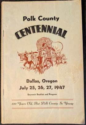
The Polk County Centennial Committee and Wes Sherman’s Polk County Centennial souvenir booklet and program explores the gradual pioneer settlement and enduring civic development of the fertile Willamette Valley and the forested foothills of the Oregon Coast Range. The narrative illustrates how the environmental realities of this landscape—defined by rich alluvial soils, dense stands of western timber, and the gentle, meandering arteries of the Willamette River and its tributaries—welcomed early settlers but still required immense resilience and adaptation to establish permanent homesteads. By detailing the steady transition from the initial, isolated land claims of Oregon Trail arrivals to the collaborative growth of enduring communities like Dallas and Independence, the text highlights how the county's flourishing relied on the careful, community-driven cultivation of its natural abundance. Ultimately, the account demonstrates that cooperatively clearing the valley for agriculture and integrating reliable river and rail transit were essential steps in transforming a distant pioneer destination into a thriving, deeply rooted agricultural and civic heartland of western Oregon. 96 pages : illustrations, portraits ; 24 cm Non-circulating [ 1 ]
|
1947 |
|
Stern-wheelers up Columbia a century of steamboating in the Oregon country by Randall V. Mills 
Jennie was different. Her wheels were astern, instead of port and starboard. Her rudders were close to the wheel. But she was the prize forerunner of a host of river favorites - the stern-wheelers - that were particularly adaptable to river sailing. The Jennie Clark was fast; she could cut swiftly through the rough waters of the Columbia River; she was narrow enough to skim around rocks and rapids. The story of her trips, and those of many of her successors, presents a nostalgic panorama of the adventurous days of the old Northwest, when steamboats and the men who captained them sailed their way into a new civilization. This is the first special account of steamboat navigation in the Columbia River country, and a comprehensive picture of the opening up and subsequent development of the Northwest. From the arrival of the little Beaver at Fort Vancouver in 1836 to the maiden voyage of the 219-foot stern-wheeler Portland in 1947, this entertaining book offers many facets, including the historical conflicts with Indians, the development of the wheat fleet, famous ship disasters, and accounts of the spectacular ships that ran the rapids. The region covered includes all the rivers and lakes of the Northwest except the Puget Sound area. There are tales, too, of the men who manned these ships - of Captain J. C. Ainsworth, who learned steamboating on the Mississippi; of Ben Holladay, far-famed in stagecoach history, who came north to carve his niche in steamship transportation; of U. B. Scott, whose steamship system grew to huge proportions; of the men of the Oregon Steamship Navigation Company, and many others. There are few Jennies left. Boat enthusiasts should take note of the compact appendix listing all boats, with dates of construction, sizes, types, and details of their final dispositions. It is all here - rich in lore, in the grandeur and dynamism that characterizes the great Northwest itself. 212 pages : illustrations, maps ; 25 cm Non-circulating [ 1 ]
|
1947 |
|
Fort Langley outpost of Empire by B. A. McKelvie 
An account of the Hudson's Bay Company's operation at Fort Langley in southern British Columbia in the early-to-mid 19th Century ix, 98 pages illustrations (some color) maps (on lining-papers) 27 cm Desiderata
|
1947 |
|
Esquimalt "place of shoaling water" by Leigh Burpee Robinson 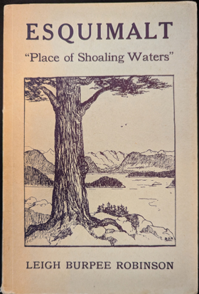
Esquimalt: Place of Shoaling Waters by Leigh Burpee Robinson is a 1947 local history detailing the early settlement and maritime evolution of Esquimalt, British Columbia. The book chronicles the area's transformation from its origins as a Salish First Nations home and Hudson's Bay Company property into Canada's vital western naval base. Through rich historical detail and illustrations by B. Digby Robinson, the author explores the military and community developments that firmly established Esquimalt's significance on the Pacific Coast. 1 online resource (128 pages) Non-circulating [ 1 ]
|
1948 |
|
The valley of youth by Charles William Holliday 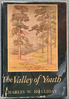
The author was born in London in 1870. At the age of 16 he went to sea, sailing around the Horn to San Francisco. In 1889, he moved to British Columbia, and engaged in ranching and other occupations in the Okanagan country. In 1937, he moved to Victoria, where he wrote this, his first book 357 pages : illustrations (some color), map (on lining-papers) ; 25 cm Non-circulating [ 1 ]
|
1948 |
|
Letters of Dr. John McLoughlin written at Fort Vancouver 1829-1832 by John McLoughlin, Burt Brown Barker 
John McLoughlin and Burt Brown Barker’s Letters of Dr. John McLoughlin written at Fort Vancouver 1829-1832 chronicles the relentless corporate colonization and massive bureaucratic subjugation of the vast, geographically isolated Columbia River basin. The narrative maps how the severe environmental realities of this untamed Pacific topography—defined by the treacherous, storm-battered bar of the Columbia estuary, impenetrable coastal timberlands, and the staggering, unmapped distances of the inland empire—initially dictated a highly precarious mercantile existence, severing early fur brigades from reliable trans-oceanic supply lines. By detailing McLoughlin's ruthless, centralized deployment of heavy agrarian infrastructure, mechanized riverine sawmills, and a rigidly engineered, continent-spanning logistics grid anchored entirely at Fort Vancouver, the text illustrates how the geopolitical monopoly of the Hudson's Bay Company was strictly governed by the urgent necessity of artificially mastering this colossal geographic void. Ultimately, the account demonstrates that systematically domesticating the raw ecological wealth of the Pacific Northwest and violently imposing a highly integrated, proto-industrial corporate architecture over a fractured wilderness were the absolute prerequisites for binding the untamed Columbia basin to the global commercial machinery of the British Empire. [2], iv, [2], 376 pages : map (on lining paper) ; 25 cm Non-circulating [ 2 ]
|
1948 |
|
Longview, the remarkable beginnings of modern western city by John M. McClelland
John M. McClelland’s Longview, the remarkable beginnings of a modern western city chronicles the aggressive, hyper-calculated corporate colonization and massive hydrological subjugation of a volatile, flood-prone riverine delta situated at the confluence of the Cowlitz and Columbia rivers. The narrative maps how the severe environmental realities of this heavily saturated topography—defined by unstable alluvial marshes, violent seasonal inundations, and the untamed kinetic energy of the Pacific Northwest’s primary aquatic arteries—initially rendered the landscape completely uninhabitable for large-scale terrestrial settlement. By detailing the explosive deployment of colossal, steam-powered dredging infrastructure and the ruthless, grid-based imposition of a fully pre-fabricated urban architecture by the Long-Bell Lumber Company, the text illustrates how the physical and economic survival of the city was strictly dictated by the urgent necessity to artificially elevate, blockade, and master this massive wetland. Ultimately, the account demonstrates that violently burying the natural tidal basin beneath millions of cubic yards of dredged river sand and engineering the world's largest, heavily mechanized timber-processing epicenter were the absolute prerequisites for transforming a geographic void into a highly integrated, instantly modernized corporate anchor of the Pacific edge. 158 pages : illustrations, portraits Non-circulating [ 1 ]
|
1949 |
|
Sketches of early High Prairie by Nelia Binford Fleming
Nelia Binford Fleming’s Sketches of early High Prairie chronicles the arduous pioneer colonization and rigorous agricultural subjugation of a violently exposed, wind-scoured plateau suspended directly above the massive tectonic rift of the Columbia River Gorge. The narrative maps how the severe environmental realities of this unforgiving inland topography—defined by vast, sun-baked steppes, brutal rain-shadow drought, and the sheer basalt barricades severing the plateau from the region's primary aquatic arteries—initially paralyzed efficient terrestrial transit and dictated a profoundly isolated, precarious pioneer existence. By detailing the grueling transition from vulnerable, disconnected homesteads relying on primitive subsistence farming to the aggressive clearing of rugged scrubland and the eventual deployment of heavy, mechanized dry-land wheat infrastructure, the text illustrates how the physical and economic survival of the settlement was strictly governed by the urgent necessity of artificially domesticating this harsh, elevated geographic void. Ultimately, the account demonstrates that violently breaking the arid hardpan soil and systematically imposing a robust, integrated agrarian grid to conquer the profound continental detachment of Klickitat County were the absolute prerequisites for binding a desolate, wind-swept rimrock frontier to the broader commercial machinery of the inland empire. 61 pages, 4 unnumbered leaves of plates : illustrations, portrait ; 23 cm Non-circulating [ 1 ]
|
1949 |
|
Percival R. Jeffcott’s Nooksack tales and trails chronicles the arduous pioneer colonization and relentless terrestrial and hydrological subjugation of the violently overgrown, river-gouged frontier of Whatcom County at the extreme northwestern edge of the contiguous continent. The narrative maps how the severe environmental realities of this untamed coastal topography—defined by an impenetrable barricade of dense temperate rainforest, treacherous floodplain marshes, and the volatile, untapped kinetic energy of the Nooksack River—initially completely paralyzed overland transit and dictated a profoundly isolated, precarious pioneer existence. By detailing the grueling transition from vulnerable, disconnected riverbank camps reliant on fragile indigenous canoe routes to the aggressive physical dismantling of massive, deeply entrenched timber jams blocking the waterways, the text illustrates how the economic survival of the valley was strictly governed by the urgent necessity of artificially mastering this heavily saturated labyrinth. Ultimately, the account demonstrates that systematically domesticating the wild hydrological arteries of the basin and violently carving robust, mechanized overland transit corridors through sheer old-growth wilderness were the absolute prerequisites for shattering the region's geographical detachment and transforming a rugged, isolated borderland into a highly integrated agrarian and timber anchor of the Pacific seaboard. [14], 436 pages : illustrations, folded map, portraits ; 24 cm Non-circulating [ 1 ]
|
1949 |