Catalog of British Columbiana and Pacific Northwest Americana
Encyclopedia Cascadia Catalog contains book titles of mostly non-fiction Pacific Northwest Coast of North America Titles (primarially British Columbia, Idaho, Oregon and Washington State) in an easy-to-understand title catalog. If you see a link with this badge ONLINE CIRC it means that there is an online institution that provides free access to that title. In some cases there may be more than one institution hosting the title digitally.
| Catalog Title | Published |
|---|---|
|
Portland, Oregon, its history and builders by Joseph Gaston 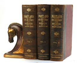
in connection with the antecedent explorations, discoveries, and movements of the pioneers that selected the site for the great city of the Pacific 3 volumes : illustrations, maps, portraits ; 27 cm ONLINE CIRC [ 3 ]
|
1911 |
|
Portland's audacious champion how Bill Naito overcame anti-Japanese hate and became an intrepid civic leader by Erica Naito-Campbell , Oregon State University Press (Publisher) 
"William "Bill" Sumio Naito (1925-1996) was a remarkable and visionary individual--the Portland-born son of Japanese immigrants who became one of the city's most significant business and civic leaders. Every day thousands of people drive on Naito Parkway alongside Portland's Waterfront Park, yet little has been written about the man for whom it was named. In this first biography, Erica Naito-Campbell, Bill's granddaughter, shows how his story is also the story of Portland, the city he loved. Naito's life, from the Great Depression and World War II through Portland's rebirth in the 1970s and its profound growth, tracked most of the major events in the city and was the catalyst for many of them. Through hard-earned success in importing and real estate with his brother Sam, Naito came to wield considerable power in the city, and his leadership led to much of what we consider iconic Portland today: the "Portland Oregon" sign near the Burnside Bridge, the annual Christmas tree in Pioneer Courthouse Square, and Harbor Drive's conversion to Waterfront Park. Naito's name became synonymous with civic leadership, whether it was growing Portland's urban tree canopy, revitalizing its downtown, or preserving historic buildings. But less is known about his difficult childhood--with a father who worked twelve-hour days and a mother whose treatment of him was harsh at best--and the racism he endured during World War II. After the expulsion of Japanese Americans following Pearl Harbor and his military service in Occupied Japan, Naito overcame great emotional turmoil to return to Portland and become one of its greatest change-makers."-- Provided by publisher x, 278 pages : illustrations, map, portraits ; 23 cm CIRC [ 0 ]
|
2024 |
|
Portland public sculptors monuments, memorials and statuary, 1900-2003 by Fred F. Poyner 
"This book is a non-fiction study of the lives of ten different sculptors and the key public sculptures each contributed to the landscape and identity of Portland, Oregon, between 1900 and 2003. Each chapter examines the history of how these artworks were created, the challenges each sculptor faced, and how these artworks in a variety of sculpture media have contributed to the public arts scene of Portland into the twenty-first century. For its discussion of historical sculpture unique to Portland, a researched examination is made into those subjects selected by each sculptor, where influences of national identity, patriotism, symbolic representation, and the lives of each sculptor help to better understand the history and forces at work which brought these sculptures into existence. Interviews with two of the sculptors offer personal insights into their creative process: from the studio design to final installation in Portland. From Roland Hinton Perry and Alice Cooper, to James Lee Hansen and Raymond Kaskey, sculptures ranging from bronze castings of U.S. presidents, to other historical and allegorical figures in copper and marble, the author provides an in-depth review and presentation of Portland's public art as never seen before"-- Publisher's website 128 pages : illustrations (some color), portraits ; 24 cm CIRC [ 0 ]
|
2021 |
|
Portland in three centuries the place and the people by Carl Abbott 
A compact and comprehensive history of Portland from first European contact to the twenty-first century, Portland in Three Centuries introduces the women and men who have shaped Oregon’s largest city. The expected politicians and business leaders appear, but Carl Abbott also highlights workers and immigrants, union members and dissenters, women at work and in the public realm, artists and activists, and other movers and shakers. Incorporating social history and contemporary scholarship in his narrative, Abbott examines current metropolitan character and issues, giving close attention to historical background. He explores the context of opportunities and problems that have helped to shape the rich mosaic that is Portland. This revised and updated second edition includes greater attention to the Indigenous peoples of the Portland region, Portland’s communities of color, and the challenges of recent years that have thrust Portland into the national spotlight. A highly readable character study of a city, and enhanced by more than sixty historic and contemporary images, Portland in Three Centuries will appeal to readers interested in Portland, in Oregon, and in Pacific Northwest history. 192 pages : illustrations, maps ; 26 cm CIRC [ 1 ]
|
2011 |
|
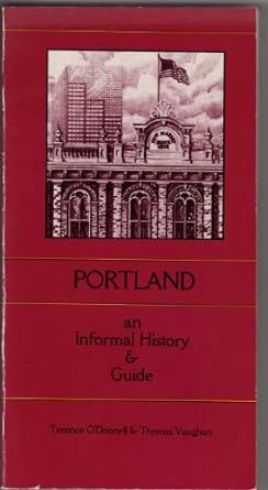
Portland an informal history & guide by Terence O'Donnell, Thomas Vaughan
|
1984 |
|
Portland people, politics, and power, 1851-2001 by Jewel Beck Lansing 
This is the definitive book on Portland's political history, beginning in 1845 when a 16-lot townsite was laid out on the bank of the Willamette River and continuing through the sesquicentennial of Portland city government. Jewel Lansing has amassed a treasure trove of information on Portland's civic and political life, which she presents in a lively volume, organized around accounts of the successive reigns of Portland's mayors. The story is rich in anecdotes that bring to life the unique individuals and controversial issues of Portland's distant and more recent past. Lansing shows that Portland's path to its present place as the 28th largest city in the United States, with a deserved reputation as one of the nation's most livable cities, has not always been smooth. Corruption, profiteering, and wide-open vice characterized the City of Roses at the turn of the 20th century, and every era has had its own controversies and rivalries: disputes over railroad franchises and rights-of-way, women's suffrage, public versus private power, the Chinese Exclusion Act, Prohibition, and the siting of freeways, to name just a few. Anyone with an interest in Portland, and in learning more about the individuals, events, and issues that have shaped it, will find this comprehensive history fascinating and informative. About the author: Jewel Lansing served as the elected City of Portland Auditor from 1983 to 1986 and as Multnomah County Auditor from 1975 to 1982. She was the author of eight books, including two about women and politics, and a murder mystery set in Portland City Hall. She is honored on Portland's Walk of the Heroines for her pioneering role as a woman in government and politics and her outstanding civic contributions. xii, 576 pages : illustrations, map ; 24 cm CIRC [ 1 ]
|
2003 |
|
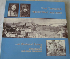
Port Townsend--years that are gone an illustrated history by Peter Simpson, James Hermanson
|
1979 |
|
Port Orford, a history by Patrick Masterson 
Published by local historian Patrick Masterson, Port Orford, A History chronicles the dramatic evolution of Oregon's oldest continuously settled town, perched precariously on a storm-lashed headland above the Pacific. The book traces the area's rich timeline from its 1851 founding amidst a brief gold rush and subsequent conflicts with local Native tribes, through its decades as a rugged timber and commercial fishing hub. Drawing on historical documents and archival photographs, the text captures the fierce independence required to inhabit a remote coastal enclave characterized by treacherous waters and geographic isolation. A keen insight drawn from the work is how Port Orford's unusual open-water port—where boats must be hoisted in and out of the sea by giant land-based cranes—serves as a physical metaphor for the town's entire existence; it illustrates that surviving on the edge of the wilderness demands a permanent, ingenious defiance against standard modern infrastructure. ii, 203 pages : illustrations ; 29 cm CIRC [ 1 ]
|
1994 |
|
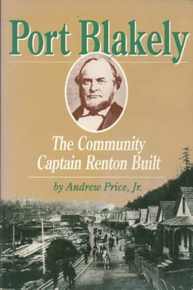
Port Blakely the community Captain Renton built by Andrew Price
|
1990 |
|
Port Angeles, U.S.A. by John D. McCallum, Lorraine Wilcox Ross , James Warner Bellah (Writer of introduction) 
197 pages, 32 unnumbered pages of plates : illustrations, map (on lining papers), portraits ; 24 cm CIRC [ 1 ]
|
1961 |
|
Port Alberni more than just a mill town by Jan Peterson 
Any community that has ever been labelled a mill town carries both the promise of prosperity and the constant threat of collapse, its fortune hinging on a single industry whose performance is as much related to the whims of a global economy as it is to the abundance of a key natural resource. The people of Port Alberni, located deep in Vancouver Islands Alberni Valley, know all too well the highs and lows that come with such a label. Jan Peterson, who lived in Port Alberni for two of the towns most tumultuous decades and worked as a reporter for the Alberni Valley Times, describes how the towns people persevered through three decades of boom and bust, developed a vibrant arts and sporting community, and strived to make life better under any circumstances. From the prosperous 1970s, when Port Alberni earned the reputation of forestry capital of Canada, to the decline of the industry in the 1980s, when economic uncertainty signalled a need for diversification, to the environmental protests in nearby Clayoquot Sound, which polarized the community, Port Alberni tells the story of Port Alberni from a perspective that is rarely heard. Through fascinating interviews and meticulous historical research, Peterson captures the heart and soul of a town so often defined by dollars and cents. 264 pages, 16 unnumbered pages of plates : illustrations, maps, portraits ; 22 cm. CIRC [ 1 ]
|
2014 |
|
Popular Day Hikes: South-Central Okanagan Kelowna, Penticton, Oliver by Gerry Shea 
Gerry Shea’s Popular Day Hikes: South-Central Okanagan serves as an accessible, comprehensive trail guide for exploring the diverse landscapes stretching from Kelowna and Penticton down to Oliver. The book details 35 distinct routes through the region, providing practical maps, elevation profiles, and trailhead directions across a striking cross-section of semi-arid bunchgrass, ponderosa pine forests, and dramatic canyon country. A keen insight drawn from the text is how outdoor recreation guidebooks in the interior Pacific Northwest function as quiet instruments of ecological management; by systematically channeling foot traffic onto designated paths, the guide helps protect fragile desert-ecosystem flora and sensitive wildlife habitats from the pressures of a booming regional tourism economy. 143 pages : colour illustrations, maps ; 22 cm. CIRC [ 0 ]
|
2015 |
|
Polly Bemis the life and times of a Chinese American pioneer by Priscilla Wegars , Asian American Comparative Collection (University of Idaho Laboratory of Anthropology) (Publisher), Caxton Press (Caldwell, Idaho) (Publisher) 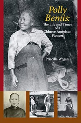
"Polly Bemis, the mistakenly named 'Lalu Nathoy' of books and film, was forcibly brought to the United States, and to Idaho Territory, in 1872 when she was just eighteen. In 1894 she married a Euroamerican man, Charlie Bemis, and they moved to a mining claim on the remote Salmon River; Charlie died in 1922 and Polly died in 1933. Since her death, Polly Bemis's life has been greatly romanticized. Supposedly, she was a prostitute, 'Hong King' was her Chinese owner, and Charlie Bemis 'won her in a poker game.' Not one of these statements is true. Polly's life was genuinely fascinating, and it is time to both celebrate the known facts about her and allow the stereotypical, undocumented legends to die out"--Provided by publisher xxvi, 529 pages : illustrations, maps ; 23 cm. CIRC [ 0 ]
|
2020 |
|
Polk County, Oregon, place names by Gordon W. Clarke
|
1977 |
|
Polk County Centennial souvenir booklet and program by Polk County Centennial Committee, Dallas, Or, Wes Sherman
|
1947 |
|
Points of Interest In Search of the Places, People, and Stories of BC by David Beers, Andrea Bennett 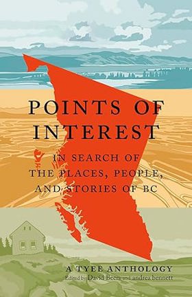
Take a trip across British Columbia with this enchanting collection of essays from thirty local writers. What makes wandering the vibrant land called British Columbia really special? Encounters with locals who are ready to share, over a coffee or a beer, quirky tales and powerful truths rooted in place and time. Consider this book a meet-up with 30 such storytellers, the perfect road companion for your journey real or imagined. The Tyee is the province’s oldest and most-read independent source of online news and ideas, renowned for its range of voices on politics, culture and nature. This anthology marking The Tyee’s 20th anniversary includes pieces published over the last two decades and includes the distinct perspectives of some of the region’s most celebrated writers, including J.B. MacKinnon, Alisa Smith, Cúagilákv (Jess H̓áust̓i), Arno Kopecky, Harrison Mooney, Michelle Cyca, Christopher Cheung, Andrew Nikiforuk, and many more, as well as illustrations by Nora Kelly. Pull up a chair and get their inside scoops on the places they call home. 288 p. CIRC [ 0 ]
|
2024 |
|
Point Roberts, U.S.A. the history of a Canadian enclave by Richard Eugene Clark , Runa Thordarson (Photographer), Robert B. Lindquist (Contributor) 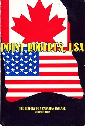
When the June 15, 1846 Treaty of Washington was signed by representatives of the United States and Great Britain, it established the forty-ninth parallel of north latitude as the boundary to the middle of the channel which separates the North American continent from Vancouver Island. That decision, probably unknowingly, left a small piece of real estate below the line but isolated by marine waters from the rest of United States / Washington land. That promontory subsequently became known as Point Roberts, a unique and interesting community, greatly influenced by Canada but fiercely American. Point Roberts is a story of political and geographic accident; it is also a story of the people who settled there, who fished and farmed, who lived under difficult circumstances and isolation. It is a chronicle of good times and bad, rising expectations and tragic events. It includes the efforts of people to create social and cultural institutions to solve their problems and to pass their culture on from one generation to the next — governmental units, churches, schools, water districts, even a cemetery. Point Roberts is also a study of two nations and their people facing off, sharing, trying to learn how to live together. That chapter still is not complete, nor is the history of Point Roberts. But its history has begun, and we are indebted to Richard Clark for gathering the existing bits and pieces to date together in this book. It teaches some valuable lessons — that human perseverance can overcome adversity, that human institutions and social inventions do advance a people, and that Point Roberts is an extremely interesting and valuable part of Washington State and the United States of America. viii, 137 pages : illustrations ; 23 cm CIRC [ 0 ]
|
1980 |
|
Point Roberts backstory tales, trails and trivia from an American enclave by Mark Swenson 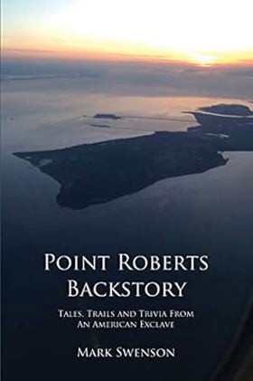
"Point Roberts Backstory tells the fascinating story of a one-of-a-kind American town. Perched on the tip of a Canadian peninsula which extends into U.S. waters, Point Roberts is a community like no other. Residents--including the school kids--have to drive through Canada to get to this unique 'enclave' from the U.S. mainland. Point Roberts has seen i tall: mysterious middens, smugglers, pirates, squatters, Icelandic-speaking settlers, rock stars and thousands of Canadians. They all mix in an unbelievable history all the more amazing when you learn it all happened in its tiny five square miles. Join Point Roberts Backstory for a tour of this incredible town in an isolated corner of America, "--Page 4 of cover 587 pages : illustrations, maps ; 23 cm CIRC [ 0 ]
|
2017 |
|
Pocket girdles and other confessions of a Northwest farm girl by Marianne Love 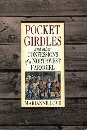
What's a pocket girdle? Find out in this hilarious collection of stories about rural childhood. "Marianne's writings catch the true and comic flavor of what it's like to grow up in rural Idaho". -- Patrick McManus 213 pages : illustrations ; 23 cm CIRC [ 0 ]
|
1994 |
|
Plowed under agriculture & environment in the Palouse by Andrew P. Duffin 
"In Plowed Under, Andrew P. Duffin traces the transformation of the Palouse region of Washington and Idaho from land thought unusable and unproductive to a wealth-generating agricultural paradise, weighing the consequences of what this progress has wrought. During the twentieth century, the Palouse became synonymous with wheat, and the landscape was irrevocably altered. At the dawn of the twenty-first century, native vegetation is almost nonexistent, stream water is so dirty that it is often unfit for even livestock, and 94 percent of all land has been converted to agriculture. Commercial agriculture also created a less noticeable ecological change: soil erosion." "Duffin argues for a candid look at the land, its people, their decisions, and the repercussions of those decisions in the hope of charting a better, more sustainable future. As he notes, the debate is not over whether to use the land, but over what that use will look like and its social and ecological results."--Jacket xv, 240 pages, 16 unnumbered pages of plates : illustrations, maps ; 24 cm. CIRC [ 0 ]
|
2007 |
|
Plants of the Oregon coastal dunes by Alfred M. Wiedemann, L. D. Johnston, Frank H. Smith 
Plants of the Oregon Coastal Dunes offers a useful, informative guide for visitors to the Oregon Dunes National Recreation Area or anyone spending time on the state's remarkable beaches. The standard reference on the Oregon dunes for thirty years, this handy guide identifies those plants most likely encountered and serves as a general introduction to the ecology of dune areas. The first two sections explain the natural history of dunes and describe plant communities associated with dunes and how they change over time. The final section provides an easy-to-use key to 90 common dune plants. Each species profile includes a photograph, a detailed description, and information on habitat and range. This new edition considers changes in dune areas in recent decades, notes conservation efforts, and updates scientific names. 120 pages : illustrations ; 23 cm CIRC [ 0 ]
|
1999 |
|
Plants of Haida Gwaii = X̲aadaa gwaay gud gina k̲'aws (Skidegate) = X̲aadaa gwaayee guu ginn k̲'aws (Massett) by Nancy J. Turner , Florence Edenshaw Davidson , John Enrico 
"For many thousands of years the lands and waters of Haida Gwaii have been home to the Haida. Plants of Haida Gwaii, written with the cooperation and collaboration of Haida knowledge holders and botanical experts, is a detailed and insightful record of the traditional uses of over 150 species of native plants. Moreover, it explains the systems of knowledge and understanding that enabled the Haida to use the resources of their islands sustainably from one generation to the next over millennia. The Haida names of these plants indicate their importance, as do the many narratives featuring them. From the ts'uu--massive western red-cedars--of the forests which provide wood used for canoes, house posts, poles and boxes, and bark carefully harvested for weaving mats, baskets and hats, to the ngaal--tough, resilient fronds of giant kelp--used to harvest herring eggs, the botanical species used by the Haida are found from the ocean to the mountain tops, and are as important today as ever before. With over 250 photographs and illustrations, this book is both beautiful and informative."-- Provided by publisher 262 pages : illustrations (some colour), colour maps, portraits (some colour) ; 24 cm CIRC [ 0 ]
|
2021 |
|
Planning the Portland urban growth boundary the struggle to transform Trend City by Sy Adler , Oregon State University Press (Publisher) 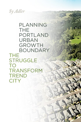
"In this companion volume to his 2012 book Oregon Plans: The Making of an Unquiet Land-Use Revolution, Sy Adler offers readers a deep analysis of Portland's Urban Growth Boundary. As part of Oregon's land-use system, urban areas are required to define a UGB, a line containing urban sprawl and separating it from agricultural land and open space. In Planning the Portland Urban Growth Boundary, Adler argues that acknowledging the Portland growth boundary in 1979 was the most significant decision the Oregon Land Conservation and Development Commission has ever made, and, more broadly, is a significant milestone in American land-use planning. Planning the Portland Urban Growth Boundary primarily covers the 1970s, the period during which the initial boundary was planned at the regional level and acknowledged as compliant with Oregon's statewide Urbanization goal. Adler's central argument is that while state and regional planning institutions were established in response to concerns about sprawl, planners working for those institutions had to confront the reality that various plans developed and implemented by city and county governments around the Portland metro would instead allow the sprawling to continue. Regional planners labeled these as "Trend City" plans, and sought to transcend and transform them during the 1970s and thereafter. Adler discusses the dynamics of these partially successful efforts and the conflicts that characterized the development of the UGB during the 1970s-between different levels of government, and between public, private, and civic sector advocates. When the regional UGB is periodically reviewed, these conflicts continue, as debates about values and technical issues related to forecasting future amounts of population, economic activity, and the availability of land for urban development over a twenty-year period roil the boundary planning process"-- Provided by publisher ix, 261 pages : map ; 23 cm CIRC [ 0 ]
|
2022 |
|
Planning a new West the Columbia River Gorge National Scenic Area by Carl Abbott, Sy Adler, Margery Post Abbott 
With the recent decline of natural resource industries in the American West, a new economic future has dawned for the region, focused on tourism, service industries, and high technology. Affluent and articulate interests are shaping a New West on the foundations of the Old West, often against the wishes of some local residents. As former timber, farming, and mining landscapes are re-allocated for recreation, tourist facilities, environmental protection, and new residential development, the debate over who gets to shape and speak for the West intensifies. In the Columbia Gorge, the creation of a National Scenic Area in 1986 enjoined differences between the goals and values of the Old and New Wests. In Planning a New West the authors present a fast-paced account of the creation of the Columbia River Gorge National Scenic Area. As the nation's first multi-entity national scenic area — a regional land use planning effort mandated by the federal government in partnership with state and local governments — the Columbia River Gorge National Scenic Area is a revealing case study that explores what may be the future for protection of historical landscapes in the American West. Planning a New West explains the political battles over the future of the Gorge, including environmentalist concerns about logging, local property owners' worries about increasing population, and the invasion of windsurfers and other recreationalists. The authors describe the range of viewpoints and the disputes that raged between contending groups trying to shape the legislation. Finally, the book covers the legislation itself and examines what has been accomplished in the ten years since its passage. Throughout this volume, the authors address a key question: what happens when a coveted landscape becomes a battleground for two legitimate and compelling visions of the American West? In examining the origins and implementations of the Columbia River Gorge National Scenic Area, Planning a New West reveals a vast experiment in mediating between old and new. x, 210 pages : illustrations, map ; 26 cm. CIRC [ 0 ]
|
1997 |
|
Place-names of the Island Halkomelem Indian people by David Lewis Rozen (Creator) 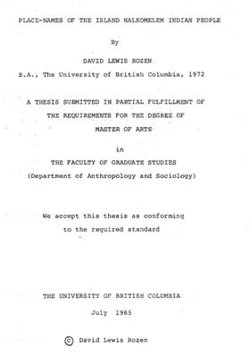
The Island Halkomelem Indian people live on the southeastern part of Vancouver Island and on some of the southern Gulf Islands in British Columbia. A total of three hundred two (302) place-names are known to these people today, in their Coast Salish language. Each of these names is transcribed in a practical writing system, corresponding to the pronunciation of the Indian words by some of the thirteen elderly Island Halkomelem people who collaborated on this study. For each geographical name, information regarding its traditional and present utilization by the Indians is given. This data is derived from interviews with the Indian people conducted by the author over a ten year period and also includes all the available information on each place-name from the pertinent ethnographic, linguistic and historical literature. After the information on the place-names is presented a brief analysis of the Indian names is attempted, focusing on a preliminary typology of the names derived from the use, English translations and etymologies of each name. A complete and detailed series of maps is included. The study concludes with some statements about how the Indian geographical toponymy reflects Island Halkomelem culture ONLINE CIRC [ 1 ]
|
1985 |