Catalog of British Columbiana and Pacific Northwest Americana
The Encyclopedia Cascadia Catalog indexes mostly non-fiction literature covering the Pacific Northwest coast of North America, with an emphasis on British Columbia, Idaho, Oregon, and Washington State.
| Catalog Title | Published |
|---|---|
|
The land of Sunrise Mountains memoirs of Idaho by Cloah Sebastian Cowling 
Cloah Sebastian Cowling’s The Land of Sunrise Mountains: Memoirs of Idaho chronicles the grueling pioneer settlement and agrarian transformation of the Snake River Plain, a massive, high-desert basin defined by its rugged volcanic topography and profound continental isolation. The narrative maps how the severe environmental realities of this arid inland steppe—characterized by unpredictable alpine climates, sheer basalt river gorges, and cavernous lava tubes—initially restricted early homesteaders to a highly precarious existence, forcing them to endure a vast landscape largely devoid of easily accessible surface water. By detailing the arduous regional transition from isolated high-desert livestock grazing to cooperative community building, the text illustrates how physical survival was strictly dictated by the necessity of mastering localized irrigation networks and erecting robust communal infrastructure to withstand the stark, forbidding environment. Ultimately, the account demonstrates that artificially adapting to this rain-starved geography and conquering the profound natural extremes of Idaho's volcanic plains were the absolute prerequisites for transforming a harsh, unyielding frontier into a permanent, self-sustaining agrarian settlement. 201 pages illustrations 21 cm Non-circulating [ 1 ]
|
1956 |
|
Memories of old Alturas County, Idaho by Lucille Hathaway Hall
Lucille Hathaway Hall’s Memories of Old Alturas County, Idaho chronicles the grueling pioneer colonization and frenetic mineral extraction of a massive, rugged jurisdiction carved directly out of the formidable Sawtooth Mountains and the high-desert plateaus of central Idaho. The narrative maps how the severe environmental realities of this remote alpine wilderness—defined by plunging subzero winters, impassable snowbound mountain passes, and sheer granite topography—initially paralyzed overland movement, forcing early prospectors and settlers to endure profound seasonal isolation. By detailing the explosive Wood River mining boom and the arduous construction of localized rail spurs and heavy ore-milling infrastructure, the text illustrates how extracting the region's immense subterranean wealth was strictly dictated by the urgent necessity to breach these towering continental barricades. Ultimately, the account demonstrates that deploying mechanized engineering to violently extract deep-vein silver deposits and artificially connecting this snow-choked high country to broader terrestrial transit networks were the absolute prerequisites for transforming an impenetrable mountainous frontier into a highly lucrative epicenter of inland industrial wealth. 72 pages : illustrations, map (on linging papers) ; 24 cm Desiderata
|
1956 |
|
The Columbia by Stewart H. Holbrook, Ernest Richardson (Illustrator), Fitzgerald Rivers of America Collection (Library of Congress)
Stewart H. Holbrook’s The Columbia chronicles the monumental pioneer and industrial subjugation of the Pacific Northwest’s most violent and dominant hydrological artery, a massive riverine highway carving directly through formidable alpine barricades and vast arid plateaus. The narrative maps how the severe environmental realities of this treacherous watercourse—ranging from the ship-killing estuarine choke point of the Columbia River Bar to the sheer, impassable basalt walls of the Columbia Gorge—initially dictated all regional transit, forcing early fur traders, loggers, and steamboat captains to relentlessly battle its untamed kinetic energy. By detailing the grueling transition from precarious riverboat navigation and localized salmon extraction to the colossal engineering triumphs of Bonneville and Grand Coulee dams, the text illustrates how the aggressive economic expansion of the inland empire was strictly governed by the necessity of artificially harnessing the river's massive volume. Ultimately, the account demonstrates that systematically domesticating this volatile aquatic highway and deploying massive concrete infrastructure to transform its raw hydrological fury into electrified, mechanized power were the absolute prerequisites for binding a geographically fractured wilderness into the modern, industrialized powerhouse of the Pacific seaboard. [10], 393 pages : illustrations, maps ; 21 cm. Desiderata
|
1956 |
|
Some history of early steamboating on Yaquina Bay by Jack Fogarty
Jack Fogarty’s Some history of early steamboating on Yaquina Bay chronicles the arduous pioneer colonization and mechanized maritime subjugation of a vital, storm-battered estuarine enclave carved into the rugged central Oregon coast. The narrative maps how the severe environmental realities of this isolated coastal basin—walled off from the fertile inland Willamette Valley by the impenetrable, heavily timbered barricade of the Coast Range and guarded by a treacherous, shifting ocean bar—initially paralyzed overland movement, forcing early settlers to rely entirely on the sheltered aquatic highway of the bay and its tributary river. By detailing the grueling, specialized deployment of shallow-draft steamboats to navigate perilous tidal mudflats and muscle massive timber harvests to localized mills, the text illustrates how the economic survival of these remote coastal settlements was strictly dictated by the necessity of adapting steam-powered marine transit to a volatile estuarine topography. Ultimately, the account demonstrates that engineering robust, localized maritime fleets and systematically mastering this isolated aquatic environment were the absolute prerequisites for transforming a geographically severed wilderness into a viable commercial hub prior to the arrival of trans-mountain rail networks. 19 pages illustrations 21 cm Non-circulating [ 1 ]
|
1956 |
|
The historical and regional geography of the Willapa Bay area, Washington by Jean Hazeltine 
Jean Hazeltine’s The historical and regional geography of the Willapa Bay area, Washington provides a comprehensive spatial and economic history of the expansive, resource-rich estuary originally charted by early pioneers as Shoalwater Bay. Set against the vast tidal mudflats, cranberry bogs, and dense coastal rainforests of the Willapa Hills, the text details how the pre-existing maritime networks of the Chinook and Willapa peoples were eventually superseded by waves of pioneer oystermen and industrial loggers. By tracing the collaborative physical labor required to harvest the bay's famous oyster beds and extract the surrounding timber, Hazeltine reveals how isolated, water-bound settlements like Oysterville, South Bend, and Raymond relied on tight-knit maritime and kinship alliances to navigate the boom-and-bust cycles of Pacific coastal trade. Ultimately, this geographic history documents how the cooperative industrialization of the region's unique tidal ecology successfully transformed a remote coastal inlet into a highly organized, enduring economic engine that supplied the booming nineteenth- and twentieth-century markets of the West Coast. Desiderata
|
1956 |
|
Pacific tugboats by Gordon R. Newell
Gordon R. Newell’s Pacific Tugboats chronicles the grueling industrial mastery of the Pacific seaboard, where a violent and geographically complex marine topography mandated the development of a highly specialized, heavy-duty towing fleet. The narrative maps how the severe environmental realities of the coastal Northwest—characterized by labyrinthine deep-water fjords, treacherous estuarine river bars, and unpredictable, storm-battered straits—frequently paralyzed conventional sail-driven commerce and completely obstructed the aquatic transit of massive inland timber harvests. By detailing the technological evolution from early, vulnerable steam-powered vessels to robust, high-powered diesel tugs, the text illustrates how the expansion of regional industry was strictly dictated by the necessity of deploying these mechanized workhorses to muscle colossal log rafts and guide vulnerable deep-draft freighters through dangerous, tide-ripped marine highways. Ultimately, the account demonstrates that engineering the raw mechanical power necessary to conquer these formidable navigational hazards was the absolute prerequisite for breaching the region's coastal isolation and linking the heavily forested western frontier to the broader global maritime economy. 191 pages illustrations 28 cm Non-circulating [ 1 ]
|
1957 |
|
Spokane story by Lucile Foster Fargo
Lucile Foster Fargo’s Spokane Story chronicles the rapid industrial colonization of a remote inland metropolis built entirely around the colossal kinetic energy of the Spokane Falls, situated within the vast, arid expanses of the Columbia Plateau. The narrative maps how the severe geographic isolation of this landlocked basin—walled off by the formidable Rocky Mountains to the east and the Cascades to the west—initially restricted early pioneers to a precarious existence, forcing them to rely entirely on the localized hydrological power of the roaring river to operate rudimentary sawmills and gristmills. By detailing the massive regional transition from an isolated river crossing to the mechanized epicenter of the Inland Empire, the text illustrates how the aggressive exploitation of surrounding timber stands, Palouse agriculture, and Coeur d'Alene mineral wealth was strictly dictated by the arrival of transcontinental rail networks engineered to conquer these massive continental distances. Ultimately, the account demonstrates that artificially harnessing the violent hydrology of the falls and deploying heavy transit infrastructure to overcome the profound physical detachment of the inland steppe were the absolute prerequisites for transforming a remote frontier outpost into the vital commercial and industrial anchor of eastern Washington. 276 pages Non-circulating [ 1 ]
|
1957 |
|
County government in Washington State by Washington State Association of County Commissioners, Barbara Byers
Barbara Byers and the Washington State Association of County Commissioners’ County Government in Washington State chronicles the structural evolution of localized administrative power, a political necessity dictated entirely by the vast, geographically fractured landscape of the Pacific Northwest frontier. The narrative maps how the severe environmental realities of the region—divided by the towering alpine barrier of the Cascade Range, expansive arid inland plateaus, and impenetrable coastal rainforests—rendered centralized territorial governance logistically impossible, forcing early pioneers to carve the wilderness into decentralized jurisdictions often bounded by sheer mountain ridges and massive riverine highways. By detailing the urgent expansion of county-level authority to construct vital rural road networks, manage rugged land claims, and regulate localized resource extraction, the text illustrates how deploying robust civic infrastructure was strictly dictated by the immense overland distances and imposing topography separating isolated settlements. Ultimately, the account demonstrates that artificially imposing administrative order and financing localized, mechanized transit corridors to conquer this profound continental detachment were the absolute prerequisites for transforming a geographically segmented wilderness into a functional, economically integrated state. 218 pages 24 cm Non-circulating [ 1 ]
|
1957 |
|
This is Washington by Bob Spring, Ira Spring, Byron Fish
Bob Spring, Ira Spring, and Byron Fish’s This is Washington chronicles the comprehensive industrial and pioneer subjugation of a massively diverse territorial expanse defined by deeply fractured, jarring geographical extremes. The visual and textual narrative maps how the severe environmental realities of the state—ranging from the rain-choked, impenetrable coastal timberlands of the Olympic Peninsula and the volatile marine labyrinth of Puget Sound to the formidable alpine barricade of the Cascade Range and the arid, sun-baked scablands of the Columbia Basin—strictly dictated the distinct survival strategies and localized economic engines of early regional settlements. By detailing the monumental, varied engineering efforts required across these isolated zones—whether deploying heavy maritime fleets to navigate inland waterways, forcing logging infrastructure into sheer coastal mountainsides, or constructing colossal hydroelectric dams to artificially irrigate and reclaim the eastern deserts—the text illustrates how large-scale prosperity was entirely governed by the necessity of mastering these localized topographies. Ultimately, the account demonstrates that systematically conquering this collection of distinctly hostile environments with heavy mechanical, hydrological, and transit infrastructure was the absolute prerequisite for binding a geographically segmented, untamed wilderness into a unified, modern industrial state. 157 pages : illustrations ; 23 cm Desiderata
|
1957 |
|
Empire of the Columbia a history of the Pacific Northwest by Dorothy O. Johansen, Charles M. Gates
Dorothy O. Johansen and Charles M. Gates’s Empire of the Columbia chronicles the monumental pioneer and industrial subjugation of a vast continental expanse unified and dominated by the violent, immense hydrological network of the Columbia River basin. The narrative maps how the severe environmental realities of this massively fractured topography—spanning the treacherous coastal ocean bar, the towering alpine barricades of the Cascades, and the sprawling, arid inland plateaus—initially dictated all human migration and economic expansion, forcing early explorers and settlers to rely exclusively on this singular, volatile aquatic highway. By detailing the grueling transition from vulnerable fur-trading canoe fleets and arduous overland wagon migrations to the deployment of transcontinental railways and colossal hydroelectric dams, the text illustrates how the aggressive exploitation of regional timber, agriculture, and raw kinetic energy was strictly governed by the necessity of mastering these imposing geographic extremes. Ultimately, the account demonstrates that artificially harnessing the violent hydrology of the Columbia and deploying massive mechanized infrastructure to breach the region's immense overland barriers were the absolute prerequisites for transforming a geographically isolated, untamed wilderness into a deeply integrated, industrialized empire on the Pacific seaboard. xiii, 685 pages illustrations, maps 24 cm Non-circulating [ 1 ]
|
1957 |
|
This was sawmilling by Ralph W. Andrews 
History about the sawmill industry in the Pacific Northwest is rich in memories. Here is the vital and true story of the triumphant growth and its undying promise, shown with superb photography and told with exciting text. The utilitarian waterwheel, the great days of the steam sawmill, and the epic courage of the schooner masters are told in all their glory. Ralph Andrews augments his careful and thorough research with anecdotes of the men who transformed logs into the building materials of a nation. The reader takes a step back in time, as the history of the industry which has gone on continuously since 1825 is brought to life. 176 pages : illustrations ; 23 cm Desiderata
|
1957 |
|
Milestones on Vancouver Island the story of this "Island to the West", its past, and its present by C. P. Lyons 
C. P. Lyons’s Milestones on Vancouver Island chronicles the grueling pioneer colonization and resource extraction of a massive, heavily forested landmass completely severed from the North American continent by the treacherous waters of the Pacific Ocean. The narrative maps how the island’s formidable topography—defined by an impassable, glaciated mountainous spine and impenetrable coastal rainforests—forced early settlements to cling precariously to the sheltered eastern shoreline along the Strait of Georgia. By detailing the massive industrial efforts required to exploit rich coal deposits and vast timber reserves, the text illustrates how establishing robust maritime infrastructure and localized logging rail networks was strictly dictated by the severe overland constraints of this rugged terrain. Ultimately, the account demonstrates that conquering the extreme geographic isolation and dense biological barriers of this offshore frontier was the absolute prerequisite for integrating its immense natural wealth into the broader Pacific maritime economy. viii, 315 pages : illustrations, maps ; 21 cm Non-circulating [ 1 ]
|
1958 |
|
Tosoiba by Lula Barnard, Faunda Bybee , Lola Walker , Daughters of Utah Pioneers Camp Meads
Lula Barnard, Faunda Bybee, and Lola Walker’s Tosoiba, compiled for the Daughters of Utah Pioneers, chronicles the grueling agrarian colonization of southeastern Idaho’s Gem Valley, an isolated, high-altitude basin defined by its rugged volcanic topography and punishing alpine climate. The collected narratives map how the severe environmental realities of this arid inland steppe forced early Mormon pioneers to rely on immediate, cooperative hydrological engineering, systematically diverting mountain runoff to establish vital crop irrigation networks. Ultimately, the account demonstrates that artificially mastering this localized hydrology and constructing robust communal infrastructure to endure the brutal winter extremes were the absolute prerequisites for transforming a forbidding high-desert expanse into a permanent, agriculturally self-sufficient frontier settlement. x, 326 pages : illustrations, portraits, map ; 23 cm Non-circulating [ 1 ]
|
1958 |
|
Search for the Northwest Passage by Lucile Saunders McDonald
Lucile Saunders McDonald’s Search for the Northwest Passage chronicles the centuries-long maritime struggle to locate a navigable oceanic corridor through the treacherous, ice-choked topography of the North American arctic and subarctic coasts. The narrative maps how the severe environmental realities of the northern latitudes—characterized by impenetrable glacial packs, disorienting coastal fogs, and violent storm systems—relentlessly battered early European exploratory fleets and thwarted global trading ambitions. By detailing the grueling, often fatal voyages of successive maritime expeditions, the text illustrates how the absolute physical barrier of the frozen continental landmass forced navigators to continuously engineer more resilient vessels and adapt to punishing aquatic extremes. Ultimately, the account demonstrates that the unrelenting, hostile marine geography of the northern frontier strictly dictated the pace of exploration, proving that imperial ambitions were fundamentally constrained by the formidable climatic realities of this isolated oceanic edge. 137 pages illustrations 23 cm Non-circulating [ 1 ]
|
1958 |
|
Clatsop County, Oregon a history by Emma Gene Miller
Emma Gene Miller’s Clatsop County, Oregon: A History chronicles the arduous pioneer settlement and industrial development of the extreme northwestern edge of the Oregon territory, a rugged coastal enclave defined by the violent collision of the Columbia River and the Pacific Ocean. The narrative maps how the impenetrable barrier of the coastal temperate rainforest severely obstructed early overland migration, forcing indigenous populations, fur traders, and subsequent settlers to rely entirely on navigating the treacherous aquatic highway of the Columbia River Bar. By detailing the transition from an isolated trading outpost to a booming epicenter for salmon canning and massive timber extraction, the text illustrates how engineering robust maritime infrastructure was strictly dictated by the severe environmental realities of this storm-battered estuarine topography. Ultimately, the account demonstrates that artificially stabilizing this hazardous navigational gateway and conquering the dense biological mass of the surrounding wilderness were the absolute prerequisites for anchoring a permanent, export-driven economy on this volatile oceanic frontier. 291 pages : illustrations ; 22 cm Non-circulating [ 1 ]
|
1958 |
|
Town where time stood still the story of Seabeck by Gordon R. Newell, Don Sherwood 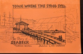
Gordon R. Newell and Don Sherwood’s Town Where Time Stood Still chronicles the rapid rise and sudden industrial collapse of Seabeck, an isolated pioneer mill town carved directly out of the dense temperate rainforests bordering Washington's Hood Canal. The narrative maps how the impenetrable overland topography of the Kitsap Peninsula forced early timber barons to rely exclusively on this sheltered, deep-water aquatic highway to export massive lumber harvests to global maritime markets. By detailing the settlement’s complete economic dependence on its centralized waterfront sawmill, the text illustrates how a singular reliance on highly localized resource extraction and vulnerable marine infrastructure dictated both its booming pioneer prosperity and its ultimate vulnerability. Ultimately, the account demonstrates how the inescapable geographic isolation that initially birthed this thriving lumber empire eventually ensured its demise following a catastrophic mill fire, freezing the bypassed coastal enclave in time as overland rail networks fundamentally reshaped the broader Pacific seaboard. 32 unnumbered pages : illustrations ; 14 x 21 cm Non-circulating [ 1 ]
|
1958 |
|
Land of giants the drive to the Pacific Northwest, 1750-1950 by David Lavender
David Lavender’s Land of Giants: The Drive to the Pacific Northwest, 1750-1950 chronicles the monumental, two-century imperial and industrial conquest of an impossibly scaled wilderness defined by impenetrable mountain barricades, towering temperate rainforests, and violent riverine highways. The narrative maps how the sheer physical magnitude of the region—stretching from the treacherous maritime choke point of the Columbia River Bar to the sheer alpine walls of the Rocky Mountains—initially dictated all human movement, forcing early explorers and overland pioneers to rely entirely on dangerous aquatic corridors for basic survival. By detailing the massive transition from rudimentary fur-trading outposts to a booming regional empire driven by mechanized timber extraction, transcontinental rail networks, and unprecedented hydroelectric dam construction, the text illustrates how the large-scale subjugation of this oversized topography was strictly governed by the severe environmental constraints of the Pacific edge. Ultimately, the account demonstrates that systematically breaching these massive continental barriers and artificially harnessing the region's volatile hydrology were the absolute prerequisites for transforming a geographically isolated frontier into the industrialized powerhouse of the modern Pacific seaboard. x pages, 2 unnumbered pages, 468 pages, 12 unnumbered leaves of plates : illustrations, maps ; 25 cm. Non-circulating [ 1 ]
|
1958 |
|
A bibliography of Pacific Northwest history by Oregon Historical Society (Compiler), Thomas Vaughan (Compiler), Priscilla Knuth (Compiler)
"This bibliography of Pacific Northwest history has been compiled by the staff of the Oregon Historical Society, especially for high school and college students and teachers. Necessarily the range is broad and qualified by what is available for various study levels. Included are books, articles and documents published up to the fall of 1957."--Page i 44 leaves ; 28 cm. Non-circulating [ 1 ]
|
1958 |
|
This was railroading by George B. Abdill 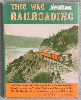
An Historical Collection of Rare Photos and True Stories about the Tracks, Trains and Trainmen of the Pacific Northwest including Northern California. 1958 First Edition. 192 pages : illustrations ; 28 cm Non-circulating [ 1 ]
|
1958 |
|
Dawson Creek, past and present an historical sketch by M. E. Coutts 
M. E. Coutts’s Dawson Creek, Past and Present chronicles the dramatic evolution of a remote agrarian outpost situated on the grueling ecological frontier where the fertile Peace River prairies collide with the unforgiving boreal wilderness of northern British Columbia. The narrative maps how profound continental isolation and punishing subarctic winters initially restricted early pioneers to localized survival, completely severed from southern markets by vast expanses of impenetrable muskeg and rugged alpine barriers. By detailing the explosive military engineering of the Alaska Highway, the text illustrates how the urgent geopolitical necessity to bridge these massive northern distances drove the rapid construction of an unprecedented overland transit corridor. Ultimately, the account demonstrates that deploying mechanized infrastructure to conquer this harsh, landlocked geography was the absolute prerequisite for transforming an isolated prairie settlement into the vital, industrialized gateway to the subarctic frontier. 115 pages : illustrations ; 28 cm Non-circulating [ 1 ]
|
1958 |
|
Blanket Bill Jarman northwest Washington mystery man : first pioneer settler in Whatcom and Skagit counties by Percival Robert Jeffcott 
Published in 1958, Percival Robert Jeffcott's book is a biographical account of William Robert "Blanket Bill" Jarman, recognized as the first white pioneer to settle in Washington's Whatcom and Skagit counties. The work seeks to untangle the factual history of Jarman's frontier life from the dense web of myths, legends, and tall tales that had grown around him over the decades. By meticulously cross-referencing interviews and local lore with documentary evidence—such as Hudson's Bay Company records—Jeffcott systematically investigates and debunks several exaggerated stories, including a famous tale about Jarman being ransomed. Ultimately, the text serves as both a detailed character study of an elusive regional figure and a rigorous examination of early Pacific Northwest pioneer folklore. xii, 202 p. : ill. ; 24 cm. Non-circulating [ 1 ]
|
1958 |
|
A History of Coquitlam and Fraser Mills, 1858-1958 by H. A. J. Monk, John Stewart 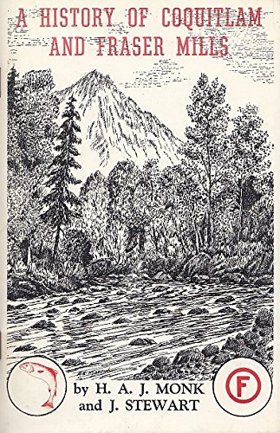
H. A. J. Monk and John Stewart’s A History of Coquitlam and Fraser Mills, 1858-1958 chronicles the explosive industrial colonization of a sprawling, heavily timbered riverine expanse located at the strategic confluence of the Coquitlam and Fraser rivers. The narrative maps how the impenetrable biological mass of the ancient coastal rainforest and the volatile, flood-prone hydrology of the lower Fraser delta initially choked overland movement, forcing early settlers and timber barons to rely exclusively on this massive aquatic highway to transport raw logs and export milled lumber. By detailing the monumental industrial effort required to construct Fraser Mills—which evolved into the largest lumber processing facility in the British Empire—and the grueling pioneer labor needed to clear the dense alluvial floodplains for viable agriculture, the text illustrates how large-scale economic expansion was strictly governed by the severe physical realities of this riparian topography. Ultimately, the account demonstrates that systematically harvesting these colossal timber stands and engineering robust mechanized milling infrastructure directly upon the riverbanks were the absolute prerequisites for transforming a rain-soaked, isolated wilderness into a globally dominant epicenter of Pacific seaboard timber manufacturing. 76 pages : illustrations, maps ; 23 cm Desiderata
|
1958 |
|
British investments and the American mining frontier, 1860-1901 by Clark C. Spence, American Historical Association 
This significant study offers information on the British investors who brought capital to America's mining industry in the late nineteenth century. The author devotes primary attention to the promotional activities that led to the organization and operation of more than 500 English joint venture stock companies between 1860 and 1901 ix, 288 pages : illustrations ; 24 cm Desiderata
|
1958 |
|
History of Alert Bay and district by Elizabeth Healey 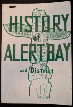
Elizabeth Healey’s History of Alert Bay and district chronicles the pioneer settlement and industrial expansion of a remote insular outpost entirely severed from the continental mainland by the treacherous waters of the Queen Charlotte Strait. The narrative maps how the severe geographic isolation of Cormorant Island and the impenetrable biological mass of the surrounding coastal rainforests forced both indigenous populations and European pioneers to rely exclusively on these volatile marine channels for basic survival and regional transit. By detailing the transformation of an ancestral maritime hub into a booming epicenter for commercial salmon canning and coastal logging operations, the text illustrates how the settlement's economic viability was strictly dictated by the necessity of engineering robust port infrastructure and mechanized fishing fleets. Ultimately, the account demonstrates that conquering the extreme oceanographic challenges of this rugged archipelago and extracting its immense biological wealth were the absolute prerequisites for sustaining a vital, export-driven community on the profoundly isolated northern Pacific edge. 101 pages illustrations, map Non-circulating [ 1 ]
|
1958 |
|
Quesnel commercial centre of the Cariboo gold colony by Gordon R. Elliott
Gordon R. Elliott’s Quesnel: Commercial Centre of the Cariboo Gold Colony stands as the foundational civic and economic study of the pivotal river hub located at the confluence of the Fraser and Quesnel rivers. Elliott chronicles how the ancestral river crossing and fishing territory of the Southern Carrier (Dakelh) people was converted into a bustling supply depot during the 1860s gold rush. The text details Quesnel’s strategic position as the inland terminus for Fraser River sternwheelers, where freight teams, pack trains, and stagecoaches assembled before making the final eastward ascent toward the Cariboo goldfields. Elliott traces the development of early agricultural benches across Bouchie Lake, Barlow Creek, and Red Bluff, while documenting the town’s enduring commercial evolution into a forestry and distribution centre following the arrival of the Pacific Great Eastern Railway. 62 pages : illustrations, maps, portraits ; 23 cm Desiderata
|
1958 |