City of Coquitlam Metro Vancouver Regional District, British Columbia
City - A populated place with legally defined boundaries, incorporated as a city municipality under the provincial Municipal Act. W of Pitt River on N side of Fraser River, New Westminster Land District
Mapped Location
City of Coquitlam: The mapped location is an approximation and should not be used for navigation or wayfinding.
Information
General information on City of Coquitlam
- Feature Type: Incorporated
Official, historical, colloquial and alternative toponyms for City of Coquitlam
A brief list of names that this geographic feature has been named
| Name | Description |
|---|---|
| City of Coquitlam | Official |
Origin Notes and History of City of Coquitlam
References to City of Coquitlam that document the origin of its place name
Coquitlam incorporated as a District Municipality under Letters Patent 25 July 1891, R.B. Kelly, reeve; re-incorporated as a City Municipality by Order in Council 997/92, 18 June 1992, effective 1 December 1992.
Coquitlam Post Office was opened 1 March 1881; renamed Port Coquitlam Post Office 1 July 1913.
"The name Coquitlam is of [Indigenous] origin and signifies a "small red salmon," a fish which once teamed in the Coquitlam river, but now through various causes has become extinct." (Coquitlam Star, May 1912.) See the municpality's website for more information.
The name Coquitlam is of [Indigenous] origin and signifies a "small red salmon".
The name Coquitlam is that of a Salish tribe in the [area] speaking the Cowichan dialect. (17th Report of the Geographic Board of Canada, 31 March 1922.) Also spelled Kwikwitlem.
A Selected Bibliography of City of Coquitlam, Metro Vancouver Regional District, British Columbia
A compilation of essential readings detailing the history, geography, and culture of the region.
A History of Coquitlam and Fraser Mills, 1858-1958 by H. A. J. Monk, John Stewart
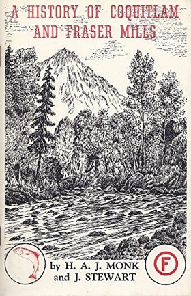
H. A. J. Monk and John Stewart’s A History of Coquitlam and Fraser Mills, 1858-1958 chronicles the explosive industrial colonization of a sprawling, heavily timbered riverine expanse located at the strategic confluence of the Coquitlam and Fraser rivers. The narrative maps how the impenetrable biological mass of the ancient coastal rainforest and the volatile, flood-prone hydrology of the lower Fraser delta initially choked overland movement, forcing early settlers and timber barons to rely exclusively on this massive aquatic highway to transport raw logs and export milled lumber. By detailing the monumental industrial effort required to construct Fraser Mills—which evolved into the largest lumber processing facility in the British Empire—and the grueling pioneer labor needed to clear the dense alluvial floodplains for viable agriculture, the text illustrates how large-scale economic expansion was strictly governed by the severe physical realities of this riparian topography. Ultimately, the account demonstrates that systematically harvesting these colossal timber stands and engineering robust mechanized milling infrastructure directly upon the riverbanks were the absolute prerequisites for transforming a rain-soaked, isolated wilderness into a globally dominant epicenter of Pacific seaboard timber manufacturing.
76 pages : illustrations, maps ; 23 cm
Desiderata
Metro Vancouver Regional District
- Albion
- Alder Creek
- Aldergrove
- Altamont
- Ambleside
- Village of Anmore
- Anniedale
- Arbutus Ridge
- Austin Heights
- Barnet
- Barnston Island
- Beach Grove
- Village of Belcarra
- Belvedere
- Bergs
- Birchland Manor
- Blueridge
- Bowen Bay
- District of Bowen Island
- Brentwood Park
- Bridgeview
- Brighouse
- Brighton Beach
- British Properties
- Broadmoor
- Brookswood
- Brunette Creek
- Brunswick Beach
- Buckingham Heights
- Buntzen Bay
- Burkeville
- City of Burnaby
- Burnaby Heights
- Burquitlam
- Canyon Heights
- Capilano Highlands
- Capitol Hill
- Cariboo
- Carraholly
- Cascade
- Cascade Heights
- Cassin
- Caulfeild
- Cedardale
- Chineside
- Cleveland Park
- Cloverdale
- Coldwell Beach
- Connaught Heights
- Coombe
- City of Coquitlam
- Cosy Cove
- Cove Cliff
- Cowans Point
- Crescent
- Crescent Beach
- Cypress Park
- Dartmoor
- Deep Cove
- Delbrook
- District of Delta
- Delta
- Dollarton
- Douglas
- Dunbar-Southlands
- Dundarave
- Eagle Harbour
- Eagle Ridge
- Eastburn
- Elgin
- Essondale
- Fairview
- Fern Ridge
- Fernlee
- Fleetwood
- Forest Hills
- Forest Knolls
- Fort Langley
- Frames
- Fraser Heights
- Fraser Mills
- Garden Village
- Glen Valley
- Glenbrooke North
- Gleneagles
- Glenmore
- Grandview
- Grandview-Woodlands
- Granite Falls
- Guildford
- Haney
- Harbour Chines
- Harbour Village
- Hastings-Sunrise
- Hazelmere
- Hollyburn
- Hopington
- Horseshoe Bay
- Ioco
- Iron Bay
- Johnson
- Johnson Heights
- Keith-Lynn
- Kelvin
- Kensington-Cedar Cottage
- Kerrisdale
- Killarney
- Kitsilano
- Ladner
- Lake Buntzen
- City of Langley
- District of Langley
- Laurentian Belaire
- Lincoln Park
- Village of Lions Bay
- Lower Lonsdale
- Lynn Valley
- Lynnmour
- Maillardville
- City of Maple Ridge
- Maplewood
- Marpole
- Mary Hill
- Mayfair
- Meadowbrook
- Metrotown
- Middlegate
- Millers Landing
- Milner
- Mount Gardner
- Mount Pleasant
- Mud Bay
- Murrayville
- City of New Westminster
- Newton
- Norgate
- North Delta
- North Lonsdale
- City of North Vancouver
- District of North Vancouver
- North Woodlands
- Oakridge
- Ocean Park
- Orlomah Beach
- Oxford Heights
- Panorama Ridge
- Park Royal
- Parkdale Gardens
- Pasley Island
- Pemberton Heights
- City of Pitt Meadows
- Pitt Meadows
- Pleasantside
- City of Port Coquitlam
- Port Guichon
- Port Hammond
- Port Kells
- Port Mann
- City of Port Moody
- Queens Park
- Queensborough
- Ranch Park
- Renfrew-Collingwood
- City of Richmond
- Riley Park
- River Springs
- Ruskin
- Sandy Cove
- Sapperton
- Seafair
- Sentinel Hill
- Seymour Heights
- Seymour Landing
- Shaughnessy
- Silver Valley
- Snug Cove
- South Cambie
- South Slope
- South Surrey
- Southarm
- Steveston
- Strachan Creek
- Strathcona
- Strawberry Hill
- Sullivan
- Sullivan Heights
- Sun Valley
- Sunbury
- Suncrest
- Sunnyside
- Sunset
- Sunset Beach
- Sunshine
- Sunshine Hills
- City of Surrey
- Surrey
- Surrey Centre
- Thompson
- Thwaytes
- Tsawwassen
- Tsawwassen
- Twin Islands
- Tynehead
- University Hill
- Upper Lynn
- City of Vancouver
- Victoria-Fraserview
- Walnut Grove
- Websters Corners
- West Bay
- West End
- West End
- West Lynn
- West Point Grey
- District of West Vancouver
- Westmount
- Westridge
- Whalley
- City of White Rock
- Whonnock
- Whytecliff
- Wigwam Inn
- Willingdon Heights
- Windsor Park
- Woodhaven
- Woodlands
- Yennadon
Political Boundaries
Last updated: 2023-09-26