Catalog of British Columbiana and Pacific Northwest Americana
The Encyclopedia Cascadia Catalog indexes mostly non-fiction literature covering the Pacific Northwest coast of North America, with an emphasis on British Columbia, Idaho, Oregon, and Washington State.
| Catalog Title | Published |
|---|---|
|
James Douglas father of British Columbia by Dorothy Blakey Smith 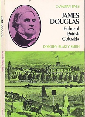
James Douglas father of British Columbia examines the aggressive imperial consolidation and sprawling fur-trade administration situated across the immensely fractured, mountainous macro-geography of the Pacific Northwest mainland and Vancouver Island. Smith details how the region's formidable topography—specifically the treacherous, whitewater chasms of the Fraser River Canyon, the sprawling, impenetrable mountain barriers of the Coast Range, and the vital, easily fortified maritime anchorages of the Salish Sea—strictly dictated the margins of Hudson's Bay Company monopoly logistics, frantic gold rush migrations, and desperate colonial road-building. By mapping Douglas’s strategic shift from directing remote interior trapping networks to commanding the massive overland engineering of the Cariboo Wagon Road—a physical necessity to assert British sovereignty over highly inaccessible inland gold fields swarming with foreign miners—the narrative highlights how this specific, imposing geography anchored a deeply precarious, top-down imposition of imperial authority. Ultimately, this biographical and geopolitical record serves as a macro-level spatial history, demonstrating how the immense overland isolation, severe topographic barricades, and vital maritime-interior corridors of this Pacific Northwest landscape fundamentally shaped the highly strategic, geographically defensive character of James Douglas's early British Columbia. 128 pages : illustrations ; 20 cm. Non-circulating [ 1 ]
|
1971 |
|
Beyond Garibaldi by Irene Ronayne, Georgina Keddell 
Beyond Garibaldi examines the isolated pioneer agricultural settlements and remote gold rush supply corridors situated across the precipitous, mountainous interior north of British Columbia's Howe Sound. Ronayne and Keddell detail how the region's formidable alpine macro-geography—specifically the towering, glaciated volcanic barrier of Mount Garibaldi, the dense, impassable chasms of the Coast Mountains, and the narrow, fertile alluvial bottomlands of the Pemberton Valley—strictly dictated the margins of early homesteading, precarious overland transit, and localized high-valley farming. By mapping the arduous establishment of scattered frontier farms and mining enclaves that carved a highly resilient existence out of the alpine wilderness stretching from Britannia Beach to Lillooet, relying entirely on treacherous mountain passes to navigate the severely restricted inland basin, the narrative highlights how this specific mountainous geography anchored a profoundly rugged, valley-bound pioneer society. Ultimately, this historical record serves as a localized spatial history, demonstrating how the immense alpine barricades, severe winter isolation, and vital riparian flatlands of this Pacific Northwest interior fundamentally shaped the highly self-reliant, geographically constrained character of the early Pemberton and Lillooet corridors. 167 pages illustrations 22 cm. Non-circulating [ 1 ]
|
1971 |
|
Pioneer trails of the Oregon coast by Samuel N. Dicken 
This study deals with the historical geography of coastal pioneer trails during the period of settlement, for the most part before 1860. The Oregon Coast is presented as it was seen trough he eyes of early travelers, and against the background of coastal features, climate, terrain, drainage and vegetation. Though this is a geography of a past period, it also includes relevant firsthand descriptions of coastal features, in the present tense, based on many years of field study by the writer. viii, 77 pages illustrations 28 cm Non-circulating [ 1 ]
|
1971 |
|
The Evergreen Fleet a pictorial history of Washington State Ferries by Harre W. Demoro
This book has more than 270 illustrations including maps and timetables. The complete history of the Washington State Ferry system with each route outlined and descriptions of each vessel 136 pages illustrations, maps 29 cm Non-circulating [ 1 ]
|
1971 |
|
The Royal Navy and the northwest coast of North America, 1810-1914 a study of British maritime ascendancy by Barry M. Gough 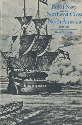
Examination of contest for the Columbia Country, the Oregon Crisis, the gold rush crises, the dispute over the San Juan Islands, and the defense of the Pacific colonies in a decade of Anglo-Americanism (1861-1871) from the perspective of the Royal Navy's involvement. Esquimalt Naval base's evolution as the Pacific headquarters of the Royal Navy to meet the changing strategic requirements of the whole Pacific area is considered in detail. The repercussions of the Crimean War and the rise of German and United States naval power on the alignment of British forces in the Pacific are also considered. xvi, 294 pages : illustrations, maps, portraits ; 25 cm Non-circulating [ 1 ]
|
1971 |
|
Requiem for a people the Rogue Indians and the frontiersmen by Stephen Dow Beckham 
Requiem for a people the Rogue Indians and the frontiersmen examines the brutal cultural collision, rapid mining incursion, and subsequent indigenous dispossession situated within the deeply incised, mountainous terrain of southwestern Oregon's Klamath and Siskiyou ranges. Beckham details how the region's formidable macro-geography—specifically the steep, heavily timbered slopes of the surrounding mountain barriers, the labyrinthine, whitewater chasms of the Rogue River canyon, and the isolated, mineral-rich inland basins—strictly dictated the margins of indigenous Takelma subsistence, sudden and aggressive pioneer gold mining operations, and the ensuing guerrilla warfare. By mapping the transformation of these isolated riverine corridors from sustained indigenous homelands into fiercely contested frontier battlegrounds, where the unforgiving mountainous topography both facilitated fierce native resistance and ultimately trapped outgunned populations in devastating military bottlenecks, the narrative highlights how this specific highly fractured geography anchored a profoundly violent, resource-driven campaign of ethnic cleansing. Ultimately, this ethnohistorical and military record serves as a localized spatial history, demonstrating how the severe topographic barricades, vital riparian corridors, and rich geological deposits of this Pacific Northwest landscape fundamentally shaped the highly tragic, fiercely contested character of the Rogue River frontier. xiv, 214 pages : illustrations, map, plan, portraits ; 22 cm. Desiderata
|
1971 |
|
Centennial history of Salmon Arm by Ernest Doe 
Ernest Doe’s Centennial History of Salmon Arm serves as the foundational civic chronicle documenting the transition of the Salmon River valley and Shuswap Lake shorelines from rural pre-emption tracts into an incorporated municipal district and city. Doe traces how late nineteenth-century homesteading corridors, early wagon roads, and agricultural clearings were established directly across the ancestral lands and seasonal gathering domains of the Secwépemc (Shuswap) people. The narrative details the crucial logistics of frontier community building, illustrating how the arrival of the Canadian Pacific Railway in 1885 catalyzed land settlement, commercial fruit orchard development, and civic governance, leading to the district municipality's formal incorporation in 1905 and subsequent municipal evolution. Drawing extensively upon municipal ledgers, early council minutes, and pioneer oral accounts, the work records the civic institutions, church bodies, and school districts that structured settler society in the interior lake country. 298 pages : illustrations, portraits, maps ; 23 cm Desiderata
|
1971 |
|
Bridge River gold by Emma de Hullu, Bralorne Pioneer Museum Society
Emma de Hullu and the Bralorne Pioneer Museum Society’s Bridge River Gold provides a firsthand social and industrial chronicle of the prolific lode gold mining camps situated along the Cadwallader Creek and Bridge River canyons. The narrative traces the discovery of high-grade quartz veins in the 1890s, detailing how remote mountain wilderness was transformed into the bustling, modern company mining communities of Bralorne, Pioneer Mine, Gold Bridge, and Brexton. De Hullu documents the physical hardships of packing heavy mill equipment over the treacherous Hurley River pass, the installation of high-pressure Pelton wheels, and the construction of underground mine shafts descending thousands of feet below sea level. Through personal memoirs, company records, and historic photographs, the work captures daily family life, union organization, and the rapid civic transformation of the Bridge River Valley during the 1930s mining boom. 160 pages : illustrations, maps, portraits ; 23 cm Desiderata
|
1971 |
|
Gold rush a pictorial history of the Southern Lakes and the Atlin gold rush by James Blower
James Blower’s Gold Rush: A Pictorial History of the Southern Lakes and the Atlin Gold Rush documents the logistical corridors connecting the Chilkoot and White Pass trails to the subarctic goldfields of northern British Columbia. Blower details the rapid rise of tent cities and boatyards along the shores of Lake Bennett and Lake Lindeman, where thousands of stampeders built improvised wooden flotillas to navigate the upper Yukon and Southern Lakes waterways. The narrative captures the construction of the White Pass and Yukon Route railway and the unique portage railroad at Taku that moved freight between Graham Inlet and Scotia Bay on Atlin Lake. Through archival photographs, the volume illustrates the grueling labor, sternwheeler operations, and spatial evolution of these subarctic transit hubs. 236 pages : illustrations, maps, portraits ; 28 cm Desiderata
|
1971 |
|
Altoona, Wahkiakum County, Washington by Carlton E. Appelo 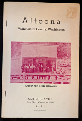
Altoona, Wahkiakum County, Washington examines the isolated industrial cannery settlement and intense maritime resource extraction situated along the steep, heavily timbered northern banks of the lower Columbia River estuary. Appelo details how the region's rugged estuarine topography—specifically the precipitous coastal bluffs plunging directly into the tidewater, the sprawling tidal mudflats, and the powerful, nutrient-rich currents of the Columbia's lower reach—strictly dictated the margins of commercial salmon packing, early pioneer homesteading, and local transportation. By mapping the construction of massive cannery complexes and pile-driven fish traps built precariously out over the water, functioning entirely independent of the rugged overland terrain through a total reliance on riverboat transit, the narrative highlights how this specific riparian geography anchored a highly specialized, water-bound economy. Ultimately, this community record serves as a deeply localized spatial history, demonstrating how the severe overland isolation, immense estuarine abundance, and dominant hydrological forces of this Pacific Northwest waterway fundamentally shaped the highly resilient, cannery-driven character of early Altoona. 88 pages illustrations 23 cm Non-circulating [ 1 ]
|
1972 |
|
Barkley Sound a history of the Pacific Rim National Park area by R. Bruce Scott 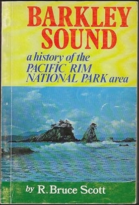
Barkley Sound a history of the Pacific Rim National Park area examines the deep maritime heritage and rugged coastal settlement situated along the storm-battered western edge of Vancouver Island. Scott details how the region's formidable coastal macro-geography—specifically the labyrinthine, island-choked waters of the sound, the dense, impenetrable temperate rainforests, and the treacherous, reef-strewn outer coast notoriously known as the Graveyard of the Pacific—strictly dictated the margins of indigenous Nuu-chah-nulth maritime culture, early European fur trading, and precarious pioneer outposts. By mapping the evolution of these isolated shores from complex indigenous whaling and fishing hubs into scattered commercial sealing stations, shipwreck lifesaving trails, and eventual protected parklands, the narrative highlights how this specific rugged environment anchored a profound and often fatal reliance on the unrelenting ocean. Ultimately, this regional record serves as a localized spatial history, demonstrating how the immense oceanic exposure, unforgiving navigational hazards, and rich marine ecology of this Pacific Northwest coastline fundamentally shaped the highly resilient, maritime-bound character of Barkley Sound. 278 pages illustrations, facsimile, maps, portraits 23 cm Non-circulating [ 1 ]
|
1972 |
|
The Clearwater of Idaho by Cecil P. Dryden 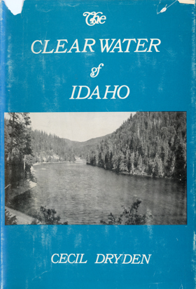
I write about a river I feel close to, having known it for well over a half century. My father's "benchland" ranch was just over the ridge from the narrow valley through which the Clearwater plows its urgent way to sea level. I have observed this river in all its vagaries; its spring rampagings which have set ferries adrift, lifted bridges from their piers, washed out trackage, and inundated highways; its summer somnolence; and its colorful September thinness which brings into view all the sumacbedecked islands, including "turkey-man's paradise," made safe by two channels against marauding coyotes. Although I know something about the land carved by the river, for this story I have relied in large measure on the works of numerous scholars whose research has left a legacy rich in Idaho lore. The book owes a special debt of gratitude to the following: Sister Alfreda Elsensohn for her monumental two-volume History of Idaho County; the late Robert G. Bailey, who produced the indispensable River of Not Return and Hell's Canyon, and his son, R. G. Bailey, Jr., for granting permission to use the photographs from River of No Return. Further, I am indebted to Potlatch Forests, Incorporated, for making available information and photographs. This book is an informal history of the Clearwater drainage area, including borderlands whose history naturally interweaves. I have not attempted to follow in detail all the threads of growth from their beginnings, but have stressed origins and directions in a setting of unfolding dramas. If certain characters and events have been omitted, the reason lies in the selective process that has had to be employed. -The Author, Cecil Dryden 258 pages illustrations 21 cm. Non-circulating [ 1 ]
|
1972 |
|
Indian wars of the Pacific Northwest by Ray Hoard Glassley
Indian wars of the Pacific Northwest examines the violent territorial conflicts and grueling military campaigns situated across the deeply fractured topography of the nineteenth-century regional frontier. Glassley details how the region's formidable physical landscape—specifically the labyrinthine volcanic trenches of the Modoc Lava Beds, the steep, densely forested ravines of the Rogue River valley, and the immense, isolating mountain passes of the interior plateau—strictly dictated the margins of indigenous defensive resistance and the logistical limits of advancing federal military forces. By mapping the tactical utilization of these extreme terrain features, where indigenous tribal forces leveraged deep river canyons and volcanic fortresses to effectively neutralize superior military numbers and artillery, the narrative highlights how this specific rugged geography anchored a highly localized, asymmetric style of frontier warfare. Ultimately, this military record serves as a macro-level spatial history, demonstrating how the immense topographic hostility, vast overland distances, and harsh geological choke points of this Pacific Northwest landscape fundamentally shaped the protracted, terrain-dependent character of the region's indigenous-settler conflicts. xi, 258 pages : illustrations ; 24 cm Non-circulating [ 1 ]
|
1972 |
|
Indian life on the Northwest coast of North America, as seen by the early explorers and fur traders during the last decades of the eighteenth century examines the complex indigenous maritime cultures and the initial European mercantile contact situated along the deeply fragmented, storm-battered littoral edge of the Pacific. Gunther details how the region's formidable coastal macro-geography—specifically the labyrinthine, island-choked fjords, the precipitous mountain ranges plunging directly into the sea, and the dense, impenetrable temperate rainforests of western red cedar—strictly dictated the margins of indigenous village placement, intense marine resource extraction, and early maritime fur trade anchorages. By mapping the network of massive cedar-plank settlements securely positioned in sheltered coves and the arrival of European vessels navigating treacherous coastal waterways for highly prized sea otter pelts, the narrative highlights how this specific marine and botanical geography anchored both indigenous prosperity and the ensuing global trade collision entirely to the ocean's edge. Ultimately, this ethnohistorical record serves as a macro-level spatial history, demonstrating how the extreme overland isolation, towering botanical scale, and rich marine ecology of this Pacific Northwest coastline fundamentally shaped the highly complex, ocean-bound character of indigenous life and early European exploration. xiv, 277 pages illustrations 21 x 23 cm Non-circulating [ 1 ]
|
1972 |
|
Oregon for the curious by Ralph Friedman
Oregon for the curious examines the decentralized historical remnants and modern backcountry exploration situated across the starkly varied macro-geography of the state's rural interior and rugged margins. Friedman details how the region's formidable physical diversity—specifically the isolated coastal headlands, the steep, timbered folds of the Cascade Range, and the sprawling, arid expanses of the eastern high desert—strictly dictated the margins of historic pioneer settlement and the subsequent abandonment of early resource-extraction boomtowns. By mapping an intricate network of forgotten secondary roads and geographic anomalies that bypass modern, centralized highway corridors, the narrative highlights how these specific isolated micro-geographies anchored and preserved fading pockets of localized agrarian and mining history. Ultimately, this exploratory guide serves as a macro-level spatial history, demonstrating how the immense topographical isolation, vast overland distances, and extreme environmental gradients of this Pacific Northwest landscape fundamentally shaped the highly fragmented, terrain-bound character of Oregon's hidden heritage. xix, 246 pages illustrations 23 cm Non-circulating [ 1 ]
|
1972 |
|
Goodbye, White Bluffs by Mary Powell Harris
Goodbye, White Bluffs examines the thriving agrarian settlement and abrupt federal erasure situated along the arid, sun-baked banks of the Columbia River in central Washington. Harris details how the region's stark interior macro-geography—specifically the sprawling, isolated sagebrush steppes, the towering sedimentary escarpments of the White Bluffs, and the vital, fast-flowing hydrological lifeline of the Hanford Reach—strictly dictated the margins of pioneer orchard cultivation and the town's eventual vulnerability. By mapping the grueling transformation of this desert plateau through localized irrigation into a tight-knit agricultural enclave, and its subsequent wholesale condemnation by a wartime government seeking vast, secluded terrain and abundant river water for the Manhattan Project, the narrative highlights how this specific remote geography anchored both the community's creation and its sudden destruction. Ultimately, this historical memoir serves as a deeply localized spatial history, demonstrating how the extreme geographic isolation, arid expanse, and powerful riverine forces of this Pacific Northwest landscape fundamentally shaped the agriculturally rich but fatally compromised character of White Bluffs. iv, 155 pages : illustrations, portraits ; 22 cm Non-circulating [ 1 ]
|
1972 |
|
Fall City in the Valley of the Moon by Margaret McKibben Corliss
Fall City in the Valley of the Moon examines the early pioneer settlement and agrarian development situated within the fertile floodplains and dense timberlands of western Washington's Snoqualmie Valley. Corliss details how the region's dynamic riverine and foothill topography—specifically the sprawling alluvial soils of the valley floor, the towering, heavily forested foothills of the Cascade Range, and the vital navigational barrier of nearby Snoqualmie Falls—strictly dictated the margins of early homesteading, agricultural cultivation, and timber extraction. By mapping the transformation of this flood-prone river basin from indigenous transit corridors into a vibrant agricultural hub reliant on precarious riverboat navigation and subsequent railway logging routes, the narrative highlights how this specific riparian geography anchored a deeply localized, river-dependent economy. Ultimately, this community record serves as a localized spatial history, demonstrating how the immense hydrological forces, rich floodplain soils, and imposing timbered terrain of this Pacific Northwest valley fundamentally shaped the highly resilient, agrarian and logging-driven character of early Fall City. 214 pages : illustrations, maps ; 28 cm Non-circulating [ 1 ]
|
1972 |
|
Du Pont--the story of a company town by May G. Munyan
Du Pont--the story of a company town examines the highly engineered industrial settlement and isolated corporate enclave situated on the expansive gravel prairies and sheltered shoreline of the southern Puget Sound. Munyan details how the region's distinct topographic and hydrological features—specifically the flat, glacially scoured outwash plains, the dense surrounding buffer of coniferous forests, and the vital deep-water maritime access of the Nisqually Reach—strictly dictated the placement and layout of this purpose-built explosives manufacturing hub. By mapping the strategic dispersal of volatile powder-works bunkers across the open prairie and the construction of a rigidly controlled, self-contained worker village tethered to the marine shipping docks, the narrative highlights how this specific, naturally isolated geography anchored the massive industrial production of dynamite necessary for western resource extraction. Ultimately, this civic record serves as a localized spatial history, demonstrating how the unique glacial topography, deep-water connectivity, and requisite physical isolation of this Pacific Northwest landscape fundamentally shaped the highly controlled, corporately engineered character of early DuPont. 240 pages illustrations 23 cm Non-circulating [ 1 ]
|
1972 |
|
Lake Chelan in the 1890's 1891 steamboat trip to Stehekin on Lake Chelan's first steamer by Nelson Wayne Durham
Lake Chelan in the 1890's 1891 steamboat trip to Stehekin on Lake Chelan's first steamer examines the early pioneer transit and nascent recreational exploration situated within the deep, glacially carved fjord-like trench of the eastern Cascade Range. Durham details how the region's extreme vertical topography—specifically the precipitous, rock-walled alpine slopes, the immense depth and narrowness of the 50-mile-long lake, and the profound overland isolation of the Stehekin valley at the lake's head—strictly dictated the margins of pioneer access and early commercial navigation. By mapping the precarious introduction of the first steam-powered vessel to navigate this formidable waterway, transforming an impenetrable mountain barrier into a vital marine corridor for remote miners and homesteaders, the narrative highlights how this specific hydro-geological trench anchored the region's total reliance on waterborne transit. Ultimately, this historical travelogue serves as a localized spatial history, demonstrating how the sheer geological scale, severe overland isolation, and crucial navigable waterway of this Pacific Northwest landscape fundamentally shaped the highly constrained, steamboat-dependent character of early Lake Chelan. 30 pages : illustrations ; 28 cm Non-circulating [ 1 ]
|
1972 |
|
Kamloops cattlemen one hundred years of trail dust by T. Alex Bulman
Kamloops cattlemen one hundred years of trail dust examines the extensive livestock-ranching economy and grueling overland cattle drives situated across the vast, semi-arid interior plateau of south-central British Columbia. Bulman details how the region's formidable interior topography—specifically the sprawling, sun-baked bunchgrass steppes of the Thompson River valley, the rugged, heavily timbered alpine summer ranges, and the vital, isolated riparian watering corridors—strictly dictated the margins of massive cattle operations and seasonal transhumance routes. By mapping the grueling establishment of expansive pioneer ranches and the arduous transit of herds across unforgiving, arid distances to distant railheads and markets, the narrative highlights how this specific high-desert geography anchored a deeply resilient, livestock-dependent frontier economy. Ultimately, this agricultural record serves as a localized spatial history, demonstrating how the immense overland distances, harsh semi-arid climate, and vital bunchgrass forage of this Pacific Northwest interior fundamentally shaped the highly rugged, ranching-driven character of the early Kamloops region. 183 pages illustrations, map (on lining papers), portraits 24 cm Non-circulating [ 1 ]
|
1972 |
|
The trees grew tall by John B. Miller 
The history of Bovill, Idaho, from its early days into the 1930s, written by John B. Miller. Miller was born on a Latah County homestead near Bovill and was a University of Idaho graduate with a degree in geology. xi, 214 pages : illustrations, maps, portraits ; 24 cm Non-circulating [ 1 ]
|
1972 |
|
The history of Terrace by Nadine Asante 
The history of Terrace examines the pioneer settlement, timber-driven economy, and critical transportation development situated within the broad, flat river benches of northwestern British Columbia's Skeena River valley. Asante details how the region's imposing mountainous macro-geography—specifically the steep, heavily timbered slopes of the Coast Mountains, the powerful, navigable currents of the Skeena River, and the rare, fertile alluvial terraces that gave the town its name—strictly dictated the margins of early homesteading, large-scale logging operations, and transcontinental railway routing. By mapping the transformation of this critical riverine chokepoint from indigenous Tsimshian trading corridors into a bustling, rail-connected timber hub highly dependent on the Grand Trunk Pacific Railway and riverboat transit, the narrative highlights how this specific valley geography anchored a profoundly transit- and resource-dependent economy. Ultimately, this civic record serves as a localized spatial history, demonstrating how the immense mountain barriers, vital hydrological lifelines, and unique flatland benches of this Pacific Northwest interior fundamentally shaped the highly rugged, transit-bound character of early Terrace. 243 pages illustrations 22 cm Non-circulating [ 1 ]
|
1972 |
|
Island year by Hazel Heckman , Laurie Olin (Illustrator) 
In her first book, Island in the Sound, Heckman brought to life Anderson Island in Puget Sound, its people, its history, and its sadly vanishing way of life. Now, in this book, she brings the same clarity of vision, warmth, and insight to the natural life of her island, recording the cycle of the seasons as an appreciative and articulate observer. This is a diary of the natural world where the same things happen again and again but are always new. Each month brings surprises, expected or not: the blossoming of the wild red flower currant in March, the appearance of a pod of killer whales in July. Mrs. Heckman’s gift to the reader, as in all of the best nature writing, is to let us see it through her eyes, as if never seen before. But the developers have arrived, and the natural world of the Island is as threatened as the way of life of its people. Mrs. Heckman knows that Anderson Island is not the Grand Canyon, that its destruction will never arouse great public indignation, but while it exists as one of the ‘little wild places’ she is able to share it and her love for it. xi, 255 pages : illustrations ; 23 cm Desiderata
|
1972 |
|
Richfield of the desert a history of Paris and Bear Lake County, Idaho by Russell R. Rich
Russell R. Rich’s Richfield of the Desert: A History of Paris and Bear Lake County, Idaho serves as a foundational civic and colonization chronicle of the Bear Lake Valley. The narrative details how 1863 Mormon pioneer companies, directed by Apostle Charles C. Rich, established permanent agrarian enclaves directly across the summer gathering corridors and hunting domains long frequented by the Shoshone and Bannock peoples. Rich documents the surveying of wide orthogonal village grids, the digging of collaborative irrigation canals diverted from Paris Creek, and the construction of the monumental Romanesque sandstone Paris Tabernacle. The volume provides detailed records of cooperative livestock regimes, early municipal governance in Paris, and the expansion of secondary farming settlements through St. Charles, Bloomington, and Ovid. viii, 264 pages : illustrations, portraits ; 24 cm Desiderata
|
1972 |
|
Vernonia the town that would not die by Josephine E. Watts
Josephine E. Watts’s Vernonia: The Town That Would Not Die recounts the resilient economic and civic history of the Nehalem Valley’s principal settlement. Watts chronicles the arrival of pioneer homesteaders in the 1870s who carved farms out of old-growth rainforest along the Nehalem River, detailing how the town was transformed into a bustling industrial powerhouse during the 1920s with the construction of the colossal Oregon-American Lumber Company mill. The work documents the devastating closure of the mill in 1957, illustrating how local civic leaders, merchants, and families organized grassroots campaigns to diversify the economy through reforestation, municipal parks, and the Vernonia Friendship Jamboree. The chronicle preserves detailed records of community life, schools, and family businesses across Vernonia, Keasey, Mist, Treharne, and Clear Creek. 208 pages : illustrations, portraits ; 23 cm Desiderata
|
1972 |